Category:Karte von Nordwestdeutschland
Jump to navigation
Jump to search
Subcategories
This category has the following 3 subcategories, out of 3 total.
Media in category "Karte von Nordwestdeutschland"
The following 17 files are in this category, out of 17 total.
-
 Baltrum 1805.jpg 826 × 540; 339 KB
-
 Borkum 1805.jpg 819 × 514; 308 KB
-
 Cloppenburg 1805 LeCoq.jpg 1,263 × 487; 406 KB
-
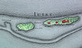 Juist 1805.jpg 944 × 548; 362 KB
-
 Karte nrw le coq.jpg 11,566 × 9,027; 45.05 MB
-
 Karte von Detmarsen (1805) Ausschnitt.jpg 1,150 × 850; 565 KB
-
 Langeoog 1805.jpg 798 × 508; 340 KB
-
 Le Coq 1805 - Herdecke.jpg 1,553 × 1,202; 976 KB
-
 Le Coq 1805 - Nordwestdeutschland - Oberhausen.png 1,632 × 2,012; 2.35 MB
-
 Le Coq 1805 - Nordwestdeutschland - Ruhrgebiet.jpg 12,000 × 8,000; 17.91 MB
-
 LeCoq (Ausschnitt Hoevelhof).jpg 721 × 431; 105 KB
-
 Lecoq - Nordwestdeutschland - Wipper - 1805.jpg 11,468 × 7,958; 21.4 MB
-
 Norderney 1805.jpg 788 × 526; 298 KB
-
 Karte Salzkotten Le Coq 1805.png 1,200 × 835; 1.69 MB
-
 Spiekeroog 1805.jpg 723 × 554; 298 KB
-

-
 Wangerooge 1805.jpg 905 × 575; 408 KB


_Ausschnitt.jpg)


.jpg)


.jpg)
