Category:Kashima, Ibaraki
Vai alla navigazione
Vai alla ricerca
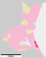
English: Kashima-shi, is a city located on the Pacific coast of Ibaraki prefecture, Japan. The population in 2005 is 63,987.
Español: Kashima es un municipio en la prefectura de Ibaraki, Japón. La población en 2005 es 63.987.
Français : Kashima est une ville de la préfecture d'Ibaraki au Japon. Elle comptait 63 987 habitants en 2005.
città giapponese della prefettura di Ibaraki | |||||
| Carica un file multimediale | |||||
| Istanza di | |||||
|---|---|---|---|---|---|
| Prende il nome da | |||||
| Luogo |
| ||||
| Situato sul mare / lago / fiume | |||||
| Forma giuridica |
| ||||
| Data di fondazione o creazione |
| ||||
| Popolazione |
| ||||
| Superficie |
| ||||
| Ha sostituito |
| ||||
| Distinto da | |||||
| sito web ufficiale | |||||
 | |||||
Sottocategorie
Questa categoria contiene le 15 sottocategorie indicate di seguito, su un totale di 15.
B
- Bokuden no Sato Sports Park (2 F)
H
- Hirai Beach (12 F)
K
- Kashima Bus Terminal (3 F)
- Kashima iron and steel works (16 F)
- Kashima Soccer Stadium (35 F)
- Kashimaguuke-ato (4 F)
L
M
- Meotozuka Kofun (Kashima) (6 F)
O
- Oritsu Beach (15 F)
P
T
File nella categoria "Kashima, Ibaraki"
Questa categoria contiene 104 file, indicati di seguito, su un totale di 104.
-
 Emblem of Kashima, Ibaraki.svg 500 × 500; 329 byte
-
 Flag of Kashima, Ibaraki.svg 600 × 375; 380 byte
-
 Kashima city Ibaraki prefecture Japan.svg 534 × 688; 18 KB
-
 Kashima in Ibaraki Prefecture Ja.svg 450 × 567; 18 KB
-
 20110812 port kashima anmonia.jpg 300 × 180; 8 KB
-
 2013 0519茨城県道242号6278.JPG 2 272 × 1 704; 989 KB
-
 Cropped Solar eclipse at kashima Japan May 21 2012.jpg 671 × 626; 17 KB
-
 Deer sculpture.jpg 3 024 × 3 024; 2,78 MB
-
 EF64 1000番台 鹿島線.jpg 1 936 × 1 291; 578 KB
-
 Factory in Kashima, Ibaraki Prefecture; February 2011.jpg 4 256 × 2 832; 8,01 MB
-
 Factory in Kashima, Ibaraki Prefecture; March 2012.jpg 3 757 × 2 703; 7,08 MB
-
 Flag of Kashima Ibaraki.JPG 158 × 100; 14 KB
-
 FMKashima.jpg 2 736 × 3 648; 2,11 MB
-
 Gasometer in Kashima coastal industrial zone 01.jpg 4 192 × 2 745; 7,3 MB
-
 Gasometer in Kashima coastal industrial zone 02.jpg 4 256 × 2 832; 7,64 MB
-
 Hirai Beach, Ibaraki 01.jpg 5 926 × 3 951; 2,26 MB
-
 Hirai Beach, Ibaraki 02.jpg 5 870 × 3 913; 3,85 MB
-
 Hirai Beach, Ibaraki 03.jpg 5 881 × 3 921; 2,94 MB
-
 Hirai Beach, Ibaraki 04.jpg 5 856 × 3 904; 2,71 MB
-
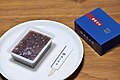 Hitachi-Fudoki, a famous confectionery from Kashima City, Ibaraki Prefecture 01.jpg 6 048 × 4 024; 5,39 MB
-
 Hitachi-Fudoki, a famous confectionery from Kashima City, Ibaraki Prefecture 02.jpg 6 048 × 4 024; 5,29 MB
-
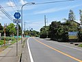
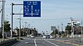
 Ibaraki pref road 192 in Kyūchū.jpg 3 264 × 2 448; 1,93 MB
-
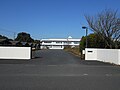
 Ibaraki Prefectural Kashima High School.JPG 2 048 × 1 536; 1,77 MB
-
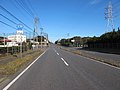
 Ibaraki prefectural road Route 18 (Ibaraki-Kashima line) in Narage, Kashima city.jpg 4 928 × 3 280; 9,87 MB
-
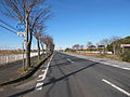
 Ibaraki prefectural road route 186 (Arai-Namegata line) in Tsuga,Kashima city.JPG 2 272 × 1 704; 1,21 MB
-
 Ibaraki prefectural road route 238 (Suga-Kitahuto line) in Yawara,Kashima city.JPG 2 272 × 1 704; 1,15 MB
-
 Ibaraki prefectural road route 239 (Aou-KIsaki line) in Aou,Kashima city.JPG 2 272 × 1 704; 1,12 MB
-
 Ibaraki prefectural road route 242 (Hokota-Kashima line) in Koya,Kashima city.JPG 2 816 × 2 112; 1,38 MB
-
 Ibaraki prefectural road route 255 (Kashima-port line) in Aou,Kashima city.JPG 2 272 × 1 704; 1,06 MB
-
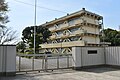
 Ibaraki-Kashima-City-Office.JPG 3 264 × 2 448; 1,64 MB
-
 Jingu-bridge-II,jingu-bashi,kashima-city,japan.JPG 1 600 × 1 200; 825 KB
-
 Jingu-bridge-III,jingu bashi,kashima-city,japan.JPG 1 600 × 1 200; 694 KB
-
 JR bus Kanto Kashima branch.jpg 700 × 525; 86 KB
-
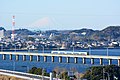 JR Kashima line and Mt.Fuji,Kashima-city,Japan.jpg 4 496 × 3 000; 3,12 MB
-
 JRバス関東 鹿嶋支店.jpg 4 032 × 1 391; 1,16 MB
-
 Kamatari-jinja honden.JPG 6 012 × 3 992; 4,85 MB
-
 Kashima 20210814093538 (51815209948).jpg 4 032 × 3 024; 2,88 MB
-
 Kashima 20210814094943 (51815209163).jpg 4 032 × 3 024; 3,72 MB
-
 Kashima Castle (Hitachi), hori.jpg 5 568 × 3 712; 11,28 MB
-
 Kashima Castle (Hitachi), sekihi.jpg 5 544 × 3 676; 7,23 MB
-
 Kashima Heights Sports Plaza.png 1 007 × 806; 1,6 MB
-
 Kashima Ibaraki chapter.JPG 100 × 75; 3 KB
-
 Kashima Ibaraki.JPG 1 352 × 1 014; 531 KB
-
 Kashima Kinrou Bunkakaikan.jpg 4 928 × 3 280; 10,93 MB
-
 Kashima municipal dwelling house - panoramio.jpg 1 600 × 1 200; 704 KB
-
 Kashima municipal Kano junior high school.jpg 3 696 × 2 456; 2,81 MB
-
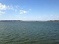
 Kashima Nada from Ono Shiosai Hamanasu Park 01.jpg 3 851 × 2 568; 2,61 MB
-
 Kashima Police Station (Ibaraki).JPG 2 048 × 1 536; 1,32 MB
-
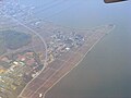
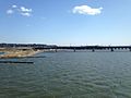
 Kashima Port 01.jpg 3 849 × 2 566; 2,1 MB
-
 Kashima Port 02.jpg 3 888 × 2 592; 2,43 MB
-
 Kashima Port 03.jpg 3 888 × 2 592; 2,2 MB
-
 Kashima postoffice(ibaragi pref).jpg 3 264 × 2 448; 3,33 MB
-
 Kashima Public Library 1.jpg 3 696 × 2 456; 2,42 MB
-
 Kashima Public Library 2.jpg 3 696 × 2 456; 7,67 MB
-
 Kashima Public Library 3.jpg 3 696 × 2 456; 3,93 MB
-
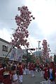 Kashima Shrine Lantern Festival,Kashima-city,Japan.jpg 1 944 × 2 896; 1,15 MB
-
 Kashima sports center (Kashima city, Ibaraki prefecture).jpg 3 696 × 2 456; 4,74 MB
-
 Kashima Steel Works 01.jpg 3 819 × 2 546; 2,59 MB
-
 Kashima-jingu, Kashima, Ibaraki Prefecture; April 2012.jpg 3 615 × 2 410; 6,94 MB
-
 KashimaGakuen.JPG 2 048 × 1 536; 998 KB
-
 KashimaJuniorHighSchool.jpg 3 648 × 2 736; 2,12 MB
-
 Kashimanada High School.JPG 2 048 × 1 536; 1,44 MB
-
 Konpon-ji Temple (Kashima city, Ibaraki) 01.jpg 4 928 × 3 280; 12,49 MB
-
 Konpon-ji Temple (Kashima city, Ibaraki) 02.jpg 4 928 × 3 280; 11,25 MB
-
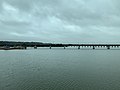
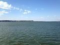
 Lake Kitaura from train of Kashima Line 1.JPG 3 211 × 2 408; 2,19 MB
-
 Lake Kitaura from train of Kashima Line 2.JPG 3 188 × 2 391; 2,21 MB
-
 Lake Kitaura from train of Kashima Line 3.jpg 3 159 × 2 370; 2,17 MB
-
 Lake Kitaura from train of Kashima Line 4.jpg 3 222 × 2 416; 2,38 MB
-
 Monument for Kashima Antlers near Kashima Shrine.JPG 3 220 × 2 415; 2,23 MB
-
 Nissan LEAF in Kashima, Ibaraki 2018-08-05.jpg 3 024 × 4 032; 3,03 MB
-
 Oarai Kashima Line in Kashima City 01.jpg 4 880 × 3 253; 5,87 MB
-
 Oarai Kashima Line in Kashima City 02.jpg 3 996 × 2 664; 2,26 MB
-
 Oarai Kashima Line in Kashima City 03.jpg 5 965 × 3 977; 5,34 MB
-
 Ono Shiosai Hamanasu Park, Ibaraki 01.jpg 6 000 × 4 000; 5,38 MB
-
 Ono Shiosai Hamanasu Park, Ibaraki 02.jpg 6 000 × 4 000; 5,24 MB
-
 Ono Shiosai Hamanasu Park, Ibaraki 03.jpg 6 000 × 4 000; 3,65 MB
-
 Population distribution of Kashima, Ibaraki, Japan.svg 512 × 256; 22 KB
-
 Potato field in Kashima, Ibaraki 01.jpg 5 827 × 3 885; 5,11 MB
-
 Potato field in Kashima, Ibaraki 02.jpg 6 000 × 4 000; 3,89 MB
-
 R051-182.jpg 1 500 × 843; 219 KB
-
 R124-094.jpg 2 736 × 1 536; 1 009 KB
-
 R124-102.jpg 2 736 × 1 536; 815 KB
-
 Ryu Shrine near Kashima Shrine.JPG 3 264 × 2 448; 2,96 MB
-
 Safari - panoramio (2).jpg 4 256 × 2 832; 5,18 MB
-
 Sculpture of deers near Kashima Shrine.JPG 3 264 × 2 448; 2,94 MB
-
 Sculpture of Tsukahara Bokuden.jpg 2 448 × 3 264; 3,15 MB
-
 SeiShin.JPG 1 536 × 2 048; 1,09 MB
-
 Solar eclipse at kashima Japan May 21 2012.jpg 1 600 × 1 600; 1,1 MB
-
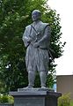 Statue of Tsukahara Bokuden.JPG 1 453 × 2 098; 608 KB
-
 Stele of 100 Landscape of Ibaraki Prefecture near Kashima Shrine.JPG 3 264 × 2 448; 2,85 MB
-
 Stele of Tsukahara Bokuden’s born place.JPG 3 264 × 2 448; 2,07 MB
-
 Street view near Kashima Shrine 20140308.JPG 3 264 × 2 448; 2,83 MB
-
 Street view of Kashima, Ibaraki 20140308.JPG 3 264 × 2 448; 2,39 MB
-
 Taya, Kashima, Ibaraki.JPG 6 016 × 4 000; 6,21 MB
-
 The container which was carried away by a tsunami,Kashima-city,Japan.jpg 1 000 × 671; 270 KB
-
 View in front of Kashima-Jingu Station.JPG 3 264 × 2 448; 2,64 MB
-
 ゆにろーず鹿嶋 - panoramio (1).jpg 3 072 × 1 728; 2,31 MB
-
 ゆにろーず鹿嶋 - panoramio (2).jpg 3 072 × 1 728; 2,16 MB
-
 ゆにろーず鹿嶋 - panoramio (3).jpg 3 072 × 1 728; 2,42 MB
-
 ゆにろーず鹿嶋 - panoramio.jpg 3 072 × 1 728; 2,42 MB
-
 ヤマダ電機鹿島 - panoramio.jpg 3 072 × 1 728; 2,63 MB
-
 地図-茨城県鹿嶋市-2006.png 236 × 233; 6 KB
-
 潮騒はまなす公園 - panoramio.jpg 4 368 × 2 912; 945 KB
-
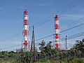 鹿島共同火力.JPG 4 000 × 3 000; 1,48 MB


.jpg)


.jpg)
.jpg)
.jpg)


_in_Narage,_Kashima_city.jpg)
_in_Tsuga,Kashima_city.JPG)
_in_Yawara,Kashima_city.JPG)
_in_Aou,Kashima_city.JPG)
_in_Koya,Kashima_city.JPG)
_in_Aou,Kashima_city.JPG)
.jpg)
.jpg)
,_hori.jpg)
,_sekihi.jpg)
.JPG)
.jpg)
.jpg)
_01.jpg)
_02.jpg)