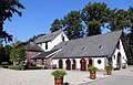
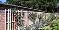
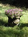
Category:Kasteel Maarsbergen
Jump to navigation
Jump to search
| Object location | | View all coordinates using: OpenStreetMap |
|---|
 | |||||
| Upload media | |||||
| Instance of | |||||
|---|---|---|---|---|---|
| Part of | |||||
| Location | Maarsbergen, Utrechtse Heuvelrug, Utrecht, Netherlands | ||||
| Street address |
| ||||
| Located on street |
| ||||
| Heritage designation |
| ||||
 | |||||
|
This is a category about rijksmonumentcomplex number 509612
|
|
This is a category about rijksmonument number 509611
|
| Address |
|
Subcategories
This category has the following 2 subcategories, out of 2 total.
F
- Folcoldusheuvel (4 F)
O
- Oranjerie, Maarsbergen (3 F)
Media in category "Kasteel Maarsbergen"
The following 48 files are in this category, out of 48 total.
-
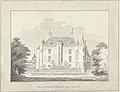
 1749, J.de Beyer - Maarn - 20143370 - RCE.jpg 1,200 × 805; 261 KB
-
 Achterzijde - Maarsbergen - 20143375 - RCE.jpg 1,200 × 815; 217 KB
-
 Gedeelte rechter zijgevel - Maarsbergen - 20329751 - RCE.jpg 800 × 1,200; 272 KB
-
 Het Huis Maarsbergen, van achteren, RP-T-1900-A-4409.jpg 5,762 × 4,406; 3.81 MB
-

-

-

-

-

-

-

-

-
-

-

-

-
 HUA-809917-Gezicht op het kasteel Maarsbergen te Maarsbergen gemeente Maarn .jpg 1,772 × 1,227; 616 KB
-

-

-
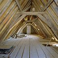 Interieur zolder, kap voorste gedeelte - Maarsbergen - 20329758 - RCE.jpg 1,187 × 1,200; 271 KB
-
 Interieur, restant stucversiering Arkeltorentje - Maarsbergen - 20329756 - RCE.jpg 1,187 × 1,200; 261 KB
-
 Interieur, restant stucversiering Arkeltorentje - Maarsbergen - 20329757 - RCE.jpg 1,184 × 1,200; 240 KB
-
 Kasteel Maarsbergen, RP-T-1894-A-2994.jpg 6,054 × 4,074; 4.11 MB
-
 Kasteel, aanzicht - Maarsbergen - 20143377 - RCE.jpg 1,200 × 945; 247 KB
-
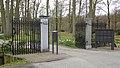 Maarsbergen - Hoofdhek Huis Maarsbergen RM509666.JPG 4,608 × 2,610; 1.58 MB
-
 Maarsbergen - Huis Maarsbergen achterzijde RM509611.JPG 4,407 × 3,381; 1.56 MB
-
 Maarsbergen - Huis Maarsbergen bloemenkas en druivenkas RM509663.JPG 4,608 × 2,100; 1.29 MB
-
 Maarsbergen - Huis Maarsbergen duivetoren RM509661.JPG 3,456 × 4,608; 3.43 MB
-
 Maarsbergen - Huis Maarsbergen Inrijhek noord RM509667.jpg 4,410 × 3,282; 5.12 MB
-
 Maarsbergen - Huis Maarsbergen Inrijhek west RM509668.jpg 4,446 × 3,336; 5.56 MB
-
 Maarsbergen - Huis Maarsbergen koetshuis met stallen RM509659.JPG 4,452 × 2,855; 1.6 MB
-
 Maarsbergen - Huis Maarsbergen parkaanleg RM509658.JPG 4,608 × 2,870; 1.82 MB
-
 Maarsbergen - Huis Maarsbergen RM509611.JPG 4,374 × 3,345; 1.15 MB
-
 Maarsbergen - Huis Maarsbergen tuinmuur RM509665.JPG 4,227 × 2,155; 1.42 MB
-
 Maarsbergen - Huis Maarsbergen tuinvaas RM509670.JPG 3,456 × 4,608; 2.49 MB
-
 Maarsbergen - Huis Maarsbergen twee aaneengebouwde schuren RM509660.JPG 4,539 × 2,695; 1.21 MB
-
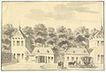
 Maarsbergen.jpg 2,136 × 1,446; 533 KB
-
 Overzicht achtergevel - Maarsbergen - 20329749 - RCE.jpg 1,184 × 1,200; 279 KB
-
 Overzicht achtergevel - Maarsbergen - 20329750 - RCE.jpg 1,192 × 1,200; 335 KB
-
 Overzicht Duiventoren - Maarsbergen - 20329755 - RCE.jpg 1,185 × 1,200; 416 KB
-
 Overzicht voorgevel - Maarsbergen - 20329747 - RCE.jpg 1,185 × 1,200; 319 KB
-
 Overzicht voorgevel - Maarsbergen - 20329748 - RCE.jpg 1,187 × 1,200; 297 KB
-

-

-
 Reproductie van tekening van Roghman - Maarsbergen - 20143376 - RCE.jpg 1,200 × 921; 265 KB
-
 Ronde toren met duivenslag - Maarsbergen - 20143379 - RCE.jpg 1,192 × 1,200; 491 KB
-

-
 Voorzijde - Maarsbergen - 20143374 - RCE.jpg 1,200 × 815; 192 KB


