Category:Kerk, Warstiens
Jump to navigation
Jump to search
| Object location | | View all coordinates using: OpenStreetMap |
|---|
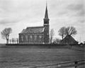
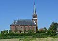
church building in Boarnsterhim, Netherlands  | |||||
| Upload media | |||||
| Instance of | |||||
|---|---|---|---|---|---|
| Part of | |||||
| Location | Warstiens, Leeuwarden, Friesland, Netherlands | ||||
| Street address |
| ||||
| Located on street |
| ||||
| Architect | |||||
| Heritage designation |
| ||||
| Inception |
| ||||
| official website | |||||
 | |||||
Kerk:
|
This is a category about rijksmonument number 514850
|
Baarhuisje en hek:
|
This is a category about rijksmonument number 514851
|
Orgel:
|
This is a category about rijksmonument number 460744
|
| Address |
|
Media in category "Kerk, Warstiens"
The following 10 files are in this category, out of 10 total.
-
 Exterieur - Warstiens - 20250235 - RCE.jpg 1,200 × 959; 226 KB
-
 Herfoarme tsjerke, Warstiens.jpg 5,344 × 3,774; 7.77 MB
-
 Hervormde kerk Warstiens.jpg 2,592 × 1,944; 847 KB
-
 Interieur, aanzicht orgel, orgelnummer 1615 - Warstiens - 20417388 - RCE.jpg 2,492 × 3,543; 3.17 MB
-
 Kerkje.JPG 1,944 × 2,592; 1.72 MB
-
 Klok fan Warstiens.jpg 3,494 × 5,097; 7.69 MB
-
 Midsiuwske tsjerke fan Warstiens (Jacobus Stellingwerf, 1721).jpg 1,193 × 899; 533 KB
-
 Overzicht westgevel met kerktoren en kerkhof - Warstiens - 20345805 - RCE.jpg 947 × 1,200; 213 KB
-
 Tsjerke fan Warstiens.jpg 1,936 × 1,296; 1.15 MB
-
 Warstiens kerk.jpg 2,032 × 1,524; 626 KB


.jpg)

