Category:Killead
Jump to navigation
Jump to search
English: Killead (from the ) is a small village in County Antrim, Northern Ireland, near Aldergrove and Antrim. In the 2001 Census it had a population of 78 people. It is situated within the Antrim Borough Council area
village in the United Kingdom _Killead_-_geograph.org.uk_-_115746.jpg) | |||||
| Upload media | |||||
| Instance of | |||||
|---|---|---|---|---|---|
| Location | County Antrim, Northern Ireland | ||||
 | |||||
Media in category "Killead"
The following 61 files are in this category, out of 61 total.
-
 9H-WFC, Aldergrove (September 2016) - geograph.org.uk - 5104205.jpg 640 × 282; 23 KB
-

-
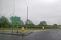
 Ballyrobin roundabout - geograph.org.uk - 3497843.jpg 3,881 × 1,890; 1.06 MB
-
 C-FEAK, Aldergrove (July 2016) - geograph.org.uk - 5032539.jpg 640 × 316; 28 KB
-
 Carmavy Road - geograph.org.uk - 3550320.jpg 4,000 × 3,000; 5.45 MB
-
 Carmavy Road - geograph.org.uk - 4230745.jpg 4,000 × 2,664; 6.25 MB
-
 Cattle, Killead (August 2016) - geograph.org.uk - 5072305.jpg 640 × 316; 79 KB
-
 Choices at the roundabout - geograph.org.uk - 2572769.jpg 640 × 417; 34 KB
-
 Direction signs, Killead (August 2016) - geograph.org.uk - 5091655.jpg 640 × 357; 136 KB
-
 Drennan's Road, Killead (July 2016) - geograph.org.uk - 5032459.jpg 640 × 335; 95 KB
-
 EC-MFS, Aldergrove (July 2016) - geograph.org.uk - 5036711.jpg 640 × 286; 25 KB
-
 EI-FDS, Aldergrove (August 2016) - geograph.org.uk - 5082276.jpg 640 × 287; 26 KB
-
 EI-FOG, Aldergrove (July 2016) - geograph.org.uk - 5034509.jpg 640 × 320; 26 KB
-
 EI-FRP, Aldergrove (August 2016) - geograph.org.uk - 5082246.jpg 640 × 267; 28 KB
-
 EI-FVG, Aldergrove (August 2018) - geograph.org.uk - 5863830.jpg 848 × 416; 76 KB
-
 EI-FYA Aldergrove (September 2018) - geograph.org.uk - 5903303.jpg 800 × 329; 41 KB
-
 EW-276PJ, Aldergrove (March 2019) - geograph.org.uk - 6093319.jpg 1,004 × 386; 95 KB
-
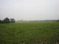 Field at Aldergrove - geograph.org.uk - 115400.jpg 640 × 480; 71 KB
-

-
 G-EZAW, Aldergrove (August 2016) - geograph.org.uk - 5082203.jpg 640 × 255; 49 KB
-
 G-EZBC, Aldergrove (September 2016) - geograph.org.uk - 5104338.jpg 628 × 344; 37 KB
-
 G-EZDB, Aldergrove (July 2016) - geograph.org.uk - 5036687.jpg 640 × 319; 32 KB
-
 G-EZDM, Aldergrove (July 2016) - geograph.org.uk - 5048841.jpg 640 × 290; 30 KB
-
 G-EZFJ, Aldergrove (September 2016) - geograph.org.uk - 5104313.jpg 640 × 325; 49 KB
-
 G-EZIY, Aldergrove (August 2016) - geograph.org.uk - 5091507.jpg 640 × 273; 32 KB
-

-
 G-EZPD, Aldergrove (August 2016) - geograph.org.uk - 5082103.jpg 640 × 281; 48 KB
-

-
 G-EZUJ, Aldergrove (July 2016) - geograph.org.uk - 5056241.jpg 640 × 329; 30 KB
-
 G-EZWA, Aldergrove (July 2016) - geograph.org.uk - 5056265.jpg 640 × 314; 29 KB
-
 G-GDFO, Aldergrove (August 2016) - geograph.org.uk - 5082286.jpg 640 × 287; 27 KB
-
 G-GDFO, Aldergrove (September 2016) - geograph.org.uk - 5104270.jpg 640 × 303; 33 KB
-
 G-GDFT, Aldergrove (August 2016) - geograph.org.uk - 5082232.jpg 640 × 255; 27 KB
-
 G-PSNO, Aldergrove (August 2016) - geograph.org.uk - 5071488.jpg 640 × 385; 29 KB
-
 G-TCDH, Aldergrove (July 2016) - geograph.org.uk - 5032514.jpg 640 × 281; 25 KB
-
 G-TCDO, Aldergrove (August 2016) - geograph.org.uk - 5091541.jpg 640 × 303; 25 KB
-
 HA-LWP, Aldergrove (August 2016) - geograph.org.uk - 5071447.jpg 640 × 286; 26 KB
-
 Keef Halla - geograph.org.uk - 76316.jpg 640 × 480; 86 KB
-
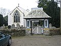
 Killead Presbyterian Church - geograph.org.uk - 115749.jpg 640 × 480; 94 KB
-
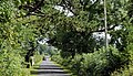
 Killead Road - geograph.org.uk - 3497817.jpg 4,000 × 3,000; 2.48 MB
-

-

-
 Lay-by near Killead (August 2016) - geograph.org.uk - 5091671.jpg 640 × 376; 98 KB
-
 N14120, Aldergrove (July 2016) - geograph.org.uk - 5034520.jpg 640 × 337; 33 KB
-
 N19141, Aldergrove (July 2016) - geograph.org.uk - 5048867.jpg 640 × 302; 29 KB
-
 No Beer Here^ - geograph.org.uk - 78262.jpg 640 × 480; 82 KB
-
 Oldstone Road - geograph.org.uk - 4230719.jpg 3,762 × 2,214; 5.32 MB
-

-
 Rural Bungalow - geograph.org.uk - 115405.jpg 640 × 480; 89 KB
-
-
 The Carmavy Road, Killead (August 2016) - geograph.org.uk - 5091635.jpg 631 × 364; 130 KB
-

-

-
 YR-FZA, Aldergrove - July 2017(2) - geograph.org.uk - 5464674.jpg 640 × 301; 25 KB
-
 Control Zone - geograph.org.uk - 115402.jpg 640 × 480; 94 KB
-
 Hillside near Tully - geograph.org.uk - 119380.jpg 640 × 480; 93 KB
-
 Killead Road - geograph.org.uk - 115398.jpg 640 × 480; 58 KB
-
 Loanen - geograph.org.uk - 115752.jpg 640 × 480; 116 KB
-

-
 Rural bungalow - geograph.org.uk - 115401.jpg 640 × 480; 91 KB
-
 White House - geograph.org.uk - 115403.jpg 640 × 480; 53 KB
_-_geograph.org.uk_-_5104205.jpg)
_-_geograph.org.uk_-_62388.jpg)

_-_geograph.org.uk_-_5032539.jpg)


_-_geograph.org.uk_-_5072305.jpg)

_-_geograph.org.uk_-_5091655.jpg)
_-_geograph.org.uk_-_5032459.jpg)
_-_geograph.org.uk_-_5036711.jpg)
_-_geograph.org.uk_-_5082276.jpg)
_-_geograph.org.uk_-_5034509.jpg)
_-_geograph.org.uk_-_5082246.jpg)
_-_geograph.org.uk_-_5863830.jpg)

_-_geograph.org.uk_-_5380049.jpg)
_-_geograph.org.uk_-_5104338.jpg)
_-_geograph.org.uk_-_5036687.jpg)
_-_geograph.org.uk_-_5048841.jpg)
_-_geograph.org.uk_-_5104313.jpg)
_-_geograph.org.uk_-_5091507.jpg)
,_Aldergrove_(July_2016)_-_geograph.org.uk_-_5056309.jpg)
_-_geograph.org.uk_-_5082103.jpg)
,_Aldergrove_(July_2016)_-_geograph.org.uk_-_5036784.jpg)
_-_geograph.org.uk_-_5056241.jpg)
_-_geograph.org.uk_-_5056265.jpg)
_-_geograph.org.uk_-_5082286.jpg)
_-_geograph.org.uk_-_5104270.jpg)
_-_geograph.org.uk_-_5071488.jpg)
_-_geograph.org.uk_-_5032514.jpg)
_-_geograph.org.uk_-_5091541.jpg)
_-_geograph.org.uk_-_5071447.jpg)


_Airport_(July_2016)_-_geograph.org.uk_-_5034547.jpg)
_Airport_(May_2017)_-_geograph.org.uk_-_5380043.jpg)
_-_geograph.org.uk_-_5091671.jpg)
_-_geograph.org.uk_-_5034520.jpg)
_-_geograph.org.uk_-_5048867.jpg)


_-_geograph.org.uk_-_5538741.jpg)

_-_geograph.org.uk_-_5091635.jpg)
_(August_2016)_-_geograph.org.uk_-_5091618.jpg)
_-_geograph.org.uk_-_5104369.jpg)
_-_geograph.org.uk_-_5464674.jpg)


_-_geograph.org.uk_-_5903303.jpg)
_-_geograph.org.uk_-_6093319.jpg)
_-_geograph.org.uk_-_5082203.jpg)
_-_geograph.org.uk_-_5082232.jpg)