Category:Kilmahog
Jump to navigation
Jump to search
hamlet situated half a mile to the west of Callander, Scotland  | |||||
| Upload media | |||||
| Instance of | |||||
|---|---|---|---|---|---|
| Location |
| ||||
 | |||||
English: Kilmahog (: Cell of St. Chug) is a hamlet situated half a mile to the west of Callander, Scotland.
Simple English: Kilmahog ( Gaelic: Cille MoChùig = Cell of St. Chug ) is a hamlet situated half a mile to the west of Callander, Scotland, at the junction of the Trossachs and Lochearnhead roads.
Media in category "Kilmahog"
The following 64 files are in this category, out of 64 total.
-
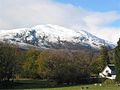 Ben Ledi from Kilmahog.jpg 640 × 480; 47 KB
-
 Callander pass of leny railway 2064507 7d8b23c1.jpg 640 × 386; 172 KB
-
 Coach Park, Kilmahog Woollen Mill - geograph.org.uk - 2336065.jpg 1,600 × 1,200; 515 KB
-
 Cornice, Ben Ledi - geograph.org.uk - 470581.jpg 453 × 640; 52 KB
-
 Cottages at Kilmahog - geograph.org.uk - 2662132.jpg 1,600 × 1,200; 367 KB
-
 Countryside at Kilmahog - geograph.org.uk - 3570747.jpg 640 × 480; 59 KB
-
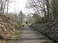
 Cycle path at Kilmahog - geograph.org.uk - 4357183.jpg 1,024 × 678; 299 KB
-
 Cycle Path near Kilmahog (1) - geograph.org.uk - 2349679.jpg 3,648 × 2,736; 4.97 MB
-
 Cycle Path near Kilmahog (2) - geograph.org.uk - 2349688.jpg 3,648 × 2,736; 5.26 MB
-
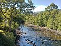
 Cycleway beside Loch Venachar - geograph.org.uk - 736277.jpg 480 × 640; 209 KB
-
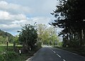 East end of Kilmahog on A84 - geograph.org.uk - 2956148.jpg 640 × 461; 74 KB
-
 Entrance to Kilmahog Burial Ground - geograph.org.uk - 3721727.jpg 768 × 1,024; 751 KB
-
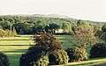
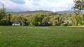 Field at Kilmahog - geograph.org.uk - 3726571.jpg 1,024 × 576; 332 KB
-

-
 Hamish und Honey.jpg 5,184 × 3,456; 8.11 MB
-
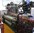 Hattersley Power Loom 01.jpg 2,835 × 2,736; 3.98 MB
-
 Hattersley Power Loom 02.jpg 2,835 × 2,736; 5.08 MB
-
 Hattersley Power Loom 03 (cropped).jpg 2,187 × 2,189; 2.72 MB
-
 Hattersley Power Loom 03.jpg 3,231 × 2,736; 3.7 MB
-
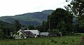 Housing Kilmahog - geograph.org.uk - 3053044.jpg 2,230 × 1,196; 1.88 MB
-
 Killmahog, Ben Ledi - geograph.org.uk - 2917153.jpg 640 × 480; 470 KB
-
 Kilmahog b and b.jpg 3,264 × 2,448; 5.23 MB
-
 Kilmahog Burial Ground - geograph.org.uk - 3721721.jpg 1,024 × 539; 332 KB
-
 Kilmahog Burial Ground - geograph.org.uk - 3721778.jpg 1,024 × 768; 719 KB
-
 Kilmahog Farmland - panoramio.jpg 3,888 × 2,592; 4.7 MB
-
 Kilmahog geograph-3491745-by-Ben-Brooksbank.jpg 2,308 × 1,436; 1.96 MB
-
 Kilmahog Junction. - geograph.org.uk - 62208.jpg 640 × 480; 163 KB
-
 Kilmahog parking area off A821 - geograph.org.uk - 2956116.jpg 640 × 472; 67 KB
-

-
 Kilmahog woollen mill from A84 - geograph.org.uk - 2956125.jpg 640 × 480; 63 KB
-
 Kilmahog, St Chug's graveyard - geograph.org.uk - 796492.jpg 640 × 480; 340 KB
-
 Looking across the fields at Kilmahog - geograph.org.uk - 2553843.jpg 2,592 × 1,944; 2.95 MB
-
 The Lade Inn at Kilmahog - geograph.org.uk - 2553836.jpg 2,592 × 1,944; 2.14 MB
-
 The Trossachs, Killmahog - geograph.org.uk - 2917212.jpg 640 × 480; 520 KB
-
 Tourist trap - geograph.org.uk - 2927531.jpg 2,048 × 1,536; 1.63 MB
-
 Trossachs Weaving Mill, Killmahog - geograph.org.uk - 2917204.jpg 640 × 480; 570 KB
-
 Trossachs Woollen Mill, Kilmahog - geograph.org.uk - 2660236.jpg 1,600 × 1,200; 494 KB
-
 Trossachs Woollen Mill.jpg 5,184 × 3,456; 6.42 MB
-
 View from kilmahog.jpg 3,264 × 2,448; 4.75 MB
-
 Anie Farmhouse - geograph.org.uk - 331230.jpg 640 × 480; 120 KB
-

-

-
 Brooding Mountain Top - geograph.org.uk - 656657.jpg 640 × 482; 67 KB
-
 Callander to Strathyre Cycleway - geograph.org.uk - 394863.jpg 640 × 480; 225 KB
-

-
 Farmland by Milton - geograph.org.uk - 202054.jpg 640 × 480; 73 KB
-

-
 Forestry track bridge over Anie Burn - geograph.org.uk - 331240.jpg 640 × 480; 122 KB
-
 From Beinn Dearg - geograph.org.uk - 549719.jpg 640 × 480; 148 KB
-
 Garbh Uisge - geograph.org.uk - 394847.jpg 640 × 480; 218 KB
-
 Garbh Uisge - geograph.org.uk - 394855.jpg 480 × 640; 235 KB
-
 Goldeneye (Bucephala clangula) - geograph.org.uk - 715012.jpg 485 × 640; 85 KB
-
 Heron on Loch Venachar - geograph.org.uk - 484698.jpg 640 × 480; 97 KB
-
 Lochan Balloch - geograph.org.uk - 549729.jpg 640 × 480; 132 KB
-

-
 Meall Biorach - geograph.org.uk - 331195.jpg 640 × 480; 70 KB
-
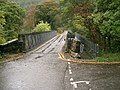 Metal Bridge - geograph.org.uk - 62204.jpg 640 × 480; 155 KB
-
 Mountain Top - geograph.org.uk - 656644.jpg 640 × 482; 60 KB
-
 Ruined farmhouse at Coilantogle - geograph.org.uk - 265185.jpg 640 × 480; 95 KB
-
 Ruins above Anie Farmhouse - geograph.org.uk - 331203.jpg 640 × 480; 148 KB
-
 Samson's Stone - geograph.org.uk - 330231.jpg 640 × 480; 99 KB
-
 Small pond below Tom an Fhacail - geograph.org.uk - 539820.jpg 640 × 480; 165 KB
-
 Towards Lochan Balloch - geograph.org.uk - 549709.jpg 640 × 480; 169 KB
-
 Track by Allt a' Chip Dhuibh - geograph.org.uk - 549693.jpg 640 × 480; 151 KB


_-_geograph.org.uk_-_2349679.jpg)
_-_geograph.org.uk_-_2349688.jpg)


.jpg)


_-_geograph.org.uk_-_715012.jpg)


