Category:Kingsley, Staffordshire
Jump to navigation
Jump to search
Cebuano: Kingsley maoy lungsod sa Hiniusang Gingharian. Ang Kingsley nahimutang sa kondado sa Staffordshire ug apil sa nasod sa Inglatera, sa habagatang bahin sa nasod, ka molupyo. (→Kingsley (lungsod sa Hiniusang Gingharian, Inglatera, Staffordshire, lat 53,02, long -1,98))
English: Kingsley is a small village in the Staffordshire Moorlands near to Cheadle, and situated on the A52 from Stoke on Trent to Ashbourne. The civil parish population taken at the 2011 census was 2,204. (→Kingsley, Staffordshire)
Español: Kingsley es una parroquia civil y un pueblo del distrito de Staffordshire Moorlands, en el condado de Staffordshire (Inglaterra). (→Kingsley (Staffordshire))
Polski: Kingsley – wieś w Anglii, w hrabstwie Staffordshire. Leży 26 km na północ od miasta Stafford i 211 km na północny zachód od Londynu. (→Kingsley (Staffordshire))
Svenska: Kingsley är en ort i Storbritannien. Den ligger i grevskapet Staffordshire och riksdelen England, i den södra delen av landet. (→Kingsley (ort i Storbritannien, England, Staffordshire, lat 53,02, long -1,98))

village in Staffordshire, United Kingdom | |||||
| Upload media | |||||
| Instance of | |||||
|---|---|---|---|---|---|
| Location | Staffordshire Moorlands, Staffordshire, West Midlands, England | ||||
| Said to be the same as | Kingsley (Wikimedia duplicated page, civil parish) | ||||
 | |||||
Subcategories
This category has the following 2 subcategories, out of 2 total.
K
- Kingsley Holt (1 F)
W
Media in category "Kingsley, Staffordshire"
The following 200 files are in this category, out of 213 total.
(previous page) (next page)-
 1804 Caldon Tramway at Whiston - geograph.org.uk - 987519.jpg 640 × 480; 68 KB
-
 5197 Taking on Water - geograph.org.uk - 5483860.jpg 640 × 481; 476 KB
-
 A well-worn path - geograph.org.uk - 2530779.jpg 1,200 × 900; 285 KB
-
 A52 and milepost near Kingsley - geograph.org.uk - 1879518.jpg 640 × 480; 147 KB
-
 A52 and milepost, Kingsley - geograph.org.uk - 1879562.jpg 640 × 480; 175 KB
-
 A52 and milepost, Whiston - geograph.org.uk - 1879740.jpg 640 × 480; 158 KB
-
 A52 road bridge over the railway at Froghall - geograph.org.uk - 3089140.jpg 2,592 × 1,936; 2.47 MB
-
 A52, Froghall Bridge - geograph.org.uk - 5483905.jpg 640 × 481; 505 KB
-
 All clear to go - Froghall, Staffordshire - geograph.org.uk - 4771206.jpg 731 × 1,024; 462 KB
-
 Approaching Kingsley Holt - geograph.org.uk - 5056160.jpg 1,600 × 1,200; 688 KB
-
 Blakeley Farm - geograph.org.uk - 4303411.jpg 1,200 × 900; 135 KB
-
 Blakeley Lane - geograph.org.uk - 2968541.jpg 1,024 × 768; 165 KB
-
 Blakeley Lane at Hillside Farm - geograph.org.uk - 2968545.jpg 1,024 × 768; 178 KB
-
 Blossom on the field boundary above Cottage Farm - geograph.org.uk - 2968713.jpg 1,024 × 768; 179 KB
-

-

-
 Bunting up at Froghall station - geograph.org.uk - 3089156.jpg 2,592 × 1,936; 2.92 MB
-
 Caldon Tramway at Whiston - geograph.org.uk - 956486.jpg 640 × 480; 119 KB
-
 Cenotaph View - geograph.org.uk - 5918374.jpg 800 × 600; 69 KB
-
 Churnet Valley Railway - footplate - geograph.org.uk - 6058074.jpg 427 × 640; 99 KB
-
 Churnet Valley Railway - No, 4277 - geograph.org.uk - 5989579.jpg 640 × 422; 97 KB
-

-

-

-

-
 Cottage on The Green - geograph.org.uk - 2957066.jpg 800 × 600; 98 KB
-
 Crossroads at Kingsley Holt - geograph.org.uk - 5056207.jpg 1,600 × 1,200; 427 KB
-
 Demolition at Moneystone Quarry - geograph.org.uk - 2964398.jpg 1,200 × 900; 160 KB
-
 Diesel at Froghall - geograph.org.uk - 2760824.jpg 1,024 × 768; 307 KB
-
 Double track to single track - geograph.org.uk - 2964447.jpg 1,200 × 900; 278 KB
-
 Dovedale Road - geograph.org.uk - 5918371.jpg 800 × 600; 107 KB
-
 Eaves Lane, Whiston Eaves - geograph.org.uk - 2968722.jpg 1,024 × 768; 142 KB
-
 Eavesford Farm - geograph.org.uk - 4605678.jpg 1,200 × 900; 468 KB
-
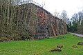
 Embankment on the 1785 Caldon Low Tramroad - geograph.org.uk - 4605634.jpg 1,200 × 900; 416 KB
-
 Empty track bed at Ross Bridge - geograph.org.uk - 4605760.jpg 1,200 × 900; 569 KB
-
-
 Entrance to footpath, Eaves Lane - geograph.org.uk - 2968744.jpg 1,024 × 768; 118 KB
-
 Fallen tree and footbridge - geograph.org.uk - 3872307.jpg 1,200 × 900; 385 KB
-
 Farm Crossing on the Churnet Valley Railway - geograph.org.uk - 2964439.jpg 1,200 × 900; 366 KB
-
 Farmland north of Hillside Farm - geograph.org.uk - 2968548.jpg 1,024 × 768; 166 KB
-
 Farmland west of Hillside Farm - geograph.org.uk - 2968558.jpg 1,024 × 768; 135 KB
-
 Fields near Hazlecross - geograph.org.uk - 396355.jpg 640 × 480; 74 KB
-
 Flowery meadow in the Churnet valley - geograph.org.uk - 2970959.jpg 1,024 × 768; 153 KB
-
 Flowery meadow near Littleheath Houses - geograph.org.uk - 2968736.jpg 1,024 × 768; 187 KB
-
 Flying the flag at Littleheath House Farm - geograph.org.uk - 2968811.jpg 1,024 × 768; 177 KB
-
 Footbridge at Ross Bridge - geograph.org.uk - 3872311.jpg 1,200 × 900; 383 KB
-
 Footbridge over Shirley Brook - geograph.org.uk - 4309338.jpg 1,200 × 900; 375 KB
-
 Footpath north of Clamgoose Lane - geograph.org.uk - 531781.jpg 640 × 366; 62 KB
-
 Footpath on abandoned tramway - geograph.org.uk - 2956401.jpg 600 × 800; 207 KB
-
 Footpath steps - geograph.org.uk - 4605660.jpg 900 × 1,200; 672 KB
-
 Footpath to Littleheath Houses - geograph.org.uk - 4615193.jpg 1,200 × 900; 372 KB
-
 Ford across the River Churnet - geograph.org.uk - 2957070.jpg 600 × 800; 133 KB
-
 Former church in Kingsley - geograph.org.uk - 5057486.jpg 1,600 × 1,200; 538 KB
-
 Former Flint Mill, Consall - geograph.org.uk - 2968838.jpg 1,024 × 768; 191 KB
-
 Former trackway to Shirley - geograph.org.uk - 4309335.jpg 1,200 × 900; 227 KB
-

-
 Froghall Bridge.jpg 1,024 × 768; 277 KB
-
 Froghall Canal Basin, Staffordshire - geograph.org.uk - 2449238.jpg 800 × 519; 245 KB
-
 Froghall Mill - geograph.org.uk - 2652137.jpg 1,200 × 900; 179 KB
-
 Froghall Mill - geograph.org.uk - 4844284.jpg 640 × 480; 96 KB
-
 Froghall railway station - geograph.org.uk - 3089165.jpg 2,592 × 1,936; 2.61 MB
-
 Froghall Station - geograph.org.uk - 5059213.jpg 991 × 1,500; 1.08 MB
-
 Froghall Station - geograph.org.uk - 5563759.jpg 1,024 × 768; 154 KB
-
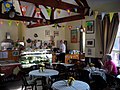 Froghall Station tearoom - geograph.org.uk - 2379452.jpg 2,048 × 1,536; 557 KB
-
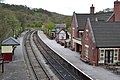
 Froghall station, southbound platform - geograph.org.uk - 2760816.jpg 1,024 × 768; 298 KB
-
 Froghall Wharf - former lime kilns - geograph.org.uk - 4858617.jpg 640 × 427; 114 KB
-
 Froghall Wharf Top Level - geograph.org.uk - 2956397.jpg 800 × 600; 187 KB
-
 Gate leading to ford across the Churnet - geograph.org.uk - 2970947.jpg 779 × 768; 145 KB
-

-

-

-
 High Street, Kingsley.jpg 1,600 × 1,200; 500 KB
-
 Hollins Lane and Hazles Farm - geograph.org.uk - 396314.jpg 640 × 480; 80 KB
-
 Horse Shoe House - geograph.org.uk - 4616294.jpg 1,200 × 900; 407 KB
-
 Houses at Garston - geograph.org.uk - 2968538.jpg 1,024 × 768; 220 KB
-
 Junction of Ross Road and Ross Lane - geograph.org.uk - 4605726.jpg 1,200 × 900; 474 KB
-
 Key Wood - geograph.org.uk - 2964431.jpg 1,200 × 900; 265 KB
-
 Kingsley and Froghall Station - geograph.org.uk - 1879642.jpg 640 × 480; 118 KB
-
 Kingsley and Froghall Station - geograph.org.uk - 3553120.jpg 640 × 481; 263 KB
-
 Kingsley and Froghall Station - geograph.org.uk - 3553125.jpg 640 × 481; 235 KB
-
 Kingsley and Froghall Station - geograph.org.uk - 3553153.jpg 640 × 481; 281 KB
-
 Kingsley and Froghall Station - geograph.org.uk - 3927449.jpg 640 × 427; 85 KB
-
 Kingsley and Froghall Station in Staffordshire - geograph.org.uk - 4606731.jpg 906 × 1,280; 888 KB
-
 Kingsley and Froghall Station in Staffordshire - geograph.org.uk - 4771168.jpg 1,024 × 768; 696 KB
-
 Kingsley and Froghall Station in Staffordshire - geograph.org.uk - 4771180.jpg 1,024 × 768; 715 KB
-

-

-

-

-
 Kingsley Bird ^ Falconry Centre - geograph.org.uk - 5072780.jpg 1,500 × 1,000; 866 KB
-
 Kingsley Holt, Blacksmiths Arms - geograph.org.uk - 4688434.jpg 1,024 × 768; 146 KB
-
 Kingsley Moor Farm - geograph.org.uk - 479571.jpg 640 × 480; 58 KB
-

-

-
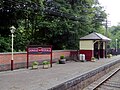
 Kingsley ^ Froghall station - geograph.org.uk - 2760836.jpg 1,024 × 768; 212 KB
-
 Kingsley ^ Froghall station - geograph.org.uk - 2954955.jpg 3,960 × 2,172; 1.8 MB
-
 Kingsley ^ Froghall Station - geograph.org.uk - 2957209.jpg 800 × 600; 166 KB
-
 Kingsley ^ Froghall Station - geograph.org.uk - 4842992.jpg 640 × 427; 66 KB
-
 Kingsley ^ Froghall Station - geograph.org.uk - 4858613.jpg 640 × 424; 81 KB
-
 Kingsley ^ Froghall Station - geograph.org.uk - 5704135.jpg 640 × 480; 79 KB
-
 Kingsley ^ Froghall Station - geograph.org.uk - 6054109.jpg 640 × 427; 65 KB
-
 Lime kiln at Froghall, Staffordshire - geograph.org.uk - 2460668.jpg 488 × 640; 155 KB
-
 Lime kilns at Froghall Wharf - geograph.org.uk - 2957222.jpg 800 × 600; 146 KB
-
 Lime kilns at Froghall, Staffordshire - geograph.org.uk - 2460663.jpg 800 × 673; 324 KB
-
 Lime kilns in Froghall 01.jpg 2,555 × 1,916; 2.98 MB
-
 Lime kilns in Froghall 02.jpg 1,918 × 2,557; 2.96 MB
-
 Lime kilns in Froghall 03.jpg 1,940 × 2,587; 3.22 MB
-
 Lime kilns in Froghall 04.jpg 2,592 × 1,944; 3.01 MB
-
 Lion Cottage - geograph.org.uk - 1872748.jpg 1,200 × 900; 163 KB
-
 Little Eaves Farm - geograph.org.uk - 2964410.jpg 1,200 × 900; 298 KB
-
 LNER N7 69621 at Froghall station - geograph.org.uk - 3091070.jpg 2,592 × 1,936; 2.27 MB
-
 Lock into Froghall Basin, Staffordshire - geograph.org.uk - 2449527.jpg 600 × 800; 351 KB
-
 Lockwood Hall Farm - geograph.org.uk - 4616333.jpg 1,200 × 900; 389 KB
-
 Locomotive - Churnet Valley Railway - geograph.org.uk - 6084770.jpg 640 × 427; 71 KB
-

-
 Meadowland with buttercups - geograph.org.uk - 2968800.jpg 1,024 × 768; 180 KB
-
 Milepost at SK 002 470.jpg 492 × 701; 81 KB
-
 Milepost at SK 016 470.jpg 492 × 701; 66 KB
-
 Milepost at SK 018 460.jpg 600 × 800; 187 KB
-
 Milepost near Kingsley - geograph.org.uk - 1879526.jpg 480 × 640; 213 KB
-
 Milepost, Kingsley - geograph.org.uk - 1879591.jpg 480 × 640; 206 KB
-
 Milepost, Whiston - geograph.org.uk - 1879758.jpg 480 × 640; 142 KB
-
 Milestone at Greenhead, Kingsley.jpg 480 × 640; 187 KB
-

-

-
 New footbridge on the Churnet Way - geograph.org.uk - 4615235.jpg 1,200 × 900; 746 KB
-
 Newhall Street, Kingsley - geograph.org.uk - 5056248.jpg 1,200 × 1,600; 648 KB
-

-
 Old Fence Line - geograph.org.uk - 1443484.jpg 480 × 640; 178 KB
-
 Old footpath sign - geograph.org.uk - 1443529.jpg 480 × 640; 187 KB
-
 Old lane through Moneystone - geograph.org.uk - 4303425.jpg 1,200 × 900; 200 KB
-

-
 On the Staffordshire Way - near Lockwood Waste - geograph.org.uk - 2153914.jpg 1,024 × 768; 347 KB
-
 Overbridge on the 1847 Caldon Low tramroad - geograph.org.uk - 4303370.jpg 1,200 × 900; 344 KB
-

-

-

-

-
 Platform View - geograph.org.uk - 5906709.jpg 800 × 600; 140 KB
-
 Power lines west of Blakeley Farm - geograph.org.uk - 2968551.jpg 1,024 × 768; 116 KB
-
 Primeval looking woodland - geograph.org.uk - 1443559.jpg 640 × 360; 131 KB
-
 Quarried-Out Road - geograph.org.uk - 2964368.jpg 1,200 × 900; 358 KB
-
 Railway Inn, Froghall - geograph.org.uk - 4858622.jpg 640 × 471; 82 KB
-
 River Churnet, Weir at Froghall - geograph.org.uk - 5483873.jpg 640 × 480; 623 KB
-
 Road junction in Kingsley - geograph.org.uk - 5057502.jpg 1,600 × 1,200; 474 KB
-
 Ross Bridge - geograph.org.uk - 3873056.jpg 1,200 × 900; 426 KB
-
 Ross Lane - geograph.org.uk - 3872354.jpg 1,200 × 900; 370 KB
-
 Ross Road - geograph.org.uk - 4605705.jpg 1,200 × 900; 542 KB
-
 Rowan berries - geograph.org.uk - 1443576.jpg 480 × 640; 171 KB
-
-
 Shirley Brook - geograph.org.uk - 4309336.jpg 1,200 × 900; 381 KB
-
 Shirley Farm - geograph.org.uk - 4309342.jpg 1,200 × 900; 170 KB
-
 Site of old coal pits - geograph.org.uk - 4606542.jpg 1,200 × 900; 471 KB
-
 Sledging - geograph.org.uk - 1199010.jpg 640 × 480; 114 KB
-
 Solidago in the hedgerow - geograph.org.uk - 531885.jpg 640 × 480; 151 KB
-
 Sprink Meadow - geograph.org.uk - 1443591.jpg 640 × 480; 110 KB
-
 Squeezed between the Churnet and the railway - geograph.org.uk - 2970975.jpg 1,024 × 768; 219 KB
-
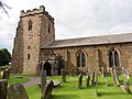 St Werburgh's Church, Kingsley.jpg 4,608 × 3,456; 3.99 MB
-
 Station Car park - geograph.org.uk - 5918383.jpg 800 × 600; 112 KB
-
 Station View - geograph.org.uk - 5906712.jpg 800 × 600; 186 KB
-
 Steam locomotive at Froghall , Staffordshire - geograph.org.uk - 4606729.jpg 1,280 × 960; 987 KB
-

-

-

-
 Steam locomotive at Kingsley and Froghall station - geograph.org.uk - 1889454.jpg 1,600 × 1,200; 730 KB
-
 Stile at the entry to Clewlow Sprink - geograph.org.uk - 4615221.jpg 1,200 × 900; 691 KB
-
 Stile on the path into Key Wood - geograph.org.uk - 2964419.jpg 1,200 × 900; 406 KB
-
 Stile on the path through Ochre Wood - geograph.org.uk - 4605768.jpg 1,200 × 900; 686 KB
-
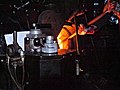 Stoking the Boiler - geograph.org.uk - 3553141.jpg 640 × 481; 258 KB
-

-
 Sunny Side - geograph.org.uk - 2957062.jpg 800 × 600; 92 KB
-
 Telegraph pole in a flowery meadow - geograph.org.uk - 2968803.jpg 1,024 × 768; 181 KB
-
 Temperance Hall and the Old Smithy - geograph.org.uk - 2957069.jpg 800 × 600; 105 KB
-
 Terrace of Houses at Froghall - geograph.org.uk - 5483900.jpg 640 × 481; 507 KB
-
-
 The A52 at Froghall in Staffordshire - geograph.org.uk - 4792553.jpg 768 × 1,024; 663 KB
-
 The A52 at Froghall in Staffordshire - geograph.org.uk - 4792554.jpg 1,024 × 768; 749 KB
-
 The Churnet valley west of Oakamoor - geograph.org.uk - 2971037.jpg 1,024 × 768; 185 KB
-
 The fascination of steam - geograph.org.uk - 2270717.jpg 1,969 × 1,476; 2.51 MB
-
 The former Uttoxeter Canal - geograph.org.uk - 3872322.jpg 1,200 × 900; 422 KB
-
 The Green, Kingsley - geograph.org.uk - 5057580.jpg 1,600 × 1,200; 526 KB
-

-

-
 The Railway at Froghall, Staffordshire - geograph.org.uk - 2457536.jpg 800 × 473; 197 KB
-
 The Railway Inn at Froghall - geograph.org.uk - 1889445.jpg 1,600 × 1,200; 375 KB
-
 The Railway Inn, Froghall - geograph.org.uk - 1879675.jpg 640 × 480; 84 KB
-
 The Railway Inn, Froghall - geograph.org.uk - 5483895.jpg 640 × 481; 423 KB
-
 The remains of Ross Cottages - geograph.org.uk - 5063797.jpg 1,280 × 960; 767 KB
-
 The River Churnet east of Banktop Woods - geograph.org.uk - 2970984.jpg 1,024 × 768; 154 KB
-
 The Sneyd and Positive Pet Training - geograph.org.uk - 4605618.jpg 1,200 × 900; 380 KB
-
 The steep and winding footpath to Foxt - geograph.org.uk - 4309326.jpg 1,200 × 900; 426 KB
-
 The train now departing... - geograph.org.uk - 2270729.jpg 1,554 × 1,969; 1.87 MB
-
 Thornbury Hall - geograph.org.uk - 458904.jpg 640 × 480; 56 KB
-
 Trackbed of the 1804 Caldon Low Plateway - geograph.org.uk - 4346694.jpg 1,200 × 900; 302 KB
-
 Trackway and footpath to Oldridge - geograph.org.uk - 4303405.jpg 1,200 × 900; 246 KB
-
 Tramway Footpath, Froghall - geograph.org.uk - 2118656.jpg 1,496 × 1,122; 1.13 MB
-
 Two singles to Bethlehem^ - geograph.org.uk - 2760842.jpg 1,024 × 768; 398 KB
-
 Un-named stream and the Churnet Valley Railway - geograph.org.uk - 3873046.jpg 1,200 × 900; 424 KB
-

-
 Water tank at Froghall station - geograph.org.uk - 3089147.jpg 2,592 × 1,936; 2.32 MB


.jpg)


