Category:Kirche aus Kohlgrund (Hessenpark)
Jump to navigation
Jump to search
| Object location | | View all coordinates using: OpenStreetMap |
|---|
building in Germany | |||||
| Upload media | |||||
| Instance of | |||||
|---|---|---|---|---|---|
| Location |
| ||||
 | |||||
Media in category "Kirche aus Kohlgrund (Hessenpark)"
The following 6 files are in this category, out of 6 total.
-
 Hessenpark, Kirche aus Kohlgrund (1).JPG 4,928 × 3,264; 5.82 MB
-
 Hessenpark, Kirche aus Kohlgrund, Altaraum.jpg 4,928 × 3,240; 6.74 MB
-
 Hessenpark, Kirche aus Kohlgrund, Kanzel.jpg 4,920 × 3,264; 7.03 MB
-
 Hessenpark, Kirche aus Kohlgrund, Ofen.jpg 2,761 × 4,763; 5.75 MB
-
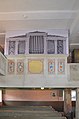 Hessenpark, Kirche aus Kohlgrund, Orgel.jpg 3,256 × 4,906; 7.31 MB
-
 Hessenpark, Kirche aus Kohlgrund.JPG 3,264 × 4,928; 6.81 MB
.JPG)


