Category:Kirchental bei Gungolding
Jump to navigation
Jump to search
valley in Walting, Germany  | |||||
| Upload media | |||||
| Instance of | |||||
|---|---|---|---|---|---|
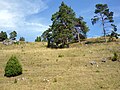
| Location | Walting, Eichstätt, Upper Bavaria, Bavaria, Germany | ||||
| Width |
| ||||
| Length |
| ||||
| Area |
| ||||
| Elevation above sea level |
| ||||
| official website | |||||
 | |||||
Media in category "Kirchental bei Gungolding"
The following 4 files are in this category, out of 4 total.
-
 Kirchental von Gungolding.jpg 4,000 × 3,000; 1.97 MB
-
 Landschaft bei Gungolding.jpg 3,000 × 4,000; 6.61 MB
-
 Wachholderheide bei Gungolding.jpg 4,000 × 3,000; 2.18 MB
-
 Wanderung im Kirchental.jpg 4,000 × 3,000; 8.44 MB


Categories:
- Geotopes in Landkreis Eichstätt
- Walting
- Natural monuments in Landkreis Eichstätt
- Naturschutzgebiet Gungoldinger Wacholderheide
- FFH-Gebiet Mittleres Altmühltal mit Wellheimer Trockental und Schambachtal
- Vogelschutzgebiet Felsen und Hangwälder im Altmühltal und Wellheimer Trockental
- Schutzzone im Naturpark Altmühltal (Landschaftsschutzgebiet)