Category:Kirkhamgate
Jump to navigation
Jump to search
village in United Kingdom  | |||||
| Upload media | |||||
| Instance of | |||||
|---|---|---|---|---|---|
| Location | Wakefield, West Yorkshire, Yorkshire and the Humber, England | ||||
 | |||||
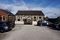
English: Kirkhamgate is a small village, a few miles north-west of Wakefield, West Yorkshire, England. In 1936 it became part of the former Stanley Urban District.
Subcategories
This category has the following 4 subcategories, out of 4 total.
Media in category "Kirkhamgate"
The following 75 files are in this category, out of 75 total.
-

-
 Allison Terrace - Batley Road - geograph.org.uk - 3634805.jpg 640 × 480; 85 KB
-
 Bales and Manure. - geograph.org.uk - 118706.jpg 640 × 480; 101 KB
-
 Batley Road - geograph.org.uk - 2740911.jpg 640 × 480; 54 KB
-
 Batley Road at Kirkhamgate. - geograph.org.uk - 118714.jpg 640 × 480; 100 KB
-
-
 Batley Road, East Ardsley - geograph.org.uk - 1753498.jpg 640 × 468; 108 KB
-
 Batley Road, Kirkhamgate - geograph.org.uk - 1760509.jpg 518 × 389; 147 KB
-
 Batley Road, Kirkhamgate - geograph.org.uk - 2092165.jpg 1,024 × 681; 136 KB
-

-

-

-
 Dogloitch Wood - geograph.org.uk - 31059.jpg 640 × 480; 103 KB
-

-
 Entrance to White Gate Farm - geograph.org.uk - 5746230.jpg 1,600 × 1,065; 686 KB
-
 Farm near Beck Bottom - geograph.org.uk - 991396.jpg 640 × 480; 60 KB
-
 Farm near Brandy Carr. - geograph.org.uk - 118720.jpg 640 × 480; 127 KB
-
 Farmland by Brandy Carr Road - geograph.org.uk - 990950.jpg 640 × 480; 92 KB
-
 Field on Brandy Carr hill - geograph.org.uk - 1760569.jpg 518 × 389; 161 KB
-
 Footpath - Brandy Carr Road - geograph.org.uk - 3634906.jpg 480 × 640; 85 KB
-
 Footpath - end of Kirkham Avenue - geograph.org.uk - 3634921.jpg 480 × 640; 94 KB
-
 Footpath to Kirkhamgate. - geograph.org.uk - 118710.jpg 640 × 480; 95 KB
-
 Footpath to Woodhouse Lane - geograph.org.uk - 990948.jpg 480 × 640; 151 KB
-
 Gawthorpe Lane - geograph.org.uk - 1762876.jpg 640 × 480; 112 KB
-

-
 Gawthorpe Lane, Gawthorpe - geograph.org.uk - 1555259.jpg 640 × 480; 84 KB
-
 Greenlay Drive - Batley Road - geograph.org.uk - 3634811.jpg 640 × 480; 56 KB
-

-
 Hawthorne Close - Brandy Carr Road - geograph.org.uk - 3634926.jpg 640 × 480; 92 KB
-

-
 Hey Beck, West Ardsley - geograph.org.uk - 31061.jpg 640 × 480; 171 KB
-

-

-
 Kirkham Avenue - Brandy Carr Road - geograph.org.uk - 3634910.jpg 640 × 480; 84 KB
-
 Kirkham Avenue - Brandy Carr Road - geograph.org.uk - 3634913.jpg 640 × 480; 74 KB
-
 Kirkham Avenue off Brandy Carr Road, Kirkhamgate - geograph.org.uk - 5746174.jpg 1,600 × 1,065; 646 KB
-
 Kirkhamgate Primary School - geograph.org.uk - 990935.jpg 640 × 418; 63 KB
-
 Kirkhamgate Village Hall - geograph.org.uk - 6410977.jpg 800 × 600; 73 KB
-
 Kirkhamgate Village Hall - geograph.org.uk - 990934.jpg 640 × 461; 78 KB
-
 Kirkhamgate Village Stores - geograph.org.uk - 1760510.jpg 518 × 389; 157 KB
-
 Lindale Garth - Lindale Lane - geograph.org.uk - 3635011.jpg 640 × 480; 69 KB
-
 Lindale Lane Kirkhamgate - geograph.org.uk - 991389.jpg 480 × 640; 96 KB
-
 Lindale Lane, Kirkhamgate. - geograph.org.uk - 118717.jpg 640 × 480; 126 KB
-
 Lindale Methodist Church - geograph.org.uk - 5746149.jpg 1,600 × 1,065; 563 KB
-
 Lindale Methodist Church, Kirkhamgate - geograph.org.uk - 1760504.jpg 518 × 389; 143 KB
-
 Lower Park Farm - geograph.org.uk - 31063.jpg 640 × 566; 87 KB
-
 M1 - viewed from Batley Road - geograph.org.uk - 3634895.jpg 640 × 480; 65 KB
-
 M1 Motorway West Yorkshire - geograph.org.uk - 31068.jpg 640 × 480; 70 KB
-
 M1 viewed from Park Mill Lane - geograph.org.uk - 2092164.jpg 1,024 × 681; 137 KB
-
 Muddy track at Beck Bottom - geograph.org.uk - 990957.jpg 480 × 640; 142 KB
-
 New Row - Batley Road - geograph.org.uk - 3634797.jpg 640 × 480; 60 KB
-

-

-
 Pippins Green Avenue - Lindale Lane - geograph.org.uk - 3635009.jpg 640 × 434; 52 KB
-
 Playing Field - end of New Row - geograph.org.uk - 3634803.jpg 640 × 480; 51 KB
-
 Sheds near FP Stanley 49 - geograph.org.uk - 3011231.jpg 640 × 480; 93 KB
-
 Stream at Beck Bottom - geograph.org.uk - 990951.jpg 640 × 480; 165 KB
-
 The M1, Ossett - geograph.org.uk - 1077159.jpg 640 × 398; 49 KB
-
 The Nooking off Brandy Carr Road, Kirkhamgate - geograph.org.uk - 5746194.jpg 1,600 × 1,065; 581 KB
-
 The Nooking off Brandy Carr Road, Kirkhamgate - geograph.org.uk - 5746199.jpg 1,600 × 1,065; 760 KB
-

-
 The prosaically-named Beck Bottom - geograph.org.uk - 1760550.jpg 518 × 389; 141 KB
-
 The Wakefield Way footpath - geograph.org.uk - 5960721.jpg 1,024 × 683; 210 KB
-
 Track - Batley Road - geograph.org.uk - 3634784.jpg 640 × 480; 93 KB
-
 Track - Batley Road - geograph.org.uk - 3634792.jpg 640 × 480; 90 KB
-

-
 View from Jaw Hill - geograph.org.uk - 1009885.jpg 640 × 480; 98 KB
-
 Village Hall, Kirkhamgate - geograph.org.uk - 5746151.jpg 1,600 × 1,065; 544 KB
-
 War memorial in Kirkhamgate. - geograph.org.uk - 5960720.jpg 1,024 × 683; 161 KB
-
 War memorial, Kirkhamgate - geograph.org.uk - 1760515.jpg 518 × 389; 161 KB
-
 War memorial, Kirkhamgate - geograph.org.uk - 1762925.jpg 1,523 × 2,000; 536 KB
-
 War Memorial, Kirkhamgate - geograph.org.uk - 6410976.jpg 800 × 600; 91 KB
-
 Warning notice - geograph.org.uk - 3011223.jpg 640 × 480; 85 KB
-
 West View - Batley Road - geograph.org.uk - 3634829.jpg 640 × 480; 73 KB
-
 Westfield Crescent, Kirkhamgate - geograph.org.uk - 1762905.jpg 640 × 418; 79 KB


