Category:Kloveniersburgwal 37, Amsterdam
Jump to navigation
Jump to search
| Object location | | View all coordinates using: OpenStreetMap |
|---|
building in Amsterdam, Netherlands  | |||||
| Upload media | |||||
| Instance of | |||||
|---|---|---|---|---|---|
| Location | Amsterdam, North Holland, Netherlands | ||||
| Street address |
| ||||
| Located on street | |||||
| Heritage designation |
| ||||
 | |||||
|
This is a category about rijksmonument number 2979
|
| Address |
|
Media in category "Kloveniersburgwal 37, Amsterdam"
The following 10 files are in this category, out of 10 total.
-
 J.H. Schaefer, Afb PBKD00304000002.jpg 1,781 × 1,170; 241 KB
-
 Kloveniersburgwal 23-43.jpg 2,058 × 1,332; 455 KB
-

-
 Kloveniersburgwal 37, Amsterdam.jpg 2,736 × 3,648; 3.16 MB
-
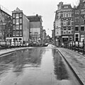 Nieuwe Hoogstraat vanaf Kloveniersburgwal - Amsterdam - 20010935 - RCE.jpg 1,197 × 1,200; 319 KB
-

-
 Stadsarchief Amsterdam, Afb ANWT00100000001.jpg 1,771 × 1,501; 342 KB
-
 Sunset , Amsterdam , Netherlands - panoramio (83).jpg 2,848 × 4,272; 11.13 MB
-

-
 Voorgevels - Amsterdam - 20018359 - RCE.jpg 807 × 1,200; 184 KB


_en_hoger_gezien_in_zuidelijke_richting_naar_de_Bushuissluis_(Brug_224)_tussen_de_Nieuwe_Hoogstraat_(links)_en_de_Oude_Hoogstraat_(rechts).jpg)


.jpg)

