Category:Knappenhalde
Jump to navigation
Jump to search
| Object location | | View all coordinates using: OpenStreetMap |
|---|
| Upload media | |||||
| Instance of | |||||
|---|---|---|---|---|---|
| Location | Oberhausen, Düsseldorf Government Region, North Rhine-Westphalia, Germany | ||||
 | |||||
Subcategories
This category has the following 5 subcategories, out of 5 total.
Media in category "Knappenhalde"
The following 35 files are in this category, out of 35 total.
-

-
 Gladbeck-Bottrop - Halde Prosperstraße+Knappenhalde+Halde Beckstraße (Halde 22) 01 ies.jpg 5,616 × 3,744; 8.36 MB
-

-
 Knappenhalde Geländemodell.jpg 1,920 × 1,080; 1.3 MB
-
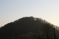 Knappenhalde oberhausen.JPG 3,888 × 2,592; 2.82 MB
-
 Knappenviertel4Halde2010-01-03k.jpg 2,162 × 1,574; 240 KB
-
 Oberhausen + Rhein-Herne-Kanal + Neue Mitte + Knappenhalde (Gasometer) 01 ies.jpg 8,500 × 3,500; 12.97 MB
-
 Oberhausen - Knappenhalde (Aussichtsturm Knappenhalde) 01 ies.jpg 5,616 × 3,744; 11.42 MB
-
 Oberhausen - Knappenhalde (Aussichtsturm Olga-Park) 01 ies.jpg 5,616 × 3,744; 8.77 MB
-
 Oberhausen - Knappenhalde (Ripshorster Straße) 01 ies.jpg 5,616 × 3,744; 14.05 MB
-
 Oberhausen - Knappenhalde (Ripshorster Straße) 02 ies.jpg 5,616 × 3,744; 13.41 MB
-
 Oberhausen - Knappenhalde - X 01 ies.jpg 5,616 × 3,744; 6.69 MB
-
 Oberhausen - Knappenhalde - X 02 ies.jpg 5,616 × 3,744; 6.84 MB
-
 Oberhausen - Knappenhalde 01 ies.jpg 5,616 × 3,744; 10.58 MB
-
 Oberhausen - Knappenhalde 02 ies.jpg 3,744 × 5,616; 6.17 MB
-
 Oberhausen - Knappenhalde 03 ies.jpg 3,744 × 5,616; 7.99 MB
-
 Oberhausen - Knappenhalde 04 ies.jpg 5,616 × 3,744; 9.53 MB
-
 Oberhausen - Knappenhalde 05 ies.jpg 5,616 × 3,744; 10.62 MB
-
 Oberhausen - Knappenhalde 06 ies.jpg 5,616 × 3,744; 11.79 MB
-
 Oberhausen - Knappenhalde 07 ies.jpg 5,616 × 3,744; 14.78 MB
-
 Oberhausen - Knappenhalde 08 ies.jpg 5,616 × 3,744; 9.15 MB
-
 Oberhausen - Knappenhalde 09 ies.jpg 5,616 × 3,744; 15.35 MB
-
 Oberhausen - Knappenhalde 10 ies.jpg 5,616 × 3,744; 12.03 MB
-
 Oberhausen - Knappenhalde 11 ies.jpg 3,744 × 5,616; 12.55 MB
-
 Oberhausen - Knappenhalde 12 ies.jpg 5,616 × 3,744; 12.7 MB
-
 Oberhausen - Knappenhalde 13 ies.jpg 5,616 × 3,744; 12.38 MB
-
 Oberhausen - Knappenhalde 14 ies.jpg 5,616 × 3,744; 14.29 MB
-
 Oberhausen - Knappenhalde 15 ies.jpg 5,616 × 3,744; 9.6 MB
-
 Oberhausen - Lipperstraße - Knappenhalde - Y 01 ies.jpg 5,616 × 3,744; 13.1 MB
-
 Oberhausen - Lipperstraße - Knappenhalde - Y 02 ies.jpg 5,616 × 3,744; 8.78 MB
-
 Oberhausen - Lipperstraße - Knappenhalde - Y 03 ies.jpg 3,744 × 5,616; 11.03 MB
-
 Oberhausen - Lipperstraße - Knappenhalde - Y 04 ies.jpg 5,616 × 3,744; 7.44 MB
-
 Oberhausen - Neue Mitte + Knappenhalde (Gasometer) 01 ies.jpg 5,616 × 3,744; 16.08 MB
-
 Oberhausen - Neue Mitte + Knappenhalde (Gasometer) 02 ies.jpg 5,616 × 3,744; 20.55 MB
-
 Oberhausen Knappenhalde - Industrietempel von Hannes Forster (1994).jpg 3,879 × 2,586; 9.31 MB
_01.jpg)
_01_ies.jpg)
_01_ies.jpg)


_01_ies.jpg)
_01_ies.jpg)
_01_ies.jpg)
_02_ies.jpg)


_01_ies.jpg)
_02_ies.jpg)
.jpg)
_01_ies.jpg)