Category:Koestraat 10, Zwolle
Jump to navigation
Jump to search
| Object location | | View all coordinates using: OpenStreetMap |
|---|
 | |||||
| Upload media | |||||
| Instance of |
| ||||
|---|---|---|---|---|---|
| Location | Zwolle, Overijssel, Netherlands | ||||
| Street address |
| ||||
| Located on street | |||||
| Heritage designation |
| ||||
 | |||||
|
This is a category about rijksmonument number 41694
|
| Address |
|
Media in category "Koestraat 10, Zwolle"
The following 8 files are in this category, out of 8 total.
-
 Evenzijde, straatwand - Zwolle - 20230660 - RCE.jpg 806 × 1,200; 133 KB
-
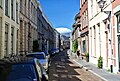 Koestraat 10-24, Zwolle.jpg 2,048 × 1,375; 471 KB
-
 Rechter voorkamer - Zwolle - 20230673 - RCE.jpg 1,200 × 824; 208 KB
-
 Rechter voorkamer - Zwolle - 20230674 - RCE.jpg 811 × 1,200; 250 KB
-
 Rechter voorkamer - Zwolle - 20230675 - RCE.jpg 818 × 1,200; 250 KB
-
 Rechter voorkamer - Zwolle - 20230677 - RCE.jpg 1,200 × 815; 218 KB
-
 Voorgevel - Zwolle - 20230676 - RCE.jpg 959 × 1,200; 266 KB
-
 Zwolle Koestraat10.jpg 2,736 × 3,648; 4.69 MB


