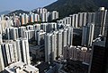
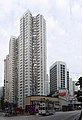
Category:Kornhill Garden
Jump to navigation
Jump to search
| Object location | | View all coordinates using: OpenStreetMap |
|---|
中文:康山花園
Private Sector Participation Scheme estate in Hong Kong  | |||||
| Upload media | |||||
| Instance of |
| ||||
|---|---|---|---|---|---|
| Location | Hong Kong, PRC | ||||
 | |||||
Media in category "Kornhill Garden"
The following 15 files are in this category, out of 15 total.
-
 HK 港島東區 鰂魚涌 Quarry Bay 康安街 Hong On Street 康山道 Kornhill Road 康怡花園 October 2023 R12S 02.jpg 4,000 × 3,000; 5.02 MB
-
 Hong Kong (16782627418).jpg 3,582 × 2,372; 1.39 MB
-
 Hong Kong Isnald Eastern District Buildings 200909.jpg 3,003 × 1,946; 4.57 MB
-
 Hong Kong Isnald Eastern District Buildings 201407.jpg 2,656 × 1,768; 3.73 MB
-
 King's Road Cityplaza.jpg 4,128 × 3,096; 4.83 MB
-
 Kornhill 200909.jpg 2,919 × 1,984; 4.33 MB
-
 Kornhill Garden 202107.jpg 1,600 × 1,200; 1.73 MB
-
 Kornhill Garden residence back home 20210509.png 1,533 × 861; 1.64 MB
-
 Kornhill Gardens 1.jpg 2,859 × 4,183; 5.44 MB
-
 Kornhill Gardens 2.jpg 3,646 × 1,332; 3.49 MB
-
 Kornhill Road near King's Road East Junction.jpg 5,520 × 4,140; 8.82 MB
-
 Properties in Quarry Bay viewed from Mount Parker Road.jpg 4,032 × 3,024; 3.38 MB
-
 Taikoo Shing Road 01.jpg 4,160 × 3,120; 4.69 MB
-
 WU8932 Hong Kong Island 32A 19-04-2022.jpg 4,032 × 3,024; 2.13 MB
-
 東達中心 (32959751000).jpg 10,000 × 9,130; 46.3 MB

.jpg)


.jpg)