Category:Kriegerdenkmal 1870/71 (Hamburg-Reitbrook)
Jump to navigation
Jump to search
| Camera location | | View all coordinates using: OpenStreetMap |
|---|
Media in category "Kriegerdenkmal 1870/71 (Hamburg-Reitbrook)"
The following 3 files are in this category, out of 3 total.
-
 Kriegerdenkmal 1870 - 1871.jpg 5,184 × 3,888; 9.14 MB
-
 Kriegerdenkmal 1870- 1871.jpg 5,184 × 3,888; 9.87 MB
-
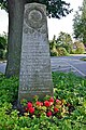 Kriegerdenkmal 1870-71 in Hamburg-Reitbrook.jpg 3,008 × 4,520; 6.65 MB


