Category:Kronberger Straße 28 (Frankfurt am Main)
Jump to navigation
Jump to search
| Object location | | View all coordinates using: OpenStreetMap |
|---|
Media in category "Kronberger Straße 28 (Frankfurt am Main)"
The following 5 files are in this category, out of 5 total.
-
 Frankfurt, Kronberger Straße 28.jpg 4,690 × 4,386; 11.55 MB
-
 Kronberger 28.jpg 300 × 400; 199 KB
-
 Stolperst kronberger 28 kohn hedwig.jpg 400 × 400; 230 KB
-
 Stolperstein kronberger 28 bing anna johanna.jpg 400 × 400; 219 KB
-
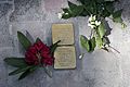 Stolpersteine Kronberger-Str. 28 Bing, Anna Kohn, Hedwig.jpg 8,576 × 5,696; 2.46 MB


