Category:Kylesku
Jump to navigation
Jump to search
hamlet in Highland, Scotland, UK  | |||||
| Upload media | |||||
| Instance of | |||||
|---|---|---|---|---|---|
| Location | Highland, Scottish Highlands, Scotland | ||||
 | |||||
Subcategories
This category has the following 2 subcategories, out of 2 total.
B
- Kylesku Bridge (44 F)
K
- Kylesku Ferry (15 F)
Media in category "Kylesku"
The following 77 files are in this category, out of 77 total.
-

-

-
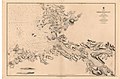 Admiralty Chart No 2502 Eddrachilles Bay, Published 1857.jpg 10,087 × 6,652; 19.26 MB
-

-
 Assynt , Loch Gleann Dubh - geograph.org.uk - 2258417.jpg 3,008 × 2,000; 1.64 MB
-
 Assynt , Loch Gleann Dubh - geograph.org.uk - 2258451.jpg 3,008 × 2,000; 1.64 MB
-
 At anchor at Kylesku - geograph.org.uk - 1938708.jpg 960 × 627; 132 KB
-
 Boat approaching Kylesku slipway - geograph.org.uk - 5205992.jpg 1,024 × 678; 199 KB
-
 Caolas Cumhann - geograph.org.uk - 4328993.jpg 1,024 × 751; 154 KB
-
 Captain goes aboard off Kylesku - geograph.org.uk - 1375410.jpg 640 × 492; 72 KB
-
 Comas na Cusgaig - geograph.org.uk - 6348185.jpg 3,520 × 2,304; 1,010 KB
-
 Crossing the bridge, Kylesku - geograph.org.uk - 5206059.jpg 1,024 × 797; 211 KB
-
 Early morning light on Loch Glendu. - geograph.org.uk - 4649360.jpg 640 × 480; 33 KB
-
 Eastward to Loch Glendhu from the Kylesku Ferry, 1957 - geograph.org.uk - 4216546.jpg 2,347 × 1,579; 1.47 MB
-

-
 Fishing, Loch Glendhu, opposite Kylesku - geograph.org.uk - 5882404.jpg 5,472 × 3,648; 3.13 MB
-
 Kylesku - geograph.org.uk - 822943.jpg 640 × 381; 211 KB
-
 Kylesku and Quinaig - geograph.org.uk - 1804182.jpg 576 × 374; 51 KB
-
 Kylesku Bridge - geograph.org.uk - 4779495.jpg 640 × 339; 62 KB
-
 Kylesku Bridge - geograph.org.uk - 5109000.jpg 640 × 480; 278 KB
-
 Kylesku Bridge as seen from Sail Gharbh - geograph.org.uk - 6466239.jpg 1,799 × 1,199; 341 KB
-
 Kylesku Bridge from below - geograph.org.uk - 5530304.jpg 1,255 × 1,600; 294 KB
-
 Kylesku Bridge from Ben Strome - geograph.org.uk - 5208249.jpg 1,024 × 678; 131 KB
-
 Kylesku Bridge from the north - geograph.org.uk - 5531005.jpg 1,600 × 1,060; 450 KB
-
 Kylesku Bridge viewed from the water - geograph.org.uk - 6273111.jpg 4,000 × 3,000; 5.51 MB
-
 Kylesku Bridge with the Stack of Glen Coul in the distance - geograph.org.uk - 5264675.jpg 1,800 × 1,013; 1,000 KB
-
 Kylesku Ferry - 1975 - geograph.org.uk - 2219519.jpg 2,272 × 1,515; 698 KB
-
 Kylesku Ferry - 1975 - geograph.org.uk - 2219526.jpg 2,272 × 1,515; 631 KB
-
 Kylesku Ferry - 1975 - geograph.org.uk - 2219530.jpg 2,272 × 1,515; 581 KB
-
 Kylesku Ferry - 1975 - geograph.org.uk - 2219532.jpg 2,272 × 1,515; 456 KB
-
 Kylesku Ferry - geograph.org.uk - 3977532.jpg 640 × 427; 74 KB
-
 Kylesku Ferry - geograph.org.uk - 6348190.jpg 3,520 × 2,303; 1.6 MB
-
 Kylesku Ferry - geograph.org.uk - 878115.jpg 550 × 339; 35 KB
-
 Kylesku Ferry 1974 - geograph.org.uk - 5149601.jpg 2,462 × 1,609; 727 KB
-
 Kylesku Ferry at Kylestrome - geograph.org.uk - 5708294.jpg 1,600 × 1,073; 362 KB
-
 Kylesku Ferry at Kylestrome, mid 1950s - geograph.org.uk - 5245888.jpg 1,872 × 1,266; 285 KB
-
 Kylesku Fishery Jetty - geograph.org.uk - 3139211.jpg 800 × 530; 144 KB
-
 Kylesku Hotel and slipway - geograph.org.uk - 2971910.jpg 800 × 530; 117 KB
-
 Kylesku Loch Glencoul 3199621 660a5da2.jpg 631 × 337; 283 KB
-
 Kylesku Narrows - 1978 - geograph.org.uk - 2958739.jpg 2,272 × 1,515; 261 KB
-
 Kylesku Narrows - 1978 - geograph.org.uk - 2958744.jpg 2,272 × 1,515; 524 KB
-
 Kylesku Narrows - 1978 - geograph.org.uk - 4322518.jpg 2,272 × 1,514; 432 KB
-
 Kylesku slipway - geograph.org.uk - 443395.jpg 640 × 427; 71 KB
-
 Kylesku XXII Submarine Flotilla War Memorial.jpg 640 × 480; 51 KB
-
 Loch Gleann Dubh - geograph.org.uk - 823671.jpg 640 × 427; 228 KB
-
 Loch Glendhu - geograph.org.uk - 2302831.jpg 2,815 × 1,701; 1.4 MB
-
 Loch Glendhu.jpg 2,048 × 1,536; 500 KB
-
 Looking back to Quinag from Kylesku - geograph.org.uk - 751324.jpg 640 × 425; 93 KB
-
 Looking up to Loch Glendhu - geograph.org.uk - 6193760.jpg 1,024 × 573; 151 KB
-
 M.v.Statesman landing at Kylesku - geograph.org.uk - 868604.jpg 640 × 426; 67 KB
-
 Mobile bank at Kylesku - geograph.org.uk - 5206000.jpg 1,024 × 678; 152 KB
-
 Morning light on Loch Glendhu - geograph.org.uk - 4016693.jpg 1,024 × 708; 207 KB
-
 Mussel farm near Kylesku Bridge - geograph.org.uk - 6193923.jpg 1,024 × 575; 80 KB
-
 MV 'Statesman' - geograph.org.uk - 823667.jpg 640 × 427; 239 KB
-
 New jetty at Kylesku - geograph.org.uk - 868595.jpg 640 × 426; 70 KB
-
 Old ferry slipway, Kylestrome - geograph.org.uk - 5205989.jpg 1,024 × 711; 260 KB
-
 Old Kylesku Ferry - 1978 - geograph.org.uk - 2958748.jpg 2,272 × 1,515; 896 KB
-
 Queen of Kylesku Ferry - 1975 - geograph.org.uk - 2219512.jpg 2,272 × 1,515; 436 KB
-
 Road bridge at Kylesku - geograph.org.uk - 5535782.jpg 1,500 × 888; 1.05 MB
-
 Rocks at low tide - geograph.org.uk - 3695986.jpg 1,439 × 957; 527 KB
-
 Sheltered moorings - geograph.org.uk - 5775566.jpg 3,000 × 3,191; 2.55 MB
-
 Slipway at Kylesku - geograph.org.uk - 1379231.jpg 640 × 480; 94 KB
-
 The elegant Kylesku Bridge - geograph.org.uk - 6193690.jpg 1,024 × 575; 148 KB
-
 The elegant Kylesku Bridge - geograph.org.uk - 6194589.jpg 575 × 1,024; 108 KB
-
 The head of Loch Glendhu - geograph.org.uk - 3144175.jpg 800 × 530; 84 KB
-
 The Kylesku bridge. - geograph.org.uk - 4649356.jpg 640 × 352; 39 KB
-
 The Kylesku Ferry - geograph.org.uk - 4638056.jpg 2,400 × 1,599; 571 KB
-

-
 The northern ramp of Kylesku Ferry in 1976 - geograph.org.uk - 4562652.jpg 8,213 × 5,141; 3.16 MB
-
 The old slip way at Kylestrome - geograph.org.uk - 2790043.jpg 1,000 × 669; 154 KB
-
 The rocky shore of Loch Glendhu - geograph.org.uk - 4649394.jpg 640 × 369; 41 KB
-
 The view east from Kylesku - geograph.org.uk - 5775563.jpg 4,000 × 2,164; 1.32 MB
-
 View from Kylesku - geograph.org.uk - 1764713.jpg 720 × 464; 53 KB
-
 Wet weather at Kylesku Bridge - geograph.org.uk - 6609420.jpg 1,600 × 1,066; 329 KB
-
 Kylesku fishing jetty - geograph.org.uk - 443388.jpg 427 × 640; 68 KB
-
 Kylesku Jetty - geograph.org.uk - 193477.jpg 640 × 480; 92 KB
-
 Kylesku Village - geograph.org.uk - 32065.jpg 640 × 480; 77 KB


