Category:La Pouëze
Jump to navigation
Jump to search
former commune in Maine-et-Loire, France    | |||||
| Upload media | |||||
| Instance of |
| ||||
|---|---|---|---|---|---|
| Location |
| ||||
| Dissolved, abolished or demolished date |
| ||||
| Population |
| ||||
| Area |
| ||||
| Replaced by | |||||
 | |||||
Subcategories
This category has the following 7 subcategories, out of 7 total.
Media in category "La Pouëze"
The following 24 files are in this category, out of 24 total.
-
 Blason famille fr La Poeze.svg 600 × 660; 8 KB
-
 Charbonniers.JPG 1,600 × 1,200; 901 KB
-
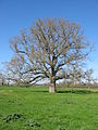 Chêne-1.JPG 1,200 × 1,600; 869 KB
-
 Circuit-ign-poueze.JPG 1,491 × 946; 483 KB
-
 Clairet-1.JPG 4,000 × 3,000; 2.56 MB
-
 La poueze - panoramio.jpg 4,000 × 3,000; 1.97 MB
-
 La Pouëze - Mairie.jpg 1,824 × 1,368; 414 KB
-
 Livet-plaque-bronze.jpg 3,487 × 2,231; 1.28 MB
-
 Mai-poez.jpg 1,540 × 1,080; 150 KB
-
 Mairie de la poueze - panoramio.jpg 4,000 × 3,000; 1.99 MB
-
 Map commune FR insee code 49249.png 756 × 605; 45 KB
-
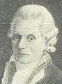
 Morel.jpg 1,182 × 1,081; 107 KB
-
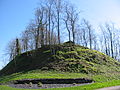 Motte-feodale.JPG 1,600 × 1,200; 903 KB
-
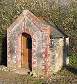 Oratoire-antoine.JPG 983 × 1,059; 493 KB
-
 Panneau-2-source-erdre.JPG 1,155 × 792; 261 KB
-
 Panneau-source-erdre.JPG 1,535 × 1,031; 428 KB
-
 Parc-villenière.JPG 1,600 × 1,200; 1.18 MB
-
 Population - Municipality code 49249.svg 475 × 355; 13 KB
-
 Source-2-erdre.JPG 827 × 1,002; 290 KB
-
 Source-brionneau.JPG 566 × 1,390; 477 KB
-
 Source-erdre.jpg 881 × 1,096; 393 KB
-
 Talour.jpg 363 × 490; 131 KB
-
 Theatre-ardoise.JPG 611 × 1,232; 150 KB
-
 Vieux-chêne.JPG 903 × 1,060; 480 KB


