Category:Lamarsh
Jump to navigation
Jump to search
village and civil parish in Essex, England | |||||
| Upload media | |||||
| Instance of | |||||
|---|---|---|---|---|---|
| Location | Braintree, Essex, East of England, England | ||||
| Population |
| ||||
 | |||||
Subcategories
This category has the following 2 subcategories, out of 2 total.
- Holy Innocents Church, Lamarsh (18 F)
L
- The Lamarsh Lion (2 F)
Media in category "Lamarsh"
The following 88 files are in this category, out of 88 total.
-
 153 approaching bridge in the Stour Valley.jpg 5,035 × 2,719; 2.01 MB
-
 153 in Stour Valley 220619.jpg 5,020 × 2,689; 1.63 MB
-
 A corner of Lamarsh churchyard - geograph.org.uk - 4723469.jpg 640 × 480; 149 KB
-
 Bell Hill - geograph.org.uk - 3001505.jpg 1,024 × 768; 261 KB
-
 Bell Hill, Lamarsh - geograph.org.uk - 1933798.jpg 4,000 × 3,000; 2.97 MB
-
 Bench and gate - geograph.org.uk - 5199681.jpg 5,083 × 2,687; 3.14 MB
-
 Bridge - geograph.org.uk - 3000069.jpg 1,024 × 768; 324 KB
-
 Bridge Into Essex - geograph.org.uk - 2844261.jpg 1,024 × 768; 382 KB
-
 Cattle and river - geograph.org.uk - 3001498.jpg 1,024 × 768; 262 KB
-
 Chicken of the Woods - geograph.org.uk - 3177545.jpg 600 × 800; 240 KB
-

-

-

-

-
 Cottages near Edgar's Farm - geograph.org.uk - 5199625.jpg 5,184 × 3,456; 7.21 MB
-
 Crossing Point - geograph.org.uk - 3001502.jpg 1,024 × 768; 375 KB
-
 Elm lock gate post - geograph.org.uk - 3177563.jpg 800 × 600; 186 KB
-
 Footbridge - geograph.org.uk - 2844319.jpg 768 × 1,024; 311 KB
-
 Footpath - geograph.org.uk - 2844288.jpg 1,024 × 768; 230 KB
-

-
 Henny Road - geograph.org.uk - 2844264.jpg 1,024 × 768; 198 KB
-
 Holy Innocents, Lamarsh - Chancel - geograph.org.uk - 5587646.jpg 900 × 726; 252 KB
-
 Holy Innocents, Lamarsh - East end - geograph.org.uk - 5587644.jpg 900 × 714; 239 KB
-
 Holy Innocents, Lamarsh - East end - geograph.org.uk - 5587645.jpg 900 × 675; 273 KB
-
 Holy Innocents, Lamarsh - Font - geograph.org.uk - 5587655.jpg 641 × 900; 189 KB
-
 Holy Innocents, Lamarsh - geograph.org.uk - 5587639.jpg 674 × 900; 173 KB
-
 Holy Innocents, Lamarsh - geograph.org.uk - 5587642.jpg 900 × 680; 228 KB
-
 Holy Innocents, Lamarsh - Organ - geograph.org.uk - 5587654.jpg 644 × 900; 199 KB
-
 Holy Innocents, Lamarsh - Sanctuary - geograph.org.uk - 5587647.jpg 900 × 665; 309 KB
-

-
 Holy Innocents, Lamarsh - Wall monument - geograph.org.uk - 5587649.jpg 582 × 900; 221 KB
-
 Holy Innocents, Lamarsh - Wall monument - geograph.org.uk - 5587651.jpg 900 × 857; 264 KB
-

-
 Holy Innocents, Lamarsh - Wall monument - geograph.org.uk - 5587653.jpg 900 × 586; 174 KB
-

-
 Installed And Maintained - geograph.org.uk - 2844323.jpg 768 × 1,024; 184 KB
-
 Kissing Gate - geograph.org.uk - 3001519.jpg 1,024 × 768; 332 KB
-
 Lamarsh communication centre - geograph.org.uk - 4723419.jpg 640 × 480; 93 KB
-
 Lamarsh hall - geograph.org.uk - 5199646.jpg 4,748 × 3,184; 3.57 MB
-
 Lamarsh Hall and Church - geograph.org.uk - 668117.jpg 640 × 427; 75 KB
-
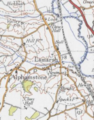 Lamarsh historical map excerpt.PNG 279 × 355; 234 KB
-
 Lamarsh village hall - geograph.org.uk - 5199640.jpg 5,184 × 3,456; 6.68 MB
-
 Lamarsh, Essex - geograph.org.uk - 137720.jpg 640 × 480; 86 KB
-
 Lane towards Lamarsh - geograph.org.uk - 4723394.jpg 640 × 480; 179 KB
-
 Lane towards Lamarsh - geograph.org.uk - 4723404.jpg 640 × 480; 162 KB
-
 Level Crossing - geograph.org.uk - 2844263.jpg 1,024 × 768; 364 KB
-
 Long Thatch - geograph.org.uk - 3001516.jpg 1,024 × 768; 220 KB
-
 Long Thatch, Lamarsh - geograph.org.uk - 2457137.jpg 640 × 480; 171 KB
-
 Looking towards Lamarsh Hill - geograph.org.uk - 2661530.jpg 3,648 × 2,736; 1.7 MB
-
 Narrow Road - geograph.org.uk - 2844314.jpg 768 × 1,024; 372 KB
-
 No public access^ - geograph.org.uk - 4269003.jpg 2,816 × 2,112; 2.46 MB
-
 Pill box overlooking the River Stour - geograph.org.uk - 2736273.jpg 1,024 × 768; 170 KB
-
 Pillbox by the River Stour - geograph.org.uk - 5198918.jpg 5,202 × 2,800; 3.08 MB
-
 Pitmire Island - geograph.org.uk - 2815570.jpg 2,816 × 2,112; 2.59 MB
-
 Pitmire Island - geograph.org.uk - 3177536.jpg 640 × 480; 125 KB
-
 Pitmire Island in the snow - geograph.org.uk - 2815574.jpg 2,816 × 2,112; 2.46 MB
-
 Pitmire Lock - geograph.org.uk - 3177557.jpg 600 × 800; 237 KB
-
 Pitmire Weir - geograph.org.uk - 3177540.jpg 800 × 600; 174 KB
-
 Public footpath and private road, on Bell Hill - geograph.org.uk - 2661620.jpg 3,648 × 2,736; 1.79 MB
-
 Pylon and trees, Lamarsh - geograph.org.uk - 3964884.jpg 2,794 × 1,572; 838 KB
-
 Pylons - geograph.org.uk - 2844330.jpg 768 × 1,024; 182 KB
-
 Railway line to Sudbury - geograph.org.uk - 5199622.jpg 4,413 × 2,973; 3.28 MB
-
 River Stour and flood plain - geograph.org.uk - 2815899.jpg 2,112 × 2,816; 2.49 MB
-
 River Stour flood plain - geograph.org.uk - 2815578.jpg 2,816 × 2,112; 2.57 MB
-
 River Stour near Lamarsh - geograph.org.uk - 5199616.jpg 5,202 × 3,119; 3.55 MB
-
 Road Sign - geograph.org.uk - 3002368.jpg 1,024 × 768; 316 KB
-
 Signpost at Lamarsh - geograph.org.uk - 5199634.jpg 5,184 × 3,456; 7.69 MB
-
 Signpost at Larkin's Lane and Moat Lane junction - geograph.org.uk - 5199686.jpg 4,808 × 3,135; 4.06 MB
-
 Snowdrop glade - geograph.org.uk - 2815592.jpg 2,816 × 2,112; 2.45 MB
-
 Snowy fields - geograph.org.uk - 3299162.jpg 640 × 480; 73 KB
-
 St Edmunds Way - geograph.org.uk - 5199651.jpg 5,202 × 3,465; 4.17 MB
-
 St Edmunds Way hilltop - geograph.org.uk - 5199670.jpg 5,202 × 3,465; 4.07 MB
-
 St Edmunds Way towards Valley Farm - geograph.org.uk - 5199692.jpg 5,202 × 3,465; 4.46 MB
-
 Start of track to Valley Farm - geograph.org.uk - 4367972.jpg 640 × 480; 133 KB
-
 Stour Valley from Daws Hall Nature Reserve - geograph.org.uk - 4269007.jpg 2,816 × 2,112; 2.63 MB
-
 Stour Valley Path - geograph.org.uk - 2999504.jpg 1,024 × 768; 242 KB
-
 Stour Valley path at Lorkin's Lane - geograph.org.uk - 5199683.jpg 4,791 × 2,855; 4.14 MB
-
 Thatched cottage near junction, Lamarsh - geograph.org.uk - 2457086.jpg 640 × 480; 193 KB
-
 The Lamarsh Lion - geograph.org.uk - 5199638.jpg 5,184 × 3,456; 5.17 MB
-
 Undulating Pasture, Lamarsh - geograph.org.uk - 3964873.jpg 3,648 × 2,736; 2.63 MB
-
 Valley Farm - geograph.org.uk - 5199698.jpg 5,184 × 3,456; 6.98 MB
-
 Valley Farm - geograph.org.uk - 5199709.jpg 5,184 × 3,456; 7.16 MB
-
 Valley Farm, Lamarsh - geograph.org.uk - 668111.jpg 640 × 427; 72 KB
-

-
 View to the church at Lamarsh - geograph.org.uk - 2736281.jpg 1,024 × 768; 194 KB
-
 Weir on River Stour at Daws Hall Nature Reserve - geograph.org.uk - 2815551.jpg 2,816 × 2,112; 2.63 MB
-
 Weir on River Stour at Daws Hall Nature Reserve - geograph.org.uk - 2815560.jpg 2,816 × 2,112; 2.3 MB
-
 Wooden building near Edgar's Farm - geograph.org.uk - 5199631.jpg 5,035 × 2,854; 2.98 MB


