Category:Landsat images with Kashmir 3D
Jump to navigation
Jump to search
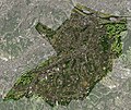
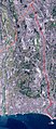
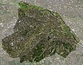
| The Landsat satellite pictures are used for this image. The data came from Global Land Cover Facility (GLCF), and are processed with Kashmir 3D. |
Wikimedia category | |||||
| Upload media | |||||
| Instance of | |||||
|---|---|---|---|---|---|
| |||||
Pages in category "Landsat images with Kashmir 3D"
The following 2 pages are in this category, out of 2 total.
Media in category "Landsat images with Kashmir 3D"
The following 125 files are in this category, out of 125 total.
-
 Akirunoshi-Landsat001.jpg 1,034 × 619; 137 KB
-
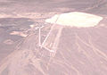 Area 51 Groom Lake.jpg 804 × 566; 88 KB
-
 Awase landsat.jpg 764 × 652; 148 KB
-
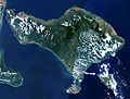 BaliLandsat001.jpg 896 × 682; 133 KB
-
 Fussashi-Landsat001.jpg 259 × 298; 32 KB
-
 Hamamatsu airbase.jpg 220 × 220; 45 KB
-
 Hamurashi-Landsat001.jpg 281 × 239; 30 KB
-
 Heiankyo landsat.jpg 400 × 400; 45 KB
-
 Hinodemachi-Landsat001.jpg 652 × 396; 59 KB
-
 Hinoharamura-Landsat001.jpg 864 × 765; 124 KB
-
 Hinuma-landsat.jpg 361 × 301; 23 KB
-
 Inbanuma landsat.jpg 417 × 323; 82 KB
-
 Iruma airbase.jpg 220 × 220; 38 KB
-
 Isahaya bay landsat.jpg 861 × 810; 153 KB
-
 Iwo-to landsat1999.jpg 1,251 × 1,148; 193 KB
-
 Kasumigaura landsat (cropped).jpg 670 × 456; 74 KB
-
 Kasumigaura landsat.jpg 1,024 × 768; 167 KB
-
 Kawasaki city.png 4,500 × 3,000; 27.03 MB
-
 Lake abashiri landsat.jpg 564 × 636; 120 KB
-
 Lake akkeshi landsat.jpg 632 × 478; 75 KB
-
 Lake biwa.jpg 1,024 × 1,399; 176 KB
-
 Lake furen landsat.jpg 940 × 649; 135 KB
-
 Lake hamana landsat.jpg 903 × 712; 158 KB
-
 Lake kojima landsat.jpg 404 × 348; 64 KB
-
 Lake kussyaro landsat.jpg 1,024 × 851; 147 KB
-
 Lake masyu landsat.jpg 644 × 563; 80 KB
-
 Lake motosu landsat.jpg 417 × 306; 113 KB
-
 Lake nakaumi landsat.jpg 1,024 × 802; 161 KB
-
 Lake notoro landsat.jpg 579 × 726; 100 KB
-
 Lake ogawara landsat.jpg 432 × 600; 93 KB
-
 Lake saroma.jpg 1,024 × 802; 158 KB
-
 Lake shikotsu landsat.jpg 947 × 858; 126 KB
-
 Lake shinji landsat.jpg 1,024 × 791; 155 KB
-
 Lake Shumarinai Landsat 01.jpg 2,326 × 1,745; 2.84 MB
-
 Lake syunkusitakara landsat.jpg 1,024 × 1,064; 643 KB
-
 Lake towada landsat.jpg 608 × 614; 99 KB
-
 Lake toya landsat.jpg 879 × 801; 163 KB
-
 Landsat Aogashima Island.jpg 250 × 197; 72 KB
-
 Landsat Hachijojima Island.jpg 649 × 474; 67 KB
-
 Landsat image of Fuji-go-ko.jpg 1,118 × 521; 197 KB
-
 Landsat IzuOshima Island.jpg 600 × 830; 197 KB
-
 Landsat Kozushima Island.jpg 295 × 358; 26 KB
-
 Landsat Mikurajima Island.jpg 241 × 301; 21 KB
-
 Landsat Miyakejima Island.jpg 436 × 454; 32 KB
-
 Landsat Niijima and Shikinejima Island.jpg 409 × 541; 39 KB
-
 Landsat Toshima Island.jpg 112 × 140; 15 KB
-
 Lattice shelterbelt in Konsen plateau Japan.png 1,082 × 720; 1.57 MB
-
 Liechtenstein Landsat001.jpg 551 × 891; 114 KB
-
 Mizuhomachi-Landsat001.jpg 345 × 381; 44 KB
-
 Mt asama landsat 3d.jpg 1,024 × 768; 91 KB
-
 Mt asama landsat.jpg 800 × 600; 125 KB
-
 Musashino Plateau.jpg 1,093 × 930; 308 KB
-
 Narita International Airport landsat.jpg 450 × 240; 65 KB
-
 Nastudomari Pen 01.jpg 1,244 × 758; 128 KB
-
 Nishina Three Lakes.jpg 408 × 635; 276 KB
-
 Odoi landsat.jpg 400 × 400; 45 KB
-
 Okutamamachi-Landsat001.jpg 782 × 643; 104 KB
-
 Omeshi-Landsat001.jpg 1,026 × 652; 143 KB
-
 Paris-Landsat001.jpg 900 × 823; 250 KB
-
 Paris-Landsat002.jpg 848 × 675; 186 KB
-
 Port of Kawasaki Landsat.jpg 620 × 495; 67 KB
-
 Port of Yokohama Landsat.jpg 1,190 × 675; 179 KB
-
 Port of yokosuka landsat.jpg 386 × 505; 46 KB
-
 Sanbanze landsat.jpg 320 × 231; 57 KB
-
 Scratchell's Bay Satellite.png 1,816 × 960; 2.32 MB
-
 Syodoshima landsat.jpg 892 × 677; 152 KB
-
 Tangjiashan Lake 2016 Landsat.jpg 696 × 500; 119 KB
-
 Tangjiashan Lake 2018 Landsat.jpg 782 × 500; 138 KB
-
 Teganuma landsat.jpg 477 × 227; 57 KB
-
 Three barriers in Japan.png 902 × 1,074; 1.95 MB
-
 Tokyo International Airport landsat.jpg 329 × 270; 50 KB
-
 Tokyobay landsat.jpg 461 × 791; 63 KB
-
 TsugaruPeninsulaJpLandsat.jpg 849 × 796; 140 KB
-
 Tsurumi.png 1,300 × 1,350; 3.65 MB
-
 Uraga channel landsat.jpg 282 × 375; 17 KB
-
 Watarase yusuichi landsat.jpg 296 × 356; 56 KB
-
 Wien-Landsat001.jpg 546 × 566; 109 KB
-
 Yokohama Landsat.jpg 1,500 × 2,100; 803 KB
-
 三鷹市の衛星写真001.jpg 381 × 319; 42 KB
-
 世田谷区衛星写真001.jpg 578 × 637; 122 KB
-
 京急衛星画像050.jpg 394 × 1,028; 110 KB
-
 京急衛星画像100中.jpg 364 × 803; 90 KB
-
 京急衛星画像100北.jpg 321 × 437; 54 KB
-
 京急衛星画像100南.jpg 460 × 608; 78 KB
-
 京王電鉄050.jpg 733 × 236; 60 KB
-
 京王電鉄100.jpg 1,466 × 471; 144 KB
-
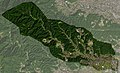
 伊那市の衛星写真001.jpg 783 × 609; 112 KB
-
 八王子市の衛星写真001.jpg 1,401 × 799; 189 KB
-
 南箕輪村衛星写真001.jpg 487 × 314; 44 KB
-
 国分寺の衛星写真001.jpg 346 × 240; 29 KB
-
 国立市の衛星写真001.jpg 238 × 242; 27 KB
-
 多摩川の衛星写真001.jpg 851 × 373; 106 KB
-
 多摩市の衛星写真001.jpg 446 × 375; 54 KB
-
 天津港“8·12”瑞海公司危险品仓库特别重大火灾爆炸事故调查报告 图1.jpg 960 × 720; 198 KB
-
 小平市衛星写真001.jpg 543 × 269; 45 KB
-
 小田急衛星画像025.jpg 497 × 453; 91 KB
-
 小田急衛星画像100中.jpg 420 × 958; 128 KB
-
 小田急衛星画像100北.jpg 972 × 688; 221 KB
-
 小田急衛星画像100西.jpg 824 × 774; 168 KB
-
 小金井の衛星写真001.jpg 272 × 246; 16 KB
-
 府中市の衛星写真001.jpg 515 × 370; 58 KB
-
 日野市の衛星写真001.jpg 470 × 368; 54 KB
-
 昭島市の衛星写真001.jpg 362 × 249; 35 KB
-
 東久留米市衛星写真001.jpg 346 × 297; 37 KB
-
 東大和市域の衛星写真001.jpg 329 × 275; 32 KB
-
 東村山市衛星写真001.jpg 353 × 339; 42 KB
-
 武蔵村山市域の衛星写真001.jpg 331 × 290; 35 KB
-
 武蔵野市の衛星写真001.jpg 379 × 199; 28 KB
-
 母島列島001.jpg 383 × 607; 66 KB
-
 清瀬市衛星写真001.jpg 293 × 340; 36 KB
-
 父島列島001.jpg 424 × 722; 57 KB
-
 父島母島001.jpg 167 × 746; 23 KB
-
 狛江衛星写真001.jpg 181 × 230; 27 KB
-
 町田市~1.JPG 629 × 414; 69 KB
-
 町田市衛星写真100.jpg 1,258 × 827; 256 KB
-
 相模原市衛星写真050.jpg 419 × 386; 52 KB
-
 相模原市衛星写真100.jpg 838 × 771; 181 KB
-
 相模川衛星写真001.jpg 1,088 × 855; 217 KB
-
 稲城の衛星写真001.jpg 346 × 337; 29 KB
-
 立川市域の衛星画像001.jpg 511 × 436; 68 KB
-
 箱根登山001.jpg 609 × 330; 57 KB
-
 萩の衛星写真001.jpg 663 × 856; 87 KB
-
 西東京市衛星写真001.jpg 294 × 352; 37 KB
-
 調布の衛星写真001.jpg 411 × 382; 38 KB
-
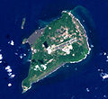
 青ヶ島の衛星写真001.jpg 45 × 54; 7 KB


.jpg)


