Category:Lange Kuhdrift (Eupen)
Jump to navigation
Jump to search
| Object location | | View all coordinates using: OpenStreetMap |
|---|
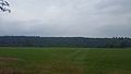
track in Eupen, Belgium  | |||||
| Upload media | |||||
| Instance of | |||||
|---|---|---|---|---|---|
| Location | Eupen, Arrondissement of Verviers, Province of Liege, Walloon Region, Belgium | ||||
| Heritage designation |
| ||||
 | |||||
Deutsch: Uralter Feldweg gesäumt von Bäumen. Es handelt sich hauptsächlich um Eichen und Ulmen
Français : Ancien chemin de terre bordé d'arbres. Ce sont principalement des chênes et des ormes
Nederlands: Oude onverharde weg gezoomt van bomen. Dit zijn uitsluitend eiken
English: Ancient dirt road lined with trees. These are exclusively oaks
|
This is a category about a monument of the German-speaking Community of Belgium, number: 31046
|
Media in category "Lange Kuhdrift (Eupen)"
The following 19 files are in this category, out of 19 total.
-
 Eupen-Lange Kuhdrift (1).jpg 5,312 × 2,988; 5.74 MB
-
 Eupen-Lange Kuhdrift (2).jpg 2,988 × 5,312; 5.39 MB
-
 Eupen-Lange Kuhdrift (3).jpg 2,988 × 5,312; 6.5 MB
-
 Eupen-Lange Kuhdrift (4).jpg 5,312 × 2,988; 3.11 MB
-
 Eupen-Lange Kuhdrift (5).jpg 2,988 × 5,312; 6.24 MB
-
 Eupen-Lange Kuhdrift (6).jpg 5,312 × 2,988; 6.64 MB
-
 Eupen-Lange Kuhdrift (7).jpg 2,988 × 5,312; 7.13 MB
-
 Lange Kuhdrift (Eupen) (01).jpg 3,024 × 4,032; 7.16 MB
-
 Lange Kuhdrift (Eupen) (02).jpg 3,890 × 1,426; 4.43 MB
-
 Lange Kuhdrift (Eupen) (03).jpg 3,024 × 4,032; 8.72 MB
-
 Lange Kuhdrift (Eupen) (04).jpg 4,032 × 3,024; 9.36 MB
-
 Lange Kuhdrift (Eupen) (05).jpg 4,032 × 3,024; 7.15 MB
-
 Lange Kuhdrift (Eupen) (06).jpg 3,923 × 5,230; 16.89 MB
-
 Lange Kuhdrift (Eupen) (07).jpg 2,223 × 4,841; 8.52 MB
-
 Lange Kuhdrift (Eupen) (08).jpg 2,250 × 4,000; 7.26 MB
-
 Lange Kuhdrift (Eupen) (09).jpg 3,484 × 3,080; 10.27 MB
-
 Lange Kuhdrift (Eupen) (10).jpg 2,250 × 4,000; 7.56 MB
-
 Lange Kuhdrift - Eupen.JPG 3,240 × 4,320; 5.71 MB
-
 Lange Kuhdrift Eupen1.JPG 2,368 × 1,446; 1.32 MB
.jpg)
.jpg)
.jpg)
.jpg)
.jpg)
.jpg)
.jpg)
_(01).jpg)
_(03).jpg)
_(04).jpg)
_(05).jpg)
_(06).jpg)
_(07).jpg)
_(08).jpg)
_(09).jpg)
_(10).jpg)

_(02).jpg)