Category:Largs
Перейти к навигации
Перейти к поиску
Deutsch: Largs ist eine Kleinstadt mit etwa 11.360 Einwohnern (Schätzung 2004) am Firth of Clyde in North Ayrshire, Schottland.
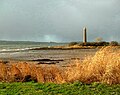
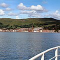
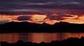
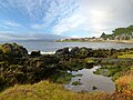
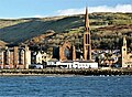
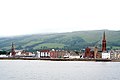
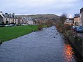
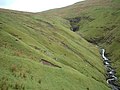
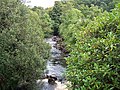
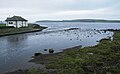
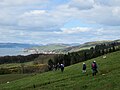
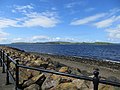
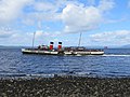
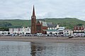
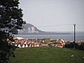
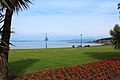
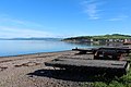
English: Largs is a town on the Firth of Clyde in North Ayrshire, Scotland, about 33 miles (53 km) from Glasgow.
Français : Largs est une ville d' Écosse située sur le Firth of Clyde dans le North Ayrshire à environ de Glasgow.
Gàidhlig: 'S e baile a th' anns an Leargaidh Ghallda ( Beurla: Largs) ann an Siorrachd Inbhir Àir a Tuath, ann an àird an iar-dheas na h-Alba. Bha am Mòd Nàiseanta Rioghail anns a' bhaile fhèin ann an 2002.
Lëtzebuergesch: Largs ass eng kleng Stad an North Ayrshire, Schottland, ongeféier 50 km vu Glasgow ewech. Si ass ee bäi Touriste ganz beléifte Vakanzeressort um Atlantik.
Nederlands: Largs is een plaats ( burgh) in het Schotse bestuurlijke gebied North Ayrshire en telt 11.241 inwoners. Largs ligt op 53 km van Glasgow, en is een badplaats met een pier.
Norsk bokmål: Largs ( skotsk gælisk: Leargaidh Ghallda) er en by i regionen North Ayrshire i Skottland, med status som burgh. Byen ligger langs Firth of Clyde, og befinner seg omtrent 53 km fra Glasgow.
Русский: Ларгс — город на западном побережье Шотландии в области Северный Эйршир, примерно 53 км от Глазго.
coastal town in North Ayrshire, Scotland, UK  | |||||
| Медиафайл | |||||
| Это частный случай понятия |
| ||||
|---|---|---|---|---|---|
| Местонахождение |
| ||||
| Находится в акватории или на берегу водоёма |
| ||||
| Численность населения |
| ||||
 | |||||
Подкатегории
В этой категории отображается 23 подкатегории из имеющихся 23.
*
- Quality images of Largs (1 Ф)
2
A
- Aubery Park (7 Ф)
B
- Blaeloch Hill (6 Ф)
- Brisbane Aisle (2 Ф)
- Brooksby House Hospital (3 Ф)
C
- Cockmalane Castle Hill (3 Ф)
D
H
- Haylie House cairn (2 Ф)
K
- Knox's Rock (5 Ф)
L
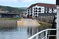
- Largs ferry terminal (12 Ф)
- Largs Viking Festival (1 Ф)
- Largs war memorial (3 Ф)
- Long Hill, North Ayrshire (5 Ф)
O
T
V
- Vikingar! (8 Ф)
Файлы в категории «Largs»
Показаны 200 файлов из 674, находящихся в данной категории.
(Предыдущая страница) (Следующая страница)-
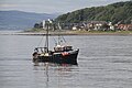
 "Guide Me" Fishing Boat off Hollywood 2 (19305777270).jpg 2366 × 1598; 962 КБ
-
 "Guide Me" Fishing Boat off Hollywood, Largs (19486936592).jpg 4786 × 1906; 2,39 МБ
-
 "Guide Me" Fishing Boat off Largs (19486941412).jpg 4246 × 2829; 2,68 МБ
-
 "Loch Shira" - panoramio.jpg 2592 × 1944; 3,18 МБ
-
 "Mo Mhairi" at Largs (19307305989).jpg 5184 × 3456; 4,91 МБ
-
 "Ranger" off Largs (19493401545).jpg 3168 × 2112; 1,3 МБ
-
 'The Pencil' - Battle of Largs Monument - geograph.org.uk - 5212049.jpg 4320 × 3240; 1,4 МБ
-
 'The Pencil' - Battle of Largs Monument - geograph.org.uk - 5212170.jpg 4160 × 3220; 1,04 МБ
-
 'The Pencil' - Battle of Largs Monument - geograph.org.uk - 5580389.jpg 3240 × 4320; 1,48 МБ
-
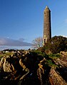 'The Pencil' - Battle of Largs Monument - geograph.org.uk - 5580595.jpg 3055 × 3884; 1001 КБ
-
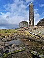 'The Pencil' - Battle of Largs Monument - geograph.org.uk - 5924742.jpg 3155 × 4208; 2,34 МБ
-
 'The Pencil' - Battle of Largs Monument - geograph.org.uk - 6103055.jpg 2796 × 3727; 2,03 МБ
-
 'The Pencil' - Battle of Largs Monument - geograph.org.uk - 6104858.jpg 1797 × 1365; 468 КБ
-
 'The Pencil' Battle of Largs Monument - geograph.org.uk - 5196917.jpg 4283 × 3186; 954 КБ
-
 'The Pencil' Battle of Largs Monument - geograph.org.uk - 5234623.jpg 1916 × 1516; 420 КБ
-
 1 Main Street, Largs.jpg 3000 × 4000; 3,21 МБ
-
 21 Main Street, Largs.jpg 3000 × 4000; 2,89 МБ
-
 3 Ferries bus - geograph.org.uk - 943683.jpg 640 × 434; 102 КБ
-
 3 Ferries bus - geograph.org.uk - 944165.jpg 640 × 438; 88 КБ
-
 A Flurry of Fifes (2629033456).jpg 1008 × 537; 98 КБ
-
 A standing stone on Largs Promenade - geograph.org.uk - 1291531.jpg 640 × 481; 55 КБ
-
 A view of Largs and Fairlie Pier from Hunterston, North Ayrshire.jpg 4459 × 1360; 875 КБ
-
 A78 in Largs - geograph.org.uk - 943692.jpg 640 × 480; 95 КБ
-
 After the tack (2656715028).jpg 2322 × 2280; 662 КБ
-
 Aird Hill and the north end of Great Cumbrae - geograph.org.uk - 4894208.jpg 1024 × 768; 139 КБ
-
 Altair (2628214949).jpg 1008 × 1014; 186 КБ
-
 Approaching Largs - geograph.org.uk - 5778604.jpg 1280 × 1280; 1,2 МБ
-
 Approaching Largs Slip - geograph.org.uk - 4540272.jpg 1920 × 1280; 1,35 МБ
-
-
 Arran & Cumbraes from Haylie Fishery - panoramio.jpg 1280 × 936; 873 КБ
-
 Arran and the Cumbraes - panoramio.jpg 1280 × 843; 495 КБ
-
 Aubery Crescent - geograph.org.uk - 943702.jpg 640 × 477; 111 КБ
-
 Aubery Park - geograph.org.uk - 3087827.jpg 640 × 374; 118 КБ
-
 Ayrshire coast at Largs, Scotland looking north.jpg 2044 × 988; 952 КБ
-
 Ayrshire Largs 1.jpg 3968 × 2976; 6,85 МБ
-
 Ayrshire Largs Aerial alt.jpg 5472 × 3648; 17,31 МБ
-
 Ayrshire Largs Aerial Pan180.jpg 8192 × 2736; 19,89 МБ
-
 Ayrshire Largs Aerial.jpg 5472 × 3648; 18,86 МБ
-
 Ayrshire Lass 1887 (2629032654).jpg 1008 × 793; 149 КБ
-

-

-
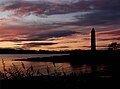
 Battle of Largs Monument - geograph.org.uk - 4640453.jpg 3072 × 1467; 286 КБ
-
 Battle of Largs Monument - geograph.org.uk - 5164060.jpg 4207 × 3085; 1,87 МБ
-
 Beach, Largs - geograph.org.uk - 2188999.jpg 640 × 480; 116 КБ
-
 Bench at Gogo Water, Largs - geograph.org.uk - 495252.jpg 640 × 480; 81 КБ
-
 Benches, Largs - geograph.org.uk - 673511.jpg 480 × 640; 99 КБ
-
 Bessel Moor - geograph.org.uk - 429656.jpg 480 × 640; 77 КБ
-
 Bird sculpture at Aubery Park - geograph.org.uk - 943721.jpg 640 × 480; 98 КБ
-
 Bowen Craig Walk, Largs - geograph.org.uk - 3604699.jpg 5184 × 3456; 7,37 МБ
-
 Bowen Craigs - geograph.org.uk - 4594965.jpg 4320 × 2432; 753 КБ
-
 Bowen Craigs - geograph.org.uk - 4903943.jpg 3988 × 2280; 1,06 МБ
-
 Bowen Craigs - geograph.org.uk - 4903957.jpg 4234 × 2319; 1,06 МБ
-
 Bowen Craigs - geograph.org.uk - 4904660.jpg 4280 × 2354; 1,05 МБ
-
 Bowen Craigs - geograph.org.uk - 4918683.jpg 3648 × 2432; 818 КБ
-
 Bowen Craigs - geograph.org.uk - 5164206.jpg 3625 × 2008; 491 КБ
-
 Bowen Craigs - geograph.org.uk - 5237405.jpg 4320 × 3240; 2,68 МБ
-
 Bowen Craigs - geograph.org.uk - 5496693.jpg 4235 × 3169; 1,33 МБ
-
 Bowen Craigs - geograph.org.uk - 5496757.jpg 4171 × 3203; 1,45 МБ
-
 Bowen Craigs - Largs - geograph.org.uk - 5576257.jpg 4320 × 3240; 1,89 МБ
-
 Bowen Craigs - Largs - geograph.org.uk - 5576291.jpg 4271 × 3158; 1,26 МБ
-
 Bowen Craigs tombolo - geograph.org.uk - 5849580.jpg 1024 × 656; 224 КБ
-
 Bowsprit fitting on a Fife yacht (2604893229).jpg 864 × 628; 151 КБ
-
 Bridge over Gogo Burn - geograph.org.uk - 944142.jpg 640 × 480; 100 КБ
-
 Bridge over the Gogo Burn - geograph.org.uk - 5268611.jpg 640 × 480; 161 КБ
-
 Bridge over the Gogo Burn - geograph.org.uk - 5268618.jpg 462 × 640; 138 КБ
-
 Bridge over the Gogo Burn - geograph.org.uk - 5268640.jpg 499 × 640; 130 КБ
-
 Bridge over the Gogo Water, Largs - geograph.org.uk - 5568936.jpg 1600 × 935; 292 КБ
-
 Cairnie's Quay - geograph.org.uk - 5248687.jpg 4242 × 3228; 1,4 МБ
-

-
 Cal Mac ferry Loch Shira at slipway in Largs - geograph.org.uk - 4651138.jpg 4000 × 3000; 2,8 МБ
-
 Caledonian MacBrayne Ferry. - panoramio (1).jpg 4320 × 2880; 3,93 МБ
-
 Caledonian MacBrayne Ferry. - panoramio.jpg 4320 × 2880; 4,23 МБ
-
 Caledonian MacBryne Largs.jpg 3872 × 2592; 2,32 МБ
-
 Calystegia silvatica at Largs.JPG 3074 × 3036; 2,31 МБ
-
 Carly Support Vessel (42399832195).jpg 2257 × 803; 1,64 МБ
-
 Carly Support Vessel (42399911175).jpg 3129 × 2159; 4,11 МБ
-
 Castle Bay shoreline - geograph.org.uk - 5777007.jpg 1280 × 960; 1,06 МБ
-
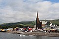
 Clark Memorial Church - geograph.org.uk - 4411410.jpg 4320 × 1873; 1,18 МБ
-
 Clark Memorial Church - Largs - geograph.org.uk - 5603171.jpg 4263 × 3129; 2,8 МБ
-
 Coloured benches, Largs - geograph.org.uk - 584032.jpg 640 × 492; 73 КБ
-
 Colourful Picnic Area, Largs - geograph.org.uk - 672771.jpg 640 × 480; 62 КБ
-
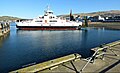
 Cumbrae Ferries. - geograph.org.uk - 494585.jpg 640 × 480; 90 КБ
-
 Cumbrae Ferry - geograph.org.uk - 3560242.jpg 1920 × 1280; 932 КБ
-
 Cumbrae Ferry arriving at Largs - geograph.org.uk - 2863508.jpg 1280 × 856; 112 КБ
-
 Cumbrae Ferry docking at Largs - geograph.org.uk - 3560252.jpg 1920 × 1280; 1,16 МБ
-
 Cumbrae Ferry, Largs (16773629222).jpg 4120 × 2745; 2,81 МБ
-
 Cumbrae Ferry, Largs - geograph.org.uk - 2863352.jpg 1280 × 856; 87 КБ
-
 Cumbrae Slip from Largs, North Ayrshire - geograph.org.uk - 6321669.jpg 1600 × 1067; 456 КБ
-
 Cumbrae to Largs Ferry (16774712785).jpg 5137 × 3425; 4,32 МБ
-
 Cumbrae-Largs Ferries - geograph.org.uk - 6080259.jpg 2592 × 1728; 1,98 МБ
-
 Danefield House (geograph 5251339).jpg 4147 × 3229; 2,06 МБ
-
 Daucus carrota at Largs.JPG 3200 × 3094; 3,21 МБ
-
 Docking at Largs Slip - geograph.org.uk - 4540276.jpg 1920 × 1280; 1,33 МБ
-
 Dodging the Cumbrae Ferry - geograph.org.uk - 3397744.jpg 640 × 453; 83 КБ
-
 DPP 00226.JPG 1000 × 667; 583 КБ
-
 En route for Largs - geograph.org.uk - 5568840.jpg 1600 × 1086; 231 КБ
-
 Evening View - geograph.org.uk - 5777110.jpg 1280 × 985; 856 КБ
-
 Fair at Largs - geograph.org.uk - 702405.jpg 640 × 426; 72 КБ
-
 Fairhaven - Great Cumbrae - geograph.org.uk - 4904597.jpg 4320 × 2287; 2,06 МБ
-
 Far Bowen Craigs - geograph.org.uk - 5212096.jpg 4185 × 3215; 1,63 МБ
-
 Far Bowen Craigs - geograph.org.uk - 5212110.jpg 4246 × 3222; 1,31 МБ
-
 Far Bowen Craigs - geograph.org.uk - 5287432.jpg 640 × 392; 120 КБ
-
 Far Bowen Craigs - geograph.org.uk - 5287436.jpg 640 × 480; 202 КБ
-
 Far Bowen Craigs - geograph.org.uk - 5287442.jpg 640 × 480; 116 КБ
-
 Far Bowen Craigs - geograph.org.uk - 5287454.jpg 640 × 480; 145 КБ
-
 Far Bowen Craigs - geograph.org.uk - 5287460.jpg 640 × 480; 135 КБ
-
 Ferries at Largs Pier - geograph.org.uk - 5268594.jpg 640 × 347; 115 КБ
-
 Ferry approaching Largs Pier - geograph.org.uk - 5290950.jpg 640 × 480; 121 КБ
-
 Ferry approaching Largs Pier - geograph.org.uk - 5290951.jpg 640 × 480; 107 КБ
-
 Ferry approaching Largs Pier - geograph.org.uk - 5290952.jpg 640 × 480; 130 КБ
-
 Ferry approaching Largs Pier - geograph.org.uk - 5295640.jpg 640 × 426; 101 КБ
-
 Ferry Corner Largs - panoramio.jpg 3072 × 2291; 4,32 МБ
-
 Ferry entering Largs harbour - geograph.org.uk - 4396771.jpg 640 × 426; 101 КБ
-
 Ferry for Great Cumbrae Island - geograph.org.uk - 6080209.jpg 2976 × 1984; 2,6 МБ
-
 Ferry Leaving for Great Cumbrae - geograph.org.uk - 3493698.jpg 1920 × 1280; 1,13 МБ
-
 Ferry Loch Riddon approaching Largs - geograph.org.uk - 3089368.jpg 640 × 266; 62 КБ
-
 Ferry Loch Riddon at Largs Pier - geograph.org.uk - 3089372.jpg 640 × 414; 154 КБ
-
 Ferry Loch Riddon at Largs Pier - geograph.org.uk - 3089379.jpg 640 × 408; 121 КБ
-
 Ferry Loch Shira at Largs - geograph.org.uk - 5693492.jpg 640 × 392; 90 КБ
-
 Ferry Loch Shira at Largs - geograph.org.uk - 5693497.jpg 640 × 391; 128 КБ
-
 Ferry Loch Shira at Largs - geograph.org.uk - 5693501.jpg 640 × 480; 132 КБ
-
 Ferry Loch Shira at Largs - geograph.org.uk - 5693505.jpg 640 × 426; 128 КБ
-
 Ferry moored at Largs Pier - geograph.org.uk - 4897366.jpg 1024 × 768; 147 КБ
-
 Ferry off Largs - geograph.org.uk - 5295862.jpg 640 × 301; 59 КБ
-
 Ferry Terminal, Largs - geograph.org.uk - 6079862.jpg 2976 × 1984; 1,81 МБ
-
 Ferry to Great Cumbrae Island, Largs - geograph.org.uk - 5045650.jpg 4608 × 3456; 2,75 МБ
-
 Firth Of Clyde , MV Loch Shira At Largs Slipway - geograph.org.uk - 3765906.jpg 1600 × 1200; 226 КБ
-
 Firth Of Clyde , Piling Onto The Cumbrae Ferry - geograph.org.uk - 3764849.jpg 1600 × 1200; 287 КБ
-
 Firth Of Clyde , Rolling Off At Largs - geograph.org.uk - 4735532.jpg 1600 × 1200; 284 КБ
-
 Firth Of Clyde - geograph.org.uk - 239933.jpg 640 × 311; 39 КБ
-
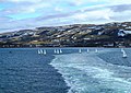
 Firth of Clyde Coastal Rowing Club Regatta - geograph.org.uk - 5843417.jpg 1024 × 464; 165 КБ
-
 Firth of Clyde Coastal Rowing Club Regatta - geograph.org.uk - 5849575.jpg 1024 × 577; 245 КБ
-
 Firth of Clyde Coastal Rowing Club Regatta - geograph.org.uk - 5849587.jpg 1024 × 475; 208 КБ
-
 Firth of Clyde Coastal Rowing Club Regatta - geograph.org.uk - 5849588.jpg 1024 × 628; 270 КБ
-
 Firth of Clyde Coastal Rowing Club Regatta - geograph.org.uk - 5849591.jpg 1024 × 768; 376 КБ
-
 Firth of Clyde Coastal Rowing Club Regatta - geograph.org.uk - 5849594.jpg 1024 × 768; 427 КБ
-

-

-
 Fishing boat in the Firth of Clyde - geograph.org.uk - 5778614.jpg 2048 × 1536; 2,02 МБ
-
 Flagpole near The Pencil - geograph.org.uk - 5287515.jpg 640 × 480; 144 КБ
-
 Floral arrangement - geograph.org.uk - 943706.jpg 640 × 556; 134 КБ
-
 Fort Street, Largs - geograph.org.uk - 3605218.jpg 5184 × 3456; 7,63 МБ
-
 From the Red Road Largs Scotland.jpg 1062 × 832; 135 КБ
-
 From the Red Road, Largs, Scotland LOC 3450331430.jpg 1024 × 766; 188 КБ
-
 From the Red Road, Largs, Scotland-LCCN2002695011.jpg 3646 × 2728; 2,71 МБ
-
 From the Red Road, Largs, Scotland-LCCN2002695011.tif 3646 × 2728; 28,46 МБ
-
 Gallowgate Street - geograph.org.uk - 944189.jpg 640 × 494; 120 КБ
-
 Gallowgate Street, Largs - geograph.org.uk - 4114622.jpg 1250 × 1003; 867 КБ
-
 General view of Largs - geograph.org.uk - 1700520.jpg 640 × 427; 70 КБ
-
 Gogo Burn - geograph.org.uk - 822729.jpg 640 × 480; 165 КБ
-
 Gogo Burn Meets the Clyde - geograph.org.uk - 494575.jpg 640 × 480; 116 КБ
-
 Gogo Glen - geograph.org.uk - 944124.jpg 640 × 480; 94 КБ
-
 Gogo River Largs - geograph.org.uk - 645180.jpg 640 × 480; 43 КБ
-
 Gogo Street - geograph.org.uk - 944120.jpg 640 × 480; 104 КБ
-
 Gogo Water - geograph.org.uk - 173135.jpg 640 × 480; 99 КБ
-
 Gogo Water - geograph.org.uk - 43590.jpg 640 × 480; 175 КБ
-
 Gogo Water and road bridge Largs - geograph.org.uk - 645175.jpg 640 × 480; 42 КБ
-

-
 Gogo Water meets the sea - geograph.org.uk - 5568926.jpg 1600 × 985; 287 КБ
-
 Gogo Water, Largs - geograph.org.uk - 495261.jpg 640 × 480; 118 КБ
-
 Gogo Water, Largs - geograph.org.uk - 495295.jpg 640 × 480; 105 КБ
-
 Great Cumbrae - geograph.org.uk - 943711.jpg 640 × 480; 90 КБ
-
 Great Cumbrae from Largs - geograph.org.uk - 5311544.jpg 640 × 480; 52 КБ
-
 Green Shutters Bistro - Largs - geograph.org.uk - 6201757.jpg 1600 × 1200; 1,07 МБ
-
 Greeto Burn,Largs - geograph.org.uk - 538183.jpg 640 × 480; 104 КБ
-
 Grotto ruins, Douglas Park, Largs.jpg 2050 × 1492; 1,57 МБ
-
 Haco's Stone, Largs, North Ayrshire.jpg 1920 × 1080; 1,07 МБ
-
 Hebridean Princess - geograph.org.uk - 5186775.jpg 4171 × 3033; 811 КБ
-
 Heron on the Gogo Burn - geograph.org.uk - 822305.jpg 640 × 480; 145 КБ
-

-
 Hunterston from Largs - geograph.org.uk - 5295856.jpg 640 × 387; 56 КБ
-
 Inverclyde National Sports Centre - geograph.org.uk - 133331.jpg 640 × 479; 96 КБ
-
 Jet Ski, Firth of Clyde - geograph.org.uk - 4540259.jpg 1857 × 1183; 255 КБ
-
 Jet Ski, Firth of Clyde - geograph.org.uk - 4540261.jpg 1920 × 1280; 945 КБ
-
 Jet Ski, Firth of Clyde - geograph.org.uk - 4540263.jpg 1920 × 1280; 1,13 МБ
-
 Kaim Hill 9 view over Largs.jpg 2984 × 2238; 1,3 МБ
-
 Knock Hill - geograph.org.uk - 5693484.jpg 640 × 480; 148 КБ
-
 Largs (35172600234).jpg 3000 × 4000; 1,91 МБ
-
 Largs (35201427683).jpg 4000 × 3000; 2,78 МБ
-
 Largs (35201466843).jpg 4000 × 3000; 2,7 МБ
-
 Largs (35622898740).jpg 4000 × 3000; 2,31 МБ
-
 Largs (35841440092).jpg 4000 × 3000; 2,64 МБ
-
 Largs - geograph.org.uk - 4540268.jpg 1920 × 1280; 1,33 МБ
-
 Largs - geograph.org.uk - 495285.jpg 640 × 480; 108 КБ
-
 Largs - geograph.org.uk - 5295560.jpg 640 × 397; 88 КБ
-
 Largs - geograph.org.uk - 5603177.jpg 4320 × 1608; 819 КБ
-
 Largs - geograph.org.uk - 5819644.jpg 1024 × 544; 227 КБ
-
 Largs - geograph.org.uk - 5819666.jpg 1024 × 768; 345 КБ
-
 Largs - geograph.org.uk - 9046.jpg 640 × 315; 142 КБ
-
 Largs and Hunterston - geograph.org.uk - 1420479.jpg 640 × 480; 57 КБ
-
 Largs and the Waverley (19487034812).jpg 5009 × 1535; 1,66 МБ
-
 Largs banner Spires.jpg 2555 × 365; 993 КБ
-
 Largs Bay - geograph.org.uk - 2005202.jpg 640 × 480; 133 КБ
-
 Largs Bay - geograph.org.uk - 3493689.jpg 1920 × 1280; 1,15 МБ
-
 Largs Bay - geograph.org.uk - 3560210.jpg 1920 × 1280; 1,34 МБ
-
 Largs Bay - geograph.org.uk - 3560213.jpg 1920 × 1280; 1,09 МБ
-
 Largs Bay - geograph.org.uk - 3560230.jpg 1920 × 1280; 930 КБ
-
 Largs Bay - geograph.org.uk - 3560263.jpg 1920 × 1280; 1,13 МБ
-
 Largs Bay - geograph.org.uk - 3560285.jpg 1920 × 1280; 1,16 МБ
-
 Largs Bay - geograph.org.uk - 4539274.jpg 1920 × 1280; 1,31 МБ
.jpg)
.jpg)

.jpg)
.jpg)


.jpg)


.jpg)

.jpg)


.jpg)
,_Largs_-_geograph.org.uk_-_5596055.jpg)
,_Largs_-_geograph.org.uk_-_5596059.jpg)


.jpg)


.jpg)


.jpg)


.jpg)


.jpg)

.jpg)


.jpg)
.jpg)
.jpg)
.jpg)
.jpg)


.jpg)
.jpg)
.jpg)