Category:Lauinger Mühlenriede
Jump to navigation
Jump to search
watercourse in Germany  | |||||
| Upload media | |||||
| Instance of | |||||
|---|---|---|---|---|---|
| Location | Königslutter am Elm, Helmstedt District, Lower Saxony, Germany | ||||
| Length |
| ||||
| Mouth of the watercourse | |||||
| Drainage basin |
| ||||
 | |||||
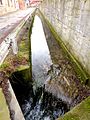
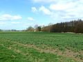
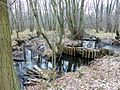
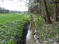
Media in category "Lauinger Mühlenriede"
The following 12 files are in this category, out of 12 total.
-
 Gluesig Infotafel1.jpg 1,920 × 1,440; 2.85 MB
-
 Gluesig Infotafel2.jpg 1,920 × 1,440; 1.52 MB
-
 GluesigInLauingen 3 201603.jpg 1,920 × 2,560; 2.22 MB
-
 GluesigInLauingen 4 201603.jpg 1,920 × 2,560; 2.01 MB
-
 GluesigInLauingen 5 201603.jpg 1,920 × 1,440; 1.69 MB
-
 GluesigPappelhof2 2017.jpg 1,920 × 1,440; 1.51 MB
-
 GluesigTeichabfluss1 2017.jpg 1,920 × 1,440; 2.19 MB
-
 GlüsigRiesebergerMoor2017.JPG 1,920 × 1,440; 1.77 MB
-
 GlüsigRiesebergerMoorRand2017.jpg 1,920 × 1,440; 2.09 MB
-
 GlüsigRiesebergerMoorRandNord2017.jpg 1,920 × 1,440; 1.99 MB
-
 GlüsigSüdlichBahndamm.jpg 1,920 × 1,439; 2.88 MB
-
 PuritzmühleWest2017.jpg 1,920 × 1,440; 1.78 MB


