Category:Laverstoke
Jump to navigation
Jump to search
village and civil parish in Hampshire, United Kingdom  | |||||
| Upload media | |||||
| Instance of | |||||
|---|---|---|---|---|---|
| Location | Basingstoke and Deane, Hampshire, South East England, England | ||||
| Population |
| ||||
 | |||||
Subcategories
This category has the following 5 subcategories, out of 5 total.
Media in category "Laverstoke"
The following 200 files are in this category, out of 274 total.
(previous page) (next page)-
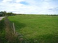
 A long and robust estate wall - geograph.org.uk - 4218375.jpg 640 × 480; 149 KB
-
 A sheep for the ram - geograph.org.uk - 2645337.jpg 1,024 × 768; 311 KB
-
 Above Freefolk - geograph.org.uk - 2594461.jpg 640 × 477; 110 KB
-
 Above Freefolk - geograph.org.uk - 2594472.jpg 640 × 477; 96 KB
-
 Abra Barrow - geograph.org.uk - 2930282.jpg 800 × 600; 109 KB
-
 Abra Barrow - geograph.org.uk - 2934211.jpg 640 × 480; 67 KB
-
 Abra Barrow - geograph.org.uk - 2934213.jpg 640 × 480; 70 KB
-
 Access for Laverstoke House - geograph.org.uk - 3552522.jpg 640 × 480; 105 KB
-
 Access to a small copse - geograph.org.uk - 2934198.jpg 640 × 480; 127 KB
-
 Almost at the hill top - geograph.org.uk - 2934181.jpg 640 × 480; 92 KB
-
 Andover to Basingstoke Railway - geograph.org.uk - 345814.jpg 640 × 480; 171 KB
-
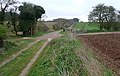
 Approaching Bere Mill on footpath from the south - geograph.org.uk - 2645332.jpg 1,024 × 768; 256 KB
-
 Approaching Roundwood - geograph.org.uk - 2350782.jpg 640 × 463; 238 KB
-
 Approaching Roundwood entrance - geograph.org.uk - 2350763.jpg 640 × 367; 207 KB
-
 Approaching Roundwood estate - geograph.org.uk - 2350824.jpg 640 × 358; 181 KB
-
 B3400 at Laverstoke village boundary - geograph.org.uk - 3106712.jpg 640 × 480; 102 KB
-
 Barley field, north of Brickkiln Wood - geograph.org.uk - 4069297.jpg 1,024 × 768; 130 KB
-
 Beautiful threesome at Laverstoke - geograph.org.uk - 2643673.jpg 768 × 1,024; 241 KB
-

-
 Blocked field entrances - geograph.org.uk - 4218460.jpg 640 × 480; 220 KB
-
 Brickkiln Wood - geograph.org.uk - 4290546.jpg 1,600 × 1,062; 571 KB
-
 Bridge by Bere Mill - geograph.org.uk - 2628981.jpg 640 × 480; 119 KB
-
 Bridleway at Roundwood - geograph.org.uk - 2350863.jpg 640 × 474; 247 KB
-
 Bridleway towards Overton Road - geograph.org.uk - 2350851.jpg 640 × 427; 206 KB
-
 Broad Beans - geograph.org.uk - 3552512.jpg 640 × 480; 146 KB
-
 Buildings at Laverstoke Grange Farm - geograph.org.uk - 2644520.jpg 1,024 × 768; 245 KB
-
 Built to impress - geograph.org.uk - 2350771.jpg 640 × 451; 232 KB
-
 By Twinley Lane - geograph.org.uk - 4093962.jpg 426 × 640; 120 KB
-
 Byway at Brickkiln Hassock - geograph.org.uk - 2340895.jpg 640 × 427; 203 KB
-
 Byway meets Laverstoke Lane - geograph.org.uk - 4295083.jpg 1,600 × 1,051; 578 KB
-
 Byway off the Harroway Belt - geograph.org.uk - 383174.jpg 640 × 477; 112 KB
-
 Byway past Brickkiln Hassock - geograph.org.uk - 2340887.jpg 454 × 640; 233 KB
-
 Byway south of Brickkiln Wood - geograph.org.uk - 4290543.jpg 1,600 × 1,062; 705 KB
-
 Byway south of Brickkiln Wood - geograph.org.uk - 4290550.jpg 1,600 × 1,062; 720 KB
-
 Byway south of Brickkiln Wood - geograph.org.uk - 4290553.jpg 1,600 × 1,062; 634 KB
-
 Byway south of Brickkiln Wood - geograph.org.uk - 4290556.jpg 1,600 × 1,062; 620 KB
-
 Byway to Brickkiln Hassock - geograph.org.uk - 2340878.jpg 640 × 403; 208 KB
-
 Byway to Laverstoke Lane - geograph.org.uk - 4294822.jpg 1,600 × 1,062; 690 KB
-
 Byway to Laverstoke Lane - geograph.org.uk - 4295078.jpg 1,600 × 1,062; 718 KB
-
 Cattle at Bere Mill - geograph.org.uk - 331214.jpg 640 × 427; 184 KB
-
 Clapper Copse - geograph.org.uk - 2628958.jpg 800 × 600; 146 KB
-
 Clearing the pit - geograph.org.uk - 2934192.jpg 640 × 480; 107 KB
-
 Closeup of gated entrance to Roundwood Farm - geograph.org.uk - 332790.jpg 1,014 × 1,074; 723 KB
-
 Country road near Whitchurch (1) - geograph.org.uk - 2772770.jpg 640 × 445; 145 KB
-
 Country road near Whitchurch (2) - geograph.org.uk - 2772791.jpg 640 × 435; 174 KB
-
 Distilling equipment - geograph.org.uk - 5136003.jpg 3,648 × 2,432; 4.12 MB
-
 Disused building at Home Farm - geograph.org.uk - 2640809.jpg 1,024 × 768; 165 KB
-
 Disused buildings at Home Farm - geograph.org.uk - 2640785.jpg 1,024 × 768; 161 KB
-
 Don't shoot, I'm going - geograph.org.uk - 2350761.jpg 640 × 438; 195 KB
-
 Eastern edge of Abra Barrow - geograph.org.uk - 2934502.jpg 640 × 480; 70 KB
-
 Edge of a wheatfield, north of Freefolk Wood - geograph.org.uk - 4069390.jpg 1,024 × 768; 145 KB
-
 Emerging winter crop - geograph.org.uk - 2932684.jpg 640 × 480; 77 KB
-
 Emerging winter wheat - geograph.org.uk - 2932682.jpg 640 × 480; 82 KB
-
 Entrance by the Harrow Way - geograph.org.uk - 3185722.jpg 640 × 431; 104 KB
-
 Entrance to the Walled Garden at Laverstoke - geograph.org.uk - 2640802.jpg 1,024 × 768; 219 KB
-
 Estate cottage at Laverstoke - geograph.org.uk - 2415514.jpg 640 × 456; 96 KB
-
 Farm buildings at Laverstoke - geograph.org.uk - 2415509.jpg 640 × 495; 75 KB
-
 Farm management at New Barn - geograph.org.uk - 2340930.jpg 640 × 427; 198 KB
-
 Farm road looking south to Abbra Barrow - geograph.org.uk - 2644110.jpg 768 × 1,024; 214 KB
-
 Farm vehicle on track near Abra Barrow - geograph.org.uk - 2644116.jpg 1,024 × 768; 163 KB
-
 Farming at Roundwood - geograph.org.uk - 2350778.jpg 640 × 465; 237 KB
-
 Farmland at New Barn - geograph.org.uk - 2340923.jpg 640 × 428; 195 KB
-
 Farmland at New Barn Farm - geograph.org.uk - 2340909.jpg 640 × 428; 231 KB
-
 Farmland near Laverstoke - geograph.org.uk - 4218495.jpg 640 × 480; 166 KB
-
 Farmland near Laverstoke - geograph.org.uk - 4218503.jpg 640 × 480; 168 KB
-
 Farmland near Laverstoke Farm - geograph.org.uk - 2340973.jpg 640 × 419; 206 KB
-
 Farmland south of Brickkiln Wood - geograph.org.uk - 4294721.jpg 1,600 × 1,062; 501 KB
-
 Farmland south of Laverstoke - geograph.org.uk - 2934185.jpg 640 × 480; 79 KB
-
 Farmland south of Laverstoke - geograph.org.uk - 2934497.jpg 640 × 475; 76 KB
-
 Farmland south-east of New Barn Farm - geograph.org.uk - 4069352.jpg 1,024 × 768; 168 KB
-
 Farmland ^ footpath junction - geograph.org.uk - 2932270.jpg 640 × 480; 67 KB
-
 Farmtrack along hill top - geograph.org.uk - 2934498.jpg 639 × 493; 108 KB
-
 Field at Laverstoke Grange Farm - geograph.org.uk - 2644534.jpg 1,024 × 768; 155 KB
-
 Field margin - Freefolk Wood - geograph.org.uk - 4294871.jpg 1,600 × 1,062; 657 KB
-
 Field margin - Freefolk Wood - geograph.org.uk - 4295037.jpg 1,600 × 1,062; 441 KB
-
 Field near Brickkiln Hassock - geograph.org.uk - 4294877.jpg 1,600 × 1,062; 536 KB
-

-

-
 Field south of Brickkiln Wood - geograph.org.uk - 4290552.jpg 1,600 × 1,062; 607 KB
-
 Fields above Laverstoke Farm - geograph.org.uk - 2340952.jpg 640 × 416; 204 KB
-

-
 Fields south of Brickkiln Wood - geograph.org.uk - 4290547.jpg 1,600 × 1,062; 527 KB
-
 Fields south of Brickkiln Wood - geograph.org.uk - 4290548.jpg 1,600 × 1,062; 412 KB
-
 Fields south of Brickkiln Wood - geograph.org.uk - 4290551.jpg 1,600 × 1,062; 476 KB
-
 Fields south of Brickkiln Wood - geograph.org.uk - 4290558.jpg 1,600 × 1,062; 809 KB
-
 Fields south of Laverstoke - geograph.org.uk - 2645241.jpg 1,024 × 768; 178 KB
-
 Footpath at Clapper Copse - geograph.org.uk - 2704335.jpg 640 × 494; 102 KB
-
 Footpath protection - geograph.org.uk - 2645244.jpg 1,024 × 768; 200 KB
-
 Footpath reaches road at Laverstoke - geograph.org.uk - 2643674.jpg 1,024 × 768; 317 KB
-
 Footpath south to Freefolk - geograph.org.uk - 2640774.jpg 1,024 × 768; 199 KB
-
 Footpath to Laverstock Grange Farm - geograph.org.uk - 2932268.jpg 640 × 480; 79 KB
-
 Footpath to Laverstoke - geograph.org.uk - 2932718.jpg 640 × 480; 85 KB
-
 Footpath to Laverstoke Farm - geograph.org.uk - 2340964.jpg 640 × 412; 213 KB
-
 Footpath to Laverstoke Farm - geograph.org.uk - 2340979.jpg 640 × 428; 231 KB
-
 Footpath to Laverstoke Grange Farm - geograph.org.uk - 2932698.jpg 640 × 480; 79 KB
-
 Footpath to Laverstoke Grange Farm - geograph.org.uk - 2932708.jpg 640 × 480; 69 KB
-
 Footpath to Laverstoke Grange Farm - geograph.org.uk - 2932709.jpg 640 × 480; 99 KB
-
 Footpath to Laverstoke Grange Farm - geograph.org.uk - 2932714.jpg 640 × 480; 104 KB
-
 Footpath to Laverstoke Grange Farm - geograph.org.uk - 2932716.jpg 640 × 480; 104 KB
-
 Footpath to Whitchurch - geograph.org.uk - 2594466.jpg 640 × 477; 108 KB
-
 Fruit on the way - geograph.org.uk - 2644130.jpg 1,024 × 768; 194 KB
-
 Green track goes east to meet farm road - geograph.org.uk - 2644121.jpg 768 × 1,024; 194 KB
-
 Guess the field use - geograph.org.uk - 2934504.jpg 640 × 480; 72 KB
-
 Had the rain, need the sun - geograph.org.uk - 2932694.jpg 640 × 480; 85 KB
-
 Harrow Way - geograph.org.uk - 3185652.jpg 640 × 480; 121 KB
-
 Harrow Way near Ash Bed Plantation - geograph.org.uk - 3185688.jpg 640 × 480; 108 KB
-
 Heading north on Priory Lane - geograph.org.uk - 3389236.jpg 640 × 431; 151 KB
-
 Healthy looking new trees - geograph.org.uk - 2934186.jpg 640 × 480; 103 KB
-
 Heavy going on the byway - geograph.org.uk - 4295081.jpg 1,600 × 1,048; 513 KB
-
 House in Freefolk - geograph.org.uk - 5136054.jpg 3,648 × 2,432; 4.94 MB
-
 House in Laverstoke - geograph.org.uk - 5136015.jpg 3,648 × 2,432; 4.59 MB
-
 Houses in Laverstoke - geograph.org.uk - 5136061.jpg 3,648 × 2,432; 3.23 MB
-
 Houses in Laverstoke Lane - geograph-2629021.jpg 640 × 480; 118 KB
-
 Isolated rural dwelling - geograph.org.uk - 2930253.jpg 640 × 428; 53 KB
-
 Keep to the byway - geograph.org.uk - 4290549.jpg 1,600 × 1,062; 655 KB
-
 Lane towards Whitchurch - geograph.org.uk - 4218470.jpg 640 × 480; 164 KB
-
 Laverstock Lane - geograph.org.uk - 2628899.jpg 640 × 445; 86 KB
-
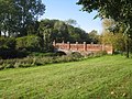
 Laverstoke - Bridge Over The River Test - geograph.org.uk - 2092599.jpg 800 × 600; 194 KB
-
 Laverstoke - Football Club - geograph.org.uk - 2092532.jpg 800 × 600; 164 KB
-
 Laverstoke - Football Club - geograph.org.uk - 2092537.jpg 800 × 600; 146 KB
-
 Laverstoke - Football Club - geograph.org.uk - 2092539.jpg 800 × 600; 85 KB
-
 Laverstoke - Little White Tenement - geograph.org.uk - 2092566.jpg 800 × 600; 109 KB
-
 Laverstoke - Lodge - geograph.org.uk - 2092615.jpg 800 × 600; 184 KB
-
 Laverstoke - Millennium Green - geograph.org.uk - 2092552.jpg 800 × 600; 180 KB
-
 Laverstoke - The River Test - geograph.org.uk - 2092605.jpg 800 × 600; 182 KB
-
 Laverstoke -Laverstoke Lane - geograph.org.uk - 2092542.jpg 800 × 600; 123 KB
-
 Laverstoke Farm - geograph.org.uk - 2340955.jpg 640 × 410; 198 KB
-
 Laverstoke football ground - geograph.org.uk - 2629016.jpg 800 × 600; 95 KB
-
 Laverstoke Lane - direction Laverstoke - geograph.org.uk - 4295085.jpg 1,600 × 1,067; 283 KB
-
 Laverstoke Lane - geograph.org.uk - 4069377.jpg 1,024 × 768; 119 KB
-
 Laverstoke Lane - geograph.org.uk - 5136066.jpg 3,648 × 2,432; 3.81 MB
-
 Laverstoke Lane - geograph.org.uk - 6392109.jpg 800 × 450; 95 KB
-
 Laverstoke Lane - geograph.org.uk - 6392130.jpg 800 × 450; 99 KB
-

-
 Laverstoke Park - geograph.org.uk - 5617436.jpg 3,264 × 2,448; 4.34 MB
-
 Lodge house, Laverstoke, Hampshire - geograph.org.uk - 4680272.jpg 640 × 590; 190 KB
-
 London Road, Laverstoke - geograph.org.uk - 4472556.jpg 2,560 × 1,920; 1.88 MB
-
 London to Exeter railway line - geograph.org.uk - 2415491.jpg 640 × 477; 109 KB
-
 Looking around the hedge - geograph.org.uk - 2932705.jpg 640 × 480; 93 KB
-
 Looking into Brickkiln Wood - geograph.org.uk - 4294745.jpg 1,600 × 1,062; 721 KB
-
 Majestic and alone - geograph.org.uk - 2643689.jpg 768 × 1,024; 197 KB
-
 Manor Cottages - geograph.org.uk - 5136031.jpg 3,648 × 2,432; 4.43 MB
-
 Manor Cottages, Freefolk, Hampshire - geograph.org.uk - 4680167.jpg 640 × 447; 143 KB
-
 Manor Cottages, Freefolk, Hampshire - geograph.org.uk - 4680220.jpg 640 × 426; 119 KB
-
 Manor Cottages, Freefolk, Hampshire - geograph.org.uk - 4680253.jpg 640 × 420; 110 KB
-
 Margins of the byway - geograph.org.uk - 4294868.jpg 1,600 × 1,062; 877 KB
-
 Mature hedgerow - geograph.org.uk - 2932712.jpg 640 × 480; 137 KB
-
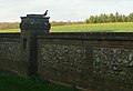
 Melville Portal (MP) - geograph.org.uk - 3552521.jpg 640 × 480; 130 KB
-
 Memorial Stone to Freefolk House, Laverstoke - geograph.org.uk - 3518228.jpg 890 × 1,257; 282 KB
-
 Micheldever Road, unfenced - geograph.org.uk - 4068955.jpg 1,024 × 768; 103 KB
-
 New Barn Cottages - geograph.org.uk - 2645233.jpg 1,024 × 768; 188 KB
-
 New Barn Farm - geograph.org.uk - 2340915.jpg 640 × 427; 169 KB
-
 New plantation at Laverstoke Grange - geograph.org.uk - 2932273.jpg 640 × 480; 111 KB
-
 New planting along the farm track - geograph.org.uk - 2934495.jpg 639 × 463; 110 KB
-
 New planting on the hill top - geograph.org.uk - 2934184.jpg 640 × 480; 115 KB
-
 Odd Ball Lane - geograph.org.uk - 2415502.jpg 640 × 477; 108 KB
-
 Oilseed rape field, south-east of New Barn Farm - geograph.org.uk - 4069366.jpg 1,024 × 768; 190 KB
-
 Oilseed rape field, west of Rays Hassock - geograph.org.uk - 4069359.jpg 1,024 × 768; 192 KB
-
 Old ^ young trees - geograph.org.uk - 2934499.jpg 640 × 423; 116 KB
-
 Original family initials^ - geograph.org.uk - 3552520.jpg 480 × 640; 124 KB
-
 Outbuilding at Bere Mill Farm - geograph.org.uk - 2645346.jpg 1,024 × 768; 187 KB
-
 Passing place on Laverstoke Lane - geograph.org.uk - 2646175.jpg 1,024 × 768; 256 KB
-
 Pasture above the River Test - geograph.org.uk - 2704340.jpg 640 × 468; 108 KB
-
 Path along field margin - geograph.org.uk - 2932690.jpg 640 × 480; 74 KB
-
 Path and farm track - geograph.org.uk - 2932271.jpg 640 × 480; 77 KB
-
 Path around the winter wheat - geograph.org.uk - 2932697.jpg 640 × 480; 75 KB
-
 Path at Ash Bed Plantation - geograph.org.uk - 3185670.jpg 640 × 391; 101 KB
-
 Path by Clapper Copse - geograph.org.uk - 2628931.jpg 640 × 480; 81 KB
-
 Path to Laverstoke Grange Farm - geograph.org.uk - 2932274.jpg 640 × 480; 89 KB
-
 Path to Manor Farm - geograph.org.uk - 6392114.jpg 800 × 450; 153 KB
-
 Patterns in the trees - geograph.org.uk - 5617446.jpg 3,264 × 2,448; 4.78 MB
-
 Pig stys - Laverstoke Grange Farm - geograph.org.uk - 2932679.jpg 640 × 480; 76 KB
-
 Pit (dis) in Clapper Copse - geograph.org.uk - 2704330.jpg 640 × 486; 114 KB
-
 Plantation at Laverstoke Grange - geograph.org.uk - 2340997.jpg 640 × 427; 232 KB
-
 Plantation at Laverstoke Grange - geograph.org.uk - 2932269.jpg 640 × 480; 79 KB
-
 Polytunnels near Home Farm - geograph.org.uk - 2640794.jpg 1,024 × 768; 209 KB
-
 Pott Bottom Cottage - geograph.org.uk - 2644508.jpg 1,024 × 768; 243 KB
-
 Priory Lane crossing the railway - geograph.org.uk - 3388747.jpg 800 × 493; 78 KB
-
 Public byway towards the A34 - geograph.org.uk - 4218400.jpg 640 × 480; 246 KB
-
 Ram at Bere Mill Farm (1) - geograph.org.uk - 2645327.jpg 1,024 × 768; 243 KB
-
 Ram at Bere Mill Farm (2) - geograph.org.uk - 2645333.jpg 1,024 × 768; 223 KB
-
 River Test at Bere Mill - geograph.org.uk - 5147568.jpg 4,000 × 3,000; 5.1 MB
-
 River Test in Freefolk - geograph.org.uk - 5136043.jpg 3,648 × 2,432; 6.33 MB
-
 River Test in Freefolk - geograph.org.uk - 5136046.jpg 3,648 × 2,432; 5.52 MB
-
 River Test in Laverstoke - geograph.org.uk - 5136021.jpg 3,648 × 2,432; 5.78 MB
-
 River Test valley - geograph.org.uk - 2628967.jpg 800 × 600; 119 KB
-
 River Test valley - geograph.org.uk - 2628983.jpg 640 × 480; 78 KB
-
 Road from the little church at Freefolk - geograph.org.uk - 2643713.jpg 1,024 × 768; 270 KB
-
 Roads in Roundwood estate - geograph.org.uk - 2350839.jpg 640 × 428; 219 KB
-
 Roundwood Farm - geograph.org.uk - 2350814.jpg 640 × 413; 176 KB
-
 Roundwood Farm - geograph.org.uk - 2350819.jpg 640 × 418; 188 KB
-
 Roundwood Farm - geograph.org.uk - 2350845.jpg 640 × 427; 164 KB
-

-
 Rutted farm track - geograph.org.uk - 2934188.jpg 640 × 480; 73 KB
-
 Seat by pond at Laverstoke - geograph.org.uk - 2643682.jpg 1,024 × 768; 254 KB
-
 Shed in clearing near Laverstoke - geograph.org.uk - 2643670.jpg 1,024 × 768; 234 KB
-

-
 Snazzy jacket - geograph.org.uk - 5136049.jpg 3,648 × 2,432; 4.88 MB
-
 South fringe of Brickkiln Wood - geograph.org.uk - 4294791.jpg 1,600 × 1,062; 600 KB
-
 South fringe of Brickkiln Wood - geograph.org.uk - 4294792.jpg 1,600 × 1,062; 663 KB


_-_geograph.org.uk_-_2772770.jpg)
_-_geograph.org.uk_-_2772791.jpg)


_-_geograph.org.uk_-_3552521.jpg)


_in_Clapper_Copse_-_geograph.org.uk_-_2704330.jpg)


_-_geograph.org.uk_-_2645327.jpg)
_-_geograph.org.uk_-_2645333.jpg)


