Category:Lentran
Jump to navigation
Jump to search
human settlement in Highland, Scotland, UK .jpg) | |||||
| Upload media | |||||
| Instance of | |||||
|---|---|---|---|---|---|
| Location |
| ||||
 | |||||
English: Lentran ) is a small village, located on the south coast of the Beauly Firth, 6 miles west of Inverness, Scottish Highlands and is in the Scottish council area of Highland.
Media in category "Lentran"
The following 22 files are in this category, out of 22 total.
-
 Access to Berryfield House - geograph.org.uk - 1543457.jpg 640 × 480; 81 KB
-
 Beauly Firth near high tide - geograph.org.uk - 4573420.jpg 1,400 × 1,055; 310 KB
-
 Beauly Firth Saltings - geograph.org.uk - 4403402.jpg 640 × 379; 69 KB
-
 Lentran House (geograph 2715013).jpg 2,567 × 1,911; 978 KB
-
 Lentran House from the East Drive - geograph.org.uk - 1026299.jpg 640 × 470; 89 KB
-

-
 Mudflats off Lentran Point - geograph.org.uk - 2899111.jpg 3,200 × 1,984; 1.95 MB
-
 Railway to the north. - geograph.org.uk - 247887.jpg 640 × 480; 118 KB
-
 Train passing the site of Lentran Station (geograph 3035676).jpg 3,000 × 1,709; 1.28 MB
-
 Craggach Farm - geograph.org.uk - 502792.jpg 640 × 426; 100 KB
-
 Dilapidated Croft Building - geograph.org.uk - 277057.jpg 640 × 480; 152 KB
-
 Farm building at Holme - geograph.org.uk - 502788.jpg 640 × 426; 60 KB
-
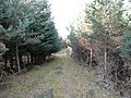
 Forest access track - geograph.org.uk - 502796.jpg 640 × 426; 121 KB
-
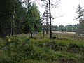
 Forest clearing - geograph.org.uk - 584520.jpg 640 × 480; 127 KB
-
 Forestry road - geograph.org.uk - 584542.jpg 640 × 480; 137 KB
-
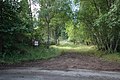
 Gate across forest road - geograph.org.uk - 584538.jpg 640 × 480; 144 KB
-
 Geese on Mudflats - geograph.org.uk - 674109.jpg 640 × 480; 40 KB
-
 Mudflats on Beauly Firth - geograph.org.uk - 391912.jpg 640 × 195; 25 KB
-
 Old road - geograph.org.uk - 584531.jpg 640 × 480; 145 KB
-
 Old road - geograph.org.uk - 584534.jpg 640 × 480; 121 KB
-
 Road junction - geograph.org.uk - 584527.jpg 640 × 480; 124 KB
-
 The edge of the forest clearing - geograph.org.uk - 584518.jpg 640 × 480; 116 KB


.jpg)


