Category:Leopoldschlag
Jump to navigation
Jump to search
municipality in Freistadt District, Upper Austria, Austria   | |||||
| Upload media | |||||
| Instance of |
| ||||
|---|---|---|---|---|---|
| Location | Freistadt District, Upper Austria, Austria | ||||
| Population |
| ||||
| Area |
| ||||
| Elevation above sea level |
| ||||
| official website | |||||
 | |||||
Subcategories
This category has the following 13 subcategories, out of 13 total.
C
- Cemetery in Leopoldschlag (4 F)
D
F
M
- Maria Schnee am Hiltschnerberg (12 F)
- Marktbrunnen, Leopoldschlag (3 F)
N
- Nepomuk-Säule, Leopoldschlag (7 F)
P
- Pranger, Leopoldschlag (4 F)
W
- Wettershuttle (5 F)
Media in category "Leopoldschlag"
The following 66 files are in this category, out of 66 total.
-
 130601 Blasmusikfest 49 (8915668224).jpg 3,008 × 2,000; 2.78 MB
-
 2 Linden in Hiltschen.jpg 1,233 × 1,280; 539 KB
-
 20190131 KrumlovHwy 1590 (47373611112).jpg 7,952 × 5,304; 6.49 MB
-
 20190131 KrumlovHwy 1591 (33550541438).jpg 7,952 × 5,304; 7 MB
-
 20190131 KrumlovHwy 1592 (47373610382).jpg 7,952 × 5,304; 6.11 MB
-
 20190131 KrumlovHwy 1593 (33550541028).jpg 7,952 × 5,304; 19.78 MB
-
 20190131 KrumlovHwy 1594 (47373609202).jpg 7,952 × 5,304; 20.53 MB
-
 20190131 KrumlovHwy 1595 (33550540048).jpg 7,952 × 5,304; 20.09 MB
-
 20190131 KrumlovHwy 1596 (47373606922).jpg 7,952 × 5,304; 20.31 MB
-
 20190131 KrumlovHwy 1597 (46703307734).jpg 7,952 × 5,304; 20.44 MB
-
 20190131 KrumlovHwy 1598 (40460752293).jpg 7,952 × 5,304; 20.22 MB
-
 20190131 KrumlovHwy 1600 (40460751873).jpg 7,952 × 5,304; 20.03 MB
-
 20190131 KrumlovHwy 1602 (47426447591).jpg 7,952 × 5,304; 6.12 MB
-
 20190131 KrumlovHwy 1603 (40460751313).jpg 7,952 × 5,304; 6.57 MB
-
 20190131 KrumlovHwy 1604 (47426446721).jpg 7,952 × 5,304; 7.37 MB
-
 20190131 KrumlovHwy 1605 (40460750873).jpg 7,952 × 5,304; 7.59 MB
-
 20190131 KrumlovHwy 1606 (47426445511).jpg 7,952 × 5,304; 7.19 MB
-
 20190131 KrumlovHwy 1607 (40460750483).jpg 7,952 × 5,304; 6.77 MB
-
 20190131 KrumlovHwy 1608 (40460750373).jpg 7,952 × 5,304; 7.56 MB
-
 20190131 KrumlovHwy 1609 (46703160444).jpg 7,952 × 5,304; 22 MB
-
 20190131 KrumlovHwy 1611 (40460750173).jpg 7,952 × 5,304; 20.44 MB
-
 20190131 KrumlovHwy 1612 (46703305274).jpg 7,952 × 5,304; 22.53 MB
-
 20190131 KrumlovHwy 1613 (32484579367).jpg 7,952 × 5,304; 20.75 MB
-
 20190131 KrumlovHwy 1614 (46703304414).jpg 7,952 × 5,304; 20.66 MB
-
 20190131 KrumlovHwy 1615 (32484578297).jpg 7,952 × 5,304; 20.19 MB
-
 20190131 KrumlovHwy 1616 (46703303664).jpg 7,952 × 5,304; 20.75 MB
-
 20190131 KrumlovHwy 1617 (32484577067).jpg 7,952 × 5,304; 20.31 MB
-
 20190131 KrumlovHwy 1618 (46703302994).jpg 7,952 × 5,304; 23.63 MB
-
 20190131 KrumlovHwy 1619 (32484575497).jpg 7,952 × 5,304; 9.91 MB
-
 20190131 KrumlovHwy 1621 (46511305555).jpg 7,952 × 5,304; 11.66 MB
-
 20190131 KrumlovHwy 1622 (46703300994).jpg 7,952 × 5,304; 9.03 MB
-
 20190131 KrumlovHwy 1623 (46511304395).jpg 7,952 × 5,304; 9.94 MB
-
 20190131 KrumlovHwy 1624 (46703299714).jpg 7,952 × 5,304; 9.02 MB
-
 20190131 KrumlovHwy 1625 (46511303495).jpg 7,952 × 5,304; 7 MB
-
 20190131 KrumlovHwy 1626 (46703298904).jpg 7,952 × 5,304; 6.74 MB
-
 20190131 KrumlovHwy 1627 (46511302925).jpg 7,952 × 5,304; 5.67 MB
-
 20190131 KrumlovHwy 1628 (46703298364).jpg 7,952 × 5,304; 6.06 MB
-
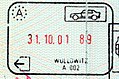
 Austria-entry-road-wullowitz2001.jpg 1,107 × 812; 344 KB
-
 Austria-exit-road-wollowitz2001.jpg 1,142 × 753; 268 KB
-
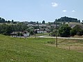
 DorfLeopoldschlag-2017-07-06-FromSouthEast.jpg 4,608 × 3,456; 5.36 MB
-
 DorfLeopoldSchlag-2017-07-06-OdVJV.jpg 4,608 × 3,456; 5.82 MB
-
 Lage Leopoldschlag.png 1,100 × 700; 48 KB
-
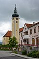 Leopoldschlag - Kirche und Marktgemeindeamt.jpg 800 × 1,200; 648 KB
-
 Leopoldschlag - Ortsteil Mardetschlag 30798.jpg 1,600 × 1,200; 867 KB
-
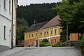
 Leopoldschlag House 80099.JPG 1,936 × 1,301; 1.68 MB
-
 Leopoldschlag im Bezirk FR.png 645 × 645; 28 KB
-
 Leopoldschlag in FR.png 500 × 375; 14 KB
-
 Leopoldschlag.jpg 1,200 × 800; 840 KB
-
 Main European Drainage divide near Dorf Leopoldschlag Austria 01.JPG 3,264 × 2,448; 4 MB
-
 Main European Drainage divide near Dorf Leopoldschlag Austria 02.JPG 3,264 × 2,448; 3.48 MB
-
 Malše.jpg 1,630 × 2,453; 5.27 MB
-
 MarktLeopoldschlag-2017-07-06-FromSouthWest.jpg 4,608 × 3,456; 5.62 MB
-
 MarktLeopoldschlag-2017-07-06-JizniCastNamesti.jpg 4,608 × 3,456; 5.47 MB
-
 MarktLeopoldschlag-2017-07-06-NamestiOdJihu-Obr02.jpg 4,608 × 3,456; 5.65 MB
-
 MarktLeopoldschlag-2017-07-06-NamestiOdJihu.jpg 4,608 × 3,456; 4.92 MB
-
 MarktLeopoldschlag-2017-07-06-SeverniStranaNamesti.jpg 4,608 × 3,456; 5.92 MB
-
 MarktLeopoldschlag-2017-07-06-SeverozapadniKoutNamesti.jpg 4,608 × 3,456; 5.55 MB
-
 MarktLeopoldschlag-2017-07-06-Wassergasse.jpg 4,608 × 3,456; 5.65 MB
-
 Martinstein in Leopoldschlag.jpg 1,280 × 848; 580 KB
-
 Pfarrhof Leopoldschlag.jpg 640 × 480; 47 KB
-
 Sommer-Linde in Wullowitz.jpg 1,070 × 1,280; 385 KB
-
 Stiegersdorf - Tschechische Grenze.JPG 2,560 × 1,920; 1.62 MB
-
 Stiegersdorf Mühle 2.jpg 2,560 × 1,920; 2.19 MB
-
 Stiegersdorf Nr.3 Rtg Tschechien.JPG 2,560 × 1,920; 2.01 MB
-
 Wappen at leopoldschlag.png 166 × 207; 3 KB
-
 Česko-rakouské pomezí (CK), imgp8011 (2017-05).jpg 3,072 × 2,048; 2.28 MB
.jpg)

.jpg)
.jpg)
.jpg)
.jpg)
.jpg)
.jpg)
.jpg)
.jpg)
.jpg)
.jpg)
.jpg)
.jpg)
.jpg)
.jpg)
.jpg)
.jpg)
.jpg)
.jpg)
.jpg)
.jpg)
.jpg)
.jpg)
.jpg)
.jpg)
.jpg)
.jpg)
.jpg)
.jpg)
.jpg)
.jpg)
.jpg)
.jpg)
.jpg)
.jpg)
.jpg)


,_imgp8011_(2017-05).jpg)