Category:Lewes
Перейти к навигации
Перейти к поиску

город в Англии, административный центр графства Восточный Суссекс и одноимённого административного района .jpg)   | |||||
| Медиафайл | |||||
| Это частный случай понятия |
| ||||
|---|---|---|---|---|---|
| Находится в охранной зоне | |||||
| Местонахождение | Льюис, Восточный Суссекс, Юго-Восточная Англия, Англия | ||||
| Численность населения |
| ||||
| Площадь |
| ||||
| официальный сайт | |||||
 | |||||
English: Lewes is the county town in the county of East Sussex, England.
Подкатегории
В этой категории отображается 18 подкатегорий из имеющихся 18.
Файлы в категории «Lewes»
Показаны 200 файлов из 1854, находящихся в данной категории.
(Предыдущая страница) (Следующая страница)-
 1, Cliffe High St - geograph.org.uk - 4782269.jpg 640 × 426; 70 КБ
-
 1, South Street - geograph.org.uk - 4771650.jpg 640 × 426; 69 КБ
-
 1-7, The Fosse - geograph.org.uk - 5522040.jpg 4000 × 3000; 3,29 МБ
-
 10 - 15, Friar's Walk - geograph.org.uk - 4791558.jpg 426 × 640; 84 КБ
-
 100, High St - geograph.org.uk - 5026247.jpg 640 × 426; 70 КБ
-
 101, High St - geograph.org.uk - 4759100.jpg 640 × 426; 60 КБ
-
 11, Albion St - geograph.org.uk - 4786035.jpg 426 × 640; 50 КБ
-
 111, High St - geograph.org.uk - 4759051.jpg 640 × 426; 93 КБ
-
 114, High St - geograph.org.uk - 4759045.jpg 640 × 426; 65 КБ
-
 115, High St - geograph.org.uk - 4759044.jpg 640 × 441; 70 КБ
-
 120, High St - geograph.org.uk - 4759041.jpg 640 × 418; 72 КБ
-
 121, High St - geograph.org.uk - 4759039.jpg 640 × 426; 76 КБ
-
 128, High St - geograph.org.uk - 4759037.jpg 640 × 426; 67 КБ
-
 13, Cliffe High St - geograph.org.uk - 4771639.jpg 640 × 426; 63 КБ
-
 140 South Street - geograph.org.uk - 4929704.jpg 5184 × 3456; 7,56 МБ
-
 140, South Street, Lewes - geograph.org.uk - 4929712.jpg 4000 × 3000; 3,26 МБ
-
 140, South Street, Lewes - geograph.org.uk - 4929713.jpg 4000 × 3000; 2,53 МБ
-
 141, High St - geograph.org.uk - 4759069.jpg 640 × 426; 96 КБ
-
 141, High St - geograph.org.uk - 5026227.jpg 640 × 426; 78 КБ
-
 143, High St - geograph.org.uk - 5026237.jpg 640 × 426; 52 КБ
-
 147, High St - geograph.org.uk - 4759097.jpg 640 × 426; 64 КБ
-
 15-27, St John's Street - geograph.org.uk - 5522044.jpg 3535 × 2651; 2,35 МБ
-
 166, High St - geograph.org.uk - 5026280.jpg 640 × 426; 61 КБ
-
 2 - 10, Albion St - geograph.org.uk - 4786037.jpg 640 × 426; 81 КБ
-
 2 - 10, Albion St - geograph.org.uk - 4786053.jpg 640 × 426; 83 КБ
-
 2, Cliffe High St - geograph.org.uk - 4782268.jpg 640 × 426; 75 КБ
-
 2, Lansdown Place - geograph.org.uk - 4791582.jpg 426 × 640; 53 КБ
-
 2000 AD Flood Level Plaque - geograph.org.uk - 5401866.jpg 640 × 239; 35 КБ
-
 211, High St - geograph.org.uk - 5026337.jpg 640 × 426; 85 КБ
-
 212, High St - geograph.org.uk - 4782321.jpg 640 × 426; 105 КБ
-
 212, High St - geograph.org.uk - 5026342.jpg 640 × 426; 104 КБ
-
 220 - 221, High St - geograph.org.uk - 4782287.jpg 640 × 426; 86 КБ
-
 224, High St - geograph.org.uk - 4782276.jpg 640 × 424; 74 КБ
-
 34, High St - geograph.org.uk - 4782351.jpg 640 × 426; 88 КБ
-
 5, Fisher St - geograph.org.uk - 4785927.jpg 640 × 426; 54 КБ
-
 69 - 73, Market St - geograph.org.uk - 4786020.jpg 640 × 426; 82 КБ
-
 A Harvey's Fermenting Tank - geograph.org.uk - 5401894.jpg 640 × 424; 60 КБ
-
 A path in Lewes - geograph.org.uk - 2377692.jpg 640 × 480; 55 КБ
-
 A pylon and a house - geograph.org.uk - 4037902.jpg 640 × 430; 44 КБ
-
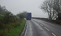
 A2029 - geograph.org.uk - 4762761.jpg 640 × 426; 67 КБ
-
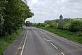
 A2029, Lewes - geograph.org.uk - 2475841.jpg 640 × 430; 62 КБ
-
 A26 and chalk quarries - geograph.org.uk - 3493300.jpg 640 × 430; 86 КБ
-
 A26 approaching Earwig Corner - geograph.org.uk - 4037891.jpg 640 × 488; 70 КБ
-
 A26 at Earwig Corner - geograph.org.uk - 3497664.jpg 640 × 430; 75 КБ
-
 A26 entering Lewes - geograph.org.uk - 3493302.jpg 640 × 430; 93 КБ
-
 A26 Road - geograph.org.uk - 2293575.jpg 640 × 480; 131 КБ
-
 A26 south of the Cuilfail Tunnel - geograph.org.uk - 1834910.jpg 640 × 430; 45 КБ
-
 A26 south of the Cuilfail Tunnel - geograph.org.uk - 4037886.jpg 640 × 430; 97 КБ
-
 A26 towards Lewes - geograph.org.uk - 2841077.jpg 640 × 490; 104 КБ
-
 A26 west of Cliffe Industrial Estate - geograph.org.uk - 3009045.jpg 3648 × 2736; 2,07 МБ
-
 A26, Malling - geograph.org.uk - 3497645.jpg 640 × 430; 81 КБ
-
 A26, Malling - geograph.org.uk - 5032266.jpg 640 × 426; 79 КБ
-
 A26, south of Earwig Corner - geograph.org.uk - 3497646.jpg 640 × 430; 57 КБ
-
 A27 - geograph.org.uk - 5022766.jpg 640 × 426; 59 КБ
-

-
 A27 approaching, Lewes - geograph.org.uk - 4929715.jpg 4000 × 3000; 4,37 МБ
-
 A27 bridge - geograph.org.uk - 2625581.jpg 640 × 480; 89 КБ
-
 A27 bridge - geograph.org.uk - 2630930.jpg 640 × 480; 79 КБ
-
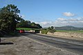
 A27 crosses the River Ouse - geograph.org.uk - 2471044.jpg 640 × 430; 58 КБ
-
 A27 eastbound at Kingston Hollow - geograph.org.uk - 4817927.jpg 1200 × 789; 256 КБ
-
 A27 hidden in the trees - geograph.org.uk - 4737706.jpg 640 × 426; 64 КБ
-
 A27 over the River Ouse - geograph.org.uk - 2468721.jpg 640 × 430; 53 КБ
-
 A27 over the River Ouse - geograph.org.uk - 2471052.jpg 640 × 430; 72 КБ
-
 A27 to Lewes and beyond - geograph.org.uk - 6177434.jpg 1280 × 1302; 1,34 МБ
-
 A27 towards Brighton - geograph.org.uk - 2855468.jpg 640 × 480; 74 КБ
-
 A27, east of Ashcombe Roundabout - geograph.org.uk - 3689458.jpg 640 × 430; 43 КБ
-
 A275 - geograph.org.uk - 4710029.jpg 640 × 426; 72 КБ
-
 A275 - geograph.org.uk - 4710034.jpg 640 × 426; 61 КБ
-
 A275 - geograph.org.uk - 4710073.jpg 640 × 426; 100 КБ
-
 A277 - geograph.org.uk - 5032300.jpg 640 × 426; 82 КБ
-
 A277 bridge across the River Ouse - geograph.org.uk - 2473845.jpg 640 × 430; 50 КБ
-
 A277 Bridge over the River Ouse - geograph.org.uk - 4771620.jpg 640 × 426; 81 КБ
-
 A277 Bridge over the River Ouse - geograph.org.uk - 4771623.jpg 640 × 426; 56 КБ
-
 A277 Bridge over the River Ouse - geograph.org.uk - 4771624.jpg 640 × 426; 65 КБ
-
 A277 bridge over the River Ouse - geograph.org.uk - 4782280.jpg 640 × 426; 69 КБ
-
 A277 bridge over the River Ouse - geograph.org.uk - 4906612.jpg 640 × 426; 49 КБ
-
 A277, Western Rd - geograph.org.uk - 5032289.jpg 640 × 426; 66 КБ
-
 A277, Western Rd - geograph.org.uk - 5032294.jpg 640 × 426; 65 КБ
-
 Abinger Place - geograph.org.uk - 2435766.jpg 640 × 480; 86 КБ
-
 Abinger Place - geograph.org.uk - 4762764.jpg 640 × 426; 62 КБ
-
 Access Route to the Sewage Works - geograph.org.uk - 974044.jpg 479 × 640; 83 КБ
-
 Across the River to Friston Forest - geograph.org.uk - 670397.jpg 479 × 640; 82 КБ
-
 Albion St - geograph.org.uk - 4782331.jpg 640 × 426; 72 КБ
-

-
 All Saints Centre - geograph.org.uk - 4791566.jpg 640 × 420; 75 КБ
-
 All Saints Centre - geograph.org.uk - 4791567.jpg 640 × 363; 61 КБ
-
 All Saints Centre - geograph.org.uk - 4791568.jpg 640 × 426; 73 КБ
-
 All Saints Centre - geograph.org.uk - 4791569.jpg 640 × 426; 99 КБ
-
 All Saints Centre - geograph.org.uk - 4791570.jpg 426 × 640; 90 КБ
-
 Alley off High St - geograph.org.uk - 4762610.jpg 640 × 426; 80 КБ
-
 Allotments - geograph.org.uk - 4702162.jpg 640 × 426; 135 КБ
-
 Allotments - geograph.org.uk - 4702164.jpg 640 × 426; 143 КБ
-
 Allotments on the edge of Lewes - geograph.org.uk - 4737705.jpg 640 × 426; 88 КБ
-
 American Football, Stanmer Park - geograph.org.uk - 596435.jpg 640 × 479; 69 КБ
-
 Ammonite - geograph.org.uk - 5949741.jpg 1024 × 681; 124 КБ
-
 Ammonite on a roundabout, Lewes - geograph.org.uk - 5032267.jpg 640 × 426; 61 КБ
-
 An Ex Lifeboat^ - geograph.org.uk - 5484904.jpg 5472 × 3648; 2,78 МБ
-
 Anne of Cleves House Museum, Lewes - geograph.org.uk - 5326316.jpg 3637 × 2565; 3,8 МБ
-
 Antioch House - geograph.org.uk - 4759093.jpg 640 × 426; 50 КБ
-
 Apartments under construction, Railway Lane - geograph.org.uk - 5124847.jpg 3937 × 2956; 2,38 МБ
-
 Approaching Ashcombe Roundabout - geograph.org.uk - 3689453.jpg 640 × 430; 38 КБ
-
 Approaching the end of the field - geograph.org.uk - 5022745.jpg 640 × 426; 86 КБ
-

-
 Argos - geograph.org.uk - 4782211.jpg 640 × 426; 61 КБ
-
 Asham Wharf - geograph.org.uk - 761276.jpg 640 × 479; 125 КБ
-
 Ashcombe bottom entrance.jpg 2146 × 3816; 2,51 МБ
-
 Ashcombe Roundabout - geograph.org.uk - 3689457.jpg 640 × 430; 56 КБ
-
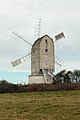 Ashcombe Windmill - geograph.org.uk - 6388238.jpg 2016 × 3022; 1017 КБ
-
 Ashlee Hincks (cropped).jpg 1125 × 1329; 160 КБ
-
 ASK Italian - geograph.org.uk - 5026300.jpg 640 × 426; 69 КБ
-
 Athletes Only Cross Here^ - geograph.org.uk - 5686961.jpg 3648 × 5472; 2,3 МБ
-
 B 2192 to Lewes - geograph.org.uk - 2365402.jpg 640 × 383; 45 КБ
-
 B2192 - geograph.org.uk - 4037897.jpg 640 × 452; 85 КБ
-
 B2192 - geograph.org.uk - 4037899.jpg 640 × 504; 96 КБ
-
 B2192 - geograph.org.uk - 4037915.jpg 640 × 430; 66 КБ
-
 B2192 to Lewes - geograph.org.uk - 2741344.jpg 4000 × 3000; 3,54 МБ
-
 B2192 towards Lewes - geograph.org.uk - 2115431.jpg 640 × 427; 67 КБ
-
 B2193 - geograph.org.uk - 5026143.jpg 640 × 426; 71 КБ
-
 Back in Motion - geograph.org.uk - 4785964.jpg 640 × 426; 66 КБ
-
 Bakehouse Pizzeria - geograph.org.uk - 4906623.jpg 640 × 426; 37 КБ
-
 Bankside Farm - geograph.org.uk - 1446444.jpg 480 × 640; 99 КБ
-
 Barbican House - geograph.org.uk - 4762613.jpg 640 × 426; 79 КБ
-
 Barn at Little Heaven - geograph.org.uk - 2478839.jpg 640 × 480; 138 КБ
-
 Barn Cricketing Bottom - geograph.org.uk - 465630.jpg 640 × 480; 103 КБ
-
 Barn Field - geograph.org.uk - 1413908.jpg 640 × 480; 69 КБ
-
 Barrels, Harveys Brewery - geograph.org.uk - 4771632.jpg 640 × 441; 63 КБ
-
 Bartholomew House - geograph.org.uk - 4762617.jpg 426 × 640; 72 КБ
-
 Beacon Hurst - geograph.org.uk - 1450447.jpg 480 × 640; 96 КБ
-
 Beardsfield Nursery - geograph.org.uk - 1449339.jpg 480 × 640; 128 КБ
-
 Beer House - geograph.org.uk - 4710112.jpg 640 × 426; 73 КБ
-
 Beer House - geograph.org.uk - 4710114.jpg 640 × 426; 81 КБ
-

-
 Belsons Brook - geograph.org.uk - 3079560.jpg 640 × 480; 80 КБ
-
 Bill's on Cliffe High Street, Lewes - geograph.org.uk - 4810194.jpg 1200 × 799; 317 КБ
-
 Blackcap's meadow above Ashcombe Bottom East.jpg 3827 × 2168; 2,5 МБ
-
 Blackdog Hill - geograph.org.uk - 1474771.jpg 640 × 480; 73 КБ
-
 Blaker's Tower, Priory Park - geograph.org.uk - 3093286.jpg 480 × 640; 78 КБ
-
 Blossom by the A26, Lewes - geograph.org.uk - 1838820.jpg 640 × 365; 65 КБ
-
 Boats on the River Ouse - geograph.org.uk - 2471087.jpg 640 × 430; 94 КБ
-
 Bonfire Society penalty shoot-out, Lewes FC - geograph.org.uk - 2721902.jpg 1600 × 1191; 473 КБ
-
 Bormer Brook - geograph.org.uk - 3082904.jpg 640 × 480; 60 КБ
-
 Bottom Entrance - geograph.org.uk - 1455891.jpg 640 × 480; 83 КБ
-
 Boundary stone by green on Lewes golf course - geograph.org.uk - 2742337.jpg 4000 × 3000; 3,72 МБ
-
 Bowling Green, Lewes Castle - geograph.org.uk - 2435670.jpg 640 × 480; 66 КБ
-
 Bowling Green, Lewes Castle, Sussex - geograph.org.uk - 2216816.jpg 3872 × 2592; 3,49 МБ
-
 Brack Mound House - geograph.org.uk - 4762679.jpg 640 × 465; 84 КБ
-
 Brack Mount - geograph.org.uk - 4408780.jpg 1280 × 851; 285 КБ
-
 Brack Mount, Lewes - geograph.org.uk - 3237001.jpg 2816 × 2112; 2,68 МБ
-
 Brack Mount, Lewes - geograph.org.uk - 895694.jpg 640 × 480; 149 КБ
-
 Bradford Rd - geograph.org.uk - 4758716.jpg 640 × 426; 79 КБ
-
 Brats, children's shop, Lewes (15595509940).jpg 2154 × 1639; 2 МБ
-
 Brick ^ flint detail, Lewes Library - geograph.org.uk - 5124851.jpg 3796 × 2850; 2,97 МБ
-
 Bridge carrying road to Old Malling Farm - geograph.org.uk - 3988020.jpg 640 × 480; 182 КБ
-
 Bridge on Cliffe High Street - geograph.org.uk - 2901671.jpg 640 × 480; 90 КБ
-
 Bridge over the Ouse at Lewes - geograph.org.uk - 4290245.jpg 1600 × 1194; 464 КБ
-

-
 Bridleway in Lewes - geograph.org.uk - 4710037.jpg 640 × 426; 119 КБ
-
 Bridleway to Lewes - geograph.org.uk - 4702163.jpg 640 × 426; 101 КБ
-
 Brighton Rd, A277 - geograph.org.uk - 4975581.jpg 640 × 426; 71 КБ
-
 Brighton Road at the A27 roundabout, Lewes - geograph.org.uk - 2599007.jpg 1600 × 1200; 555 КБ
-
 Brighton Road, Lewes - geograph.org.uk - 3250338.jpg 640 × 428; 122 КБ
-

-
 Brightonandhovealbionwomen2012.jpg 1944 × 1296; 438 КБ
-
 Brook St - geograph.org.uk - 4766499.jpg 640 × 426; 97 КБ
-
 Broomans Lane - geograph.org.uk - 4791554.jpg 640 × 430; 76 КБ
-

-
 Buildings in South Street, Lewes - geograph.org.uk - 6166969.jpg 1024 × 683; 196 КБ
-
 Bull House - geograph.org.uk - 4762591.jpg 426 × 640; 60 КБ
-
 Bull House - geograph.org.uk - 4762600.jpg 426 × 640; 58 КБ
-
 Bull House - geograph.org.uk - 5026254.jpg 640 × 426; 75 КБ
-
 Bung Hole - geograph.org.uk - 1446040.jpg 480 × 640; 84 КБ
-
 Bungalows, Green Park Corner - geograph.org.uk - 1456413.jpg 426 × 640; 80 КБ
-
 Burial plot, Church of St Michael - geograph.org.uk - 4766535.jpg 640 × 426; 111 КБ
-
 Bus Garage - geograph.org.uk - 4791504.jpg 640 × 426; 54 КБ
-
 Bus Station - geograph.org.uk - 4791502.jpg 640 × 426; 64 КБ
-
 Bus Station - geograph.org.uk - 4791506.jpg 640 × 426; 68 КБ
-
 Bush with sheep on Malling Hill - geograph.org.uk - 2342511.jpg 2592 × 1944; 2,34 МБ
-
 Cairn on Malling Hill - geograph.org.uk - 2741444.jpg 4000 × 3000; 3,74 МБ
-
 Car park - geograph.org.uk - 4367740.jpg 640 × 480; 91 КБ
-
 Car park at Lewes football club - geograph.org.uk - 2509481.jpg 640 × 480; 156 КБ
-
 Car Park at Rear of Waitrose, Eastgate Street, Lewes (March 2016).JPG 4600 × 2600; 1,86 МБ
-
 Car Park, Sussex Downs College - geograph.org.uk - 255104.jpg 640 × 479; 116 КБ
-
 Car Park, Underhill Lane - geograph.org.uk - 1450074.jpg 640 × 480; 104 КБ
-
 Caravan for sale in Lewes - geograph.org.uk - 3119715.jpg 1600 × 1224; 365 КБ
-
 Cask Fillers - geograph.org.uk - 5401906.jpg 424 × 640; 56 КБ
-
 Castle Banks - geograph.org.uk - 2435738.jpg 480 × 640; 82 КБ
-
 Castle Banks - geograph.org.uk - 2435747.jpg 480 × 640; 72 КБ
-
 Castle bowling green - geograph.org.uk - 2848622.jpg 640 × 426; 54 КБ
-
 Castle Lane, Lewes - geograph.org.uk - 3120253.jpg 3000 × 4000; 4,09 МБ
-
 Castle Place - geograph.org.uk - 4762611.jpg 640 × 426; 63 КБ
-
 Castle Precincts Cottages - geograph.org.uk - 4762676.jpg 640 × 426; 120 КБ
-
 Castle Precincts, Lewes, Sussex - geograph.org.uk - 4170952.jpg 1024 × 768; 124 КБ
-
 Castlegate House - geograph.org.uk - 4762631.jpg 640 × 426; 77 КБ
-
 Castlegate House - geograph.org.uk - 4762672.jpg 640 × 426; 61 КБ
-
 Cattle on Malling Hill - geograph.org.uk - 2741434.jpg 4000 × 3000; 3,49 МБ
-
 Cattle on the path - geograph.org.uk - 2471073.jpg 640 × 430; 59 КБ
-
 Celery Sewer - geograph.org.uk - 3082908.jpg 480 × 640; 78 КБ
-
 Chailey Moat and lake (geograph 2118849).jpg 640 × 428; 114 КБ
-
 Chalk cliff above the A26 - geograph.org.uk - 1838783.jpg 640 × 298; 59 КБ
-
 Chalk cliffs above River Ouse - geograph.org.uk - 108829.jpg 640 × 480; 117 КБ


.jpg)


.jpg)


.JPG)


.jpg)

