Category:Leziate
Jump to navigation
Jump to search
English: Leziate is a hamlet and a civil parish in the English county of Norfolk .The village is north-north-east of London. The Village is located a small distance south of the B1445 which rouns between King's Lynn and Mundesley. The nearest railway station is at King's Lynn for the Fen Line which runs between King's Lynn and Cambridge. The nearest airport is Norwich International Airport. The parish of Leziate in the 2001 census, has a population of 581. For the purposes of local government, the parish falls within the district of King's Lynn and West Norfolk.
village and civil parish in Norfolk, UK | |||||
| Upload media | |||||
| Instance of | |||||
|---|---|---|---|---|---|
| Location | King's Lynn and West Norfolk, Norfolk, East of England, England | ||||
| Area |
| ||||
 | |||||
Subcategories
This category has the following 2 subcategories, out of 2 total.
A
Media in category "Leziate"
The following 70 files are in this category, out of 70 total.
-
 "Millionaires Row", Ashwicken, Norfolk - geograph.org.uk - 2051212.jpg 2,848 × 2,136; 3.15 MB
-
 A field-woodland boundary - geograph.org.uk - 1323831.jpg 640 × 480; 125 KB
-
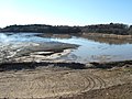
 A green lake - geograph.org.uk - 1546383.jpg 640 × 480; 106 KB
-
 A sandy path - geograph.org.uk - 1546253.jpg 640 × 480; 101 KB
-
 A view over Leziate lake - geograph.org.uk - 1546702.jpg 640 × 480; 75 KB
-
 A young heifer - geograph.org.uk - 2051183.jpg 2,848 × 2,136; 3.05 MB
-
 Allen's Garage, Station Road, Leziate - geograph.org.uk - 5989961.jpg 4,608 × 3,456; 2.95 MB
-
 An inland beach but "No Swimming Allowed" - geograph.org.uk - 1741612.jpg 2,848 × 2,136; 3.03 MB
-
 B1145 towards Gayton - geograph.org.uk - 5539597.jpg 640 × 480; 49 KB
-
 B1145 towards Gayton - geograph.org.uk - 5539609.jpg 640 × 480; 57 KB
-
 B1145, Ashwicken - geograph.org.uk - 5539604.jpg 640 × 480; 100 KB
-
 Barley field adjoining footpath - geograph.org.uk - 1322396.jpg 640 × 480; 93 KB
-
 Bawsey Country Park near Kings Lynn - geograph.org.uk - 1546272.jpg 640 × 480; 98 KB
-
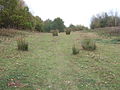 Bawsey grass punks - geograph.org.uk - 1546158.jpg 640 × 480; 103 KB
-
 Beef and mushroom pie^ - geograph.org.uk - 2051143.jpg 2,848 × 2,136; 2.98 MB
-
 Brow of the Hill, Bawsey - geograph.org.uk - 5990029.jpg 4,608 × 3,456; 7.12 MB
-
 Bullock grazing on conservation land - geograph.org.uk - 2051113.jpg 2,848 × 2,136; 3 MB
-
 Can you see the lake^ - geograph.org.uk - 1546402.jpg 640 × 480; 107 KB
-
 Church Lane, Ashwicken, Norfolk - geograph.org.uk - 2050832.jpg 2,848 × 2,136; 2.89 MB
-
 Distant smoke - geograph.org.uk - 1546663.jpg 640 × 480; 81 KB
-
 East Winch airstrip, aerial 2013 - geograph.org.uk - 3673383.jpg 640 × 427; 53 KB
-
 Farm road, Ashwicken - geograph.org.uk - 1865701.jpg 640 × 480; 126 KB
-

-
 Farmland at Leziate off Holthouse Lane - geograph.org.uk - 5990022.jpg 4,608 × 3,456; 2.59 MB
-
 Farmland near Watcher's Wood - geograph.org.uk - 5539606.jpg 640 × 480; 55 KB
-

-
 Field gate on farm track west of Gayton - geograph.org.uk - 1324036.jpg 640 × 492; 132 KB
-
 Fields off the B1145 - geograph.org.uk - 5539594.jpg 640 × 480; 42 KB
-
 Flooded track between Leziate and Ashwicken - geograph.org.uk - 2051157.jpg 2,848 × 2,136; 3.07 MB
-
 Flower on the track side - geograph.org.uk - 2051095.jpg 2,848 × 2,136; 2.89 MB
-
 Footpath near the reservoirs - geograph.org.uk - 1546645.jpg 640 × 480; 151 KB
-
 Footpath to Dadle's wood - geograph.org.uk - 1865705.jpg 640 × 480; 135 KB
-
 Former rectory, Ashwicken - geograph.org.uk - 1865697.jpg 640 × 480; 147 KB
-
 Garage and shed at Leziate - geograph.org.uk - 5990028.jpg 4,608 × 3,456; 6.42 MB
-
 Gate into a pasture beside Lynn Road - geograph.org.uk - 1323824.jpg 640 × 480; 133 KB
-
 Hempton Fen Covert, Pott Row, King's Lynn - geograph.org.uk - 2049468.jpg 2,848 × 2,136; 3.08 MB
-
 Holthouse Lane, Leziate - geograph.org.uk - 5990024.jpg 4,608 × 3,456; 4.31 MB
-
 Houses along Brow of the Hill and autumnal oak trees - geograph.org.uk - 5990031.jpg 4,456 × 3,342; 4.43 MB
-
 Lake near Kings Lynn - panoramio.jpg 1,200 × 800; 558 KB
-
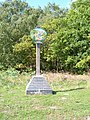 Leziate and Ashwicken village sign.jpg 480 × 640; 103 KB
-
 Looking across paddocks to All Saints' church - geograph.org.uk - 4127077.jpg 4,320 × 3,240; 2.96 MB
-
 Looking up Church Lane, Ashwicken - geograph.org.uk - 2050851.jpg 2,848 × 2,136; 3.06 MB
-
 Main Road near Ashwicken, Norfolk - geograph.org.uk - 2050863.jpg 2,848 × 2,136; 3 MB
-

-
 Narrow Gauge railway Track Bawsey Leziate Sand works British Sand Sibelco 3.jpg 7,360 × 4,912; 5.4 MB
-
 No mains water supply^ - geograph.org.uk - 2049480.jpg 2,848 × 2,136; 3.18 MB
-
 On the edge of Leziate sailing lake, Norfolk - geograph.org.uk - 2051205.jpg 2,848 × 2,136; 2.99 MB
-
 Path of dismantled railway line - geograph.org.uk - 1205309.jpg 480 × 640; 98 KB
-
 Path to the church, Ashwicken - geograph.org.uk - 4127074.jpg 4,320 × 3,240; 5.23 MB
-
 Public footpath to the village of Gayton - geograph.org.uk - 1322379.jpg 640 × 480; 117 KB
-
 Quad bikes only - geograph.org.uk - 4437576.jpg 1,280 × 1,920; 458 KB
-
 Ruined railway building - geograph.org.uk - 1205312.jpg 480 × 640; 145 KB
-
 Rushes and buttercups in wet pasture - geograph.org.uk - 1323836.jpg 640 × 480; 108 KB
-
 Sand cliffs edge the lake - geograph.org.uk - 1741625.jpg 2,848 × 2,136; 3.05 MB
-
 Sand quarry - geograph.org.uk - 1741644.jpg 2,848 × 2,136; 3.03 MB
-
 Sand quarry off Church Lane - geograph.org.uk - 2050971.jpg 2,848 × 2,136; 3.09 MB
-
 Sand quarry off Church Lane, Leziate - geograph.org.uk - 2289514.jpg 760 × 570; 196 KB
-
 Silica sand excavation, Leziate, Norfolk - geograph.org.uk - 2050948.jpg 2,848 × 2,136; 3.1 MB
-
 Straw left - sand right - geograph.org.uk - 2051168.jpg 2,848 × 2,136; 3.2 MB
-
 Stubble and coppice, Ashwicken - geograph.org.uk - 5539603.jpg 640 × 480; 69 KB
-
 Track from Millionaires Row - geograph.org.uk - 2051067.jpg 2,848 × 2,136; 2.93 MB
-
 Turkey feed mill - geograph.org.uk - 529237.jpg 3,008 × 2,000; 2.57 MB
-
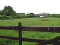 View across paddock - geograph.org.uk - 1322384.jpg 640 × 480; 70 KB
-

-
 Watering hole on the bank of Gaywood River - geograph.org.uk - 2049459.jpg 2,848 × 2,136; 2.94 MB
-
 Well Hall Lane past Well Hall Farm - geograph.org.uk - 1322373.jpg 640 × 480; 83 KB
-
 Well Hall Lane, Ashwicken near King's Lynn - geograph.org.uk - 2718917.jpg 4,320 × 3,240; 5.52 MB
-

-
 Wheat, track, and woodland near Leziate - geograph.org.uk - 544328.jpg 3,008 × 2,000; 3.36 MB
-
 Who stole the track^ - geograph.org.uk - 2051196.jpg 2,848 × 2,136; 3.1 MB


