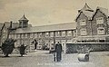
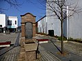
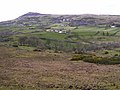
Category:Limavady
Перейти к навигации
Перейти к поиску
Български: Лимава̀ди (на английски Limavady, на ирландски Léim an Mhadaidh, буквени символи и звуков файл за произношение [1], най-близко до Лимъваа̀дий) е град в северната част на Северна Ирландия. Разположен е около река Роу в графство Лъндъндери на около 85 km северозападно от столицата Белфаст. Главен административен център на район Лимавади. Имал е жп гара от 29 декември 1852 г. до 2 май 1955 г. На около 15 km западно от Лимавади е летището на Дери. Населението му е 12 135 жители според данни от преброяването през 2001 г.
Deutsch: Limavady (; irisch: Léim an Mhadaidh; dt.: „Sprung des Hundes“) ist eine größere Marktstadt und ein
English: Limavady is a market town just south west of Coleraine, Northern Ireland. It had a population of 12,135 people in the 2001 Census, an increase of some 17% compared to 1991. In the 30 years after 1971 Limavady’s population almost doubled.
Esperanto: Limavady (irlande Léim a' Mhadaidh, skote Limavadie) estas kampurbo de la kantono Derry en Nord-Irlando. La urbo havis 12 135 loĝantojn laux la popolnombrado de 2001. Ĝi situas je 27 km oriente Derry kaj 23 km sud-okcidente Corelaine.
Nederlands: Limavady ( Iers: Léim an Mhadaidh) is een drukke marktplaats in het County Londonderry in Noord-Ierland, gelegen in de Roe Valley. In 2001 woonden er 12.135 mensen.
Norsk bokmål: Limavady er en by i grevskapet Londonderry i Nord-Irland. Den er administrasjonssenter for distriktet Limavady.
Polski: Limavady ( irl. Léim an Mhadaidh) - miasto w Wielkiej Brytanii (Irlandia Północna; w Hrabstwie Londonderry). Według danych szacunkowych na rok 2009 liczy 13 966 mieszkańców.
Scots: Limavady is a wee toun in the Coonty of Lunnonderry, Northren Ireland. Its lies on the baunks o the river Roe.
Svenska: Limavady är en stad i grevskapet Londonderry i Nordirland. Limavady är även huvudort för distriktet Limavady. År 2001 hade Limavady 12 135 invånare.
город в Северной Ирландии, административный центр одноимённого района  | |||||
| Медиафайл | |||||
| Это частный случай понятия | |||||
|---|---|---|---|---|---|
| Местонахождение |
| ||||
| официальный сайт | |||||
 | |||||
Подкатегории
В этой категории отображается 2 подкатегории из имеющихся 2.
L
R
Файлы в категории «Limavady»
Показаны 200 файлов из 312, находящихся в данной категории.
(Предыдущая страница) (Следующая страница)-
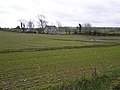
 A happy cow at Terrydremont North - geograph.org.uk - 716654.jpg 640 × 479; 44 КБ
-
 A371 Catherine Street, Limavady - geograph.org.uk - 4628787.jpg 640 × 480; 155 КБ
-
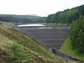 Banagher Dam - panoramio.jpg 1024 × 768; 318 КБ
-
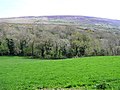
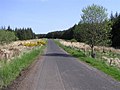
 Binevenagh forest - geograph.org.uk - 1087755.jpg 640 × 480; 34 КБ
-
 Binevenagh Lake - panoramio.jpg 2048 × 1536; 1,42 МБ
-
 Boveva Orange Hall - geograph.org.uk - 1357000.jpg 640 × 480; 70 КБ
-
 Broad Road - geograph.org.uk - 801152.jpg 640 × 479; 48 КБ
-
 Broglasco Townland - geograph.org.uk - 791498.jpg 640 × 479; 52 КБ
-
 Broglasco Townland - geograph.org.uk - 791499.jpg 640 × 478; 60 КБ
-
 Broglasco Townland - geograph.org.uk - 791500.jpg 640 × 260; 29 КБ
-
 Broglasco Townland - geograph.org.uk - 791501.jpg 640 × 479; 64 КБ
-
 Broighter Townland - geograph.org.uk - 791490.jpg 640 × 479; 56 КБ
-
 Broighter Townland - geograph.org.uk - 791528.jpg 640 × 479; 56 КБ
-
 Burnally Townland - geograph.org.uk - 791505.jpg 640 × 479; 62 КБ
-
 Cairn of Peace, nr Limavady - geograph.org.uk - 791495.jpg 640 × 479; 44 КБ
-
 Cannon, Limavady - geograph.org.uk - 5080379.jpg 640 × 480; 197 КБ
-

-
 Carnowry Townland - geograph.org.uk - 791846.jpg 640 × 479; 73 КБ
-
 Carrick Mills car park - geograph.org.uk - 730681.jpg 640 × 479; 121 КБ
-
 Carrowmuddle Townland - geograph.org.uk - 791603.jpg 640 × 479; 70 КБ
-
 Carrowreagh Townland - geograph.org.uk - 791539.jpg 640 × 479; 65 КБ
-
 Carrydoo Townland - geograph.org.uk - 792047.jpg 640 × 479; 68 КБ
-
 Catherine Street, Limavady - geograph.org.uk - 4628784.jpg 640 × 480; 161 КБ
-
 Catherine Street, Limavady - geograph.org.uk - 4628798.jpg 640 × 480; 160 КБ
-
 Caught in the Act! (19813129038).jpg 3480 × 2792; 3,62 МБ
-
 Church of Ireland, Limavady - geograph.org.uk - 5080362.jpg 640 × 480; 150 КБ
-
 Clagan Townland - geograph.org.uk - 716554.jpg 640 × 479; 58 КБ
-
 Cliffs at Binevenagh - panoramio - Alistair Cunningham (1).jpg 2048 × 1536; 1,41 МБ
-
 Cliffs at Binevenagh - panoramio - Alistair Cunningham (2).jpg 2048 × 1536; 1,29 МБ
-
 Cliffs at Binevenagh - panoramio - Alistair Cunningham (3).jpg 2048 × 1536; 1,47 МБ
-
 Cliffs at Binevenagh - panoramio - Alistair Cunningham (4).jpg 1536 × 2048; 1,37 МБ
-
 Cliffs at Binevenagh - panoramio - Alistair Cunningham (5).jpg 2048 × 1536; 1,4 МБ
-
 Cliffs at Binevenagh - panoramio - Alistair Cunningham.jpg 2048 × 1536; 1,22 МБ
-
 Cliffs at Binevenagh - panoramio.jpg 2048 × 1536; 1,43 МБ
-
 Cloney Townland - geograph.org.uk - 791657.jpg 640 × 479; 38 КБ
-
 Clooney Townland - geograph.org.uk - 791643.jpg 640 × 479; 46 КБ
-
 Clooney Townland - geograph.org.uk - 791984.jpg 640 × 479; 52 КБ
-
 Column detail, J McConnell, Limavady - geograph.org.uk - 4391495.jpg 640 × 481; 137 КБ
-
 Connell Street, Limavady - geograph.org.uk - 1455693.jpg 640 × 480; 63 КБ
-

-
 Corndale Townland - geograph.org.uk - 791509.jpg 640 × 479; 48 КБ
-
 Crindle Nursery - geograph.org.uk - 791606.jpg 640 × 479; 91 КБ
-
 Curraghlane Mountainside - geograph.org.uk - 731216.jpg 640 × 479; 59 КБ
-
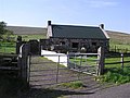 Derelict cottage at Gortcobies - geograph.org.uk - 801147.jpg 640 × 479; 64 КБ
-
 Derry More - geograph.org.uk - 791990.jpg 640 × 402; 52 КБ
-
-
 Douglas' Bar, Limavady - geograph.org.uk - 4628796.jpg 640 × 480; 167 КБ
-
 Dowland Townland - geograph.org.uk - 791961.jpg 640 × 479; 49 КБ
-
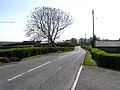
 Draperstown. "A Road With A View" - geograph.org.uk - 1239114.jpg 640 × 480; 80 КБ
-

-
 Drumachose Presbyterian Church from graveyard in December snow.jpg 2560 × 1920; 1,39 МБ
-
 Drumaderry Townland - geograph.org.uk - 791926.jpg 640 × 479; 66 КБ
-
 Drumalief Townland - geograph.org.uk - 791999.jpg 640 × 479; 62 КБ
-
 Drumavally Townland - geograph.org.uk - 791629.jpg 640 × 479; 52 КБ
-
 Drummond Townland - geograph.org.uk - 1472964.jpg 640 × 479; 40 КБ
-
 Dunhill Road (A37) - geograph.org.uk - 801159.jpg 640 × 479; 60 КБ
-
 Dunmore Townland - geograph.org.uk - 801477.jpg 640 × 479; 72 КБ
-
 Dunmore Townland - geograph.org.uk - 801482.jpg 640 × 479; 62 КБ
-
 Dunmore Townland - geograph.org.uk - 801485.jpg 640 × 479; 83 КБ
-
 Farlow Road - geograph.org.uk - 716573.jpg 640 × 479; 52 КБ
-
 Floral display, Limavady - geograph.org.uk - 5080413.jpg 640 × 480; 188 КБ
-
 Flush Bracket, Limavady - geograph.org.uk - 5803990.jpg 1280 × 1280; 2,43 МБ
-
 Forest near Avish - geograph.org.uk - 791822.jpg 640 × 479; 69 КБ
-
 Forest Road - geograph.org.uk - 791871.jpg 640 × 479; 87 КБ
-
 Formoyle Hill - geograph.org.uk - 801468.jpg 640 × 479; 71 КБ
-
 From Binevenagh - panoramio - Alistair Cunningham (1).jpg 2048 × 1536; 1,33 МБ
-
 From Binevenagh - panoramio - Alistair Cunningham.jpg 2048 × 1536; 1,45 МБ
-
 From Binevenagh - panoramio.jpg 2048 × 1536; 1,3 МБ
-
 Glack Townland - geograph.org.uk - 708156.jpg 640 × 479; 68 КБ
-
 Glenconway Townland - geograph.org.uk - 708341.jpg 640 × 479; 57 КБ
-
 Golf course at Limavady - geograph.org.uk - 496993.jpg 640 × 480; 162 КБ
-
 Golf Course in Limavady - geograph.org.uk - 396552.jpg 640 × 480; 169 КБ
-

-
 J McConnell, Newtown Square, Limavady - geograph.org.uk - 4391492.jpg 640 × 480; 155 КБ
-
 Jane Ross mural, Limavady - geograph.org.uk - 4391574.jpg 640 × 481; 169 КБ
-
 Jane Ross plaque, Limavady - geograph.org.uk - 4391533.jpg 640 × 480; 164 КБ
-
 Jane Ross residence, Limavady - geograph.org.uk - 4391540.jpg 1399 × 1867; 1,1 МБ
-
 Just before Sunday service.jpg 2560 × 1920; 1,5 МБ
-
 Largantea Picnic Area - geograph.org.uk - 801503.jpg 640 × 479; 77 КБ
-

-
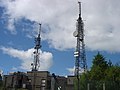 Limavady - Tale of the two Towers. - geograph.org.uk - 491897.jpg 640 × 480; 72 КБ
-
 Limavady banner Drumachose Presbyterian Church.jpg 2450 × 350; 187 КБ
-
 Limavady Baptist Church.jpg 1770 × 1174; 291 КБ
-
 Limavady Taxis - Kebab King - McNulty's - geograph.org.uk - 4391568.jpg 640 × 480; 166 КБ
-
 Limavady Town - geograph.org.uk - 813698.jpg 640 × 479; 55 КБ
-
 Limavady Town - geograph.org.uk - 813701.jpg 640 × 479; 68 КБ
-
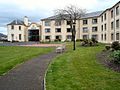 Limavady, Radisson Hotel.jpg 640 × 480; 146 КБ
-
 Lisnagrib Townland - geograph.org.uk - 791898.jpg 640 × 479; 63 КБ
-
 Lisnagrib Townland - geograph.org.uk - 791900.jpg 640 × 479; 78 КБ
-
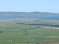
 Lough Foyle View - geograph.org.uk - 1298267.jpg 640 × 426; 45 КБ
-
 Lower Ballyleighery - geograph.org.uk - 791751.jpg 640 × 479; 55 КБ
-
 Magilligan - panoramio.jpg 1024 × 768; 235 КБ
-
 Magilligan from Binevenagh - panoramio.jpg 2048 × 1536; 1,23 МБ
-
 Main Street, Limavady - geograph.org.uk - 1455684.jpg 640 × 480; 97 КБ
-
 Main Street, Limavady - geograph.org.uk - 5811610.jpg 1280 × 720; 997 КБ
-
 Maine North - geograph.org.uk - 730880.jpg 640 × 479; 51 КБ
-
 Maine North - geograph.org.uk - 730900.jpg 640 × 479; 65 КБ
-
 Maine North Townland - geograph.org.uk - 730881.jpg 640 × 479; 45 КБ
-
 Maine South - geograph.org.uk - 730906.jpg 640 × 479; 69 КБ
-
 Maine South - geograph.org.uk - 730909.jpg 640 × 479; 81 КБ
-
 Maine South Townland - geograph.org.uk - 730907.jpg 640 × 479; 82 КБ
-
 McCloskey Meats, Limavady - geograph.org.uk - 4391500.jpg 640 × 480; 168 КБ
-
 Moneyquiggy Townland - geograph.org.uk - 767037.jpg 640 × 479; 106 КБ
-
 Moys Townland - geograph.org.uk - 716514.jpg 640 × 479; 49 КБ
-
 Muldonagh Townland - geograph.org.uk - 767437.jpg 640 × 274; 34 КБ
-
 Mulkeeragh Townland - geograph.org.uk - 716674.jpg 640 × 479; 60 КБ
-
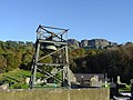
 Museum, Roe Valley Country Park - geograph.org.uk - 716662.jpg 640 × 479; 64 КБ
-
 Myroe Presbyterian Church - geograph.org.uk - 791512.jpg 640 × 478; 42 КБ
-
 Myroe Presbyterian War Memorial Hall - geograph.org.uk - 791519.jpg 640 × 479; 65 КБ
-
 Near Avish - geograph.org.uk - 791821.jpg 640 × 479; 46 КБ
-
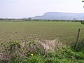
 Near Binevenagh - geograph.org.uk - 791797.jpg 640 × 479; 89 КБ
-
 Near Bonnanaboigh - geograph.org.uk - 716455.jpg 640 × 479; 55 КБ
-
 Near Drumsurn - geograph.org.uk - 730903.jpg 640 × 479; 54 КБ
-
 Near Dungiven - geograph.org.uk - 731219.jpg 640 × 479; 83 КБ
-
 Near Dungiven - geograph.org.uk - 731225.jpg 640 × 479; 67 КБ
-
 Near Gortmoylagh Forest - geograph.org.uk - 741857.jpg 640 × 479; 69 КБ
-
 Near Gortnaghey - geograph.org.uk - 716429.jpg 640 × 479; 53 КБ
-
 Near Lenamore - geograph.org.uk - 731020.jpg 640 × 479; 53 КБ
-
 Near Limavady - geograph.org.uk - 716595.jpg 640 × 479; 58 КБ
-
 Near Limavady - geograph.org.uk - 716614.jpg 640 × 479; 67 КБ
-
 Near Limavady - geograph.org.uk - 716623.jpg 640 × 378; 29 КБ
-
 Newtown Square, Limavady - geograph.org.uk - 4391489.jpg 640 × 480; 178 КБ
-

-
 Old Ford on the River Roe - geograph.org.uk - 396497.jpg 640 × 480; 194 КБ
-
 On Hill Climb at Glenshane - geograph.org.uk - 1298361.jpg 640 × 426; 67 КБ
-
 Plaque at Cairn, Magilligan - geograph.org.uk - 791681.jpg 640 × 570; 82 КБ
-
 Plaque, Hon Willian Ferguson Massey - geograph.org.uk - 5080347.jpg 640 × 480; 190 КБ
-
 Pollys Brae Road - geograph.org.uk - 716508.jpg 640 × 479; 69 КБ
-
 Pollys Brae Road - geograph.org.uk - 716515.jpg 640 × 479; 48 КБ
-
 Postbox, Limavady - geograph.org.uk - 5811645.jpg 1280 × 1280; 1,36 МБ
-
 Radisson Roe Golf Course - geograph.org.uk - 716541.jpg 640 × 479; 100 КБ
-
 Railway Bridge, Maine South - geograph.org.uk - 730910.jpg 640 × 479; 72 КБ
-
 Raised flowerbeds, Limavady - geograph.org.uk - 5080406.jpg 640 × 480; 192 КБ
-
 Ringsend Road - geograph.org.uk - 730793.jpg 640 × 479; 52 КБ
-
 Ringsend Road - geograph.org.uk - 767055.jpg 640 × 479; 58 КБ
-
-
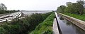
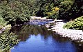
 River Roe, Limavady - geograph.org.uk - 730693.jpg 640 × 273; 55 КБ
-
 Riverside Walk, Straw - geograph.org.uk - 716458.jpg 640 × 479; 61 КБ
-
 Road and mast at Muldonagh - geograph.org.uk - 767434.jpg 479 × 640; 84 КБ
-
 Road at Ballygoland - geograph.org.uk - 791652.jpg 640 × 479; 48 КБ
-
 Road at Ballyleighery - geograph.org.uk - 791755.jpg 640 × 479; 60 КБ
-
 Road at Ballymoney - geograph.org.uk - 791917.jpg 640 × 479; 90 КБ
-
 Road at Binevenagh - geograph.org.uk - 791879.jpg 640 × 479; 77 КБ
-
 Road at Binevenagh Forest - geograph.org.uk - 791780.jpg 640 × 479; 60 КБ
-
 Road at Broighter - geograph.org.uk - 791529.jpg 640 × 479; 62 КБ
-
 Road at Carnowry - geograph.org.uk - 791825.jpg 640 × 479; 43 КБ
-
 Road at Derry More - geograph.org.uk - 791995.jpg 640 × 479; 61 КБ
-
 Road at Dirtagh - geograph.org.uk - 792021.jpg 640 × 479; 54 КБ
-
 Road at Dowland - geograph.org.uk - 791965.jpg 640 × 479; 53 КБ
-
 Road at Drumaderry - geograph.org.uk - 791958.jpg 640 × 479; 102 КБ
-
 Road at Dunmore - geograph.org.uk - 801473.jpg 640 × 479; 55 КБ
-
 Road at Dunmore - geograph.org.uk - 801491.jpg 640 × 479; 65 КБ
-
 Road at Formoyle - geograph.org.uk - 801464.jpg 640 × 479; 80 КБ
-
 Road at Glebe - geograph.org.uk - 791619.jpg 640 × 479; 49 КБ
-
 Road at Gortgarn - geograph.org.uk - 792071.jpg 640 × 479; 76 КБ
-
 Road at Gortmore - geograph.org.uk - 791800.jpg 640 × 479; 62 КБ
-
 Road at Gortnamoyagh - geograph.org.uk - 731071.jpg 640 × 479; 53 КБ
-
 Road at Gortnamoyagh Forest - geograph.org.uk - 767040.jpg 640 × 479; 57 КБ
-
 Road at Grange Park Wood - geograph.org.uk - 801551.jpg 640 × 479; 63 КБ
-
 Road at Killtbready - geograph.org.uk - 792028.jpg 640 × 479; 73 КБ
-
 Road at Killybready - geograph.org.uk - 792038.jpg 640 × 479; 79 КБ
-
 Road at Maine North - geograph.org.uk - 730899.jpg 640 × 479; 46 КБ
-
 Road at Moneyquiggy - geograph.org.uk - 767035.jpg 640 × 479; 63 КБ
-
 Road at Round Knowe - geograph.org.uk - 791875.jpg 640 × 479; 69 КБ
-
 Road at Tircreven - geograph.org.uk - 791694.jpg 640 × 479; 70 КБ
-
 Road at Tircreven - geograph.org.uk - 791701.jpg 640 × 479; 54 КБ
-
 Road at Tirmaquin - geograph.org.uk - 730779.jpg 640 × 479; 59 КБ
-
 Road at Upper Drummans - geograph.org.uk - 791646.jpg 640 × 479; 47 КБ
-
 Road at Windy Hill - geograph.org.uk - 791803.jpg 640 × 479; 49 КБ
-
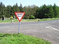
 Road junction at Ballyquin - geograph.org.uk - 730897.jpg 640 × 277; 25 КБ
-
 Road Junction, Glenhead - geograph.org.uk - 716521.jpg 640 × 479; 65 КБ
-
 Road near Avish - geograph.org.uk - 791818.jpg 640 × 479; 56 КБ
-
 Road near Dungiven - geograph.org.uk - 731217.jpg 640 × 479; 83 КБ
-
 Road near Glebe - geograph.org.uk - 716644.jpg 640 × 479; 44 КБ
-
 Road near Temain Hill - geograph.org.uk - 767054.jpg 640 × 479; 58 КБ
-
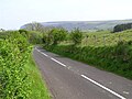
 Road west of Limavady - geograph.org.uk - 716596.jpg 640 × 292; 32 КБ
-
 Roe Estuary - geograph.org.uk - 791548.jpg 640 × 479; 51 КБ
-
-
 Roe Valley Country Park - geograph.org.uk - 716663.jpg 640 × 479; 75 КБ
-
 Roe Valley Country Park - panoramio.jpg 1024 × 768; 424 КБ
-
 Roe Valley Hospital.jpg 283 × 174; 23 КБ
-
 Rough Fort near Limavady - geograph.org.uk - 716578.jpg 640 × 479; 84 КБ
-
 Rubbish site, Drumaduff - geograph.org.uk - 730920.jpg 640 × 479; 74 КБ
-
 Ruin at Baranailt Road - geograph.org.uk - 716546.jpg 640 × 479; 92 КБ
-
 Ruin near Gortgarn - geograph.org.uk - 731009.jpg 640 × 479; 86 КБ
-
 Samuel Sterling fountain, Limavady - geograph.org.uk - 4391527.jpg 640 × 480; 164 КБ
-
 Scotty's, Main Street, Limavady - geograph.org.uk - 4391562.jpg 640 × 480; 160 КБ
-
 Scriggan Townland - geograph.org.uk - 716697.jpg 640 × 479; 89 КБ
-
 Scriggan Townland - geograph.org.uk - 716699.jpg 640 × 479; 61 КБ
-
 Seacoast Road - geograph.org.uk - 791507.jpg 640 × 479; 54 КБ
-
 Seacoast Road - geograph.org.uk - 791522.jpg 640 × 479; 73 КБ
-
 Seacoast Road - geograph.org.uk - 791610.jpg 640 × 479; 57 КБ
-
 Seacoast Road - geograph.org.uk - 791612.jpg 640 × 479; 45 КБ
-

-
 Seagate, Limavady - geograph.org.uk - 791974.jpg 640 × 278; 39 КБ
-
 Sesnagh Townland - geograph.org.uk - 716537.jpg 640 × 479; 55 КБ
-
 Sesnagh Townland - geograph.org.uk - 716539.jpg 640 × 479; 58 КБ
-
 Smulgedon Townland - geograph.org.uk - 741583.jpg 640 × 479; 48 КБ
-
 Smulgedon Townland - geograph.org.uk - 741591.jpg 640 × 479; 62 КБ
-
 Smulgedon Townland - geograph.org.uk - 741820.jpg 640 × 479; 63 КБ


.jpg)


.jpg)
.jpg)
.jpg)
.jpg)
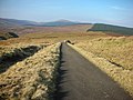
.jpg)


_-_geograph.org.uk_-_801159.jpg)


.jpg)


