Category:Limbo Lane
Jump to navigation
Jump to search

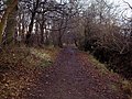
Limbo Lane is a public bridleway running between Thingwall Road and Arrowe Brook Lane, Irby. It is designated FP46 in Wirral Council's Definitive Statement of 2013 and is 1.320km (0.82miles) long.
Subcategories
This category has the following 4 subcategories, out of 4 total.
Media in category "Limbo Lane"
The following 17 files are in this category, out of 17 total.
-
 Limbo Lane fingerpost, Thingwall Road.jpg 3,404 × 4,539; 18.95 MB
-
 Limbo Lane entrance, Thingwall Road.jpg 4,575 × 3,432; 18.41 MB
-
 Limbo Lane - geograph.org.uk - 121998.jpg 480 × 640; 183 KB
-
 Limbo Lane north of Thingwall Road.jpg 4,608 × 3,456; 21.48 MB
-
 Bridleway from Limbo Lane to Arrowe Country Park 1.jpg 4,608 × 3,456; 19.3 MB
-
 Limbo Lane - geograph.org.uk - 637844.jpg 640 × 480; 119 KB
-
 Limbo Lane plantation 4.jpg 4,600 × 3,450; 16.95 MB
-
 Limbo Lane access from Glenwood Drive.jpg 4,608 × 3,456; 19.88 MB
-
 Limbo Lane towards Arrowe Brook Lane 1.jpg 4,522 × 3,391; 18.18 MB
-
 Limbo Lane towards Arrowe Brook Lane 2.jpg 3,450 × 4,600; 20.02 MB
-
 Limbo Lane towards Arrowe Brook Lane 3.jpg 4,519 × 3,389; 20.27 MB
-

-
 Limbo Lane towards Arrowe Brook Lane 4.jpg 3,456 × 4,608; 15.95 MB
-
 Limbo Lane towards Arrowe Brook Lane 5.jpg 4,587 × 3,440; 17.61 MB
-
 Limbo Lane towards Arrowe Brook Lane 6.jpg 3,391 × 4,522; 16.18 MB
-
 Limbo Lane fingerpost, Arrowe Brook Lane.jpg 3,456 × 4,608; 12.25 MB
-
 Limbo Lane from Arrowe Brooke Lane.jpg 4,539 × 3,404; 17.17 MB


