Category:Littleborough, Nottinghamshire
Jump to navigation
Jump to search
English: Littleborough is a hamlet in Nottinghamshire, England. It is located 8 miles east of Retford, and is in the civil parish of Sturton le Steeple. Littleborough is the site of the Roman town of Segelocum, situated on the west bank of the River Trent where the road from Lincoln to Doncaster bridged or forded the river,
village in Nottinghamshire, United Kingdom  | |||||
| Upload media | |||||
| Instance of |
| ||||
|---|---|---|---|---|---|
| Location | Sturton le Steeple, Bassetlaw, Nottinghamshire, East Midlands, England | ||||
| official website | |||||
 | |||||
Subcategories
This category has the following 2 subcategories, out of 2 total.
Media in category "Littleborough, Nottinghamshire"
The following 17 files are in this category, out of 17 total.
-
 A clear ditch - geograph.org.uk - 1011019.jpg 427 × 640; 109 KB
-
 Ferry House, Littleborough - geograph.org.uk - 4188651.jpg 1,280 × 944; 308 KB
-
 George V postbox at Littleborough - geograph.org.uk - 285327.jpg 427 × 640; 87 KB
-
 Littleborough Road - geograph.org.uk - 2878028.jpg 640 × 427; 83 KB
-
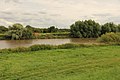
 River Trent near Littleborough - geograph.org.uk - 43677.jpg 640 × 480; 103 KB
-
 Site of Littleborough Ferry (geograph 4098636).jpg 1,024 × 683; 166 KB
-
 Beech Tree - geograph.org.uk - 285276.jpg 427 × 640; 84 KB
-
 Coates farmland - geograph.org.uk - 531185.jpg 640 × 427; 55 KB
-
 Coates Road - geograph.org.uk - 531159.jpg 640 × 427; 62 KB
-
 Craikbank Lane - geograph.org.uk - 531088.jpg 640 × 427; 74 KB
-
 Craikbank Lane - geograph.org.uk - 531189.jpg 640 × 427; 63 KB
-
 Littleborough Cottage - geograph.org.uk - 530964.jpg 640 × 427; 69 KB
-
 Littleborough Roman Road - geograph.org.uk - 530970.jpg 640 × 427; 69 KB
-
 Long Farm Lane - geograph.org.uk - 285275.jpg 640 × 427; 61 KB
-
 North Leys Road - geograph.org.uk - 531154.jpg 640 × 427; 57 KB
-
 Swan lake - geograph.org.uk - 285299.jpg 640 × 427; 32 KB
-
 Upper Ings - geograph.org.uk - 285263.jpg 640 × 427; 78 KB


.jpg)


