Category:Llangadog (community)
Jump to navigation
Jump to search
Cymraeg: Cymuned yn nwyrain Sir Gaerfyrddin yw Llangadog. Saif yn nyffryn Tywi, hanner ffordd rhwng Llandeilo a Llanymddyfri, ac ar ochr gorllewinol Parc Cenedlaethol Bannau Brycheiniog. Amaethyddiaeth yw'r prif ddiwydiant, ac mae'r boblogaeth tua 1,000.
English: Llangadog is a community located in Carmarthenshire, Wales. As well as the village of Llangadog, the community includes Bethlehem and Capel Gwynfe. A notable local landscape feature is Y Garn Goch with two Iron Age hill forts.
community in Carmarthenshire, Wales | |||||
| Upload media | |||||
| Instance of | |||||
|---|---|---|---|---|---|
| Location | Carmarthenshire, Wales | ||||
 | |||||
Subcategories
This category has the following 5 subcategories, out of 5 total.
A
B
G
L
Media in category "Llangadog (community)"
The following 200 files are in this category, out of 216 total.
(previous page) (next page)-
 "The Blues to the right, please" - geograph.org.uk - 5537633.jpg 3,264 × 2,448; 2.01 MB
-
 A 'Top Gear' road^ - geograph.org.uk - 4161841.jpg 4,320 × 3,240; 3.22 MB
-
 A better sign than the Star in the East^ - geograph.org.uk - 4038607.jpg 3,264 × 2,448; 3.11 MB
-
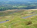
 A landscape scarred by old industry - geograph.org.uk - 4165355.jpg 4,320 × 3,240; 3.03 MB
-
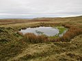
 A peaty landscape - geograph.org.uk - 4161286.jpg 4,320 × 3,240; 3.67 MB
-

-

-
 A4069 at Pen-y-cae-du - geograph.org.uk - 4671386.jpg 640 × 481; 67 KB
-
 A4069 at Pont Clydach - geograph.org.uk - 4671403.jpg 640 × 480; 60 KB
-
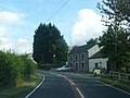
 A4069 High Street, Llangadog - geograph.org.uk - 4671326.jpg 640 × 480; 59 KB
-
 A4069 near Carnaugwynion - geograph.org.uk - 4671399.jpg 640 × 481; 71 KB
-
 A4069 near Foel Fawr - geograph.org.uk - 536799.jpg 584 × 447; 119 KB
-
 A4069 near Pont-ar-llechau - geograph.org.uk - 4671366.jpg 640 × 481; 88 KB
-
 A4069 nearing a hairpin bend - geograph.org.uk - 4671407.jpg 640 × 481; 44 KB
-
 A4069 nearing Llangadog - geograph.org.uk - 4671315.jpg 640 × 481; 88 KB
-
 A4069 nears Pont Newydd - geograph.org.uk - 4671372.jpg 640 × 480; 96 KB
-
 A4069 reaches the top - geograph.org.uk - 4671410.jpg 640 × 480; 39 KB
-
 A4069 south of Llangadog - geograph.org.uk - 4671330.jpg 640 × 481; 45 KB
-
 Afon Brân - geograph.org.uk - 6239193.jpg 2,048 × 1,536; 1.45 MB
-
 Afon Clydach and Waun Llwyd - geograph.org.uk - 4130324.jpg 2,078 × 1,559; 628 KB
-
 Afon Clydach just below Pont Clydach - geograph.org.uk - 4576766.jpg 800 × 600; 152 KB
-
 Afon Meilwch Ford - geograph.org.uk - 6142254.jpg 3,000 × 2,000; 6.84 MB
-
 Afon Sawdde - geograph.org.uk - 5536432.jpg 3,264 × 2,448; 2.94 MB
-
 Afon Sawdde - geograph.org.uk - 6083662.jpg 2,048 × 1,536; 798 KB
-
 Afon Sawdde - geograph.org.uk - 6123464.jpg 2,448 × 3,264; 4.44 MB
-
 Afon Sawdde - Sawdde River - geograph.org.uk - 5234728.jpg 640 × 480; 88 KB
-
 All Saints Church - geograph.org.uk - 6228791.jpg 3,264 × 2,448; 2.68 MB
-
 All Saints churchyard - geograph.org.uk - 6228792.jpg 3,264 × 2,448; 3.07 MB
-
 Banc Celynog - geograph.org.uk - 5087144.jpg 640 × 480; 91 KB
-
 Beacons Way - geograph.org.uk - 5537623.jpg 3,264 × 2,448; 2.12 MB
-
 Berthlwyd - geograph.org.uk - 5537624.jpg 3,264 × 2,448; 2.68 MB
-
 Bethlehem Road and cottages - geograph.org.uk - 4671337.jpg 640 × 481; 72 KB
-
 Bethlehem Road bend - geograph.org.uk - 4671345.jpg 640 × 481; 76 KB
-
 Bethlehem Road near Long Wood - geograph.org.uk - 4671342.jpg 640 × 481; 70 KB
-
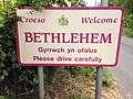
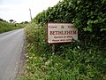
 Bethlehem village boundary sign - geograph.org.uk - 4671348.jpg 640 × 479; 97 KB
-
 Blaenllynfell - geograph.org.uk - 4221361.jpg 640 × 480; 68 KB
-
 Brest Cwm Llwyd - geograph.org.uk - 5200141.jpg 640 × 480; 70 KB
-
 Bridge nr. Cwm Meilwch - geograph.org.uk - 541087.jpg 600 × 450; 80 KB
-
 Bridge parapet with fields beyond - geograph.org.uk - 3797024.jpg 1,500 × 1,125; 2.09 MB
-
 Bryn Teg (136m) - geograph.org.uk - 4327614.jpg 480 × 640; 117 KB
-
 Bryn-glâs to left of unclassified - geograph.org.uk - 1333033.jpg 640 × 480; 287 KB
-
 Bwthyn Cwm-site - Cwm-site Cottage - geograph.org.uk - 6028348.jpg 1,024 × 768; 346 KB
-
 Carn Goch - geograph.org.uk - 4310706.jpg 2,560 × 1,920; 2.1 MB
-
 Carn Pen Rhiw Du - geograph.org.uk - 4167498.jpg 640 × 480; 89 KB
-
 Carn Pen Rhiw-ddu - geograph.org.uk - 4165343.jpg 4,320 × 3,240; 3.65 MB
-
 Carn Pen Rhiw-ddu - geograph.org.uk - 915184.jpg 640 × 480; 87 KB
-
 Carn Pen-y-clogau - geograph.org.uk - 4165320.jpg 4,320 × 2,160; 1.93 MB
-
 Carreg Cennen Castle - geograph.org.uk - 5537668.jpg 3,264 × 2,448; 1.44 MB
-
 Carreg Lwyd - geograph.org.uk - 5222234.jpg 640 × 480; 130 KB
-
 Cleared forest - geograph.org.uk - 541031.jpg 600 × 450; 84 KB
-
 Coed Pen-Arthur - geograph.org.uk - 509835.jpg 450 × 528; 69 KB
-
 Country house in Llangadog - geograph.org.uk - 6242529.jpg 2,048 × 1,536; 1.4 MB
-
 Craig y Sawrwg - geograph.org.uk - 4167895.jpg 640 × 480; 70 KB
-
 Cwm Gwenllan - geograph.org.uk - 6228794.jpg 2,048 × 1,536; 1.39 MB
-
 Cwm Sawdde Fechan - geograph.org.uk - 4167906.jpg 640 × 480; 76 KB
-
 Cwmcoy - geograph.org.uk - 509078.jpg 600 × 450; 71 KB
-
 Entrance to the churchyard, Llangadog - geograph.org.uk - 6302742.jpg 2,000 × 1,500; 760 KB
-
 Ewe with a view - geograph.org.uk - 4165364.jpg 3,240 × 4,320; 3.02 MB
-
 Ex-ford - geograph.org.uk - 532307.jpg 600 × 450; 72 KB
-
 Farm building - geograph.org.uk - 6228871.jpg 3,091 × 2,122; 2.27 MB
-
 Farmyard at Bryncoch - geograph.org.uk - 6228781.jpg 3,264 × 2,448; 3.74 MB
-
 Ffairfach Grits on Y Garn Goch - geograph.org.uk - 1526126.jpg 640 × 480; 111 KB
-
 Ffarm Newfoundland - Newfoundland Farm - geograph.org.uk - 6005434.jpg 1,024 × 768; 210 KB
-
 Ffordd y Bannau - The Beacons Way - geograph.org.uk - 5222230.jpg 640 × 480; 93 KB
-
 Foel Fawr - geograph.org.uk - 5536381.jpg 3,264 × 2,448; 3.02 MB
-
 Footbridge on Nant Dwfn - geograph.org.uk - 1497340.jpg 640 × 480; 96 KB
-
 Ford - geograph.org.uk - 541084.jpg 600 × 450; 107 KB
-
 Forest margin - geograph.org.uk - 541078.jpg 600 × 450; 68 KB
-
 Forest Road - geograph.org.uk - 938080.jpg 640 × 480; 98 KB
-

-
 Gate to Carreglwyd - geograph.org.uk - 1262618.jpg 601 × 640; 166 KB
-
 Georgian Town House - geograph.org.uk - 6239103.jpg 2,829 × 2,062; 1.45 MB
-
 Ger - Near Blaenllynfell - geograph.org.uk - 4167889.jpg 640 × 480; 69 KB
-
 Ger Delfryn - Near Delfryn - geograph.org.uk - 4107658.jpg 640 × 480; 102 KB
-
 Glan Ceidrych - geograph.org.uk - 5087159.jpg 640 × 480; 101 KB
-
 Glan Rhyd Meilwch - geograph.org.uk - 532306.jpg 600 × 450; 69 KB
-
 Glanmeilwch - geograph.org.uk - 509085.jpg 600 × 450; 81 KB
-
 Gors - geograph.org.uk - 5537615.jpg 3,264 × 2,448; 3.48 MB
-

-
 Gwesty'r Castell - geograph.org.uk - 5537470.jpg 3,264 × 2,448; 2.25 MB
-
 Gwynfor 1912 - 2005 - geograph.org.uk - 5537604.jpg 3,264 × 2,448; 3.08 MB
-
 Hairpin on A4069 - geograph.org.uk - 21988.jpg 640 × 480; 79 KB
-
 Headwaters of the Clydach - geograph.org.uk - 4161829.jpg 3,240 × 3,874; 3.06 MB
-
 Hen heol - Old Road - geograph.org.uk - 4173506.jpg 480 × 640; 72 KB
-
 Hen heol - Old road - geograph.org.uk - 5087148.jpg 640 × 480; 105 KB
-
 Heol Coed Penrhiwiau - Penrhiwiau Wood Road - geograph.org.uk - 5945933.jpg 1,024 × 768; 381 KB
-
 Heol i'r ucheldir - Road to the high ground - geograph.org.uk - 5945814.jpg 1,024 × 768; 360 KB
-
 Hillside below Pen Rhiw-ddu - geograph.org.uk - 4161846.jpg 4,320 × 3,240; 4.6 MB
-
 Information board - geograph.org.uk - 6242512.jpg 2,048 × 1,536; 810 KB
-
 Into the park - geograph.org.uk - 1307913.jpg 640 × 480; 67 KB
-
 Isolated peat hag on the moortop - geograph.org.uk - 4165335.jpg 4,315 × 2,160; 1.98 MB
-
 Lane from Bethlehem near Tal-y-garn - geograph.org.uk - 4671354.jpg 640 × 480; 59 KB
-
 Lime Kiln, Foel Fawr Quarries - geograph.org.uk - 4130330.jpg 2,288 × 1,712; 826 KB
-
 Llangadog church - geograph.org.uk - 5899918.jpg 2,592 × 1,944; 1.44 MB
-
 Llangadog Railway station - geograph.org.uk - 6083674.jpg 2,046 × 1,536; 1.06 MB
-
 Llwybr Bryngwyn - Bryngwyn Path - geograph.org.uk - 5086353.jpg 640 × 480; 99 KB
-

-
-
 Llwybr ceffyl Cwm Ffrwd - Cwm Ffrwd bridleway - geograph.org.uk - 6028323.jpg 1,024 × 768; 366 KB
-
 Llwybr ceffyl Cwm Ffrwd - Cwm Ffrwd bridleway - geograph.org.uk - 6028328.jpg 1,024 × 768; 252 KB
-

-

-

-
 Llwybr ceffyl Parc Owen - Parc Owen bridleway - geograph.org.uk - 6028290.jpg 1,024 × 768; 233 KB
-
 Llwybr Dolau Path - geograph.org.uk - 5086345.jpg 640 × 480; 145 KB
-

-

-
 Llwybr Garreg Lwyd - Garreg Lwyd Path - geograph.org.uk - 6005992.jpg 1,024 × 768; 327 KB
-
 Llwybr ger Tynywaun - A path near Tynywaun - geograph.org.uk - 6028278.jpg 1,024 × 768; 222 KB
-
 Llwybr Glan Ddu - Glan Ddu Path - geograph.org.uk - 6028271.jpg 1,024 × 768; 302 KB
-
 Llwybr Glan Ddu - Glan Ddu Path - geograph.org.uk - 6028274.jpg 1,024 × 768; 188 KB
-
 Llwybr Glan Ddu - Glan Ddu Path - geograph.org.uk - 6028285.jpg 1,024 × 768; 270 KB
-
 Llwybr Glyn Clawdd - Glyn Clawdd Path - geograph.org.uk - 6028264.jpg 1,024 × 768; 218 KB
-
 Llwybr Gwynfe House Path - geograph.org.uk - 4168067.jpg 640 × 480; 92 KB
-
 Llwybr Maesydderwyn - Maesydderwen Path - geograph.org.uk - 5945885.jpg 1,024 × 768; 443 KB
-
 Llwybr Mount Pleasant Path - geograph.org.uk - 4172988.jpg 640 × 480; 113 KB
-
 Llwybr Pantmawr - Pantmawr Path - geograph.org.uk - 4168082.jpg 640 × 480; 133 KB
-
 Llwybr Pen y Banc - Pen y Banc Footpath - geograph.org.uk - 5234714.jpg 640 × 480; 103 KB
-
 Llwybr Penrhiw - Penrhiw Path - geograph.org.uk - 6028343.jpg 1,024 × 767; 297 KB
-
 Llwybr Tydist - Tydist Path - geograph.org.uk - 5945893.jpg 1,024 × 768; 334 KB
-
 Llwybr Tydist - Tydist Path - geograph.org.uk - 5945903.jpg 1,024 × 767; 188 KB
-
 Llwyn y Neuadd - geograph.org.uk - 3820506.jpg 640 × 433; 110 KB
-
 Milestone - Llandovery 6 - geograph.org.uk - 4891153.jpg 480 × 640; 124 KB
-
 Minor road at Clogau Mawr - geograph.org.uk - 537445.jpg 640 × 480; 145 KB
-
 Minor road at Clogau Mawr - geograph.org.uk - 537466.jpg 572 × 424; 113 KB
-
 Mountain road - geograph.org.uk - 5537664.jpg 8,021 × 3,030; 6.79 MB
-
 Nant Dwfn - geograph.org.uk - 1497458.jpg 640 × 480; 100 KB
-
 Nant Garw Valley - geograph.org.uk - 865536.jpg 640 × 480; 74 KB
-
 Nantgwyn - geograph.org.uk - 532317.jpg 600 × 450; 58 KB
-
 O little village of Bethlehem - geograph.org.uk - 4521752.jpg 4,608 × 3,456; 5.04 MB
-
-
 Old lime kiln on Foel Fawr - geograph.org.uk - 537384.jpg 585 × 449; 122 KB
-
 Old limestone quarries on Foel Fawr - geograph.org.uk - 4161834.jpg 3,240 × 4,320; 3.44 MB
-

-

-
 On the road to Bethlehem - geograph.org.uk - 5536436.jpg 3,264 × 2,448; 3.26 MB
-
 Ordnance Survey Cut Mark - geograph.org.uk - 6225549.jpg 1,024 × 669; 235 KB
-
 Ordnance Survey Flush Bracket 885 - geograph.org.uk - 4744421.jpg 4,000 × 3,000; 5.12 MB
-
 Ordnance Survey Flush Bracket 886 - geograph.org.uk - 4744435.jpg 4,000 × 3,000; 4.2 MB
-
 Ordnance Survey Flush Bracket 887 - geograph.org.uk - 4744448.jpg 4,000 × 3,000; 4.68 MB
-
 Ordnance Survey Flush Bracket 888 - geograph.org.uk - 4744456.jpg 4,000 × 3,000; 3.58 MB
-
 Ordnance Survey Flush Bracket 903 - geograph.org.uk - 4744768.jpg 4,000 × 3,000; 3.88 MB
-
 Ordnance Survey Flush Bracket 904 - geograph.org.uk - 4744773.jpg 4,000 × 3,000; 3.09 MB
-
 Ordnance Survey Flush Bracket 905 - geograph.org.uk - 4744780.jpg 4,000 × 3,000; 4.27 MB
-
 Ordnance Survey Pivot - geograph.org.uk - 5765005.jpg 571 × 640; 205 KB
-
 Ordnance Survey Pivot - geograph.org.uk - 5765007.jpg 435 × 640; 134 KB
-
 Painter on ladder - geograph.org.uk - 5537637.jpg 3,264 × 2,448; 1.45 MB
-
 Panorama from Pen Rhiw Ddu - geograph.org.uk - 6238955.jpg 6,862 × 3,032; 6.44 MB
-
 Peat and ponies - geograph.org.uk - 4161821.jpg 4,320 × 3,240; 2.77 MB
-
 Pen Llwyndu (157m) - geograph.org.uk - 4327617.jpg 640 × 480; 66 KB
-
 Pen Maesydderwen - geograph.org.uk - 4327621.jpg 640 × 480; 86 KB
-
 Pen Rhiw Ddu - geograph.org.uk - 5536391.jpg 3,264 × 2,448; 2.75 MB
-
 Pen Rhiw Ddu - geograph.org.uk - 6238956.jpg 3,264 × 2,448; 2.5 MB
-
 Pen-Crug Farm - geograph.org.uk - 6228778.jpg 3,264 × 2,448; 3.42 MB
-
 Pont Aber Falls - geograph.org.uk - 5537596.jpg 3,264 × 2,448; 4.38 MB
-
 Pont ar Llechau - geograph.org.uk - 6123460.jpg 3,264 × 2,448; 3.87 MB
-
 Pont Brân - geograph.org.uk - 6239200.jpg 3,264 × 2,448; 2.97 MB
-
 Pont Clydach - geograph.org.uk - 5536412.jpg 3,264 × 2,448; 3.3 MB
-
 Posing on a pimple - geograph.org.uk - 4165273.jpg 3,240 × 4,320; 3.01 MB
-
 Quarry at Cefn y Truman - geograph.org.uk - 368356.jpg 640 × 480; 100 KB
-
 Rhiw Wen - geograph.org.uk - 4173523.jpg 640 × 480; 64 KB
-
 Rhiwiau-isaf - geograph.org.uk - 938089.jpg 640 × 480; 96 KB
-
 River at Pont aber - geograph.org.uk - 1110580.jpg 640 × 480; 148 KB
-
 River Tywi - geograph.org.uk - 6083657.jpg 2,048 × 1,536; 1.15 MB
-
 Road junction - geograph.org.uk - 6228774.jpg 3,264 × 2,448; 4.12 MB
-
 Road through woodland at Blaen Cennen - geograph.org.uk - 6228776.jpg 2,448 × 3,264; 3.13 MB
-
 Road to Cwmcoy - geograph.org.uk - 509081.jpg 600 × 450; 55 KB
-
 Road to Cwmcoy - geograph.org.uk - 532322.jpg 600 × 450; 105 KB
-
 Road to Gwynfe - geograph.org.uk - 525034.jpg 600 × 450; 49 KB
-
 Rocks and a tree in the Brecon Beacons National Park - geograph.org.uk - 1745221.jpg 1,600 × 1,200; 703 KB
-
 Rocky outcrop on slopes below Pen Rhiw Ddu - geograph.org.uk - 5536403.jpg 3,264 × 2,448; 2.74 MB
-
 Ruin at Pant-y-clogau - geograph.org.uk - 1497429.jpg 640 × 480; 99 KB
-
 Ruin in Talylan Forest - geograph.org.uk - 4135769.jpg 1,120 × 840; 260 KB
-
 Ruin in the trees - geograph.org.uk - 4327625.jpg 640 × 480; 139 KB
-
 Ruin on farm track below Clogau bach - geograph.org.uk - 1497470.jpg 640 × 480; 100 KB
-
 Ruined barn - geograph.org.uk - 541085.jpg 600 × 441; 98 KB
-
 Ruined Farm Building - geograph.org.uk - 4327634.jpg 640 × 480; 126 KB
-
 Ruined farmhouse at Pwll-y-fuwch - geograph.org.uk - 1497469.jpg 640 × 480; 98 KB
-
 Sheep pasture - geograph.org.uk - 532319.jpg 600 × 450; 45 KB
-
 Sheep pens - geograph.org.uk - 532280.jpg 600 × 450; 67 KB
-
 Sledding at the roadside quarry - geograph.org.uk - 1182789.jpg 640 × 480; 74 KB
-
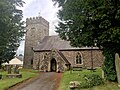 St Cadog Church - geograph.org.uk - 6239097.jpg 3,054 × 2,289; 2.73 MB
-
 Sticil Dan y Garn - Darn y Garn stile - geograph.org.uk - 5087073.jpg 640 × 480; 142 KB
-

-
 Stone benches on Garn Goch - geograph.org.uk - 4512925.jpg 1,024 × 768; 193 KB
-
 The A4069 at Pontbren - geograph.org.uk - 4576759.jpg 800 × 600; 185 KB
-

-

-
 The Black Lion - geograph.org.uk - 6239094.jpg 2,046 × 1,536; 857 KB
-
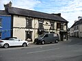 The Black Lion, Llangadog - geograph.org.uk - 5899928.jpg 2,592 × 1,944; 1.43 MB
-
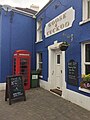 The Goose and Cuckoo - geograph.org.uk - 5536429.jpg 2,448 × 3,264; 2.03 MB
-
 The infant Afon Clydach - geograph.org.uk - 4161826.jpg 4,320 × 3,240; 2.95 MB
-
 The Twyi-Towy valley - geograph.org.uk - 3997270.jpg 1,024 × 680; 265 KB
-
 Top of Foel Fraith - geograph.org.uk - 4221366.jpg 640 × 480; 56 KB
-
 Tourist info, moorland, and Foel Fawr from viewpoint - geograph.org.uk - 1745232.jpg 1,600 × 1,200; 487 KB
-
 Track to Gellybevan Farm - geograph.org.uk - 509088.jpg 600 × 450; 70 KB
-
 Track to Llwyn-y-neuadd - geograph.org.uk - 509853.jpg 600 × 450; 74 KB
-

-
 Trichrug - geograph.org.uk - 1262638.jpg 640 × 480; 98 KB
-
 Tuag at - Towards Clogau Bach - geograph.org.uk - 4173539.jpg 640 × 480; 98 KB


_-_geograph.org.uk_-_4327614.jpg)


_-_geograph.org.uk_-_4327617.jpg)


&filefrom=Tuag+at+-+Towards+Garreg+Lwyd+-+geograph.org.uk+-+4167664.jpg#mw-category-media)