Category:Location maps of Putumayo Department
Jump to navigation
Jump to search
 |
This category should only contain blank "Location maps" created for geo-location purposes which follow a same uniform standard, and have been created with a Geographic information system (GIS) software program using a compatible equirectangular or conical projection and for which the geographic coordinate system is known. For more information or questions see the wikiproject: German Wikipedia:Kartenwerkstatt/Positionskarten and this discussion page. |
Media in category "Location maps of Putumayo Department"
The following 16 files are in this category, out of 16 total.
-
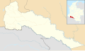 Colombia Putumayo location map (+locator map).svg 2,114 × 1,271; 379 KB
-
 Colombia Putumayo location map (+urban areas +locator map).svg 2,114 × 1,271; 386 KB
-
 Colombia Putumayo location map (+urban areas).svg 2,114 × 1,271; 194 KB
-
 Colombia Putumayo location map (adm +urban areas +locator map).svg 2,114 × 1,271; 286 KB
-
 Colombia Putumayo location map (adm +urban areas).svg 2,114 × 1,271; 94 KB
-
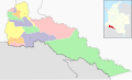 Colombia Putumayo location map (adm colored).svg 2,114 × 1,271; 286 KB
-
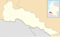
 Colombia Putumayo location map (adm).svg 2,114 × 1,271; 86 KB
-
 Colombia Putumayo location map 2 (+locator map).svg 2,114 × 1,271; 379 KB
-
 Colombia Putumayo location map 2 (+urban areas +locator map).svg 2,114 × 1,271; 386 KB
-
 Colombia Putumayo location map 2 (+urban areas).svg 2,114 × 1,271; 194 KB
-
 Colombia Putumayo location map 2 (adm +urban areas +locator map).svg 2,114 × 1,271; 286 KB
-
 Colombia Putumayo location map 2 (adm +urban areas).svg 2,114 × 1,271; 94 KB
-
 Colombia Putumayo location map 2.svg 2,114 × 1,271; 186 KB
-
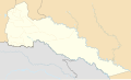 Colombia Putumayo location map.svg 2,114 × 1,271; 186 KB
-
 Putumayo Topographic 2.png 2,559 × 1,559; 7.58 MB
-
 Putumayo Topographic.png 380 × 232; 114 KB
.svg)
.svg)
.svg)
.svg)
.svg)
.svg)
.svg)
.svg)
.svg)
.svg)
.svg)
.svg)


