Category:Location maps of powiats in Podlaskie Voivodeship
Jump to navigation
Jump to search
Media in category "Location maps of powiats in Podlaskie Voivodeship"
The following 14 files are in this category, out of 14 total.
-
 Powiat augustowski location map.png 1,338 × 1,155; 151 KB
-
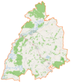
 Powiat białostocki location map.png 2,183 × 1,329; 375 KB
-
 Powiat bielski (województwo podlaskie) location map.png 1,182 × 892; 139 KB
-
 Powiat grajewski location map.png 1,069 × 1,045; 107 KB
-
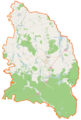
 Powiat hajnowski location map.png 1,158 × 1,380; 151 KB
-
 Powiat kolneński location map.png 1,030 × 769; 189 KB
-
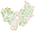
 Powiat moniecki location map.png 1,056 × 1,233; 122 KB
-
 Powiat sejneński location map.png 688 × 1,020; 180 KB
-
 Powiat siemiatycki location map.png 1,280 × 1,022; 132 KB
-
 Powiat sokólski location map.png 739 × 721; 94 KB
-
 Powiat suwalski location map.png 1,021 × 1,241; 178 KB
-
 Powiat wysokomazowiecki location map.png 951 × 1,376; 132 KB
-
 Powiat zambrowski location map.png 935 × 902; 92 KB
-
 Powiat łomżyński location map.png 1,313 × 1,151; 150 KB


_location_map.png)


