Category:Locator map images that should use vector graphics
Jump to navigation
Jump to search
Images composed of simple shapes, lines, and letters such as those below should be recreated using vector graphics as an SVG file. These have a number of advantages such as making it easier for subsequent editors to edit them, enabling arbitrary scaling at high quality, and sharp high-resolution renderings for print versions. See Commons:Images for cleanup for more information.
English: Locator maps for illustrating the location of a geographical object.
Svenska: Lägeskartor är kartor som markerar läget för ett område, men nästan inga andra detaljer.
Deutsch: Karten zur Illustration der Lage von geographischen Objekten.
This is a subcategory of Category:Images that should use vector graphics. You can add images to this category using the template {{Convert to SVG|locator map}}.
Subcategories
This category has the following 31 subcategories, out of 31 total.
- Locator maps of districts of Vantaa (101 F)
- Locator maps of gulfs (22 F)
- Locator maps of oceans (27 F)
- Maps by User:Nyttend (3199 F)
- NUTS maps of Spain (33 F)
Pages in category "Locator map images that should use vector graphics"
This category contains only the following page.
Media in category "Locator map images that should use vector graphics"
The following 200 files are in this category, out of 10,062 total.
(previous page) (next page)-
 000 Vojvodina harta.PNG 350 × 290; 53 KB
-

-
 10. Carte de distribution des anses en oméga.jpg 1,886 × 1,158; 1.06 MB
-
 1005 regions colors.png 1,000 × 961; 98 KB
-
 118th US House of Representatives Justice Democrats map.png 2,880 × 1,449; 928 KB
-
 14 pays du 2iE.jpg 1,134 × 772; 84 KB
-
 150px-NHMap-doton-Alton.png 150 × 286; 4 KB
-
 150px-NHMap-doton-Ashland.png 150 × 286; 12 KB
-
 150px-NHMap-doton-Barnstead.png 150 × 286; 4 KB
-
 150px-NHMap-doton-Bartlett.png 150 × 286; 4 KB
-
 150px-NHMap-doton-Belmont.png 150 × 286; 4 KB
-
 150px-NHMap-doton-Bridgewater.png 150 × 286; 4 KB
-
 150px-NHMap-doton-Bristol.png 150 × 286; 4 KB
-
 150px-NHMap-doton-Campton.png 150 × 286; 4 KB
-
 150px-NHMap-doton-Canaan.png 150 × 286; 4 KB
-
 150px-NHMap-doton-Canterbury.png 150 × 286; 4 KB
-
 150px-NHMap-doton-CenterHarbor.png 150 × 286; 11 KB
-
 150px-NHMap-doton-Conway.png 150 × 286; 4 KB
-
 150px-NHMap-doton-Danbury.png 150 × 286; 4 KB
-
 150px-NHMap-doton-Freedom.png 150 × 286; 4 KB
-
 150px-NHMap-doton-Gilford.png 150 × 286; 4 KB
-
 150px-NHMap-doton-Gilmanton.png 150 × 286; 4 KB
-
 150px-NHMap-doton-Grafton.png 150 × 286; 4 KB
-
 150px-NHMap-doton-Hebron.png 150 × 286; 4 KB
-
 150px-NHMap-doton-Holderness.png 150 × 286; 12 KB
-
 150px-NHMap-doton-Lincoln.png 150 × 286; 4 KB
-
 150px-NHMap-doton-Madison.png 150 × 286; 4 KB
-
 150px-NHMap-doton-Moultonborough.png 150 × 286; 12 KB
-
 150px-NHMap-doton-New-Durham.png 150 × 286; 4 KB
-
 150px-NHMap-doton-New-Hampton.png 150 × 286; 11 KB
-
 150px-NHMap-doton-Ossipee.png 150 × 286; 4 KB
-
 150px-NHMap-doton-Plymouth.png 150 × 286; 4 KB
-
 150px-NHMap-doton-Rumney.png 150 × 286; 4 KB
-
 150px-NHMap-doton-Salisbury.png 150 × 286; 4 KB
-
 150px-NHMap-doton-Sanbornton.png 150 × 286; 4 KB
-
 150px-NHMap-doton-Springfield.png 150 × 286; 4 KB
-
 150px-NHMap-doton-Tamworth.png 150 × 286; 4 KB
-
 150px-NHMap-doton-Tuftonboro.png 150 × 286; 4 KB
-
 150px-NHMap-doton-Warren.png 150 × 286; 4 KB
-
 150px-NHMap-doton-Waterville-Valley.png 150 × 286; 4 KB
-
 150px-NHMap-doton-Wentworth.png 150 × 286; 4 KB
-
 150px-NHMap-doton-Wilmot.png 150 × 286; 4 KB
-
 150px-NHMap-doton-Wolfeboro.png 150 × 286; 12 KB
-
 150px-NHMap-doton-Woodstock.png 150 × 286; 4 KB
-
 1846 Eastern Australia state boundaries.jpg 300 × 495; 28 KB
-

-
 1862 change to Queensland's western border.jpg 200 × 329; 21 KB
-
 1918.8 Blank World Map.PNG 1,500 × 740; 85 KB
-
 1947-Khasi states.png 636 × 456; 13 KB
-
 1949 PRC map.png 728 × 593; 142 KB
-
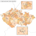 2 digit postcode czech republic.png 885 × 885; 40 KB
-
 2 digit postcode slovakia.png 885 × 788; 23 KB
-
 2 digit postcode spain.png 885 × 885; 102 KB
-
 2005alumina.PNG 1,425 × 625; 60 KB
-
 2005talc.png 1,425 × 625; 16 KB
-
 2007 US News Top 40 colleges.png 738 × 498; 82 KB
-
 2009 Bedfordshire Ceremonial Numbered.png 200 × 298; 3 KB
-
 2010-2011 Arab world protests-improved.PNG 800 × 518; 106 KB
-
 2011 Dimos Kefalonias.png 800 × 1,366; 161 KB
-
 2011 Dimos Tanagras.png 1,200 × 700; 190 KB
-
 2015 AFC Asian Cup.png 487 × 447; 10 KB
-
 2015臺中六補選.png 708 × 633; 23 KB
-
 2022 Africa floods map 1.jpg 480 × 424; 113 KB
-
 275px-LocMap of WH Lushan National Park.JPG 275 × 206; 12 KB
-
 275px-LocMap of WH Three Rivers.png 275 × 206; 16 KB
-
 32 States of South Sudan within regions.png 3,100 × 2,302; 445 KB
-
 5 Boroughs New York City Map Julius Schorzman.png 2,652 × 2,582; 5.47 MB
-
 5 continents.PNG 460 × 280; 10 KB
-
 5 continents1.PNG 460 × 280; 10 KB
-
 50px-India-locator-map-T-PA.jpg 46 × 50; 11 KB
-
 640px-Kazakhstan provinces.png 640 × 358; 73 KB
-
 800px-Arab-Israeli Map2.png 800 × 455; 39 KB
-
 83107 - Roquebrune adm.png 507 × 454; 26 KB
-
 92694LM.png 500 × 375; 20 KB
-
 Aabenraa Kommune (1970-2006).png 854 × 960; 330 KB
-
 Aabybro Kommune (1970-2006).png 854 × 960; 330 KB
-
 Aacy.JPG 942 × 1,140; 104 KB
-
 Aakirkeby Kommune (1970-2006).png 854 × 960; 330 KB
-
 Aalborg Kommune (1970-2006).png 854 × 960; 333 KB
-
 Aalestrup Kommune (1970-2006).png 854 × 960; 330 KB
-
 Aarhus Kommune (1970-2006).png 854 × 960; 333 KB
-
 Aarhus municipality with districts.png 1,998 × 1,371; 179 KB
-
 Aars Kommune (1970-2006).png 854 × 960; 331 KB
-
 AarschotLocatie.png 270 × 203; 5 KB
-
 AartselaarLocatie.png 270 × 203; 5 KB
-
 Aarup Kommune (1970-2006).png 854 × 960; 329 KB
-
 Aaskov Kommune (1970-2006).png 854 × 960; 331 KB
-
 Aba.png 1,200 × 1,200; 44 KB
-
 Abanga-bigné location.jpg 1,200 × 1,114; 432 KB
-
 ABCEilandenLocatie.PNG 250 × 115; 5 KB
-
 Abidjan Department locator map Côte d'Ivoire (1969-74).jpg 4,137 × 4,257; 1.07 MB
-
 Abidjan Department locator map Côte d'Ivoire (1988-95).jpg 4,137 × 4,257; 1.28 MB
-
 Abidjan Department locator map Côte d'Ivoire.jpg 4,137 × 4,257; 1.54 MB
-
 Abkhazia relations.png 1,357 × 628; 37 KB
-
 ABQ n NM.png 271 × 300; 19 KB
-
 Abreus (Cuban municipal map).png 1,264 × 494; 37 KB
-
 Abrud in Romania.png 221 × 166; 9 KB
-
 Abruzzo 1990.png 591 × 527; 15 KB
-
 Acacia pycnanthaDistMap739.png 961 × 773; 25 KB
-
 Acciaroli pos SA.gif 463 × 375; 10 KB
-
 Acer platanoides.png 902 × 587; 41 KB
-
 Acholiland, Uganda.png 487 × 600; 132 KB
-
 ACT-Jervis Bay-Sydney-MJC.png 1,000 × 1,172; 45 KB
-
 Addis Ababa (district map).png 640 × 600; 18 KB
-
 Addis Ketema (Addis Ababa Map).png 640 × 600; 17 KB
-
 Addison vt highlight.png 465 × 744; 35 KB
-
 Adiantum viridimontanum distribution.png 570 × 550; 42 KB
-
 Adıyaman districts.png 1,056 × 816; 20 KB
-
 Adjud in Romania.png 221 × 166; 9 KB
-
 Admin-map-Chuvashia-region.gif 300 × 376; 15 KB
-
 Administrative division of Fengyuan, Taichung, Taiwan.png 4,792 × 4,312; 889 KB
-
 Administrative divisions of Guangfeng.jpg 520 × 613; 80 KB
-
 Administrative map of Gujarat.png 3,014 × 2,391; 660 KB
-
 Administrativna mapa srbije-bac.PNG 243 × 346; 22 KB
-
 Adriatic Sea map uk.png 2,000 × 2,722; 796 KB
-
 Adriatic Sea map.png 704 × 999; 235 KB
-
 Advance, MI location.png 1,868 × 1,568; 162 KB
-
 Adziubzha.PNG 788 × 652; 48 KB
-
 Aegotheles cristatus range.png 600 × 599; 167 KB
-
 Aegotheles insignis range.png 800 × 399; 102 KB
-
 Aegotheles range.png 600 × 599; 166 KB
-
 Aegotheles tatei range.png 800 × 399; 97 KB
-
 Aegotheles wallacii range.png 800 × 399; 99 KB
-
 Aegothelesaffinisdist.png 800 × 400; 95 KB
-
 Aegothelesalbertisidist.png 800 × 399; 100 KB
-
 Aegothelesarchboldidist.png 800 × 399; 98 KB
-
 Aegothelesbennettiidist.png 800 × 399; 100 KB
-
 Aegothelescrinifronsrange.png 800 × 399; 96 KB
-
 AFCI Programs.jpg 370 × 256; 17 KB
-
 AffligemLocatie.png 270 × 203; 5 KB
-
 AFG.png 944 × 599; 10 KB
-
 Afghanistan Badakhshan Province location.PNG 600 × 461; 11 KB
-
 Afghanistan provinces blank.png 2,000 × 1,536; 29 KB
-
 Afghanistan Provinces’s Demographic status.jpg 828 × 626; 166 KB
-
 Afghanistan regional locator map.png 1,403 × 1,196; 63 KB
-
 Afghanistan-Helmand.png 300 × 230; 9 KB
-
 Afghanistan-Jowzjan.png 300 × 230; 9 KB
-
 Africa (Arab Maghreb Union).png 341 × 341; 10 KB
-
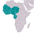 Africa (Western region).png 341 × 341; 10 KB
-
 Africa ChamberlinTrimetric.png 800 × 872; 125 KB
-
 Africa Map Kenya, Tanzania, Zambia, Zimbabwe.jpg 771 × 792; 81 KB
-
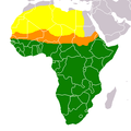 Africa Sahara Sahel SubSaharan.png 341 × 341; 6 KB
-
 Africa-countries-bulge.png 341 × 341; 10 KB
-
 Africa-countries-WAFU-UFOA.png 360 × 392; 14 KB
-
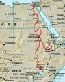 Africa.NileMap.01.png 200 × 252; 72 KB
-
 Afrika Politisch 2.png 982 × 991; 210 KB
-
 Agatsuma-with-numbers.png 222 × 140; 1 KB
-
 Agramonte (mapa de localización en Cuba).png 1,281 × 491; 161 KB
-
 Aguada de Pasajeros (Cuban municipal map).png 1,264 × 494; 37 KB
-
 Agubedia.PNG 604 × 778; 28 KB
-
 Agul-rayon-0.png 2,000 × 2,860; 835 KB
-
 Ahmasjärvi.png 385 × 664; 18 KB
-
 Ahnapee.png 538 × 306; 29 KB
-
 Airforceisland.JPG 320 × 329; 28 KB
-
 Airforceisland.png 320 × 329; 13 KB
-
 Akaky Kaliti (Addis Ababa Map).png 640 × 600; 17 KB
-
 Akershus2.png 349 × 434; 9 KB
-
 AKMap-doton-Adak.PNG 300 × 186; 7 KB
-
 AKMap-doton-Akhiok.PNG 300 × 186; 7 KB
-
 AKMap-doton-Akiak.png 300 × 186; 7 KB
-
 AKMap-doton-Akutan.PNG 300 × 186; 7 KB
-
 AKMap-doton-Alakanuk.png 300 × 186; 7 KB
-
 AKMap-doton-Alatna.PNG 300 × 186; 7 KB
-
 AKMap-doton-Aleknagik.png 300 × 186; 7 KB
-
 AKMap-doton-Ambler.PNG 300 × 186; 7 KB
-
 AKMap-doton-AnaktuvukPass.png 300 × 186; 7 KB
-
 AKMap-doton-Anchorage.PNG 300 × 186; 5 KB
-
 AKMap-doton-AnchorPoint.PNG 300 × 186; 7 KB
-
 AKMap-doton-Anderson.png 300 × 186; 7 KB
-
 AKMap-doton-Angoon.png 300 × 186; 7 KB
-
 AKMap-doton-Aniak.PNG 300 × 186; 7 KB
-
 AKMap-doton-Anvik.PNG 300 × 186; 7 KB
-
 AKMap-doton-ArcticVillage.PNG 300 × 186; 7 KB
-
 AKMap-doton-Atka.png 300 × 186; 7 KB
-
 AKMap-doton-Atmautluak.PNG 300 × 186; 7 KB
-
 AKMap-doton-Atqasuk.PNG 300 × 186; 7 KB
-
 AKMap-doton-AttuStation.PNG 300 × 186; 7 KB
-
 AKMap-doton-Barrow.png 300 × 186; 7 KB
-
 AKMap-doton-Beaver.PNG 300 × 186; 7 KB
-
 AKMap-doton-Bettles.PNG 300 × 186; 7 KB
-
 AKMap-doton-BigDelta.PNG 300 × 186; 7 KB
-
 AKMap-doton-BigLake.PNG 300 × 186; 7 KB
-
 AKMap-doton-BrevigMission.png 300 × 186; 7 KB
-
 AKMap-doton-Buckland.PNG 300 × 186; 7 KB
-
 AKMap-doton-Butte.PNG 300 × 186; 7 KB
-
 AKMap-doton-Cantwell.png 300 × 186; 7 KB
-
 AKMap-doton-Central.PNG 300 × 186; 7 KB
-
 AKMap-doton-Chalkyitsik.PNG 300 × 186; 7 KB
-
 AKMap-doton-Chefornak.PNG 300 × 186; 7 KB
-
 AKMap-doton-Chenega.PNG 300 × 186; 7 KB
-
 AKMap-doton-Chevak.PNG 300 × 186; 7 KB
-
 AKMap-doton-Chickaloon.png 300 × 186; 7 KB
-
 AKMap-doton-Chicken.PNG 300 × 186; 7 KB
-
 AKMap-doton-ChignikLagoon.PNG 300 × 186; 7 KB
-
 AKMap-doton-ChignikLake.PNG 300 × 186; 7 KB
-
 AKMap-doton-ChilkootPass.png 300 × 186; 7 KB
-
 AKMap-doton-Chiniak.PNG 300 × 186; 7 KB
-
 AKMap-doton-Chistochina.PNG 300 × 186; 7 KB
-
 AKMap-doton-Chitina.PNG 300 × 186; 7 KB
-
 AKMap-doton-Circle.PNG 300 × 186; 7 KB


.png)
.png)

.png)
.png)
.png)
.png)

.png)


.png)
.png)


.jpg)
.jpg)


.png)
.png)


.png)
.png)


.png)


.png)
.png)
.png)