Category:Locator maps of Cape Verde islands
Jump to navigation
Jump to search
Subcategories
This category has the following 2 subcategories, out of 2 total.
Media in category "Locator maps of Cape Verde islands"
The following 11 files are in this category, out of 11 total.
-
 Image-Locator map of Maio, Cape Verde.png 1,317 × 1,017; 29 KB
-
 Locator map of Brava, Cape Verde.png 1,317 × 1,017; 29 KB
-
 Locator map of Fogo, Cape Verde.png 1,317 × 1,017; 29 KB
-
 Locator map of Sal, Cape Verde.png 1,317 × 1,017; 29 KB
-
 Locator map of Santa Luzia, Cape Verde.png 1,317 × 1,017; 29 KB
-
 Locator map of Santiago, Cape Verde.png 1,317 × 1,017; 29 KB
-
 Locator map of Santo Antão, Cape Verde.png 1,317 × 1,017; 29 KB
-
 Locator map of St Luzia, Cape Verde.png 1,317 × 1,017; 10 KB
-
 Locator map of São Nicolau, Cape Verde.png 1,317 × 1,017; 29 KB
-
 Locator map of São Vicente, Cape Verde.png 1,317 × 1,017; 29 KB
-
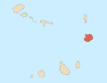 Locator maps of Boa Vista, Cape Verde.png 1,317 × 1,017; 29 KB


