Category:Locator maps of Maine
Jump to navigation
Jump to search
States of the United States: Alabama · Alaska · Arizona · Arkansas · California · Colorado · Connecticut · Delaware · Florida · Georgia · Hawaii · Idaho · Illinois · Indiana · Iowa · Kansas · Kentucky · Louisiana · Maine · Maryland · Massachusetts · Michigan · Minnesota · Mississippi · Missouri · Montana · Nebraska · Nevada · New Hampshire · New Jersey · New Mexico · New York · North Carolina · North Dakota · Ohio · Oklahoma · Oregon · Pennsylvania · Rhode Island · South Carolina · South Dakota · Tennessee · Texas · Utah · Vermont · Virginia · Washington · West Virginia · Wisconsin · Wyoming – Washington, D.C.
insular area of the United States: American Samoa · Guam · Northern Mariana Islands · Puerto Rico · United States Virgin Islands – Baker Island · Howland Island · Jarvis Island · Johnston Atoll · Kingman Reef · Midway Atoll · Navassa Island · Palmyra Atoll · Wake Island
insular area of the United States: American Samoa · Guam · Northern Mariana Islands · Puerto Rico · United States Virgin Islands – Baker Island · Howland Island · Jarvis Island · Johnston Atoll · Kingman Reef · Midway Atoll · Navassa Island · Palmyra Atoll · Wake Island
Subcategories
This category has the following 3 subcategories, out of 3 total.
Media in category "Locator maps of Maine"
The following 12 files are in this category, out of 12 total.
-
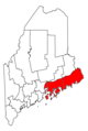 Down East.PNG 403 × 600; 16 KB
-
 Maine Locator Map.PNG 220 × 325; 6 KB
-
 Map of Maine highlighting Higgins Beach.png 402 × 600; 22 KB
-
 Map of USA ME.png 280 × 183; 35 KB
-
 Map of USA ME.svg 286 × 186; 167 KB
-
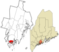
 MEMap-location-of-Allagash.png 344 × 410; 16 KB
-
 Mid-Coast Maine.PNG 402 × 600; 29 KB
-
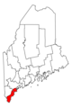 South Coast (Maine).PNG 403 × 600; 16 KB
-
-

-

-
 USA Names Maine.png 5,895 × 4,049; 1.51 MB


.PNG)


