Category:Locator maps of arrondissements of Loire to 2016
Jump to navigation
Jump to search
Media in category "Locator maps of arrondissements of Loire to 2016"
The following 9 files are in this category, out of 9 total.
-
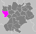 Arrondissement de Montbrison.PNG 503 × 482; 19 KB
-
 Arrondissement de Roanne.PNG 503 × 482; 19 KB
-
 Arrondissement de Saint-Étienne.PNG 503 × 482; 19 KB
-
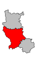 Map arrondissement code 421.svg 337 × 456; 4 KB
-
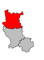 Map arrondissement code 422.svg 337 × 456; 4 KB
-
 Map arrondissement code 423.svg 337 × 456; 4 KB
-
 Locator map of Arrondissement Montbrison 2016.png 2,500 × 1,995; 1.52 MB
-
 Locator map of Arrondissement Roanne 2016.png 2,500 × 1,995; 1.51 MB
-
 Locator map of Arrondissement Saint-Étienne 2016.png 2,500 × 1,995; 1.51 MB


