Category:Locator maps of cities in Hungary
Jump to navigation
Jump to search
Countries of Europe: Albania · Austria · Belarus · Croatia · Czech Republic · France‡ · Germany · Greece · Hungary · Italy · Kazakhstan‡ · Latvia · Lithuania · Moldova · North Macedonia · Norway · Poland · Romania · Russia‡ · Serbia · Slovakia · Sweden · Switzerland · Ukraine · United Kingdom
‡: partly located in Europe
‡: partly located in Europe
Media in category "Locator maps of cities in Hungary"
The following 42 files are in this category, out of 42 total.
-
 BacsKiskunCounty.png 301 × 198; 4 KB
-
 BaranyaCounty Mohacs.png 301 × 198; 4 KB
-
 BaranyaCounty.png 301 × 198; 4 KB
-
 BAZcounty Szerencs.png 301 × 198; 4 KB
-
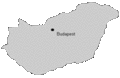
 BudapestMap23.png 301 × 198; 3 KB
-
 Carte de Gyor.jpg 590 × 301; 26 KB
-
 Cser attekinto.png 250 × 164; 14 KB
-
 CsongradCounty.png 301 × 198; 3 KB
-
 Decs.png 301 × 198; 4 KB
-
 Eger attekinto.png 1,123 × 748; 52 KB
-
 Egerbakta attekinto.png 1,123 × 748; 21 KB
-
 FejerCounty.gif 301 × 198; 3 KB
-
 Gyongyos attekinto.jpg 400 × 250; 23 KB
-
 Gyongyos location.png 1,104 × 725; 52 KB
-
 Hungary location map-2.jpg 1,184 × 743; 220 KB
-
 JaszNagykunSzolnokCounty.gif 301 × 198; 3 KB
-
 Kajaszo attekinto.jpg 300 × 190; 14 KB
-
 Kecskemét térképe.jpg 200 × 126; 10 KB
-
 Komaromesztergom-esztergom.PNG 1,123 × 748; 32 KB
-
 KomaromEsztergomCounty.gif 301 × 198; 3 KB
-
 Koroshegy Hungary location.png 1,123 × 748; 29 KB
-
 Lonya.gif 301 × 198; 3 KB
-
 Map eger.png 1,123 × 748; 66 KB
-
 MapMezobereny.jpg 301 × 198; 11 KB
-
 Mo-balassagyarmat-elhelyezkedes.png 301 × 198; 4 KB
-
 Notincsnogradban.png 794 × 515; 99 KB
-
 Nyírbátor - localização.gif 301 × 198; 10 KB
-
 PestCounty Visegrad.GIF 301 × 198; 3 KB
-
 Pusztafalu attekinto.png 1,123 × 748; 53 KB
-
 Pécel map.png 301 × 198; 4 KB
-
 SomogyCounty Szulok.jpg 301 × 198; 28 KB
-
 SomogyCounty.gif 301 × 198; 3 KB
-
 Subregion Csepreg.PNG 806 × 506; 34 KB
-
 SzabolcsSzatmarBeregCounty Nyirbator.GIF 301 × 198; 3 KB
-
 SzentendreMap.png 301 × 198; 3 KB
-
 Ungarn0101.gif 246 × 161; 5 KB
-
 Ungarn01010.gif 182 × 119; 3 KB
-
 Vac.png 301 × 198; 4 KB
-
 VeszpremCounty.gif 301 × 198; 3 KB
-
 VeszprémCounty Pápa.gif 301 × 198; 3 KB
-
 ZalaCounty.gif 301 × 198; 3 KB
-
 Zichyújfalu-in-Hungary-map.png 876 × 541; 73 KB


