Category:Locator maps of municipalities in Landkreis Aurich
Jump to navigation
Jump to search

Media in category "Locator maps of municipalities in Landkreis Aurich"
The following 28 files are in this category, out of 28 total.
-
 Aurich in AUR.svg 1,740 × 1,209; 616 KB
-
 Baltrum in AUR.svg 1,740 × 1,209; 604 KB
-
 Berumbur in AUR.svg 1,740 × 1,209; 616 KB
-
 Dornum in AUR.svg 1,740 × 1,209; 616 KB
-
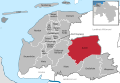
 Großefehn in AUR.svg 1,740 × 1,209; 616 KB
-
 Großheide in AUR.svg 1,740 × 1,209; 616 KB
-
 Hage in AUR.svg 1,740 × 1,209; 616 KB
-
 Hagermarsch in AUR.svg 1,740 × 1,209; 616 KB
-
 Halbemond in AUR.svg 1,740 × 1,209; 616 KB
-
 Hinte in AUR.svg 1,740 × 1,209; 616 KB
-
 Ihlow in AUR.svg 1,740 × 1,209; 616 KB
-
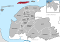
 Juist in AUR.svg 1,740 × 1,209; 616 KB
-
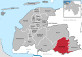
 Krummhörn in AUR.svg 1,740 × 1,209; 616 KB
-
 Leezdorf in AUR.svg 1,740 × 1,209; 603 KB
-
 Lütetsburg in AUR.svg 1,740 × 1,209; 616 KB
-
 Marienhafe in AUR.svg 1,740 × 1,209; 603 KB
-
 Memmert in AUR.svg 1,740 × 1,209; 604 KB
-
 Municipalities in AUR.svg 1,740 × 1,209; 1.2 MB
-
 Norden in AUR.svg 1,740 × 1,209; 616 KB
-
 Norderney in AUR.svg 1,740 × 1,209; 616 KB
-
 Osteel in AUR.svg 1,740 × 1,209; 603 KB
-
 Rechtsupweg in AUR.svg 1,740 × 1,209; 603 KB
-
 Samtgemeinde Brookmerland in AUR.svg 1,740 × 1,209; 616 KB
-
 Samtgemeinde Hage in AUR.svg 1,740 × 1,209; 616 KB
-
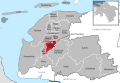
 Südbrookmerland in AUR.svg 1,740 × 1,209; 616 KB
-
 Upgant-Schott in AUR.svg 1,740 × 1,209; 603 KB
-
 Wiesmoor in AUR.svg 1,740 × 1,209; 616 KB
-
 Wirdum in AUR.svg 1,740 × 1,209; 603 KB


