Category:Locator maps of municipalities in Landkreis Trier-Saarburg
Jump to navigation
Jump to search
Urban districts (cities):
Media in category "Locator maps of municipalities in Landkreis Trier-Saarburg"
The following 113 files are in this category, out of 113 total.
-
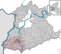
 Verbandsgemeinden in TR.svg 667 × 590; 293 KB
-
 Aach in TR.svg 667 × 590; 412 KB
-
 Ayl in TR.svg 667 × 590; 292 KB
-
 Baldringen in TR.svg 667 × 590; 292 KB
-
 Bekond in TR.svg 667 × 590; 447 KB
-
 Bescheid in TR.svg 667 × 590; 464 KB
-
 Beuren (Hochwald) in TR.svg 667 × 590; 447 KB
-
 Bonerath in TR.svg 667 × 590; 412 KB
-
 Damflos in TR.svg 667 × 590; 412 KB
-
 Detzem in TR.svg 667 × 590; 412 KB
-
 Ensch in TR.svg 667 × 590; 412 KB
-
 Farschweiler in TR.svg 667 × 590; 412 KB
-
 Fell in TR.svg 667 × 590; 412 KB
-
 Fisch in TR.svg 667 × 590; 292 KB
-
 Franzenheim in TR.svg 667 × 590; 412 KB
-
 Freudenburg in TR.svg 667 × 590; 292 KB
-
 Föhren in TR.svg 667 × 590; 412 KB
-
 Geisfeld in TR.svg 667 × 590; 412 KB
-
 Greimerath in TR.svg 667 × 590; 292 KB
-
 Grimburg in TR.svg 667 × 590; 412 KB
-
 Gusenburg in TR.svg 667 × 590; 412 KB
-
 Gusterath in TR.svg 667 × 590; 412 KB
-
 Gutweiler in TR.svg 667 × 590; 412 KB
-
 Heddert in TR.svg 667 × 590; 292 KB
-
 Hentern in TR.svg 667 × 590; 292 KB
-
 Herl in TR.svg 667 × 590; 412 KB
-
 Hermeskeil in TR.svg 667 × 590; 412 KB
-
 Hinzenburg in TR.svg 667 × 590; 412 KB
-
 Hinzert-Pölert in TR.svg 667 × 590; 412 KB
-
 Hockweiler in TR.svg 667 × 590; 412 KB
-
 Holzerath in TR.svg 667 × 590; 412 KB
-
 Igel in TR.svg 667 × 590; 412 KB
-
 Irsch in TR.svg 667 × 590; 292 KB
-
 Kanzem in TR.svg 667 × 590; 412 KB
-
 Kasel in TR.svg 667 × 590; 412 KB
-
 Kastel-Staadt in TR.svg 667 × 590; 292 KB
-
 Kell am See in TR.svg 667 × 590; 292 KB
-
 Kenn in TR.svg 667 × 590; 412 KB
-
 Kirf in TR.svg 667 × 590; 292 KB
-
 Klüsserath in TR.svg 667 × 590; 412 KB
-
 Konz in TR.svg 667 × 590; 412 KB
-
 Kordel in TR.svg 667 × 590; 412 KB
-
 Korlingen in TR.svg 667 × 590; 412 KB
-
 Köwerich in TR.svg 667 × 590; 412 KB
-
 Lampaden in TR.svg 667 × 590; 292 KB
-
 Langsur in TR.svg 667 × 590; 412 KB
-
 Leiwen in TR.svg 667 × 590; 412 KB
-
 Longen in TR.svg 667 × 590; 412 KB
-
 Longuich in TR.svg 667 × 590; 412 KB
-
 Lorscheid in TR.svg 667 × 590; 412 KB
-
 Mandern in TR.svg 667 × 590; 292 KB
-
 Mannebach in TR.svg 667 × 590; 292 KB
-
 Mehring in TR.svg 667 × 590; 412 KB
-
 Mertesdorf in TR.svg 667 × 590; 412 KB
-
 Merzkirchen in TR.svg 667 × 590; 292 KB
-
 Morscheid in TR.svg 667 × 590; 211 KB
-
 Naurath (Eifel) in TR.svg 667 × 590; 412 KB
-
 Naurath (Wald) in TR.svg 667 × 590; 412 KB
-
 Neuhütten in TR.svg 667 × 590; 412 KB
-
 Newel in TR.svg 667 × 590; 412 KB
-
 Nittel in TR.svg 667 × 590; 412 KB
-
 Oberbillig in TR.svg 667 × 590; 412 KB
-
 Ockfen in TR.svg 667 × 590; 292 KB
-
 Ollmuth in TR.svg 667 × 590; 412 KB
-
 Onsdorf in TR.svg 667 × 590; 412 KB
-
 Osburg in TR.svg 667 × 590; 412 KB
-
 Palzem in TR.svg 667 × 590; 292 KB
-
 Paschel in TR.svg 667 × 590; 292 KB
-
 Pellingen in TR.svg 667 × 590; 412 KB
-
 Pluwig in TR.svg 667 × 590; 412 KB
-
 Pölich in TR.svg 667 × 590; 412 KB
-
 Ralingen in TR.svg 667 × 590; 412 KB
-
 Rascheid in TR.svg 667 × 590; 412 KB
-
 Reinsfeld in TR.svg 667 × 590; 412 KB
-
 Riol in TR.svg 667 × 590; 412 KB
-
 Riveris in TR.svg 667 × 590; 412 KB
-
 Saarburg in TR.svg 667 × 590; 292 KB
-
 Schillingen in TR.svg 667 × 590; 292 KB
-
 Schleich in TR.svg 667 × 590; 412 KB
-
 Schoden in TR.svg 667 × 590; 292 KB
-
 Schweich in TR.svg 667 × 590; 264 KB
-
 Schömerich in TR.svg 667 × 590; 292 KB
-
 Schöndorf in TR.svg 667 × 590; 412 KB
-
 Serrig in TR.svg 667 × 590; 292 KB
-
 Sommerau in TR.svg 667 × 590; 412 KB
-
 Taben-Rodt in TR.svg 667 × 590; 292 KB
-
 Tawern in TR.svg 667 × 590; 412 KB
-
 Temmels in TR.svg 667 × 590; 412 KB
-
 Thomm in TR.svg 667 × 590; 412 KB
-
 Thörnich in TR.svg 667 × 590; 412 KB
-
 Trassem in TR.svg 667 × 590; 292 KB
-
 Trierweiler in TR.svg 667 × 590; 412 KB
-
 Trittenheim in TR.svg 667 × 590; 412 KB
-
 Verbandsgemeinde Hermeskeil in TR.svg 667 × 590; 412 KB
-
 Verbandsgemeinde Kell am See in TR.svg 667 × 590; 412 KB
-
 Verbandsgemeinde Konz in TR.svg 667 × 590; 412 KB
-
 Verbandsgemeinde Ruwer in TR.svg 667 × 590; 412 KB
-
 Verbandsgemeinde Saarburg in TR.svg 667 × 590; 412 KB
-
 Verbandsgemeinde Saarburg-Kell in TR.svg 667 × 590; 292 KB
-
 Verbandsgemeinde Schweich an der Römischen Weinstraße in TR.svg 667 × 590; 412 KB
-
 Verbandsgemeinde Trier-Land in TR.svg 667 × 590; 412 KB
-
 Vierherrenborn in TR.svg 667 × 590; 292 KB
-
 Waldrach in TR.svg 667 × 590; 412 KB
-
 Waldweiler in TR.svg 667 × 590; 292 KB
-
 Wasserliesch in TR.svg 667 × 590; 412 KB
-
 Wawern in TR.svg 667 × 590; 412 KB
-
 Wellen in TR.svg 667 × 590; 412 KB
-
 Welschbillig in TR.svg 667 × 590; 412 KB
-
 Wiltingen in TR.svg 667 × 590; 412 KB
-
 Wincheringen in TR.svg 667 × 590; 292 KB
-
 Zemmer in TR.svg 667 × 590; 412 KB
-
 Zerf in TR.svg 667 × 590; 292 KB
-
 Züsch in TR.svg 667 × 590; 412 KB


_in_TR.svg)


_in_TR.svg)
_in_TR.svg)


