Category:Locator maps of municipalities in Oita prefecture
Jump to navigation
Jump to search
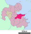
日本語: 大分県の市町村の位置図
| Prefectures of Japan 域内の市町村位置図 | |||
|---|---|---|---|
|

| ||
Media in category "Locator maps of municipalities in Oita prefecture"
The following 55 files are in this category, out of 55 total.
-
 Japan Oita Prefecture location map.svg 555 × 550; 17 KB
-
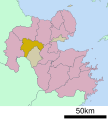
 Map of Oita Prefecture Ja.svg 352 × 345; 21 KB
-
 Beppu in Oita Prefecture Ja.svg 560 × 622; 10 KB
-
 Beppu in Oita Prefecture.png 1,181 × 901; 36 KB
-
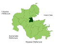
 Bungo-ono in Oita Prefecture Ja.svg 560 × 622; 10 KB
-
 Bungo-Ono in Oita Prefecture.png 1,181 × 901; 36 KB
-
 Bungotakada in Oita Prefecture Ja.svg 560 × 622; 10 KB
-
 Bungotakada in Oita Prefecture.png 1,181 × 901; 36 KB
-
 Hiji in Oita Prefecture Ja.svg 560 × 622; 10 KB
-
 Hiji in Oita Prefecture.png 1,181 × 901; 36 KB
-
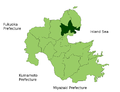
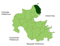
 Himeshima in Oita Prefecture Ja.svg 560 × 622; 10 KB
-
 Himeshima in Oita Prefecture.png 1,181 × 901; 36 KB
-
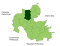
 Hita in Oita Prefecture Ja.svg 560 × 622; 10 KB
-
 Hita in Oita Prefecture.png 1,181 × 901; 36 KB
-
 Kitsuki in Oita Prefecture Ja.svg 560 × 622; 10 KB
-
 Kitsuki in Oita Prefecture.png 1,181 × 901; 36 KB
-
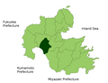
 Kokonoe in Oita Prefecture Ja.svg 560 × 622; 10 KB
-
 Kokonoe in Oita Prefecture.png 1,181 × 901; 36 KB
-
 Kunisaki in Oita Prefecture Ja.svg 560 × 622; 10 KB
-
 Kunisaki in Oita Prefecture.png 1,181 × 901; 36 KB
-
 Kusu in Oita Prefecture Ja.svg 560 × 622; 10 KB
-
 Kusu in Oita Prefecture.png 1,181 × 901; 36 KB
-
 Map Beppu en.png 1,181 × 901; 34 KB
-
 Map Bungo-ono en.png 1,181 × 901; 35 KB
-
 Map Bungotakada en.png 1,181 × 901; 35 KB
-
 Map Hita en.png 1,181 × 901; 35 KB
-
 Map Kitsuki en.png 1,181 × 901; 35 KB
-
 Map Kunisaki en.png 1,181 × 901; 34 KB
-
 Map Nakatsu en.png 1,181 × 901; 35 KB
-
 Map Oita en.png 1,181 × 901; 35 KB
-
 Map Oita Himeshima.PNG 245 × 204; 9 KB
-
 Map Saiki en.png 1,181 × 901; 35 KB
-
 Map Taketa en.png 1,181 × 901; 35 KB
-
 Map Tsukumi en.png 1,181 × 901; 34 KB
-
 Map Usa en.png 1,181 × 901; 35 KB
-
 Map Usuki en.png 1,181 × 901; 35 KB
-
 Map Yufu en.png 1,181 × 901; 35 KB
-
 Nakatsu in Oita Prefecture Ja.svg 560 × 622; 10 KB
-
 Nakatsu in Oita Prefecture.png 1,181 × 901; 36 KB
-
 NakatsuShiKennai1955.png 240 × 200; 3 KB
-
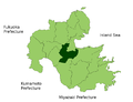
 Oita in Oita Prefecture Ja.svg 560 × 622; 10 KB
-
 Oita in Oita Prefecture.png 1,181 × 901; 36 KB
-
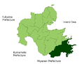
 Saiki in Oita Prefecture Ja.svg 560 × 622; 10 KB
-
 Saiki in Oita Prefecture.png 1,181 × 901; 36 KB
-
 Taketa in Oita Prefecture Ja.svg 560 × 622; 10 KB
-
 Taketa in Oita Prefecture.png 1,181 × 901; 36 KB
-
 Tsukumi in Oita Prefecture Ja.svg 560 × 622; 10 KB
-
 Tsukumi in Oita Prefecture.png 1,181 × 901; 36 KB
-
 Usa in Oita Prefecture Ja.svg 560 × 622; 10 KB
-
 Usa in Oita Prefecture.png 1,181 × 901; 36 KB
-
 Usuki in Oita Prefecture Ja.svg 560 × 622; 10 KB
-
 Usuki in Oita Prefecture.png 1,181 × 901; 36 KB
-
 Yufu in Oita Prefecture Ja.svg 560 × 622; 10 KB
-
 Yufu in Oita Prefecture.png 1,181 × 901; 36 KB
-
 大分市.png 240 × 200; 8 KB


