Category:Locator maps of neighborhoods in Amsterdam-Zuid
Jump to navigation
Jump to search
Media in category "Locator maps of neighborhoods in Amsterdam-Zuid"
The following 35 files are in this category, out of 35 total.
-
 Amsterdam - Stadsdeel Zuid.PNG 654 × 524; 65 KB
-

-

-

-
-
-

-

-

-

-

-
 Map - NL - Amsterdam - Stadsdeel Amsterdam Oud-Zuid.svg 625 × 575; 36 KB
-

-

-

-

-

-

-
 Map - NL - Amsterdam - Stadsdeel Zuideramstel.svg 625 × 575; 36 KB
-
 Map NL - Amsterdam - Apollobuurt.png 651 × 520; 28 KB
-
 Map NL - Amsterdam - Buitenveldert.png 651 × 520; 28 KB
-
 Map NL - Amsterdam - De Pijp.png 651 × 520; 11 KB
-
 Map NL - Amsterdam - Diamantbuurt.png 651 × 520; 28 KB
-
 Map NL - Amsterdam - Duivelseiland.png 651 × 520; 28 KB
-
 Map NL - Amsterdam - Hoofddorppleinbuurt.png 651 × 520; 28 KB
-
 Map NL - Amsterdam - Museumkwartier.png 651 × 520; 28 KB
-
 Map NL - Amsterdam - Nieuwe Pijp.png 651 × 520; 11 KB
-
 Map NL - Amsterdam - Oude Pijp.png 651 × 520; 28 KB
-
 Map NL - Amsterdam - Rivierenbuurt.png 651 × 520; 28 KB
-
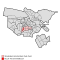
 Map NL - Amsterdam - Schinkelbuurt.png 651 × 520; 28 KB
-
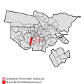
 Map NL - Amsterdam - Stadionbuurt.png 651 × 520; 28 KB
-
 Map NL - Amsterdam - Stadsdeel Oud-Zuid.png 651 × 520; 28 KB
-
 Map NL - Amsterdam - Stadsdeel ZuiderAmstel.png 651 × 520; 28 KB
-
 Map NL - Amsterdam - Willemspark.png 651 × 520; 28 KB
-
 Map NL - Amsterdam - ZuidWTC.png 651 × 520; 28 KB


