Category:Locator maps of neighborhoods in Roermond
Jump to navigation
Jump to search
Media in category "Locator maps of neighborhoods in Roermond"
The following 40 files are in this category, out of 40 total.
-
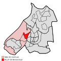 Map - NL - Roermond - Wijk 00 Centrum - Buurt 00 Binnenstad.svg 375 × 375; 31 KB
-

-
 Map - NL - Roermond - Wijk 00 Centrum - Buurt 02 Roer-Roer-Zuid.svg 375 × 375; 31 KB
-

-
 Map - NL - Roermond - Wijk 00 Centrum.svg 625 × 575; 12 KB
-

-
 Map - NL - Roermond - Wijk 01 Roermond-Oost - Buurt 01 Vrijveld.svg 375 × 375; 31 KB
-
 Map - NL - Roermond - Wijk 01 Roermond-Oost.svg 625 × 575; 12 KB
-

-
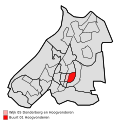
 Map - NL - Roermond - Wijk 02 Roermond-Zuid - Buurt 01 De Kemp.svg 375 × 375; 31 KB
-

-
 Map - NL - Roermond - Wijk 02 Roermond-Zuid.svg 625 × 575; 12 KB
-
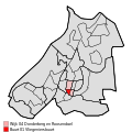
 Map - NL - Roermond - Wijk 03 Maasniel - Buurt 00 Kern Maasniel.svg 375 × 375; 31 KB
-
 Map - NL - Roermond - Wijk 03 Maasniel - Buurt 01 Leeuwen.svg 375 × 375; 31 KB
-

-

-
 Map - NL - Roermond - Wijk 03 Maasniel.svg 625 × 575; 12 KB
-

-
-

-
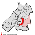
 Map - NL - Roermond - Wijk 04 Donderberg en Roosendael.svg 625 × 575; 12 KB
-

-
-
 Map - NL - Roermond - Wijk 05 Donderberg en Hoogvonderen.svg 625 × 575; 12 KB
-

-
-
 Map - NL - Roermond - Wijk 06 Asenray.svg 625 × 575; 12 KB
-
 Map - NL - Roermond - Wijk 07 Herten - Buurt 00 Ool.svg 375 × 375; 31 KB
-
 Map - NL - Roermond - Wijk 07 Herten - Buurt 01 Herten.svg 375 × 375; 31 KB
-
 Map - NL - Roermond - Wijk 07 Herten - Buurt 02 Merum.svg 375 × 375; 31 KB
-
 Map - NL - Roermond - Wijk 07 Herten - Buurt 03 Rijksweg.svg 375 × 375; 31 KB
-
 Map - NL - Roermond - Wijk 07 Herten.svg 625 × 575; 12 KB
-
 Map - NL - Roermond - Wijk 08 Swalmen - Buurt 00 Swalmen-Centrum.svg 375 × 375; 31 KB
-

-
 Map - NL - Roermond - Wijk 08 Swalmen - Buurt 02 Heide.svg 375 × 375; 31 KB
-
 Map - NL - Roermond - Wijk 08 Swalmen - Buurt 04 Asselt.svg 375 × 375; 31 KB
-

-
 Map - NL - Roermond - Wijk 08 Swalmen - Buurt 06 Boukoul.svg 375 × 375; 31 KB
-

-
 Map - NL - Roermond - Wijk 08 Swalmen.svg 625 × 575; 12 KB


