Category:Locator maps of populated places in Cumberland County, New Jersey
Jump to navigation
Jump to search
Media in category "Locator maps of populated places in Cumberland County, New Jersey"
The following 18 files are in this category, out of 18 total.
-
 Map of Camden County highlighting Voorhees.png 550 × 681; 7 KB
-
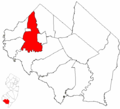
 Map of Cumberland County highlighting Bridgeton.png 549 × 499; 11 KB
-
 Map of Cumberland County highlighting Commercial Township.png 549 × 499; 10 KB
-
 Map of Cumberland County highlighting Deerfield Township.png 549 × 499; 10 KB
-
 Map of Cumberland County highlighting Downe Township.png 549 × 499; 10 KB
-
 Map of Cumberland County highlighting Fairfield Township.png 549 × 499; 10 KB
-
 Map of Cumberland County highlighting Greenwich Township.png 549 × 499; 10 KB
-
 Map of Cumberland County highlighting Hopewell Township.png 549 × 499; 10 KB
-
 Map of Cumberland County highlighting Lawrence Township.png 549 × 499; 10 KB
-
 Map of Cumberland County highlighting Maurice River Township.png 549 × 499; 10 KB
-
 Map of Cumberland County highlighting Millville.png 549 × 499; 10 KB
-
 Map of Cumberland County highlighting Shiloh.png 549 × 499; 10 KB
-
 Map of Cumberland County highlighting Stow Creek Township.png 549 × 499; 10 KB
-
 Map of Cumberland County highlighting Upper Deerfield Township.png 549 × 499; 10 KB
-
 Map of Cumberland County highlighting Vineland.png 549 × 499; 10 KB
-
 Map of Salem County highlighting Oldmans Township.png 549 × 589; 11 KB
-
 Map of Salem County highlighting Pilesgrove Township.png 549 × 589; 11 KB
-
 Map of Salem County highlighting Upper Pittsgrove Township.png 549 × 589; 11 KB


