Category:London Borough of Barnet
Jump to navigation
Jump to search
Boroughs of London: City of London · City of Westminster · Barking and Dagenham · Barnet · Bexley · Brent · Bromley · Camden · Croydon · Ealing · Enfield · Greenwich · Hackney · Hammersmith and Fulham · Haringey · Harrow · Havering · Hillingdon · Hounslow · Islington · Kensington and Chelsea · Kingston · Lambeth · Lewisham · Merton · Newham · Redbridge · Richmond · Southwark · Sutton · Tower Hamlets · Waltham Forest · Wandsworth
borough in the London Region in England   | |||||
| Upload media | |||||
| Pronunciation audio | |||||
|---|---|---|---|---|---|
| Instance of | |||||
| Location | Greater London, London, England | ||||
| Capital | |||||
| Legislative body |
| ||||
| Executive body |
| ||||
| Head of government |
| ||||
| Inception |
| ||||
| Population |
| ||||
| Area |
| ||||
| Replaces |
| ||||
| Different from | |||||
| official website | |||||
 | |||||
Subcategories
This category has the following 25 subcategories, out of 25 total.
Media in category "London Borough of Barnet"
The following 200 files are in this category, out of 3,732 total.
(previous page) (next page)-
 "Minstrel Boy" public house, Muswell Hill - geograph.org.uk - 5138454.jpg 1,600 × 1,078; 510 KB
-
 (Not) Open All Day - geograph.org.uk - 3726650.jpg 1,893 × 2,257; 1,010 KB
-
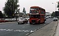 102 at Henlys Corner - geograph.org.uk - 3647432.jpg 1,554 × 954; 429 KB
-
 102 bus on Hodford Road, Golders Green - geograph.org.uk - 6125698.jpg 1,200 × 1,600; 499 KB
-
 102 bus on Lyttelton Road, Hampstead Garden Suburb - geograph.org.uk - 6171956.jpg 1,920 × 1,280; 1.74 MB
-
 15th fairway, Old Fold Manor Golf Club - geograph.org.uk - 5294989.jpg 640 × 480; 123 KB
-
 326 bus on Southover, Woodside Park - geograph.org.uk - 6459832.jpg 1,920 × 1,280; 1.06 MB
-
 33^ better whitening - geograph.org.uk - 4721625.jpg 640 × 480; 98 KB
-
 677 High Road N12 - geograph.org.uk - 2100569.jpg 640 × 480; 42 KB
-
 70 Hampden Road, Muswell Hill - geograph.org.uk - 6755054.jpg 1,920 × 1,280; 1.15 MB
-
 83 bus on Kingsbury Road - geograph.org.uk - 6443575.jpg 1,600 × 1,200; 628 KB
-
 A corner of Staples Corner - geograph.org.uk - 3163672.jpg 640 × 480; 103 KB
-
 A corner on the A41, Hendon - geograph.org.uk - 2507540.jpg 640 × 480; 56 KB
-
 A Few Changes at The Tavern - geograph.org.uk - 5360847.jpg 3,521 × 2,587; 1.35 MB
-
 A Few Goals - geograph.org.uk - 3714663.jpg 1,600 × 1,200; 481 KB
-
 A good collection of signs^ - geograph.org.uk - 2360822.jpg 640 × 430; 88 KB
-
 A green, Old Fold Manor Golf Club - geograph.org.uk - 3411235.jpg 640 × 480; 110 KB
-
 A load of rubbish - geograph.org.uk - 6064849.jpg 1,600 × 1,200; 202 KB
-
 A mountain or a molehill^ - geograph.org.uk - 6163493.jpg 1,600 × 1,200; 808 KB
-
 A parade of shops - geograph.org.uk - 5392952.jpg 3,264 × 2,448; 2.24 MB
-
 A path leading to Deanery Close - geograph.org.uk - 3874107.jpg 1,200 × 798; 513 KB
-
 A Short Terrace on Mays Lane - geograph.org.uk - 3726601.jpg 2,499 × 1,692; 861 KB
-
 A skeleton staff - geograph.org.uk - 6726452.jpg 4,000 × 3,000; 3.28 MB
-
 A Swinging Place for Kids - geograph.org.uk - 3469904.jpg 3,570 × 2,838; 3.99 MB
-
 A water tower - geograph.org.uk - 1935705.jpg 3,704 × 2,475; 4.02 MB
-
 A1 - geograph.org.uk - 5537087.jpg 640 × 426; 97 KB
-
 A1 - geograph.org.uk - 5537090.jpg 640 × 426; 84 KB
-
 A1 - geograph.org.uk - 5546647.jpg 640 × 426; 82 KB
-
 A1 approaching M1 and A41 junction - geograph.org.uk - 5560012.jpg 640 × 480; 88 KB
-
 A1 Great North Way junction with Finchley Lane - geograph.org.uk - 2214079.jpg 1,600 × 1,200; 594 KB
-
 A1 Great North Way, Hendon - geograph.org.uk - 5401601.jpg 1,064 × 1,600; 388 KB
-
 A1 Great North Way, Hendon - geograph.org.uk - 5526669.jpg 1,600 × 1,064; 504 KB
-
 A1 Great North Way, Hendon - geograph.org.uk - 5526670.jpg 1,600 × 1,064; 377 KB
-
 A1000 below railway line - geograph.org.uk - 5194348.jpg 640 × 426; 67 KB
-
 A41 - A410 roundabout - geograph.org.uk - 4524950.jpg 640 × 480; 141 KB
-
 A504 crosses the A41 - geograph.org.uk - 5514519.jpg 640 × 426; 60 KB
-
 A504 off Edgware Road West - geograph.org.uk - 5514421.jpg 640 × 426; 72 KB
-
 A5100 meets the A5 - geograph.org.uk - 6015277.jpg 1,024 × 683; 423 KB
-
 A598 - A406 junction - geograph.org.uk - 5536919.jpg 640 × 426; 59 KB
-
 A598 - geograph.org.uk - 5536925.jpg 640 × 426; 69 KB
-
 Abbey View, NW7 - geograph.org.uk - 2815963.jpg 640 × 480; 72 KB
-
 Abbots Road - geograph.org.uk - 6015231.jpg 1,024 × 683; 478 KB
-
 Abbots Road, Burnt Oak - geograph.org.uk - 6718077.jpg 1,920 × 1,280; 1,002 KB
-
 ABC Depot, Station Road - geograph.org.uk - 6086399.jpg 1,024 × 590; 159 KB
-
 Abercorn Road at the junction of Frith Lane - geograph.org.uk - 3783221.jpg 2,186 × 1,556; 971 KB
-
 Access road for houses, Hendon Wood Lane - geograph.org.uk - 2057246.jpg 1,600 × 1,200; 618 KB
-

-
 Accommodation Road, NW11 - geograph.org.uk - 2605714.jpg 481 × 640; 93 KB
-
-
 Addison Way - geograph.org.uk - 5536972.jpg 640 × 426; 118 KB
-
 Addison Way - geograph.org.uk - 5537049.jpg 640 × 425; 83 KB
-
 Addison Way - geograph.org.uk - 5537058.jpg 640 × 426; 86 KB
-
 Addison Way at the junction of Erskine Hill - geograph.org.uk - 5742329.jpg 2,304 × 1,728; 836 KB
-
 Addison Way. London NW11 - geograph.org.uk - 5207036.jpg 640 × 480; 70 KB
-

-
 Advertising hoarding by The Hyde - geograph.org.uk - 5507605.jpg 3,264 × 2,448; 2.27 MB
-
 Advertising hoarding by The Hyde - geograph.org.uk - 5507613.jpg 3,264 × 2,448; 1.94 MB
-
 Advertising hoarding on Hendon Way, Brent - geograph.org.uk - 6260314.jpg 1,884 × 1,226; 1.23 MB
-
 Advertising hoarding under the Finchley Road railway bridge - geograph.org.uk - 6136078.jpg 3,264 × 2,448; 2.03 MB
-
 Advertising outside Tesco, Finchley - geograph.org.uk - 4937758.jpg 2,048 × 1,152; 860 KB
-
 Aerodrome Road - geograph.org.uk - 2907815.jpg 640 × 480; 81 KB
-
 Aerodrome Road north of The Peel Centre - geograph.org.uk - 4142879.jpg 4,000 × 2,563; 1.3 MB
-
 Aerodrome Road, Colindale - geograph.org.uk - 2507597.jpg 640 × 480; 58 KB
-
 Aerodrome Road, Hendon - geograph.org.uk - 2507530.jpg 640 × 480; 59 KB
-
 Aeroville - geograph.org.uk - 2266655.jpg 640 × 480; 92 KB
-
 Aeroville, Colindale - geograph.org.uk - 2593492.jpg 1,600 × 1,200; 640 KB
-
 Aeroville, rear view - geograph.org.uk - 2266640.jpg 640 × 480; 122 KB
-
-
 Aladin's Kebabish - geograph.org.uk - 5514396.jpg 640 × 426; 69 KB
-
 Alan Drive, Barnet - geograph.org.uk - 2367495.jpg 640 × 430; 54 KB
-
 Albert Rd - geograph.org.uk - 5530142.jpg 640 × 426; 85 KB
-
 Alexandra Rd - geograph.org.uk - 5530135.jpg 640 × 426; 72 KB
-
 Alexandra Road and Bell Lane - geograph.org.uk - 4908148.jpg 4,000 × 3,000; 2.14 MB
-
 Alexandra Road, Hendon - geograph.org.uk - 5529121.jpg 1,600 × 1,064; 441 KB
-
 Algernon Rd - geograph.org.uk - 5514480.jpg 640 × 426; 72 KB
-
 Alkanet on Hampstead Heath Extension - geograph.org.uk - 6451667.jpg 1,600 × 1,200; 426 KB
-
 Alley Behind The Shops - geograph.org.uk - 2291916.jpg 1,067 × 1,600; 1.02 MB
-
 Alley behind the shops on Market Place - geograph.org.uk - 6447067.jpg 1,600 × 1,200; 640 KB
-
 Alleyway behind Falloden Way NW11 - geograph.org.uk - 4699028.jpg 2,304 × 1,728; 811 KB
-
 Alleyway behind shops on Golders Green Road - geograph.org.uk - 5462462.jpg 2,304 × 1,728; 852 KB
-
 Alleyway off Chase Way, Southgate - geograph.org.uk - 3669543.jpg 1,600 × 1,200; 561 KB
-
 Alleyway off Gurney Drive, Hampstead Garden Suburb - geograph.org.uk - 6605002.jpg 3,200 × 2,400; 2.77 MB
-
 Alleyway off Ossulton Way, Hampstead Garden Suburb - geograph.org.uk - 5776255.jpg 1,600 × 1,200; 376 KB
-
 Alleyway off Woodfield Drive, Southgate - geograph.org.uk - 3669612.jpg 1,600 × 1,200; 602 KB
-
 Allied House, Burnt Oak - geograph.org.uk - 2198150.jpg 4,320 × 3,240; 3.76 MB
-
 Allotments beside Abbots Road - geograph.org.uk - 6015236.jpg 1,024 × 683; 520 KB
-

-
 Allotments by Watford Way, Mill Hill - geograph.org.uk - 5151461.jpg 2,304 × 1,728; 1.54 MB
-
 Allotments on Gordon Road, Finchley - geograph.org.uk - 4180490.jpg 2,304 × 1,728; 784 KB
-
 Alma Road, Muswell Hill - geograph.org.uk - 6756517.jpg 1,920 × 1,280; 1.38 MB
-
 Almost a Cross Roads - geograph.org.uk - 3726599.jpg 2,424 × 1,479; 731 KB
-
 Almshouses, Wood Street, Chipping Barnet - geograph.org.uk - 4873561.jpg 1,600 × 1,064; 403 KB
-
 Along Dean's Lane - geograph.org.uk - 6015253.jpg 1,024 × 683; 364 KB
-
 Along Dryfield Road - geograph.org.uk - 6015248.jpg 1,024 × 683; 411 KB
-
 Along Hale Lane - geograph.org.uk - 6015260.jpg 1,024 × 683; 383 KB
-
 Along Penshurst Gardens - geograph.org.uk - 6015266.jpg 1,024 × 683; 401 KB
-
 Alongside the Brent Reservoir - geograph.org.uk - 4538820.jpg 4,000 × 3,000; 4.42 MB
-
 Alongside the Capital Ring - geograph.org.uk - 4700583.jpg 4,608 × 3,456; 3.51 MB
-
 Alongside the Dollis Brook at Totteridge Fields - geograph.org.uk - 5179137.jpg 4,608 × 3,456; 3.97 MB
-
 Alongside the Dollis Brook in Totteridge Fields - geograph.org.uk - 5179355.jpg 4,608 × 3,456; 3.33 MB
-
 Alston Road and Sebright Arms - geograph.org.uk - 4931987.jpg 640 × 463; 77 KB
-
 Alverstone Avenue, East Barnet - geograph.org.uk - 5278016.jpg 1,280 × 851; 386 KB
-
 Alyth Gardens Synagogue - geograph.org.uk - 5583490.jpg 2,304 × 1,728; 837 KB
-
 Alyth Gardens, Temple Fortune - geograph.org.uk - 5583489.jpg 2,304 × 1,728; 836 KB
-
 Alyth Gardens, Temple Fortune - geograph.org.uk - 5583491.jpg 2,304 × 1,728; 840 KB
-
 Ambulance at The Abrahams Stadium - geograph.org.uk - 2735884.jpg 1,024 × 690; 156 KB
-
 Ambulance, Widecombe Way N2 - geograph.org.uk - 2705352.jpg 640 × 480; 108 KB
-
 An ancient wooded lane in Edgware - geograph.org.uk - 5930937.jpg 4,000 × 3,000; 4.84 MB
-
 An ancient wooded lane in Edgware - geograph.org.uk - 5930938.jpg 4,000 × 3,000; 4.75 MB
-
 An ancient wooded lane in Edgware - geograph.org.uk - 5930943.jpg 4,000 × 3,000; 4.65 MB
-
 An ancient wooded lane in Edgware - geograph.org.uk - 5930945.jpg 4,000 × 3,000; 4.89 MB
-
 An ancient wooded lane near Bury Farm - geograph.org.uk - 5930953.jpg 4,000 × 3,000; 4.96 MB
-
 An Apollo space launch^ - geograph.org.uk - 2314689.jpg 480 × 640; 118 KB
-
 An empty Golders Green Station - geograph.org.uk - 6713722.jpg 3,200 × 2,400; 1.15 MB
-
 An empty Golders Green Station - geograph.org.uk - 6713723.jpg 3,200 × 2,400; 1.06 MB
-
 An entrance to Lyttelton Court, Hampstead Garden Suburb - geograph.org.uk - 6736183.jpg 3,200 × 2,400; 1.19 MB
-
 An Unmarked Path - geograph.org.uk - 6084185.jpg 5,152 × 3,864; 3.66 MB
-
-
 Angel ^ Crown, Mill Hill - geograph.org.uk - 2505993.jpg 640 × 480; 65 KB
-
 Angels - geograph.org.uk - 1929110.jpg 784 × 1,600; 388 KB
-
 Angels Fancy Dress - geograph.org.uk - 4211254.jpg 3,536 × 2,464; 1.2 MB
-
 Angels theatrical costumes, West Hendon - geograph.org.uk - 5213691.jpg 2,048 × 1,152; 1,005 KB
-
 Angle House, Whetstone - geograph.org.uk - 6283290.jpg 1,920 × 1,280; 1.42 MB
-
 Annersley Avenue, NW9 - geograph.org.uk - 2775580.jpg 640 × 480; 70 KB
-
 Annette White Lodge - geograph.org.uk - 6168858.jpg 2,968 × 2,031; 1.8 MB
-
 Another closed pub, Sanders Lane - geograph.org.uk - 3783210.jpg 2,304 × 1,728; 890 KB
-
 Another one bites the dust - geograph.org.uk - 5762527.jpg 2,304 × 1,728; 1.75 MB
-
 Another one bites the dust 2 - geograph.org.uk - 5762528.jpg 2,304 × 1,728; 804 KB
-
 Anyone for a swing^ - geograph.org.uk - 4931995.jpg 640 × 529; 192 KB
-
 Apartment Blocks, Chase Side, Southgate, London N14 - geograph.org.uk - 5095090.jpg 1,400 × 1,050; 1.63 MB
-

-
 Apartments on Stonegrove, Edgware - geograph.org.uk - 5317377.jpg 640 × 480; 84 KB
-
 Apartments, Brampton Grove - geograph.org.uk - 5526271.jpg 640 × 426; 90 KB
-
 Approaching Westcombe Drive - geograph.org.uk - 2374798.jpg 640 × 430; 55 KB
-
 Arc Court - geograph.org.uk - 3238026.jpg 640 × 480; 89 KB
-
 Arcade (or Arcadia) House - geograph.org.uk - 4392901.jpg 3,944 × 2,564; 1.41 MB
-
 Arcadia Avenue, Finchley - geograph.org.uk - 6727870.jpg 3,200 × 2,400; 873 KB
-
 Arcadia Avenue, Finchley - geograph.org.uk - 6727871.jpg 3,200 × 2,400; 1.09 MB
-
 Arctic Lodge - geograph.org.uk - 2907808.jpg 640 × 480; 91 KB
-
 Arkleigh Mansions - geograph.org.uk - 5529941.jpg 640 × 426; 82 KB
-
 Arkley Lane - geograph.org.uk - 2730968.jpg 1,600 × 1,200; 576 KB
-
 Arkley Lane - geograph.org.uk - 5295264.jpg 640 × 480; 190 KB
-
 Arkley Lane - geograph.org.uk - 5295267.jpg 640 × 480; 202 KB
-
 Arkley Lane - geograph.org.uk - 5688988.jpg 4,000 × 3,000; 4.53 MB
-
 Arkley Lane - geograph.org.uk - 5688993.jpg 4,000 × 3,000; 4.58 MB
-
 Arkley Lane bridleway - geograph.org.uk - 2730971.jpg 1,600 × 1,200; 579 KB
-
 Arkley Lane bridleway - geograph.org.uk - 2730973.jpg 1,600 × 1,200; 583 KB
-
 Arkley Lane bridleway - geograph.org.uk - 2730979.jpg 1,600 × 1,200; 578 KB
-
 Arkley Lane in the snow - geograph.org.uk - 3302877.jpg 2,560 × 1,920; 1.1 MB
-

-
 Arkley, Arkley Water Tower - geograph.org.uk - 4376300.jpg 640 × 480; 111 KB
-
 Arkley, Elm Farmhouse Pond - geograph.org.uk - 4382094.jpg 640 × 480; 78 KB
-
 Arkley, Footpath to Rowley Green (1) - geograph.org.uk - 4376248.jpg 640 × 480; 135 KB
-
 Arkley, Footpath to Rowley Green (2) - geograph.org.uk - 4376259.jpg 640 × 480; 81 KB
-

-
 Arkley, The Gate - geograph.org.uk - 4375646.jpg 640 × 466; 69 KB
-
 Armitage Road, Golders Green - geograph.org.uk - 5978285.jpg 1,600 × 1,064; 395 KB
-
 Arnos Grove Viaduct, London - geograph.org.uk - 6672499.jpg 4,032 × 1,960; 3.73 MB
-
 Arrandene 1976 - geograph.org.uk - 4766315.jpg 3,640 × 4,608; 2.59 MB
-
 Arrandene, Mill Hill 1976 - geograph.org.uk - 4033165.jpg 1,352 × 1,068; 566 KB
-
 Arundel Court - geograph.org.uk - 3650969.jpg 1,024 × 768; 215 KB
-
 Arundel Court - geograph.org.uk - 4928357.jpg 640 × 480; 112 KB
-
 Arundel Court, North Finchley - geograph.org.uk - 6755806.jpg 1,920 × 1,280; 1.33 MB
-
 Arundel Court, North Finchley - geograph.org.uk - 6755807.jpg 1,920 × 1,280; 1.3 MB
-
 Ascending the stairs, Colindale - geograph.org.uk - 4335434.jpg 2,304 × 1,728; 827 KB
-
 Ashes section, Bells Hill Burial Ground - geograph.org.uk - 3411382.jpg 640 × 480; 173 KB
-
 Ashfield Rd - geograph.org.uk - 6666522.jpg 1,024 × 684; 237 KB
-
 Ashley Lane - geograph.org.uk - 5099683.jpg 4,608 × 3,456; 3.41 MB
-
 Ashley Lane - geograph.org.uk - 5559525.jpg 640 × 480; 205 KB
-
 Ashley Lane - geograph.org.uk - 5559530.jpg 640 × 480; 212 KB
-
 Ashley Lane - geograph.org.uk - 5559565.jpg 640 × 480; 206 KB
-
 Ashley Lane - geograph.org.uk - 5559685.jpg 640 × 480; 172 KB
-
 Ashley Walk, Mill Hill - geograph.org.uk - 4199077.jpg 2,304 × 1,728; 1.82 MB
-
 Ashton Lodge care home, The Hyde - geograph.org.uk - 6302660.jpg 1,696 × 1,280; 1,016 KB
-
 Ashurst Road, North Finchley - geograph.org.uk - 6759566.jpg 1,920 × 1,280; 1.24 MB
-
 Astral Sports on Edgware Road, c1990 - geograph.org.uk - 3658141.jpg 1,796 × 1,232; 421 KB
-
 Atech Automotive by Golders Green Station - geograph.org.uk - 6731726.jpg 3,200 × 2,400; 1.35 MB
-
 Auto Action Automotive Engineers - geograph.org.uk - 5644295.jpg 1,600 × 1,200; 303 KB
-
 Autumn at Arnos Park - geograph.org.uk - 6672491.jpg 4,032 × 1,960; 4.91 MB
-
 Autumn Colours in Oakhill Park - geograph.org.uk - 6702270.jpg 8,192 × 4,435; 5.84 MB
-
 Autumn Colours in Oakhill Park - geograph.org.uk - 6702272.jpg 8,192 × 4,700; 7.49 MB
-
 Autumn Colours in Oakhill Park - geograph.org.uk - 6702273.jpg 8,192 × 5,464; 7.22 MB
-
 Autumn Colours in Oakhill Park - geograph.org.uk - 6702275.jpg 8,192 × 5,464; 6.31 MB
-
 Autumn trees, The Ridgeway NW7 - geograph.org.uk - 2710573.jpg 640 × 480; 77 KB
-
 Avro Lodge - geograph.org.uk - 2907805.jpg 480 × 640; 91 KB
-
 B551 junction with A502 - geograph.org.uk - 4141154.jpg 4,000 × 2,031; 1.36 MB
-
 Babies R us, Brent Cross South - geograph.org.uk - 5895681.jpg 1,600 × 1,200; 295 KB
-
 Backs of houses on Oakwood Road from Northway Gardens - geograph.org.uk - 3473306.jpg 1,600 × 1,200; 584 KB
-
 Backs of shops on Finchley Road from Bridge Way - geograph.org.uk - 3921734.jpg 2,304 × 1,728; 822 KB
-
 Bags on the roof - geograph.org.uk - 4386875.jpg 1,000 × 637; 662 KB
-
 Bakers Hill, Hadley Common - geograph.org.uk - 4045946.jpg 2,304 × 1,728; 823 KB
-
 Bakers Hill, Hadley Common - geograph.org.uk - 4045954.jpg 2,304 × 1,728; 823 KB
-
 Bakery Path - geograph.org.uk - 6428127.jpg 768 × 1,024; 255 KB
-
 Balfour Terrace, Squires Lane, Finchley - geograph.org.uk - 4289393.jpg 2,304 × 1,728; 804 KB
-
 Ballards Lane, Finchley - geograph.org.uk - 6696595.jpg 3,200 × 2,400; 1.06 MB
-
 Ballards Lane, Finchley - geograph.org.uk - 6696596.jpg 3,200 × 2,400; 1.22 MB
-
 Balloons and the Moon (27406405).jpg 638 × 479; 64 KB
-
 Bar Linda cafe in Golders Green Station - geograph.org.uk - 6136105.jpg 1,600 × 1,200; 381 KB
-
 Barclays Bank, Finchley Road NW11 - geograph.org.uk - 5206907.jpg 640 × 480; 60 KB
-
 Barfield Avenue, N20 - geograph.org.uk - 5291792.jpg 640 × 480; 118 KB

_Open_All_Day_-_geograph.org.uk_-_3726650.jpg)


_House_-_geograph.org.uk_-_4392901.jpg)


_-_geograph.org.uk_-_4376248.jpg)
_-_geograph.org.uk_-_4376259.jpg)


.jpg)


