Category:Lothersdale
Jump to navigation
Jump to search
village and civil parish in North Yorkshire, UK  | |||||
| Upload media | |||||
| Instance of | |||||
|---|---|---|---|---|---|
| Location | Craven, North Yorkshire, Yorkshire and the Humber, England | ||||
 | |||||
English: Lothersdale is a small village and civil parish in the Craven district of North Yorkshire, England. Situated near Skipton and located within the triangle formed by Skipton, Cross Hills and Colne. It is a small community of about 200 houses but local amenities include a park, church, chapel, pub, village hall, Clubhouse and (Ofsted 'Outstanding') primary school. The Pennine Way runs through it.
Subcategories
This category has the following 3 subcategories, out of 3 total.
Media in category "Lothersdale"
The following 186 files are in this category, out of 186 total.
-
 A path off Babyhouse Lane - geograph.org.uk - 2967220.jpg 800 × 600; 118 KB
-
 A path to Woodhead Farm - geograph.org.uk - 2967164.jpg 800 × 600; 196 KB
-
 Access Lane to Hewitts Farm - geograph.org.uk - 519509.jpg 640 × 480; 89 KB
-
 Across Lothersdale - geograph.org.uk - 4517210.jpg 4,320 × 3,240; 3.39 MB
-
 Aerials near to Thornton Moor - geograph.org.uk - 3359233.jpg 1,500 × 1,125; 1.29 MB
-
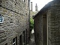 Alleyway in Lothersdale - geograph.org.uk - 865389.jpg 640 × 480; 94 KB
-
 Approach to Lothersdale on Pennine Way - geograph.org.uk - 3936776.jpg 800 × 669; 201 KB
-
 Approaching Surgill Beck - geograph.org.uk - 864983.jpg 640 × 480; 83 KB
-
 Ashfield Farm near Lothersdale - geograph.org.uk - 2967213.jpg 800 × 578; 132 KB
-
 Ashfield Farm, Stansfield Brow - geograph.org.uk - 5364441.jpg 1,024 × 657; 162 KB
-
 Babyhouse Lane - geograph.org.uk - 2639598.jpg 2,592 × 1,944; 1.45 MB
-
 Babyhouse Lane - geograph.org.uk - 3016704.jpg 640 × 480; 104 KB
-
 Barn and bales above Lothersdale - geograph.org.uk - 2641556.jpg 3,872 × 2,592; 4.96 MB
-
 Barn on Tow Top Lane - geograph.org.uk - 2889700.jpg 2,592 × 1,944; 1.67 MB
-

-
 Benchmark on building at Ashfield Farm - geograph.org.uk - 5364401.jpg 1,024 × 683; 324 KB
-
 Benchmark on Victoria House - geograph.org.uk - 5871017.jpg 683 × 1,024; 300 KB
-

-
 Bethel Chapel, Lothersdale.jpg 2,397 × 1,698; 3.79 MB
-
 Bleara Side - geograph.org.uk - 4693932.jpg 5,184 × 2,780; 1.77 MB
-
 Broom Farm - geograph.org.uk - 2646170.jpg 3,872 × 2,592; 4.48 MB
-
 Broom House Farm - geograph.org.uk - 4694282.jpg 4,846 × 2,340; 1.53 MB
-
 Broom House Farm - geograph.org.uk - 5878566.jpg 640 × 480; 81 KB
-
 Buildings at Near Surgill Head Farm - geograph.org.uk - 2967159.jpg 800 × 600; 110 KB
-
 Cairn and trig point on Elslack Moor - geograph.org.uk - 4561772.jpg 1,024 × 683; 223 KB
-
 Cairn and trig point on Pinhaw - geograph.org.uk - 3815088.jpg 1,600 × 1,200; 329 KB
-
 Calf Edge Farm, Lothersdale - geograph.org.uk - 1253815.jpg 640 × 480; 32 KB
-
 Cattlegrid above Lothersdale - geograph.org.uk - 2641525.jpg 3,872 × 2,592; 5.49 MB
-
 Chimney, Lothersdale - geograph.org.uk - 4930783.jpg 511 × 640; 167 KB
-
 Climbing Tow Top Lane - geograph.org.uk - 865394.jpg 640 × 480; 103 KB
-

-
 Cononley Lead Mine - geograph.org.uk - 3016498.jpg 640 × 480; 129 KB
-
 Cotton Grass on Pinhaw - geograph.org.uk - 3543625.jpg 3,240 × 2,881; 2.03 MB
-
 Cow Lane, Lothersdale - geograph.org.uk - 6233661.jpg 1,024 × 768; 255 KB
-
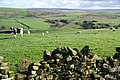 Cows and sheep above Lothersdale - geograph.org.uk - 2646153.jpg 3,872 × 2,592; 5.14 MB
-
 Cripple Hole Hill - geograph.org.uk - 3358796.jpg 1,500 × 946; 1.2 MB
-
 Crop field near Ninevah Farm - geograph.org.uk - 5878564.jpg 640 × 480; 73 KB
-
 Dale End, Back of 6, Garden Terrace - geograph.org.uk - 5382043.jpg 2,816 × 2,112; 1.38 MB
-
 Dale End, Rook Street, view looking east - geograph.org.uk - 5382050.jpg 2,816 × 2,112; 1.07 MB
-
 Dale End, view looking west - geograph.org.uk - 5382048.jpg 2,816 × 2,112; 1.15 MB
-
 Descending to Tow Top Farm - geograph.org.uk - 6039464.jpg 5,184 × 3,456; 7.54 MB
-
 Discarded bales on Hawshaw Hill - geograph.org.uk - 2652784.jpg 3,872 × 2,592; 4.13 MB
-
 Dodgson Allotment - geograph.org.uk - 4694287.jpg 5,183 × 3,046; 1.66 MB
-
 Dry-stone wall in good repair, Upper Leys Farm - geograph.org.uk - 4249978.jpg 1,024 × 614; 117 KB
-

-
 Farm buildings on Hawshaw Road - geograph.org.uk - 2967149.jpg 800 × 600; 134 KB
-
 Farmland above Kirk Sykes Farm - geograph.org.uk - 2641735.jpg 3,872 × 2,592; 4.64 MB
-
 Farmland between Near Leys and Upper Leys Farms - geograph.org.uk - 4250003.jpg 1,024 × 768; 102 KB
-
 Farms on Kirk Hill - geograph.org.uk - 2641644.jpg 3,872 × 2,592; 4.04 MB
-
 Field margin beside Green Gill - geograph.org.uk - 3358040.jpg 1,500 × 1,125; 2.01 MB
-
 Fields east of East Hainslack Farm - geograph.org.uk - 2652774.jpg 3,872 × 2,592; 3.02 MB
-
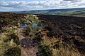 Fire damage on Little Pinhaw - geograph.org.uk - 2641759.jpg 3,872 × 2,592; 5.89 MB
-
 Forest of Poles off Tom Lane - geograph.org.uk - 2324334.jpg 4,320 × 3,240; 4.97 MB
-
 Former lead mine near Cononley (7) - geograph.org.uk - 4930486.jpg 640 × 475; 140 KB
-
 Fromraygill.JPG 3,264 × 2,448; 2.45 MB
-
 Gap stile in drystone wall - geograph.org.uk - 2639615.jpg 2,592 × 1,944; 1.38 MB
-
 George VI Postbox, Lothersdale - geograph.org.uk - 1280355.jpg 683 × 1,024; 167 KB
-
 Green Lane descending to Cross Tow Top Beck - geograph.org.uk - 6039473.jpg 5,184 × 3,456; 5.3 MB
-
 Hare and Hounds, Lothersdale (21781303842).jpg 1,937 × 1,937; 3.05 MB
-
 Harvested field below Bleara Side - geograph.org.uk - 2648818.jpg 3,872 × 2,592; 4.55 MB
-
 Hawshaw Lodge - geograph.org.uk - 2648999.jpg 3,872 × 2,592; 4.11 MB
-
 Hawshaw Lodge Barn - geograph.org.uk - 4693916.jpg 4,584 × 2,472; 1.76 MB
-
 Hawshaw Lodge Barn - geograph.org.uk - 5878412.jpg 640 × 454; 70 KB
-
 Hawshaw Road - geograph.org.uk - 2324305.jpg 4,320 × 3,240; 4.32 MB
-
 Hawshaw Road from Tom Lane - geograph.org.uk - 2967145.jpg 800 × 600; 99 KB
-
 Hillside down to Lothersdale - geograph.org.uk - 2641679.jpg 3,872 × 2,592; 5.17 MB
-
 Kirk Sykes Farm - geograph.org.uk - 2641695.jpg 3,872 × 2,592; 5.1 MB
-
 Kirk Sykes Farm - geograph.org.uk - 3815081.jpg 1,600 × 1,200; 421 KB
-
 Lane towards Norwood southwest of Leys House - geograph.org.uk - 4252463.jpg 1,600 × 1,200; 671 KB
-
 Leys House - geograph.org.uk - 2639593.jpg 2,592 × 1,944; 1.26 MB
-
 Leys Top - geograph.org.uk - 4250013.jpg 1,024 × 768; 116 KB
-
 Long Syke Edge - geograph.org.uk - 2324354.jpg 4,320 × 3,240; 4.81 MB
-
 Looking down on Lothersdale - geograph.org.uk - 2805605.jpg 3,260 × 1,632; 1,013 KB
-
 Looking up Surgill - geograph.org.uk - 2640224.jpg 3,872 × 2,592; 4.89 MB
-
 Lothersdale - geograph.org.uk - 1624.jpg 640 × 427; 60 KB
-
 Lothersdale (21736195095).jpg 2,814 × 2,603; 5.83 MB
-
 Lothersdale (4449050854).jpg 2,158 × 1,467; 2.27 MB
-
 Lothersdale - geograph.org.uk - 2033686.jpg 1,600 × 1,200; 339 KB
-
 Lothersdale - geograph.org.uk - 46221.jpg 640 × 480; 157 KB
-
 Lothersdale Beck - geograph.org.uk - 6233658.jpg 1,024 × 768; 232 KB
-
 Lothersdale from Pennine Way (4433729376).jpg 4,032 × 2,688; 8.67 MB
-
 Lothersdale from Raygill Lane.jpg 2,263 × 1,694; 2.7 MB
-
 Lothersdale from the Pennine Way - geograph.org.uk - 2247797.jpg 2,000 × 1,500; 3.09 MB
-
 Lothersdale from the Pennine Way - geograph.org.uk - 2641539.jpg 3,872 × 2,592; 5.4 MB
-
 Lothersdale Road - geograph.org.uk - 2350252.jpg 4,320 × 3,240; 2.4 MB
-
 Lothersdale Road at Upper Leys Farm - geograph.org.uk - 3016483.jpg 640 × 480; 132 KB
-

-
 Lothersdale, Dale End, The Hare and Hounds - geograph.org.uk - 5382038.jpg 2,304 × 1,436; 1.9 MB
-
 Lothersdale, View towards Dale End Mill - geograph.org.uk - 5382056.jpg 2,816 × 2,112; 1.11 MB
-
 Lothersdale.JPG 1,280 × 960; 330 KB
-
 Millpond, Lothersdale - geograph.org.uk - 1280352.jpg 1,024 × 683; 186 KB
-
 Near Lothersdale (4448272703).jpg 2,478 × 1,509; 2.45 MB
-
 Ninevah - geograph.org.uk - 3368816.jpg 1,500 × 862; 1.1 MB
-
 On Tow Top Lane - geograph.org.uk - 865451.jpg 640 × 480; 54 KB
-
 Onto Pinhaw Moor - geograph.org.uk - 519534.jpg 640 × 480; 73 KB
-
 Over the wall (4448270591).jpg 2,560 × 1,920; 3.95 MB
-
 Path above Surgill - geograph.org.uk - 2652796.jpg 3,721 × 2,481; 4.3 MB
-
 Path on Cripple Hole Hill - geograph.org.uk - 2641811.jpg 3,872 × 2,592; 5.97 MB
-
 Pennine Way and wall angle on Elslack Moor - geograph.org.uk - 4562040.jpg 1,024 × 683; 195 KB
-
 Pennine Way approaching Lothersdale - geograph.org.uk - 865382.jpg 640 × 480; 98 KB
-
 Pennine Way at Surgill Beck ford - geograph.org.uk - 3815067.jpg 1,600 × 1,200; 1 MB
-
 Pennine Way beside Kirk Syke Farm - geograph.org.uk - 6039695.jpg 5,184 × 3,456; 6.51 MB
-
 Pennine Way crosses a tributary of Stansfield Beck - geograph.org.uk - 3815080.jpg 1,600 × 1,200; 1.05 MB
-
 Pennine Way descending to Lothersdale - geograph.org.uk - 3815071.jpg 1,600 × 1,200; 612 KB
-
 Pennine Way east of Pinhaw Beacon - geograph.org.uk - 519543.jpg 640 × 480; 82 KB
-
 Pennine Way guidepost below Pinhaw - geograph.org.uk - 3543620.jpg 4,320 × 3,240; 2.51 MB
-
 Pennine Way stile and sign - geograph.org.uk - 5397497.jpg 5,184 × 3,888; 4.12 MB
-
 Pinhaw Beacon (1) - geograph.org.uk - 6039716.jpg 5,184 × 3,456; 7.32 MB
-
 Pinhaw Beacon (2) - geograph.org.uk - 6039734.jpg 5,184 × 3,456; 6.47 MB
-
 Pinhaw Beacon - geograph.org.uk - 2641799.jpg 3,872 × 2,592; 4.83 MB
-
 Pinhaw Beacon, 1273' - geograph.org.uk - 1147574.jpg 480 × 640; 72 KB
-
 Proctor Height - geograph.org.uk - 4694292.jpg 3,308 × 4,394; 1.69 MB
-
 Proctor Height - geograph.org.uk - 4694294.jpg 4,959 × 3,442; 1.7 MB
-
 Proctor Height - geograph.org.uk - 4912433.jpg 5,471 × 3,285; 1.88 MB
-
 Proctor Height Masts - geograph.org.uk - 2285063.jpg 2,494 × 3,186; 1.5 MB
-
 Rain shower beyond Hawshaw Lodge - geograph.org.uk - 2652764.jpg 3,872 × 2,592; 2.74 MB
-
 Raygill Fisheries - geograph.org.uk - 1179179.jpg 640 × 479; 136 KB
-
 Road to Little Gib and Great Gib - geograph.org.uk - 3016699.jpg 640 × 480; 134 KB
-
 Road to Raygill - geograph.org.uk - 2642608.jpg 2,592 × 1,944; 1.23 MB
-
 Road towards a watershed in the Pennines - geograph.org.uk - 2648976.jpg 3,872 × 2,592; 5.33 MB
-
 Rook Street, Lothersdale - geograph.org.uk - 2967173.jpg 800 × 600; 146 KB
-
 Rough Plantation - geograph.org.uk - 2643242.jpg 3,872 × 2,592; 5.97 MB
-
 Rough Plantation, Cripple Hole Hill - geograph.org.uk - 6233588.jpg 1,024 × 768; 156 KB
-
 Sheds on Hawshaw Hill - geograph.org.uk - 2652777.jpg 3,872 × 2,592; 3.74 MB
-
 Sheep grazing near Crowshaw - geograph.org.uk - 5878570.jpg 640 × 480; 70 KB
-

-
 Sidegate Lane (21115461433).jpg 2,248 × 3,747; 5.68 MB
-
 Signpost (21547795778).jpg 4,000 × 3,000; 11.64 MB
-
 Skipton Old Road - geograph.org.uk - 2285079.jpg 3,168 × 4,224; 2.59 MB
-
 Small building at wall corner - geograph.org.uk - 3359258.jpg 1,500 × 977; 1.26 MB
-
 Stansfield Beck - geograph.org.uk - 2641615.jpg 3,872 × 2,592; 7.35 MB
-
 Stansfield Brow near Lothersdale - geograph.org.uk - 4932459.jpg 640 × 419; 146 KB
-
 Stile on Pennine Way - geograph.org.uk - 3358086.jpg 1,500 × 1,125; 2.15 MB
-
 Summit area of Pinhaw - geograph.org.uk - 3358763.jpg 1,500 × 957; 1.17 MB
-
 Surgill Beck on the Pennine Way - geograph.org.uk - 844785.jpg 640 × 480; 129 KB
-

-
 The entrance to Nineveh Farm - geograph.org.uk - 2646455.jpg 3,872 × 2,592; 4.77 MB
-
 The Hare and Hounds, Lothersdale - geograph.org.uk - 2640230.jpg 3,872 × 2,592; 3.63 MB
-
 The Old Skipton-Colne Road - geograph.org.uk - 2324275.jpg 4,320 × 3,240; 4.38 MB
-

-
 The Pennine Way takes a left turn - geograph.org.uk - 2641660.jpg 3,872 × 2,592; 4.44 MB
-

-
 The valley of Surgill Beck - geograph.org.uk - 2640196.jpg 3,872 × 2,592; 6.33 MB
-
 The way to Far Surgill Head Farm - geograph.org.uk - 2967154.jpg 800 × 600; 157 KB
-
 The way to Th' Oliver Farm - geograph.org.uk - 2967142.jpg 800 × 600; 142 KB
-
 Thornton Moor - geograph.org.uk - 4694284.jpg 3,772 × 2,156; 1.64 MB
-
 Thornton Moor - geograph.org.uk - 4694298.jpg 5,183 × 3,261; 1.75 MB
-
 Tom Lane towards Hawshaw Road - geograph.org.uk - 2967136.jpg 800 × 600; 108 KB
-
 Tow Top Lane - geograph.org.uk - 2967168.jpg 800 × 600; 193 KB
-
 Tow Top Lane - geograph.org.uk - 3016707.jpg 640 × 480; 120 KB
-
 Tow Top Lane - geograph.org.uk - 6039470.jpg 5,184 × 3,456; 6.68 MB
-
 Track on Pinhaw Moor - geograph.org.uk - 6039744.jpg 5,184 × 3,456; 7.46 MB
-
 Track to Dukes Farm - geograph.org.uk - 2652666.jpg 3,872 × 2,592; 5.14 MB
-
 Tree at the Crossroads (4444013266).jpg 2,560 × 1,712; 3.52 MB
-
 Trees beside wall on Pennine Way - geograph.org.uk - 3358294.jpg 1,500 × 907; 1.08 MB
-
 Triangulation pillar and cairn on Elslack Moor - geograph.org.uk - 4532558.jpg 1,024 × 683; 215 KB
-
 Trig pillar on Pinhaw beacon. - geograph.org.uk - 4019680.jpg 640 × 393; 48 KB
-
 Uphill on West Road - geograph.org.uk - 5878565.jpg 640 × 480; 69 KB
-
 Upper Leys Farm - geograph.org.uk - 4249988.jpg 1,024 × 768; 212 KB
-
 Victoria House, Stockshott Lane - geograph.org.uk - 5871057.jpg 1,024 × 670; 142 KB
-
 View from Pennine Way (4432941121).jpg 2,156 × 1,317; 2 MB
-
 View from Raygill Lane (4443240973).jpg 2,509 × 1,673; 3.66 MB
-
 View from the Pennine Way (4448278527).jpg 2,560 × 1,920; 3.26 MB
-
 View of masts at Proctor Hill Heights - geograph.org.uk - 3591849.jpg 3,773 × 2,360; 1.89 MB
-
 View towards Cross Green Farm - geograph.org.uk - 6039456.jpg 5,184 × 3,456; 7.53 MB
-
 Wall rising on north side of Lothersdale - geograph.org.uk - 3368823.jpg 1,500 × 1,125; 1.84 MB
-
 West Road near Broom House Farm - geograph.org.uk - 5878568.jpg 640 × 480; 64 KB
-
 West Road, Dodgson Allotment - geograph.org.uk - 5878572.jpg 640 × 480; 57 KB
-
 Where is the right of way^ - geograph.org.uk - 2641577.jpg 3,872 × 2,592; 6.11 MB
-
 White Hill Lane - geograph.org.uk - 6039679.jpg 5,184 × 3,456; 5.87 MB
-
 Woodhead Farm - geograph.org.uk - 865374.jpg 640 × 480; 76 KB
-
 Yellow grass on Elslack Moor - geograph.org.uk - 2641774.jpg 3,872 × 2,592; 5.69 MB
-
 Cat Gill - geograph.org.uk - 473480.jpg 640 × 480; 133 KB
-
 Corn Close Bent Moor and Emmott Moor - geograph.org.uk - 553248.jpg 640 × 480; 111 KB
-
 Emmott Moor and Corn Close Bent Moor - geograph.org.uk - 553246.jpg 640 × 480; 92 KB
-
 Hewitts Farm - geograph.org.uk - 519520.jpg 640 × 480; 97 KB
-
 Higher Coppy - geograph.org.uk - 553249.jpg 640 × 480; 113 KB
-
 Higher Coppy Close Up - geograph.org.uk - 555573.jpg 640 × 480; 116 KB
-
 Kirk Sykes Farm at dusk - geograph.org.uk - 126816.jpg 640 × 426; 51 KB
-
 Laneshaw Brook - geograph.org.uk - 553252.jpg 640 × 480; 126 KB
-
 Lothersdale Methodist Church - geograph.org.uk - 102190.jpg 640 × 426; 140 KB
-
 Reservoir near Yellison House - geograph.org.uk - 473487.jpg 640 × 480; 106 KB
-
 Stile near Cat Gill Wood - geograph.org.uk - 473471.jpg 640 × 480; 136 KB
-
 The valley of Surgill Beck - geograph.org.uk - 46217.jpg 640 × 480; 144 KB
-
 Tow Top farm, near Lothersdale, Yorkshire - geograph.org.uk - 169273.jpg 640 × 480; 162 KB
-
 Trig Point and Cairn on Pinhaw Beacon - geograph.org.uk - 617577.jpg 640 × 480; 124 KB


_-_geograph.org.uk_-_4930486.jpg)


.jpg)


.jpg)
.jpg)


.jpg)


.jpg)


.jpg)


.jpg)
.jpg)


.jpg)


.jpg)
.jpg)
.jpg)


_-_geograph.org.uk_-_6039716.jpg)
_-_geograph.org.uk_-_6039734.jpg)