Category:Low tide in Highland council area
Jump to navigation
Jump to search
Subcategories
This category has only the following subcategory.
E
- Eilean Donan Castle at low tide (40 F)
Media in category "Low tide in Highland council area"
The following 200 files are in this category, out of 277 total.
(previous page) (next page)-
 A830 Bridge at Morar - geograph.org.uk - 788396.jpg 640 × 480; 66 KB
-
 Achmelvich beach at low tide - geograph.org.uk - 1375392.jpg 640 × 442; 53 KB
-
 Achnahaird Bay at (very) low tide - geograph.org.uk - 1329955.jpg 640 × 480; 64 KB
-

-
 Allt Loch a Choire - geograph.org.uk - 920296.jpg 640 × 480; 64 KB
-
 An Coileach at very low tide - geograph.org.uk - 1733917.jpg 640 × 474; 89 KB
-
 An Corran, Staffin - geograph.org.uk - 1761946.jpg 1,600 × 1,064; 367 KB
-
 An Dorneil from Lampay - geograph.org.uk - 1228632.jpg 600 × 450; 338 KB
-
 Applecross Bay. - geograph.org.uk - 359381.jpg 640 × 480; 74 KB
-
 Ardmore Bay - geograph.org.uk - 1042800.jpg 640 × 427; 187 KB
-
 Arisaig - geograph.org.uk - 39503.jpg 640 × 480; 82 KB
-
 Ath a' Chaolais - geograph.org.uk - 899655.jpg 640 × 480; 93 KB
-
 Ath a' Chaolais - geograph.org.uk - 899730.jpg 640 × 480; 129 KB
-
 Autumn sunshine in Loch Torridon at low tide - geograph.org.uk - 3179907.jpg 3,648 × 2,736; 4.9 MB
-
 Avoch harbour - geograph.org.uk - 1247875.jpg 640 × 426; 75 KB
-
 Balblair Bay - at low tide - geograph.org.uk - 624669.jpg 640 × 480; 464 KB
-
 Balnakeil at low tide looking North - geograph.org.uk - 1563674.jpg 640 × 480; 45 KB
-
 Balnakeil Beach - geograph.org.uk - 28271.jpg 640 × 478; 50 KB
-
 Balnakeil Beach - geograph.org.uk - 834211.jpg 640 × 400; 243 KB
-
 Balnakeil Beach at low tide - geograph.org.uk - 1563655.jpg 640 × 480; 76 KB
-
 Basalt columns near Ru Bornesketaig - geograph.org.uk - 541372.jpg 425 × 640; 117 KB
-
 Basalt rock shore - geograph.org.uk - 1291311.jpg 640 × 480; 105 KB
-
 Beach and Camas a' Mhòr-bheòil - geograph.org.uk - 953052.jpg 640 × 464; 102 KB
-
 Beach at Ashaig - geograph.org.uk - 1804206.jpg 1,024 × 768; 152 KB
-
 Beach at Ashaig - geograph.org.uk - 1804207.jpg 1,024 × 768; 212 KB
-
 Beach at Drumbeg - geograph.org.uk - 450393.jpg 640 × 427; 69 KB
-
 Beach at Oronsay - geograph.org.uk - 136335.jpg 548 × 396; 137 KB
-
 Beach at Sandaig - geograph.org.uk - 328500.jpg 474 × 640; 70 KB
-
 Beach at the head of Loch Bay - geograph.org.uk - 1233027.jpg 600 × 450; 343 KB
-
 Beach near Inver, at low tide - geograph.org.uk - 602507.jpg 640 × 480; 94 KB
-
 Ben Loyal and the Kyle of Tongue - geograph.org.uk - 54106.jpg 480 × 640; 47 KB
-
 Bharcasaig beach - geograph.org.uk - 1733686.jpg 1,024 × 768; 728 KB
-
 Bodha Ruadh - geograph.org.uk - 566087.jpg 640 × 480; 76 KB
-
 Broadford Bay - geograph.org.uk - 1745896.jpg 1,024 × 768; 715 KB
-
 Broadford Bay - geograph.org.uk - 1745899.jpg 1,024 × 768; 757 KB
-
 Broch in Loch Ardbhair - geograph.org.uk - 1377145.jpg 640 × 480; 81 KB
-
 By Little Clett, Brough - geograph.org.uk - 486820.jpg 640 × 480; 142 KB
-
 Camas a' Mhòr-bheòil - geograph.org.uk - 955226.jpg 640 × 472; 110 KB
-
 Camas Ban at low tide - geograph.org.uk - 790709.jpg 640 × 480; 153 KB
-
 Camas na Sgianadin - geograph.org.uk - 846887.jpg 640 × 480; 100 KB
-
 Caolas Eilean Ighe, at Low Tide - geograph.org.uk - 826284.jpg 640 × 427; 127 KB
-
 Caolas Scalpay - geograph.org.uk - 439450.jpg 640 × 480; 334 KB
-
 Caolas Scalpay - geograph.org.uk - 991152.jpg 640 × 472; 115 KB
-
 Caolas Scalpay - geograph.org.uk - 991158.jpg 640 × 475; 96 KB
-
 Castle Tioram and Cruach nam Meann - geograph.org.uk - 899723.jpg 640 × 359; 55 KB
-
 Castle Tioram at Low Tide - geograph.org.uk - 922580.jpg 640 × 480; 58 KB
-
 Causeway at Eilean Tigh - geograph.org.uk - 832181.jpg 480 × 640; 90 KB
-
 Causeway to Castle Tioram - geograph.org.uk - 1609858.jpg 640 × 359; 43 KB
-
 Causeway to Lampay - geograph.org.uk - 1228555.jpg 600 × 450; 326 KB
-
 Causeway, Plockton Harbour - geograph.org.uk - 1476165.jpg 640 × 480; 123 KB
-
 Cave at Polin Beach - geograph.org.uk - 1180761.jpg 480 × 640; 104 KB
-
 Coast at Midtown - geograph.org.uk - 1207721.jpg 640 × 480; 71 KB
-
 Coast at Midtown - geograph.org.uk - 1208054.jpg 640 × 480; 86 KB
-
 Coastline north of Port Earlish - geograph.org.uk - 1266644.jpg 640 × 480; 156 KB
-
 Coral Beach from Lampay - geograph.org.uk - 286693.jpg 640 × 430; 79 KB
-
 Crannog, Carn Dubh, Beauly Firth - geograph.org.uk - 958387.jpg 640 × 427; 139 KB
-
 Crossing a tidal inlet at Opinan - geograph.org.uk - 311582.jpg 640 × 447; 49 KB
-
 Crumbled arch - geograph.org.uk - 832193.jpg 640 × 480; 54 KB
-
 Dolphin at Chanonry Point. - geograph.org.uk - 1368027.jpg 640 × 481; 155 KB
-
 Dry harbour - geograph.org.uk - 1292759.jpg 640 × 480; 85 KB
-
 Dunnet Bay, Castletown - geograph.org.uk - 486879.jpg 640 × 480; 122 KB
-
 Dunvegan campsite - geograph.org.uk - 806539.jpg 640 × 429; 123 KB
-
 Eilean Dubh Beag - geograph.org.uk - 606290.jpg 640 × 426; 91 KB
-
 Eilean Fladday, Raasay - geograph.org.uk - 39980.jpg 480 × 640; 85 KB
-

-
 Eilean Heast from the west - geograph.org.uk - 1229416.jpg 640 × 480; 178 KB
-
 Eilean na h-Aiteig - geograph.org.uk - 443299.jpg 640 × 427; 55 KB
-
 Eilean Tigh - geograph.org.uk - 934875.jpg 640 × 360; 69 KB
-
 Eilean Tioram (Dry Island) - geograph.org.uk - 447549.jpg 640 × 424; 70 KB
-
 End of the jetty at Tarbet - geograph.org.uk - 805539.jpg 640 × 480; 85 KB
-

-

-
 Exposed sand bank, Beauly Firth - geograph.org.uk - 958359.jpg 640 × 427; 123 KB
-
 Ferry across The Kyle of Durness - geograph.org.uk - 1623975.jpg 640 × 480; 66 KB
-
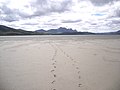 Footsteps in the sand - geograph.org.uk - 632175.jpg 640 × 480; 51 KB
-
 Foreshore at Tang Head - geograph.org.uk - 486845.jpg 640 × 480; 164 KB
-

-
 From Plockton Shore - geograph.org.uk - 6953.jpg 622 × 310; 94 KB
-
 From the track to Achinael - geograph.org.uk - 1193100.jpg 640 × 480; 126 KB
-
 Gedintailor from the beach - geograph.org.uk - 955236.jpg 640 × 483; 145 KB
-
 Geodha Smoo - geograph.org.uk - 237522.jpg 640 × 480; 91 KB
-
 Glas-leac Beag 1302392.jpg 640 × 480; 65 KB
-
 Glasnacardoch Bay - geograph.org.uk - 788355.jpg 640 × 480; 57 KB
-
 Halladale Estuary - geograph.org.uk - 166000.jpg 640 × 480; 70 KB
-
 Harrow Harbour at Low Tide - geograph.org.uk - 486843.jpg 640 × 480; 134 KB
-
 Holm Island at low tide - geograph.org.uk - 436919.jpg 640 × 480; 65 KB
-
 Inlet at Low Tide - geograph.org.uk - 393512.jpg 640 × 480; 75 KB
-
 Inlet in Loch Dunvegan - geograph.org.uk - 1224308.jpg 600 × 450; 332 KB
-
 Inside the cave, looking south - geograph.org.uk - 965337.jpg 484 × 640; 78 KB
-
 Islets joined at low tide - geograph.org.uk - 1492277.jpg 640 × 480; 60 KB
-

-
 Jetty at Camas Glas, low tide - geograph.org.uk - 1526728.jpg 640 × 480; 54 KB
-
 Kentra Bay at Low Tide - geograph.org.uk - 679110.jpg 640 × 480; 60 KB
-

-

-

-
 Kinloch Hourn - geograph.org.uk - 85652.jpg 640 × 480; 113 KB
-
 Kinlochaline, low water - geograph.org.uk - 716668.jpg 640 × 480; 63 KB
-
 Kyle of Durness - geograph.org.uk - 1135564.jpg 640 × 480; 68 KB
-
 Kyle of Durness - geograph.org.uk - 887746.jpg 640 × 359; 46 KB
-
 Lampayrocks.jpg 640 × 480; 102 KB
-
 Land meets sea at low tide - geograph.org.uk - 972643.jpg 640 × 480; 115 KB
-
 Landing at Glenelg - geograph.org.uk - 1210584.jpg 640 × 550; 99 KB
-
 Loch Beag - geograph.org.uk - 189609.jpg 640 × 480; 105 KB
-
 Loch Beag - geograph.org.uk - 974855.jpg 640 × 480; 156 KB
-
 Loch Bharcasaig, northern shore - geograph.org.uk - 1159008.jpg 640 × 480; 115 KB
-
 Loch Carron shoreline - geograph.org.uk - 1801322.jpg 640 × 480; 171 KB
-
 Loch Dunvegan - geograph.org.uk - 1224298.jpg 600 × 450; 304 KB
-
 Loch Dunvegan - geograph.org.uk - 1571365.jpg 640 × 480; 105 KB
-
 Loch Dunvegan at Low Tide - geograph.org.uk - 1445592.jpg 427 × 640; 78 KB
-
 Loch Eyre - geograph.org.uk - 1533710.jpg 640 × 425; 89 KB
-
 Loch Eyre - geograph.org.uk - 525509.jpg 640 × 425; 352 KB
-
 Loch Fleet sandbank - geograph.org.uk - 129082.jpg 547 × 382; 41 KB
-

-
 Loch Sligachan - geograph.org.uk - 1369655.jpg 640 × 480; 104 KB
-
 Lochan nam Meallan - geograph.org.uk - 821590.jpg 640 × 427; 251 KB
-
 Looking across Inverie Bay - geograph.org.uk - 1321408.jpg 640 × 480; 59 KB
-
 Looking for land - geograph.org.uk - 712449.jpg 640 × 480; 88 KB
-
 Low sun and tide - geograph.org.uk - 829597.jpg 480 × 640; 121 KB
-
 Low Tide - geograph.org.uk - 374868.jpg 640 × 482; 76 KB
-
 Low tide - geograph.org.uk - 592656.jpg 640 × 480; 171 KB
-

-
 Low tide at An Ruadh-eilean - geograph.org.uk - 829134.jpg 640 × 480; 75 KB
-
 Low tide at Ardtoe - geograph.org.uk - 502264.jpg 640 × 480; 66 KB
-
 Low tide at Arisaig - geograph.org.uk - 137054.jpg 640 × 480; 118 KB
-
 Low tide at Brora - geograph.org.uk - 1327984.jpg 640 × 480; 81 KB
-
 Low tide at Camas Glas - geograph.org.uk - 1526730.jpg 640 × 480; 98 KB
-
 Low tide at Cove - geograph.org.uk - 829440.jpg 480 × 640; 70 KB
-
 Low Tide at Dun Canna - geograph.org.uk - 243305.jpg 640 × 384; 74 KB
-
 Low tide at Isleornsay - geograph.org.uk - 2567665.jpg 480 × 640; 87 KB
-
 Low tide at Loch Hourn - geograph.org.uk - 189556.jpg 512 × 640; 118 KB
-
 Low Tide at Mellon Udrigle - geograph.org.uk - 987790.jpg 640 × 480; 31 KB
-
 Low Tide at Opinan - geograph.org.uk - 997476.jpg 640 × 417; 48 KB
-
 Low Tide at Plockton - geograph.org.uk - 97511.jpg 640 × 480; 65 KB
-
 Low Tide at Pontoon - geograph.org.uk - 393488.jpg 640 × 480; 80 KB
-
 Low tide at Sailean nan Cuileag - geograph.org.uk - 1528919.jpg 640 × 480; 132 KB
-
 Low tide at Sailean nan Cuileag - geograph.org.uk - 1528933.jpg 640 × 480; 101 KB
-
 Low tide at the head of Loch Duich - geograph.org.uk - 893952.jpg 640 × 480; 84 KB
-
 Low tide at Torrisdale Bay - geograph.org.uk - 922776.jpg 640 × 480; 32 KB
-
 Low Tide Gairloch Harbour - geograph.org.uk - 567274.jpg 640 × 427; 80 KB
-
 Low Tide in Loch Linnhe - geograph.org.uk - 987196.jpg 640 × 480; 63 KB
-
 Low tide in Plockton Bay - geograph.org.uk - 807956.jpg 640 × 480; 100 KB
-
 Low tide in Salen Bay - geograph.org.uk - 2448541.jpg 3,456 × 2,304; 4.22 MB
-

-
 Low tide near Drumancroy - geograph.org.uk - 606798.jpg 640 × 457; 35 KB
-
 Low tide near Inver - geograph.org.uk - 608072.jpg 640 × 458; 82 KB
-

-
 Low Tide on Loch Ainort - geograph.org.uk - 391046.jpg 640 × 480; 97 KB
-
 Low tide on Loch Kishorn - geograph.org.uk - 1800964.jpg 640 × 480; 96 KB
-
 Low tide on Loch Sligachan - geograph.org.uk - 1268900.jpg 640 × 480; 63 KB
-
 Low tide on the Moray Firth - geograph.org.uk - 955487.jpg 640 × 480; 182 KB
-
 Low tide on the shore of Loch Bharcasaig - geograph.org.uk - 965348.jpg 640 × 480; 118 KB
-
 Low tide on the Ullapool River - geograph.org.uk - 821714.jpg 640 × 480; 130 KB
-
 Low Tide Surf - geograph.org.uk - 2441912.jpg 2,812 × 1,943; 2.3 MB
-

-
 Manish Island - geograph.org.uk - 544314.jpg 640 × 480; 103 KB
-
 Meall Greepa - geograph.org.uk - 965352.jpg 640 × 467; 119 KB
-
 Mouth of Abhainn an Loin Mhoir - geograph.org.uk - 830336.jpg 640 × 480; 87 KB
-
 Mudflats near Dingwall - geograph.org.uk - 616484.jpg 640 × 480; 42 KB
-

-
 Mudflats west of the Cromarty Bridge - geograph.org.uk - 1448022.jpg 640 × 480; 59 KB
-
 Munlochy Bay - geograph.org.uk - 1247888.jpg 640 × 426; 76 KB
-
 North Channel - geograph.org.uk - 899572.jpg 640 × 480; 90 KB
-

-
 Northern tip of Pabay - geograph.org.uk - 1447258.jpg 640 × 480; 50 KB
-
 Nostie Bay - geograph.org.uk - 472927.jpg 640 × 418; 80 KB
-
 Onich Water - geograph.org.uk - 400161.jpg 640 × 480; 56 KB
-
 Oronsay from Ullinish point - geograph.org.uk - 223007.jpg 640 × 427; 86 KB
-

-
 Path to Sourlies - geograph.org.uk - 1515594.jpg 640 × 480; 105 KB
-
 Pier near Glenuig - geograph.org.uk - 72766.jpg 640 × 480; 134 KB
-
 Plockton at low tide - geograph.org.uk - 1257806.jpg 640 × 426; 109 KB
-
 Plockton at low tide - geograph.org.uk - 548569.jpg 640 × 117; 26 KB
-
 Plockton Bay - geograph.org.uk - 1587886.jpg 640 × 424; 77 KB
-
 Plockton Bay - geograph.org.uk - 1616004.jpg 640 × 350; 57 KB
-
 Poll nam Partan - geograph.org.uk - 833142.jpg 640 × 417; 73 KB
-
 Pool Roag - geograph.org.uk - 830326.jpg 640 × 480; 104 KB
-
 Portmahomack - geograph.org.uk - 1274312.jpg 640 × 382; 39 KB
-
 Portree at Low Tide - geograph.org.uk - 994455.jpg 640 × 414; 58 KB
-
 Portree Loch at low tide - geograph.org.uk - 1117415.jpg 640 × 480; 91 KB
-
 Rainbow over Loch Eyre - geograph.org.uk - 1775351.jpg 800 × 589; 261 KB
-
 Redpoint Beach, Low Tide - geograph.org.uk - 530125.jpg 640 × 427; 49 KB
-
 Reflections on Sandwood Beach - geograph.org.uk - 451934.jpg 640 × 427; 55 KB
-
 Reiff Bay, Low Tide - geograph.org.uk - 930805.jpg 640 × 427; 255 KB
-
 Reiff Bay, Low Tide - geograph.org.uk - 930806.jpg 640 × 427; 267 KB
-
 Reraig shore at low tide - geograph.org.uk - 1195867.jpg 640 × 480; 120 KB
-
 Ridge of sand at Sanna - geograph.org.uk - 1804651.jpg 3,264 × 2,448; 1.36 MB
-
 Road round Loch Beag - geograph.org.uk - 1033551.jpg 640 × 480; 116 KB
-
 Rock outcrop on An Aird - geograph.org.uk - 953389.jpg 640 × 480; 111 KB
-
 Rocks and seaweed - geograph.org.uk - 1571357.jpg 640 × 480; 152 KB
-
 Rocks at Low Tide - Neist Point - geograph.org.uk - 252043.jpg 640 × 480; 284 KB
-
 Rocks at Rubha Beag - geograph.org.uk - 1459198.jpg 640 × 385; 30 KB
-
 Rocks north of Ardban - geograph.org.uk - 1548342.jpg 640 × 460; 64 KB
-
 Rocks north of Rubha Ardnish - geograph.org.uk - 366632.jpg 640 × 425; 173 KB
-
 Rocks on the beach - geograph.org.uk - 953064.jpg 464 × 640; 133 KB
-
 Rocks south of Boreraig - geograph.org.uk - 495972.jpg 640 × 425; 417 KB
-
 Rocky Coastline by Sand - geograph.org.uk - 807252.jpg 640 × 480; 105 KB
-
 Rocky shore west of Lampay - geograph.org.uk - 1228571.jpg 600 × 450; 349 KB
-
 Rubha Aird Beithe - geograph.org.uk - 1528889.jpg 640 × 480; 84 KB
-
 Rubha Cruaidhlinn - geograph.org.uk - 895731.jpg 640 × 480; 231 KB


_low_tide_-_geograph.org.uk_-_1329955.jpg)


_-_geograph.org.uk_-_447549.jpg)


_-_geograph.org.uk_-_1143277.jpg)


