Category:Lustleigh
Jump to navigation
Jump to search
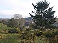
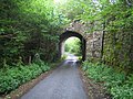
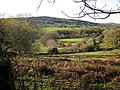
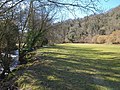
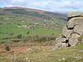
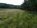
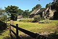
English: Lustleigh is a small village nestled in the Wrey Valley, inside the Dartmoor National Park in Devon, England. It sits between the towns of Bovey Tracey and Moretonhampstead.
village and civil parish in Devon, England, UK  | |||||
| Upload media | |||||
| Instance of | |||||
|---|---|---|---|---|---|
| Located in protected area | |||||
| Location | Teignbridge, Devon, South West England, England | ||||
 | |||||
Subcategories
This category has the following 11 subcategories, out of 11 total.
C
- Lustleigh Cleave (20 F)
- The Cleave, Lustleigh (3 F)
D
- Drakeford Bridge (5 F)
H
- Hisley Bridge (7 F)
K
- Kelly Mine, Devon (37 F)
L
- Lustleigh railway station (5 F)
- Lustleigh War Memorial (2 F)
M
T
Media in category "Lustleigh"
The following 200 files are in this category, out of 630 total.
(previous page) (next page)-
 A rabbiter setting a trap at Lustleigh, World War I, (ca 1918) (4836054716).jpg 5,052 × 4,008; 7.37 MB
-
 A382 approaching East Wray - geograph.org.uk - 3940257.jpg 1,600 × 1,052; 463 KB
-
 A382 at Kelly Cross - geograph.org.uk - 3940252.jpg 1,600 × 989; 490 KB
-
 A382 at Slade Cross - geograph.org.uk - 3940237.jpg 1,600 × 1,045; 358 KB
-
 A382 at Slade Cross - geograph.org.uk - 4231455.jpg 1,600 × 962; 962 KB
-
 A382 near Lustleigh - geograph.org.uk - 1290537.jpg 640 × 425; 63 KB
-
 A382 passing Castor Copse - geograph.org.uk - 3940239.jpg 1,600 × 1,048; 497 KB
-
 A382 passing Castor Copse - geograph.org.uk - 3940243.jpg 1,600 × 973; 510 KB
-
 Across the Bovey valley - geograph.org.uk - 3247738.jpg 640 × 470; 77 KB
-
 Apple tree in Lustleigh orchard (1521).jpg 4,288 × 2,848; 6.37 MB
-
 Apple tree in Lustleigh orchard (1524).jpg 4,288 × 2,848; 6.48 MB
-
 Apple tree, Lustleigh Town Orchard - geograph.org.uk - 6249552.jpg 4,288 × 2,848; 1.72 MB
-
 Apple trees, Lustleigh Town Orchard - geograph.org.uk - 6249554.jpg 4,030 × 2,816; 2.51 MB
-
 Apples in Lustleigh orchard (1522).jpg 4,288 × 2,848; 5.29 MB
-
 Apples in Lustleigh orchard (1523).jpg 4,288 × 2,848; 4.99 MB
-
 Apples in Lustleigh orchard (1527).jpg 4,288 × 2,848; 5.84 MB
-
 Approaching Ellimore Farm - geograph.org.uk - 2822093.jpg 640 × 454; 83 KB
-
 Approaching Foxworthy - geograph.org.uk - 3248738.jpg 640 × 501; 138 KB
-
 Approaching Trendlebere Down - geograph.org.uk - 2135531.jpg 640 × 459; 106 KB
-
 Area for forestry operations, Yeo Copse - geograph.org.uk - 6194647.jpg 1,600 × 1,200; 1.03 MB
-
 Barn at Kelly - geograph.org.uk - 678159.jpg 640 × 462; 126 KB
-
 Barn by the road at Hatherleigh - geograph.org.uk - 6194642.jpg 1,600 × 1,200; 1 MB
-
 Barns at Peck Farm - geograph.org.uk - 4535600.jpg 1,920 × 1,440; 721 KB
-
 Becka Brook - geograph.org.uk - 1086034.jpg 480 × 640; 136 KB
-
 Becka Brook in Houndtor Wood - geograph.org.uk - 5000521.jpg 640 × 480; 136 KB
-
 Belted Galloway, Hunter's Tor - geograph.org.uk - 6251520.jpg 4,022 × 2,486; 1.45 MB
-
 Belted Galloways, Hunter's Tor - geograph.org.uk - 6251527.jpg 4,282 × 2,703; 2.6 MB
-
 Belted Galloways, Hunter's Tor - geograph.org.uk - 6251568.jpg 4,288 × 2,848; 2.23 MB
-
 Bench beside Lustleigh churchyard - geograph.org.uk - 6263804.jpg 1,200 × 1,600; 1.05 MB
-
 Black Hill from near Heaven's Gate - geograph.org.uk - 6249688.jpg 2,275 × 1,684; 709 KB
-
 Boardwalk across marshy ground - geograph.org.uk - 6262887.jpg 1,600 × 1,200; 1.02 MB
-
 Boulders above Lustleigh Cleave - geograph.org.uk - 3246786.jpg 640 × 480; 131 KB
-
 Boulders in a field - geograph.org.uk - 2108485.jpg 1,600 × 1,200; 695 KB
-
 Boulders in Town Orchard, Lustleigh - geograph.org.uk - 3245637.jpg 480 × 640; 113 KB
-
 Boulders in Town Orchard, Lustleigh - geograph.org.uk - 3245725.jpg 640 × 480; 90 KB
-
 Boulders, near Lustleigh Cleave - geograph.org.uk - 1195120.jpg 640 × 480; 143 KB
-
 Boulders, on Sharpitor - geograph.org.uk - 1197113.jpg 640 × 480; 134 KB
-
 Boulders, Town Orchard, Lustleigh - geograph.org.uk - 1084284.jpg 640 × 480; 93 KB
-
 Bovey Tracey, Lower Knowle Road - geograph.org.uk - 437409.jpg 640 × 480; 144 KB
-
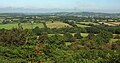
 Bovey valley - geograph.org.uk - 2135614.jpg 640 × 457; 101 KB
-
 Bovey valley - geograph.org.uk - 3248607.jpg 640 × 480; 96 KB
-
 Bovey valley - geograph.org.uk - 3248642.jpg 640 × 480; 105 KB
-
 Bovey valley - geograph.org.uk - 3248732.jpg 640 × 480; 104 KB
-
 Bovey valley - geograph.org.uk - 3726276.jpg 2,047 × 1,366; 633 KB
-
 Bovey valley at Foxworthy - geograph.org.uk - 5676277.jpg 1,200 × 1,600; 835 KB
-
 Bovey valley at Neadon - geograph.org.uk - 6250330.jpg 4,137 × 2,574; 1.36 MB
-
 Bovey valley at Neadon - geograph.org.uk - 6250338.jpg 3,824 × 2,305; 1.24 MB
-
 Bovey valley below Hisley bridge - geograph.org.uk - 132062.jpg 640 × 480; 109 KB
-
 Bovey valley below Hisley Bridge - geograph.org.uk - 2135897.jpg 640 × 465; 114 KB
-
 Bovey valley near Foxworthy - geograph.org.uk - 6250325.jpg 3,645 × 2,322; 1.17 MB
-
 Bovey valley west of Hunters Tor - geograph.org.uk - 5676274.jpg 1,600 × 1,200; 729 KB
-
 Bovey valley, viewed from Sharpitor - geograph.org.uk - 1197146.jpg 640 × 480; 86 KB
-
 Boveycombe Farmstead - geograph.org.uk - 5628105.jpg 1,600 × 1,067; 1.27 MB
-
 Bridge abutment, Lower Knowle Road - geograph.org.uk - 3312847.jpg 640 × 472; 131 KB
-

-
 Bridge over Becka Brook - geograph.org.uk - 2140863.jpg 1,024 × 683; 297 KB
-
 Bridge over River Bovey - geograph.org.uk - 4884440.jpg 1,600 × 1,200; 681 KB
-
 Bridge, Lower Knowle Road - geograph.org.uk - 3298096.jpg 640 × 480; 104 KB
-
 Bridge, Lower Knowle Road - geograph.org.uk - 3298164.jpg 480 × 640; 109 KB
-
 Bridleway above Peck Farm - geograph.org.uk - 6250344.jpg 4,288 × 2,848; 2.46 MB
-
 Bridleway alongside Yarner Wood - geograph.org.uk - 3171884.jpg 640 × 427; 266 KB
-
 Bridleway at Lustleigh - geograph.org.uk - 1983864.jpg 640 × 480; 129 KB
-
 Bridleway from Foxworthy - geograph.org.uk - 3248769.jpg 480 × 640; 129 KB
-
 Bridleway junction, Lustleigh Cleave - geograph.org.uk - 1762332.jpg 640 × 480; 165 KB
-
 Bridleway near Sharpitor - geograph.org.uk - 6251577.jpg 4,288 × 2,848; 2.29 MB
-
 Bridleway on Lustleigh Cleave - geograph.org.uk - 1762243.jpg 480 × 640; 148 KB
-
 Bridleway on Lustleigh Cleave - geograph.org.uk - 1762292.jpg 640 × 480; 131 KB
-
 Bridleway on Lustleigh Cleave - geograph.org.uk - 1762506.jpg 480 × 640; 159 KB
-
 Bridleway to Foxworthy - geograph.org.uk - 3248695.jpg 485 × 640; 110 KB
-
 Bridleway to road near Yarner Wells - geograph.org.uk - 3172012.jpg 640 × 427; 226 KB
-
 Bridleway to the cleave - geograph.org.uk - 3246675.jpg 640 × 480; 135 KB
-
 Bridleway, Foxworthy - geograph.org.uk - 6250250.jpg 4,288 × 2,848; 2 MB
-
 Bridleway, Lustleigh Cleave - geograph.org.uk - 3246853.jpg 640 × 480; 141 KB
-
 Bridleway, Lustleigh Cleave - geograph.org.uk - 3246878.jpg 640 × 426; 126 KB
-
 Bridleway, Lustleigh Cleave - geograph.org.uk - 3247701.jpg 640 × 434; 82 KB
-
 Bridleway, Lustleigh Cleave - geograph.org.uk - 6250145.jpg 4,288 × 2,848; 2.37 MB
-
 Bridleway, Lustleigh Cleave - geograph.org.uk - 6250199.jpg 4,288 × 2,848; 2.76 MB
-

-
 Brinning Cross - geograph.org.uk - 4142191.jpg 1,920 × 1,440; 664 KB
-
 Buildings at Barne Court - geograph.org.uk - 3473731.jpg 640 × 480; 79 KB
-

-
 By the Bovey - geograph.org.uk - 1761735.jpg 640 × 480; 131 KB
-
 By the Wray Brook - geograph.org.uk - 1228417.jpg 640 × 480; 87 KB
-
 Byway beside Higher Knowle Wood - geograph.org.uk - 5000496.jpg 640 × 480; 159 KB
-
 Byway to road near Hatherleigh - geograph.org.uk - 5092151.jpg 1,600 × 1,067; 764 KB
-
 Camellia by Lower Knowle Road - geograph.org.uk - 4361591.jpg 1,920 × 2,313; 1.29 MB
-
 Car leaving the parking area - geograph.org.uk - 6033760.jpg 1,024 × 768; 222 KB
-
 Car park on Dartmoor - geograph.org.uk - 5243436.jpg 640 × 480; 55 KB
-
 Casely Cleave - geograph.org.uk - 1984570.jpg 640 × 414; 82 KB
-
 Cattle at Hunter's Tor - geograph.org.uk - 6251364.jpg 4,288 × 2,848; 2.74 MB
-
 Cattle, Trendlebere Down - geograph.org.uk - 4688078.jpg 2,000 × 1,333; 2.53 MB
-
 Cemetery, Lustleigh - geograph.org.uk - 1763890.jpg 640 × 480; 100 KB
-
 Clam bridge, River Bovey (2) - geograph.org.uk - 1084485.jpg 640 × 480; 116 KB
-
 Clam bridge, River Bovey - geograph.org.uk - 1084453.jpg 480 × 640; 134 KB
-
 Combe, Trendlebere Down - geograph.org.uk - 2135581.jpg 640 × 452; 105 KB
-
 Cottage by A382 at Kelly - geograph.org.uk - 6263785.jpg 1,600 × 1,200; 1.09 MB
-
 Cottage in Lustleigh churchyard (1507).jpg 4,288 × 2,848; 6.23 MB
-
 Cottage, Lustleigh - geograph.org.uk - 3555054.jpg 477 × 640; 93 KB
-
 Cottages at Lustleigh - geograph.org.uk - 3555087.jpg 640 × 474; 77 KB
-
 Cottages at Pethybridge (geograph 6249663).jpg 3,847 × 2,721; 1.89 MB
-
 Cottages near Barnecourt - geograph.org.uk - 6251157.jpg 1,996 × 1,164; 567 KB
-
 Cottages, Lustleigh - geograph.org.uk - 6249519.jpg 3,901 × 2,790; 1.51 MB
-
 Countryside around Barne Cross - geograph.org.uk - 6251129.jpg 2,631 × 1,594; 684 KB
-
 Countryside around Barnecourt - geograph.org.uk - 6251151.jpg 3,852 × 2,026; 1.3 MB
-
 Countryside near Lustleigh - geograph.org.uk - 1763299.jpg 640 × 442; 97 KB
-
 Countryside near North Bovey - geograph.org.uk - 6251160.jpg 1,392 × 660; 134 KB
-
 Cricket ground, Lustleigh - geograph.org.uk - 1983855.jpg 640 × 454; 109 KB
-
 Cross and cottages, Lustleigh - geograph.org.uk - 5664483.jpg 1,024 × 685; 176 KB
-
 Dartmoor views - geograph.org.uk - 1562483.jpg 640 × 480; 97 KB
-
 Dartmoor Way approaching Dickford Bridge - geograph.org.uk - 163061.jpg 640 × 480; 151 KB
-
-
 Dartmoor, Trendlebere Down - geograph.org.uk - 436388.jpg 640 × 480; 122 KB
-
 Dickford Bridge - geograph.org.uk - 5676064.jpg 1,600 × 1,200; 873 KB
-
 Dismantled railway bridge - geograph.org.uk - 5092169.jpg 1,600 × 1,067; 921 KB
-
 Disused postbox, Lustleigh - geograph.org.uk - 3245077.jpg 460 × 640; 67 KB
-
 Disused railway bridge - geograph.org.uk - 2141408.jpg 1,024 × 683; 297 KB
-
 Disused railway bridge over Lower Knowle Road - geograph.org.uk - 4884379.jpg 1,600 × 1,200; 518 KB
-
 Disused railway bridge, Knowle - geograph.org.uk - 4361340.jpg 1,920 × 1,440; 982 KB
-
 Disused track, now footpath, Wrayland Barn, Lustleigh - geograph.org.uk - 6262882.jpg 1,200 × 1,600; 1.02 MB
-
 Dog's Mercury near the Bovey - geograph.org.uk - 1761664.jpg 530 × 640; 109 KB
-
 Double arch railway bridge near Knowle - geograph.org.uk - 4884393.jpg 1,600 × 1,200; 658 KB
-
 Drive and field at Hammerslake - geograph.org.uk - 3246416.jpg 640 × 480; 104 KB
-
 Dry stone wall, Lustleigh Cleave - geograph.org.uk - 3246891.jpg 640 × 444; 138 KB
-
 Ducks and Geese by a pond - geograph.org.uk - 4200611.jpg 640 × 480; 201 KB
-
 Early April View near Higher Knowle Wood - geograph.org.uk - 2395083.jpg 1,024 × 577; 188 KB
-
 Easdon Down from Hunter's Tor - geograph.org.uk - 162848.jpg 640 × 480; 103 KB
-
 Edge of Lustleigh Cleave - geograph.org.uk - 1763262.jpg 640 × 480; 142 KB
-
 Ellimore Farm - geograph.org.uk - 1197667.jpg 640 × 480; 106 KB
-
 Ellimore Farm - geograph.org.uk - 2822292.jpg 480 × 640; 122 KB
-
 Entrance to the farm at New Barn and Southlands Farm - geograph.org.uk - 5676072.jpg 1,600 × 1,200; 868 KB
-
 Erratic boulder, near Ellimore - geograph.org.uk - 1197661.jpg 640 × 480; 134 KB
-
-
 Fallen Trees in Higher Knowle Wood - geograph.org.uk - 2395046.jpg 1,024 × 577; 325 KB
-
 Farm buildings at Barnecourt - geograph.org.uk - 5123413.jpg 1,600 × 1,598; 1 MB
-
 Farm buildings, Plumley - geograph.org.uk - 1984684.jpg 640 × 401; 99 KB
-
 Farm road to Willmead - geograph.org.uk - 256419.jpg 640 × 485; 111 KB
-
 Farm track to Plumley - geograph.org.uk - 1984718.jpg 477 × 640; 121 KB
-
 Farmyard at Barnecourt - geograph.org.uk - 5123421.jpg 1,600 × 1,156; 742 KB
-
 Field above Hammerslake - geograph.org.uk - 1763274.jpg 640 × 480; 97 KB
-
 Field above Lustleigh - geograph.org.uk - 4906580.jpg 1,920 × 1,280; 864 KB
-
 Field above the Bovey - geograph.org.uk - 1761694.jpg 640 × 480; 120 KB
-
 Field above the Wray Brook - geograph.org.uk - 1764148.jpg 640 × 480; 93 KB
-
 Field above the Wray Brook - geograph.org.uk - 1764201.jpg 640 × 480; 106 KB
-
 Field access and footpath gate at Foxworthy - geograph.org.uk - 5676281.jpg 1,600 × 1,200; 820 KB
-
 Field and view west from Barnecourt - geograph.org.uk - 5676077.jpg 1,600 × 1,200; 737 KB
-
 Field at Lower Combe - geograph.org.uk - 1763383.jpg 640 × 480; 93 KB
-
 Field at Lower Knowle - geograph.org.uk - 3312936.jpg 640 × 454; 90 KB
-
 Field below Hunter's Tor - geograph.org.uk - 6250258.jpg 4,288 × 2,848; 2.24 MB
-
 Field below Rudge - geograph.org.uk - 1764130.jpg 640 × 480; 104 KB
-
 Field boundary near the Bovey - geograph.org.uk - 3248659.jpg 640 × 467; 132 KB
-
 Field by River Bovey - geograph.org.uk - 4884403.jpg 1,600 × 1,200; 656 KB
-
 Field by the bridleway to Foxworthy - geograph.org.uk - 3248584.jpg 640 × 464; 90 KB
-
 Field near Hisley - geograph.org.uk - 1086154.jpg 640 × 480; 143 KB
-
 Field near Kelly - geograph.org.uk - 678157.jpg 640 × 480; 96 KB
-
 Field near Lustleigh - geograph.org.uk - 1290568.jpg 640 × 413; 67 KB
-
 Field near Lustleigh - geograph.org.uk - 3245920.jpg 640 × 480; 89 KB
-
 Field near Lustleigh - geograph.org.uk - 6251645.jpg 4,288 × 2,848; 2.17 MB
-
 Field near Narramore - geograph.org.uk - 4142161.jpg 1,920 × 1,269; 831 KB
-
 Field north of Foxworthy - geograph.org.uk - 3248724.jpg 640 × 480; 100 KB
-
 Field south of the valley of Dickford Water - geograph.org.uk - 5676066.jpg 1,600 × 1,200; 793 KB
-
 Field, Fursdon - geograph.org.uk - 4142179.jpg 1,920 × 1,400; 620 KB
-
 Field, Lustleigh - geograph.org.uk - 6252599.jpg 4,277 × 2,596; 1.39 MB
-
 Fields at Hisley (2) - geograph.org.uk - 1086173.jpg 640 × 444; 99 KB
-
 Fields at Hisley - geograph.org.uk - 1086163.jpg 640 × 480; 128 KB
-
 Fields near South Harton farm - geograph.org.uk - 162815.jpg 640 × 480; 103 KB
-
 Flood precautions in Pullabrook Wood - geograph.org.uk - 4884518.jpg 1,600 × 1,200; 669 KB
-
 Following a path near Lustleigh - geograph.org.uk - 3245878.jpg 480 × 640; 96 KB
-

-
 Footbridge over River Bovey - geograph.org.uk - 4884438.jpg 1,600 × 1,200; 686 KB
-
 Footpath across the field, near Kelly - geograph.org.uk - 6262888.jpg 1,600 × 1,200; 1,011 KB
-

-
 Footpath at Narramore (2) - geograph.org.uk - 1466181.jpg 480 × 640; 147 KB
-
 Footpath at Narramore - geograph.org.uk - 1466036.jpg 640 × 480; 143 KB
-

-
 Footpath by River Bovey in Hisley Wood - geograph.org.uk - 4884416.jpg 1,200 × 1,600; 706 KB
-
 Footpath in Pullabrook Wood - geograph.org.uk - 4884505.jpg 1,200 × 1,600; 697 KB
-
 Footpath into Higher Knowle Wood - geograph.org.uk - 3424020.jpg 640 × 427; 195 KB
-
 Footpath leaving lane near Lustleigh - geograph.org.uk - 1764105.jpg 497 × 640; 145 KB
-
 Footpath near Lustleigh - geograph.org.uk - 1290558.jpg 640 × 480; 140 KB
-
 Footpath sign by Beech Cottage - geograph.org.uk - 5676079.jpg 1,600 × 1,200; 766 KB
-
 Footpath sign near Hammerslake - geograph.org.uk - 2823203.jpg 640 × 480; 113 KB
-
 Footpath to Kelly Cross - geograph.org.uk - 5092190.jpg 1,600 × 1,067; 597 KB
-
 Footpath to Lower Combe - geograph.org.uk - 3245953.jpg 640 × 480; 144 KB
-
 Ford at Clapper Bridge - geograph.org.uk - 5123375.jpg 1,600 × 1,200; 837 KB
-
 Former quarry on Hunters Tor - geograph.org.uk - 5676275.jpg 1,200 × 1,600; 855 KB
-
 Former railway bridge, Lustleigh - geograph.org.uk - 6262868.jpg 1,200 × 1,600; 1.08 MB
-
 Former railway line by Lower Knowle Road - geograph.org.uk - 3726376.jpg 2,048 × 1,536; 806 KB
-
 Foxworthy and the River Bovey - geograph.org.uk - 2110450.jpg 1,600 × 1,200; 712 KB
-
 Foxworthy Barn (geograph 6250207).jpg 4,288 × 2,848; 2.3 MB
-
 Foxworthy Farmhouse - geograph.org.uk - 6250241.jpg 3,896 × 2,601; 1.51 MB
-
 Foxworthy Farmhouse - geograph.org.uk - 6250243.jpg 4,288 × 2,848; 2.08 MB
-
 Foxworthy Mill - geograph.org.uk - 742563.jpg 480 × 640; 137 KB
-
 Free range hens at Ellimore - geograph.org.uk - 5473371.jpg 2,340 × 1,457; 997 KB
-
 Fungus, Lustleigh Cleave - geograph.org.uk - 6250135.jpg 4,288 × 2,848; 2.04 MB
-
 Gate and field near Narramore Farm - geograph.org.uk - 1228464.jpg 640 × 480; 111 KB
-
 Gate and track, Hisley - geograph.org.uk - 1086178.jpg 640 × 496; 140 KB
-
 Gate and wall and view, Lustleigh - geograph.org.uk - 1763422.jpg 640 × 480; 110 KB
-
 Gate by the Bovey - geograph.org.uk - 3312816.jpg 640 × 480; 137 KB
-
 Gate in woodland on Hunters Tor - geograph.org.uk - 5676271.jpg 1,200 × 1,600; 874 KB
-
 Gatepiers, Lustleigh - geograph.org.uk - 6252605.jpg 3,448 × 1,905; 805 KB
_(4836054716).jpg)


.jpg)
.jpg)


.jpg)
.jpg)
.jpg)


_-_geograph.org.uk_-_1084485.jpg)


.jpg)


.jpg)


_-_geograph.org.uk_-_1086173.jpg)


_-_geograph.org.uk_-_1466181.jpg)


.jpg)


