Category:Lydford
Jump to navigation
Jump to search
English: Lydford, sometimes spelled Lidford, is a village, once an important town, in Devon situated six miles (13 km) north of Tavistock on the western fringe of Dartmoor in the West Devon district, 27 m. North of Plymouth.
village in Devon, England, UK  L'église paroissiale | |||||
| Upload media | |||||
| Instance of | |||||
|---|---|---|---|---|---|
| Located in protected area | |||||
| Location | West Devon, Devon, South West England, England | ||||
 | |||||
Subcategories
This category has the following 5 subcategories, out of 5 total.
L
- St Petrock's Church, Lydford (11 F)
- Lydford Castle (17 F)
- Lydford railway station (5 F)
W
Media in category "Lydford"
The following 200 files are in this category, out of 520 total.
(previous page) (next page)-
 A386 at Watervale - geograph.org.uk - 2902958.jpg 800 × 600; 338 KB
-
 A386 heading north - geograph.org.uk - 3462971.jpg 640 × 480; 73 KB
-
 A386 heading north - geograph.org.uk - 3462975.jpg 640 × 480; 63 KB
-
 A386 heading north - geograph.org.uk - 3462977.jpg 640 × 480; 105 KB
-
 Access for Lydford Forest - geograph.org.uk - 4349604.jpg 1,600 × 1,054; 602 KB
-
 Access land near Willsworthy Camp - geograph.org.uk - 2452642.jpg 640 × 424; 206 KB
-
 Access track - Lydford Forest - geograph.org.uk - 4126651.jpg 1,600 × 1,086; 728 KB
-
 Access track - Lydford Forest - geograph.org.uk - 4126715.jpg 1,600 × 1,040; 731 KB
-
 Access track for Lydford Forest - geograph.org.uk - 4101707.jpg 1,600 × 1,094; 493 KB
-
 Alluvial deposition in Lydford Gorge - geograph.org.uk - 1913412.jpg 640 × 480; 144 KB
-
 Arms Tor - geograph.org.uk - 4266303.jpg 1,920 × 2,333; 1.52 MB
-
 Arms Tor - geograph.org.uk - 4424881.jpg 800 × 532; 135 KB
-
 Arms Tor from the north - geograph.org.uk - 4266232.jpg 1,920 × 1,222; 714 KB
-
 Bleak House - geograph.org.uk - 4425089.jpg 800 × 532; 154 KB
-
 Bog above Rattle Brook valley - geograph.org.uk - 4267078.jpg 1,920 × 1,320; 854 KB
-
 Bog by the Lyd - geograph.org.uk - 4274921.jpg 1,920 × 2,329; 1.79 MB
-
 Bog by the Lyd - geograph.org.uk - 4275042.jpg 1,920 × 1,380; 1.2 MB
-
 Bog Pimpernel above the Lyd - geograph.org.uk - 4275103.jpg 1,920 × 1,614; 811 KB
-
 Boundary at Lydford - geograph.org.uk - 2439116.jpg 640 × 427; 222 KB
-

-
 Boundary near Nodden Gate - geograph.org.uk - 2439127.jpg 640 × 454; 246 KB
-
 Boundary stone near Dick's Well - geograph.org.uk - 1358397.jpg 480 × 640; 296 KB
-
 Boundary stone near Dick's Well - geograph.org.uk - 2441181.jpg 640 × 428; 220 KB
-
 Boundary stone near Dick's Well - geograph.org.uk - 2441184.jpg 640 × 460; 257 KB
-
 Boundary Stone, Higher Dunna Goat - geograph.org.uk - 1557995.jpg 640 × 427; 88 KB
-
 Brat Tor and Great Links Tor.jpg 3,836 × 2,788; 2.38 MB
-
 Brat Tor to Kit Hill.jpg 3,923 × 2,728; 3.21 MB
-
 Brat Tor.jpg 4,288 × 2,848; 2.45 MB
-

-
 Bridge near Bleak House - geograph.org.uk - 4266834.jpg 1,920 × 2,560; 1.57 MB
-
 Bridge over former LSWR line - geograph.org.uk - 2895590.jpg 800 × 799; 427 KB
-
 Bridge over River Burn - geograph.org.uk - 4478955.jpg 1,600 × 1,067; 1.11 MB
-
 Bridleway - geograph.org.uk - 4424826.jpg 800 × 532; 146 KB
-
 Bridleway - geograph.org.uk - 4424836.jpg 800 × 625; 180 KB
-
 Bridleway crossing High Down - geograph.org.uk - 4420670.jpg 800 × 532; 153 KB
-
 Bridleway east of Arms Tor - geograph.org.uk - 4266729.jpg 1,920 × 1,337; 819 KB
-
 Bridleway east of Arms Tor - geograph.org.uk - 4266757.jpg 1,920 × 1,305; 845 KB
-
 Bridleway heading towards Dick's Well - geograph.org.uk - 4424954.jpg 800 × 532; 200 KB
-
 Bridleway near Dick's Well - geograph.org.uk - 4267001.jpg 1,920 × 1,250; 729 KB
-
 Bridleway to Lydford - geograph.org.uk - 3933277.jpg 1,024 × 768; 150 KB
-
 Brook at Watervale - geograph.org.uk - 2452637.jpg 640 × 448; 268 KB
-
-
 Buildings near Lydford gorge - geograph.org.uk - 3444867.jpg 640 × 480; 185 KB
-
 Cairn south of Sharp Tor - geograph.org.uk - 1738966.jpg 1,024 × 683; 171 KB
-
 Captain's House, Foxhole Mine - geograph.org.uk - 1559545.jpg 640 × 427; 78 KB
-
 Captain's House, Foxhole Mine - geograph.org.uk - 1559570.jpg 640 × 427; 90 KB
-
 Captain's House, Foxhole Tin Mine - geograph.org.uk - 4268493.jpg 1,920 × 1,186; 737 KB
-

-
 Car park, High Down - geograph.org.uk - 4275332.jpg 1,920 × 1,305; 685 KB
-
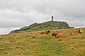
 Cattle, Rattlebrook Hill - geograph.org.uk - 4267664.jpg 1,920 × 1,195; 612 KB
-
 Cattle, Rattlebrook Hill - geograph.org.uk - 4267810.jpg 1,920 × 1,157; 587 KB
-
 Chat Tor - Dartmoor - geograph.org.uk - 135730.jpg 640 × 425; 145 KB
-
 Chat Tor.jpg 4,288 × 2,848; 2.56 MB
-
 Clear land - Lydford Forest - geograph.org.uk - 4126713.jpg 1,600 × 1,054; 725 KB
-
 Clitter, Doetor Brook valley - geograph.org.uk - 4268105.jpg 1,920 × 1,363; 943 KB
-
 Cottages in Lydford - geograph.org.uk - 319519.jpg 640 × 480; 91 KB
-

-
 Dartmoor in the distance - geograph.org.uk - 2905873.jpg 640 × 437; 69 KB
-
 Dartmoor Pony Foal - geograph.org.uk - 3440531.jpg 1,024 × 768; 451 KB
-
 Dartmoor, Brat Tor (eastern slopes) - geograph.org.uk - 1015916.jpg 640 × 480; 92 KB
-
 Dartmoor, Doe Tor - geograph.org.uk - 1015935.jpg 640 × 480; 65 KB
-

-
 Derelict Building - geograph.org.uk - 3440515.jpg 1,024 × 768; 413 KB
-
 Derelict building near Doe Tor - geograph.org.uk - 1559696.jpg 640 × 427; 82 KB
-
 Dick's Well - geograph.org.uk - 1358394.jpg 480 × 640; 290 KB
-
 Dick's Well - geograph.org.uk - 4266976.jpg 1,920 × 1,440; 1.1 MB
-
 Dick's Well - geograph.org.uk - 4424987.jpg 800 × 532; 217 KB
-
 Distant view - Warston Barton Farm - geograph.org.uk - 4126720.jpg 1,600 × 1,063; 517 KB
-
 Doe Tor - geograph.org.uk - 1559676.jpg 640 × 427; 78 KB
-
 Doe Tor - geograph.org.uk - 4273908.jpg 1,920 × 1,243; 818 KB
-
 Doe Tor - geograph.org.uk - 4273912.jpg 1,876 × 1,155; 705 KB
-
 Doe Tor Cist - geograph.org.uk - 1559658.jpg 640 × 427; 90 KB
-
 Doe Tor Farm - geograph.org.uk - 1559714.jpg 640 × 427; 97 KB
-
 Doetor Brook - geograph.org.uk - 1559631.jpg 640 × 427; 72 KB
-
 Doetor Brook - geograph.org.uk - 3440469.jpg 1,024 × 768; 455 KB
-
 Doetor Brook - geograph.org.uk - 3440502.jpg 1,024 × 768; 427 KB
-
 Doetor Brook - geograph.org.uk - 4266906.jpg 1,920 × 2,560; 1.34 MB
-
 Doetor Brook - geograph.org.uk - 4273846.jpg 1,920 × 2,507; 1.4 MB
-
 Doetor Brook - geograph.org.uk - 4273851.jpg 1,920 × 2,354; 1.25 MB
-
 Doetor Brook - geograph.org.uk - 4273875.jpg 1,920 × 2,408; 1.46 MB
-
 Doetor Brook - geograph.org.uk - 4273894.jpg 1,920 × 1,396; 906 KB
-
 Doetor Brook Falls - geograph.org.uk - 1559753.jpg 640 × 427; 112 KB
-
 Doetor Brook valley - geograph.org.uk - 4268029.jpg 1,920 × 1,286; 814 KB
-
 Doetor Brook valley - geograph.org.uk - 4268133.jpg 1,920 × 1,328; 821 KB
-
 Doetor Brook valley - geograph.org.uk - 4273943.jpg 1,918 × 1,251; 787 KB
-
 Doetor Common - geograph.org.uk - 4274125.jpg 1,920 × 1,433; 726 KB
-
 Doetor Common - geograph.org.uk - 4274139.jpg 1,920 × 1,335; 611 KB
-
 Downward track - Down Wood - geograph.org.uk - 4349627.jpg 1,024 × 655; 300 KB
-
 Downward track - Down Wood - geograph.org.uk - 4349630.jpg 1,600 × 1,046; 878 KB
-
 Downward track - Down Wood - geograph.org.uk - 4349631.jpg 1,600 × 1,073; 839 KB
-
 Eastern Cleave Wood, Lydford - geograph.org.uk - 3929152.jpg 1,536 × 1,152; 1.21 MB
-
 Ebsworthy Plantation - geograph.org.uk - 4126725.jpg 1,600 × 1,056; 695 KB
-
 Edge of the moor, Doetor Farm - geograph.org.uk - 4274487.jpg 1,920 × 1,396; 1.01 MB
-
 Entering Lydford Forest - geograph.org.uk - 4126616.jpg 1,600 × 960; 528 KB
-
 Entry to Dartmoor - geograph.org.uk - 135721.jpg 640 × 425; 132 KB
-
 Excavated Gulley - geograph.org.uk - 3516420.jpg 1,024 × 768; 445 KB
-
 Farmland north of Lydford Forest - geograph.org.uk - 4349640.jpg 1,600 × 1,063; 486 KB
-
 Feeder stream of the Lyd - geograph.org.uk - 4424818.jpg 800 × 532; 190 KB
-
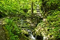
 Fern, Lydford Gorge - geograph.org.uk - 4052261.jpg 1,920 × 2,593; 1.69 MB
-
 Ferns by the Granite Way - geograph.org.uk - 4275660.jpg 1,920 × 1,440; 1.05 MB
-
 Field near Lydford - geograph.org.uk - 316837.jpg 640 × 480; 124 KB
-
 First view of Bleak House - geograph.org.uk - 2440717.jpg 640 × 449; 255 KB
-
 Flickr - don macauley - Cross in Dartmoor.jpg 3,648 × 2,736; 3.3 MB
-
 Footbridge over Doetor Brook - geograph.org.uk - 3737147.jpg 480 × 640; 106 KB
-
 Footbridge over R. Lyd, High Down - geograph.org.uk - 3737121.jpg 640 × 480; 91 KB
-
 Footbridge over the Lyd - geograph.org.uk - 5472685.jpg 1,600 × 1,067; 942 KB
-
 Footbridge over the Lyd - geograph.org.uk - 621933.jpg 640 × 427; 60 KB
-
 Footbridge, Lydford Gorge - geograph.org.uk - 4291870.jpg 1,920 × 2,560; 1.42 MB
-
 Footpath crossing enclosed land - geograph.org.uk - 4427422.jpg 800 × 532; 143 KB
-
 Footpath in Lydford - geograph.org.uk - 3925559.jpg 1,152 × 1,536; 1.42 MB
-
 Ford across the River Lyd - geograph.org.uk - 2441224.jpg 640 × 394; 243 KB
-
 Forest colours - Lydford Forest - geograph.org.uk - 4349629.jpg 1,600 × 1,103; 933 KB
-
 Forestry track in Lydford Forest - geograph.org.uk - 4126645.jpg 1,600 × 1,041; 516 KB
-
 Forestry track in Lydford Forest - geograph.org.uk - 4126655.jpg 1,600 × 986; 569 KB
-
 Forestry track in Lydford Forest - geograph.org.uk - 4126657.jpg 1,600 × 1,058; 647 KB
-
 Foxgloves, Doe Tor Farm - geograph.org.uk - 4274685.jpg 1,920 × 2,456; 1.3 MB
-
 Foxhole Mine - geograph.org.uk - 1559595.jpg 640 × 427; 80 KB
-
 Foxhole Mine Captain's House - geograph.org.uk - 1561399.jpg 640 × 427; 83 KB
-
 Fungi on cowpat, Rattlebrook Hill - geograph.org.uk - 4267889.jpg 1,920 × 1,367; 798 KB
-
 Gate near Doe Tor Farm - geograph.org.uk - 4274767.jpg 1,920 × 1,361; 847 KB
-
 Gate near the Lyd - geograph.org.uk - 4274893.jpg 1,920 × 1,440; 939 KB
-
 Gateway to Willsworthy Ranges - geograph.org.uk - 3410949.jpg 640 × 480; 78 KB
-
 Gloomy track - Lydford Forest - geograph.org.uk - 4126648.jpg 1,600 × 1,021; 566 KB
-

-
 Granite Way at Lydford - geograph.org.uk - 4275435.jpg 1,920 × 2,560; 1.57 MB
-
 Granite Way at Lydford - geograph.org.uk - 4275549.jpg 1,920 × 1,440; 995 KB
-
 Granite Way north of Lydford - geograph.org.uk - 4275770.jpg 1,920 × 1,440; 839 KB
-
 Grazing, High Down - geograph.org.uk - 3462974.jpg 640 × 480; 72 KB
-
 Grazing, Higher Beardon - geograph.org.uk - 3462970.jpg 640 × 480; 114 KB
-
 High Down - geograph.org.uk - 1559814.jpg 640 × 427; 50 KB
-
 High Down - geograph.org.uk - 4275177.jpg 1,920 × 1,246; 607 KB
-
 High Down car park - geograph.org.uk - 1559435.jpg 640 × 427; 74 KB
-
 High Moorland - geograph.org.uk - 4424861.jpg 800 × 532; 141 KB
-
 High view of the Lyd valley - geograph.org.uk - 4349617.jpg 1,600 × 1,043; 638 KB
-
 High view of the Lyd valley - geograph.org.uk - 4349619.jpg 1,024 × 668; 240 KB
-
 Highdown - Dartmoor - geograph.org.uk - 136155.jpg 640 × 425; 104 KB
-
 Higher Beardon Farm - geograph.org.uk - 2902960.jpg 800 × 600; 289 KB
-
 Higher Beardon Farm - geograph.org.uk - 3207705.jpg 1,024 × 768; 518 KB
-
 Houses on School Road - Lydford - geograph.org.uk - 4101713.jpg 1,024 × 647; 130 KB
-
 In Lydford Gorge (1) - geograph.org.uk - 3933161.jpg 1,152 × 1,536; 1.56 MB
-
 In Lydford Gorge (2) - geograph.org.uk - 3933172.jpg 1,152 × 1,536; 1.59 MB
-
 In Lydford Gorge (3) - geograph.org.uk - 3933176.jpg 1,152 × 1,536; 1.55 MB
-
 In Lydford Gorge (4) - geograph.org.uk - 3933182.jpg 1,152 × 1,536; 1.58 MB
-
 In the Doetor Brook valley - geograph.org.uk - 4273800.jpg 1,920 × 1,303; 753 KB
-
 Kate's Fall, Lydford, Devon.jpg 2,192 × 3,099; 2.09 MB
-
 Ladder stile at Lydford - geograph.org.uk - 2439120.jpg 640 × 413; 229 KB
-
 Ladder stile at Lydford - geograph.org.uk - 2441232.jpg 640 × 415; 192 KB
-
 Lambhole Wood - geograph.org.uk - 4276475.jpg 3,000 × 4,000; 4.04 MB
-
 Land at Willsworthy Camp - geograph.org.uk - 3410943.jpg 640 × 480; 81 KB
-
 Land below Brat Tor - geograph.org.uk - 2441202.jpg 640 × 427; 261 KB
-
 Lane off the A386 - geograph.org.uk - 3462967.jpg 640 × 480; 65 KB
-
 Lane towards Hedge Cross ^ River Lew - geograph.org.uk - 4126581.jpg 1,600 × 982; 503 KB
-
 Leat^ on Doetor Common - geograph.org.uk - 4274301.jpg 1,920 × 1,333; 658 KB
-
 Leat^ on Doetor Common - geograph.org.uk - 4274312.jpg 3,988 × 2,804; 2.59 MB
-
 Like herds of wildebeest ... - geograph.org.uk - 2441220.jpg 640 × 434; 193 KB
-
 Lone tree by Doetor Brook - geograph.org.uk - 2923772.jpg 480 × 640; 108 KB
-
 Looking into Lydford Forest - geograph.org.uk - 4126682.jpg 1,600 × 1,054; 583 KB
-
 Looking into Lydford Forest - geograph.org.uk - 4126691.jpg 779 × 1,024; 284 KB
-
 Looking through Down Wood - geograph.org.uk - 4349622.jpg 831 × 1,024; 326 KB
-
 Lower Dunna Goat - geograph.org.uk - 4267099.jpg 1,920 × 1,452; 776 KB
-
 Lower Dunna Goat - geograph.org.uk - 4425042.jpg 800 × 532; 154 KB
-

-

-

-
 LSWR railway no more - geograph.org.uk - 1834288.jpg 640 × 427; 126 KB
-
 Lyd Pool - geograph.org.uk - 1559778.jpg 640 × 427; 106 KB
-
 Lyd valley - geograph.org.uk - 4275093.jpg 1,920 × 1,343; 805 KB
-
 Lyd valley - geograph.org.uk - 4275113.jpg 1,920 × 1,377; 883 KB
-
 Lyd valley at Bearwalls - geograph.org.uk - 418766.jpg 640 × 480; 89 KB
-
 Lyd valley below Brat Tor, Dartmoor - geograph.org.uk - 127106.jpg 640 × 480; 112 KB
-
 Lydford Bluebells - geograph.org.uk - 2394127.jpg 640 × 426; 153 KB
-
 Lydford Bridge - geograph.org.uk - 1913425.jpg 480 × 640; 160 KB
-
 Lydford Bridge - geograph.org.uk - 2895567.jpg 600 × 800; 427 KB
-
 Lydford Bridge - geograph.org.uk - 4302202.jpg 1,920 × 2,560; 1.48 MB
-
 Lydford Bridge - geograph.org.uk - 5000030.jpg 2,212 × 3,318; 2.41 MB
-
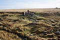
 Lydford Castle - geograph.org.uk - 1264743.jpg 640 × 480; 81 KB
-
 Lydford Castle - geograph.org.uk - 3095999.jpg 2,000 × 2,225; 4.56 MB
-
 Lydford Castle - geograph.org.uk - 4478911.jpg 1,067 × 1,600; 768 KB
-
 Lydford Castle - geograph.org.uk - 5521104.jpg 1,024 × 768; 401 KB
-
 Lydford Castle and the Castle Inn - geograph.org.uk - 2895559.jpg 800 × 600; 348 KB
-
 Lydford church - geograph.org.uk - 3925576.jpg 1,536 × 1,152; 1.25 MB
-
 Lydford Church And Castle From The Norman Earthwork - geograph.org.uk - 4172780.jpg 1,117 × 1,489; 581 KB
-
 Lydford Early Norman Fort - geograph.org.uk - 1020064.jpg 640 × 480; 98 KB
-
 Lydford Ford - geograph.org.uk - 5139687.jpg 6,000 × 4,000; 6.71 MB
-
 Lydford Gorge (1) - geograph.org.uk - 5938678.jpg 4,320 × 3,240; 3.95 MB
-
 Lydford Gorge (10) - geograph.org.uk - 5938696.jpg 4,320 × 3,240; 4.63 MB
-
 Lydford Gorge (11) - geograph.org.uk - 5938698.jpg 4,320 × 3,240; 4.42 MB
-
 Lydford Gorge (12) - geograph.org.uk - 5938700.jpg 4,320 × 3,240; 4.66 MB
-
 Lydford Gorge (13) - geograph.org.uk - 5938702.jpg 4,320 × 3,240; 5.12 MB
-
 Lydford Gorge (14) - geograph.org.uk - 5938705.jpg 4,320 × 3,240; 4.84 MB
-
 Lydford Gorge (15) - geograph.org.uk - 5938708.jpg 3,240 × 4,320; 3.66 MB
-
 Lydford Gorge (16) - geograph.org.uk - 5938712.jpg 3,240 × 4,320; 4.9 MB
-
 Lydford Gorge (2) - geograph.org.uk - 5938679.jpg 4,320 × 3,240; 4.74 MB
-
 Lydford Gorge (3) - geograph.org.uk - 5938680.jpg 4,320 × 3,240; 3.98 MB
-
 Lydford Gorge (32) - geograph.org.uk - 5939709.jpg 3,240 × 4,320; 3.94 MB
-
 Lydford Gorge (33) - geograph.org.uk - 5939723.jpg 4,320 × 3,240; 4.01 MB
-
 Lydford Gorge (34) - geograph.org.uk - 5939717.jpg 4,320 × 3,240; 4.31 MB
-
 Lydford Gorge (35) - geograph.org.uk - 5939725.jpg 3,099 × 4,131; 3.52 MB
-
 Lydford Gorge (36) - geograph.org.uk - 5939728.jpg 3,240 × 4,320; 4.32 MB
-
 Lydford Gorge (37) - geograph.org.uk - 5939730.jpg 3,240 × 4,320; 4.38 MB


_at_Wheal_Frederick_-_geograph.org.uk_-_1358382.jpg)


_-_geograph.org.uk_-_1015916.jpg)


_-_geograph.org.uk_-_3933161.jpg)
_-_geograph.org.uk_-_3933172.jpg)
_-_geograph.org.uk_-_3933176.jpg)
_-_geograph.org.uk_-_3933182.jpg)


_-_geograph.org.uk_-_5938678.jpg)
_-_geograph.org.uk_-_5938696.jpg)
_-_geograph.org.uk_-_5938698.jpg)
_-_geograph.org.uk_-_5938700.jpg)
_-_geograph.org.uk_-_5938702.jpg)
_-_geograph.org.uk_-_5938705.jpg)
_-_geograph.org.uk_-_5938708.jpg)
_-_geograph.org.uk_-_5938712.jpg)
_-_geograph.org.uk_-_5938679.jpg)
_-_geograph.org.uk_-_5938680.jpg)
_-_geograph.org.uk_-_5939709.jpg)
_-_geograph.org.uk_-_5939723.jpg)
_-_geograph.org.uk_-_5939717.jpg)
_-_geograph.org.uk_-_5939725.jpg)
_-_geograph.org.uk_-_5939728.jpg)
_-_geograph.org.uk_-_5939730.jpg)